El Hierro
The plan includes diving and exploring the island. It is the westernmost island, geographically belongs to Africa, but it is Spain.
Diving
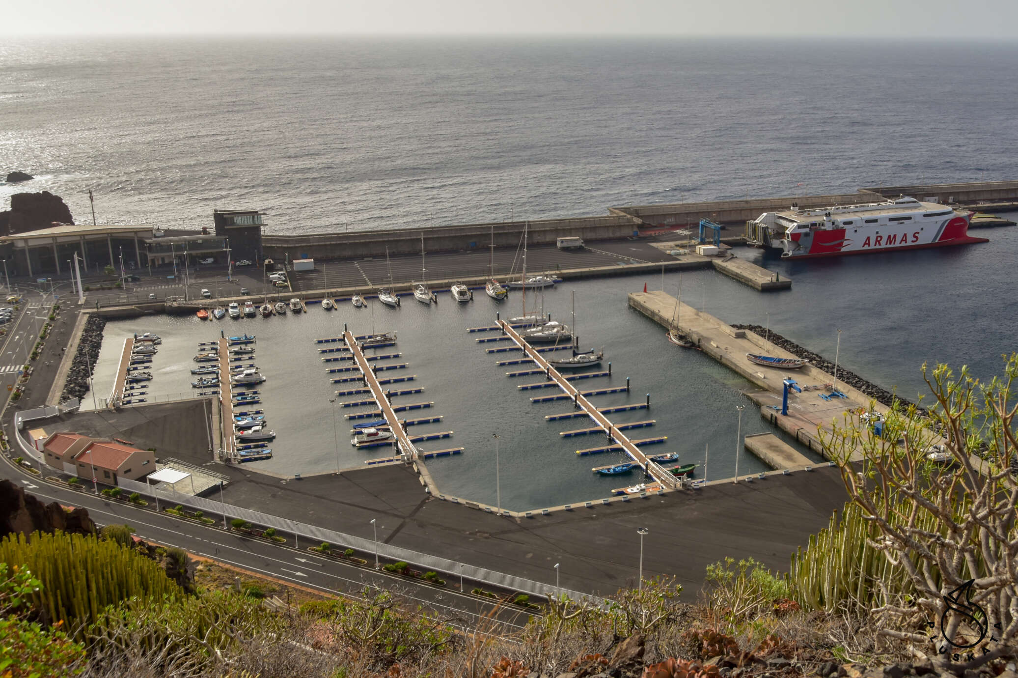
I send e-mails to 4 diving offices – two German and two Spanish, some Germans write back that there are no places available on a date that suits me, and others give a prohibitive price. In the end, I choose the Spanish office of Centro de Buceo El Hierro. We set the price and date. Unfortunately, all offices are in La Restinga and do not provide delivery services. We decide to rent a car at Cicar – our favorite rental company that has a car pick-up point in the marina (actually at the ferry terminal). For 6 days we pay 170€.
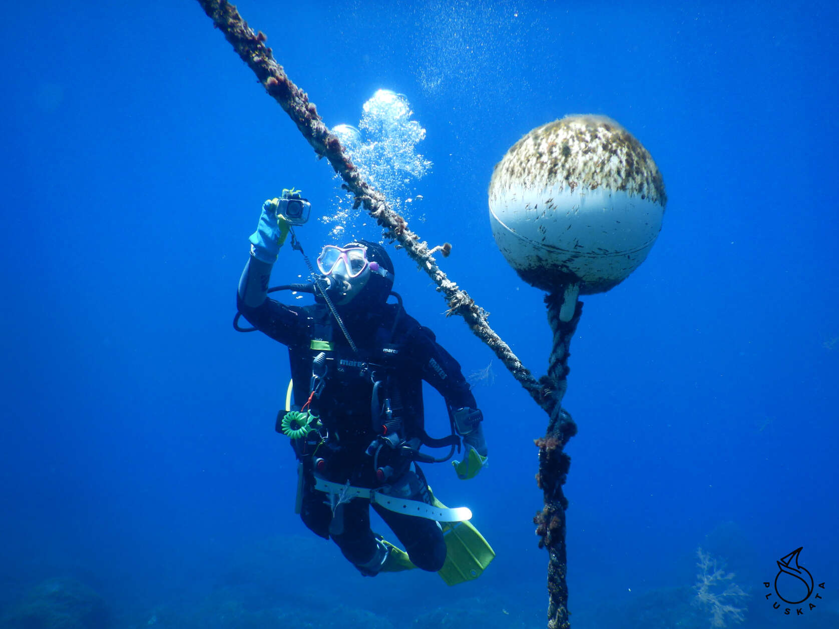
We leave for diving at 7:30 – we go to the other end of the island. After filling in the whole pile of papers, we choose the equipment, change clothes and go to the pontoon. The equipment goes by bus to the other end of the marina. There are 6 of us and an instructor (actually two, but one always stays on the boat).
First dive at Desierto site. We descend to 23 m, but the visibility is poor, the water is cloudy. There are some fish large and small, but for a reserve it is rather poor. After leaving the water, we change the cylinders and swim to the next El Salto dive site. This time we dive to 14m, but the water is still cloudy.
After returning from the second dive, we go to dinner at the El Refugio restaurant for a set of fresh fish. It’s the day of the fiesta, so we wait for a table for about an hour (you have to sign up for the waiting list), but it’s worth it.
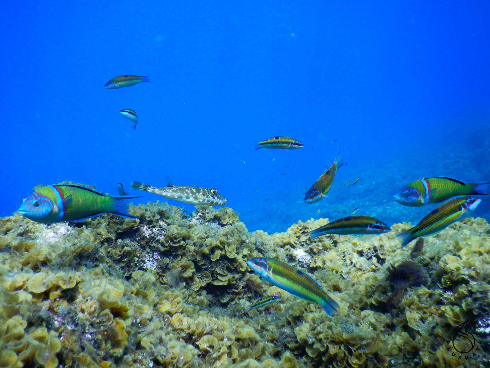
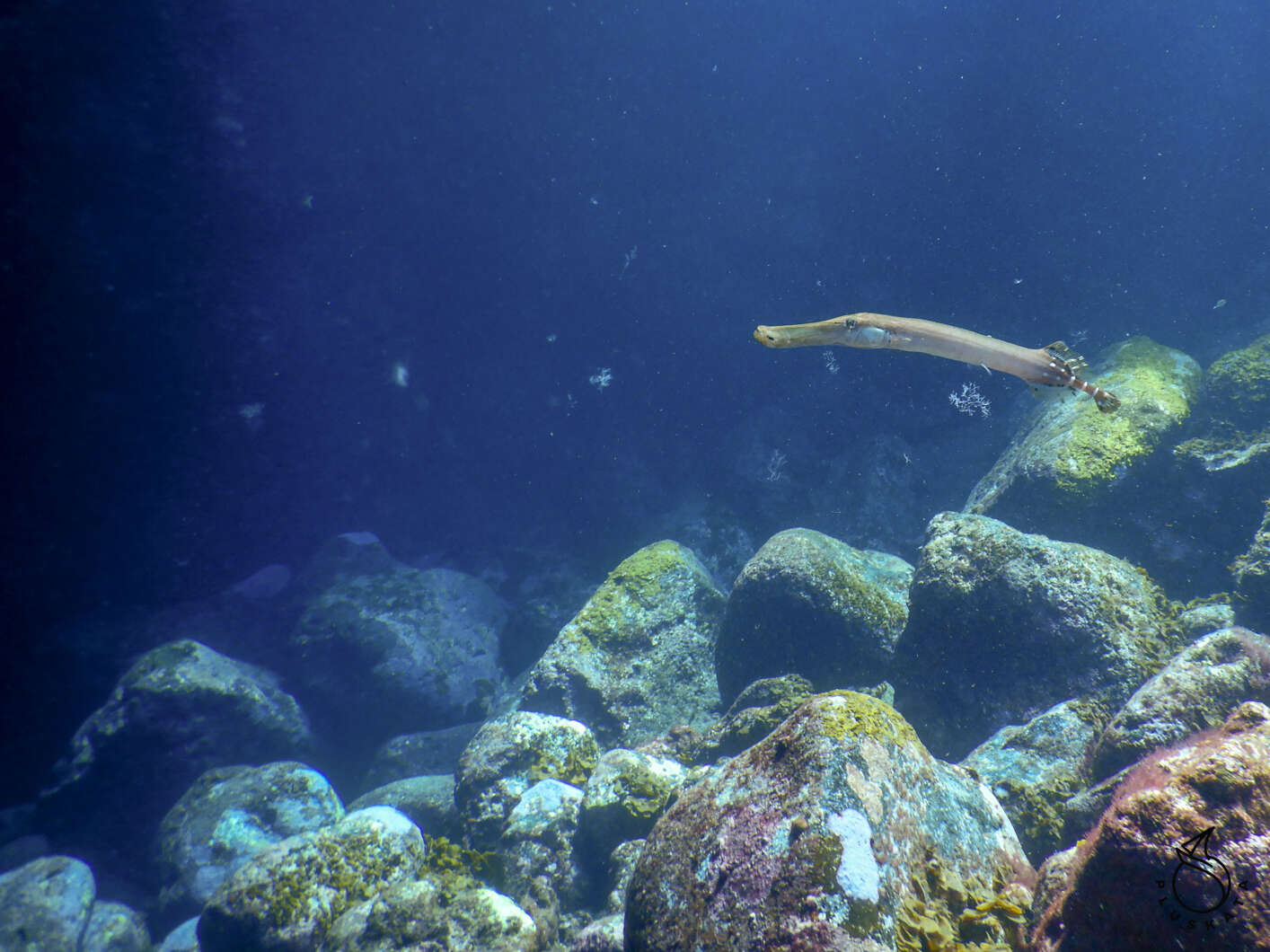
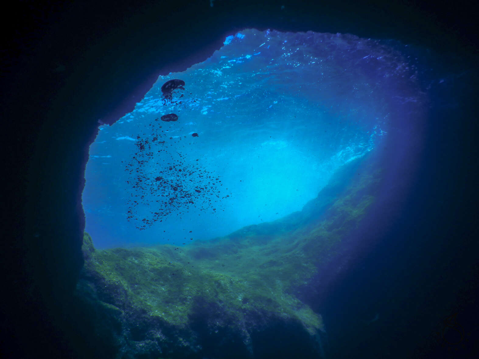
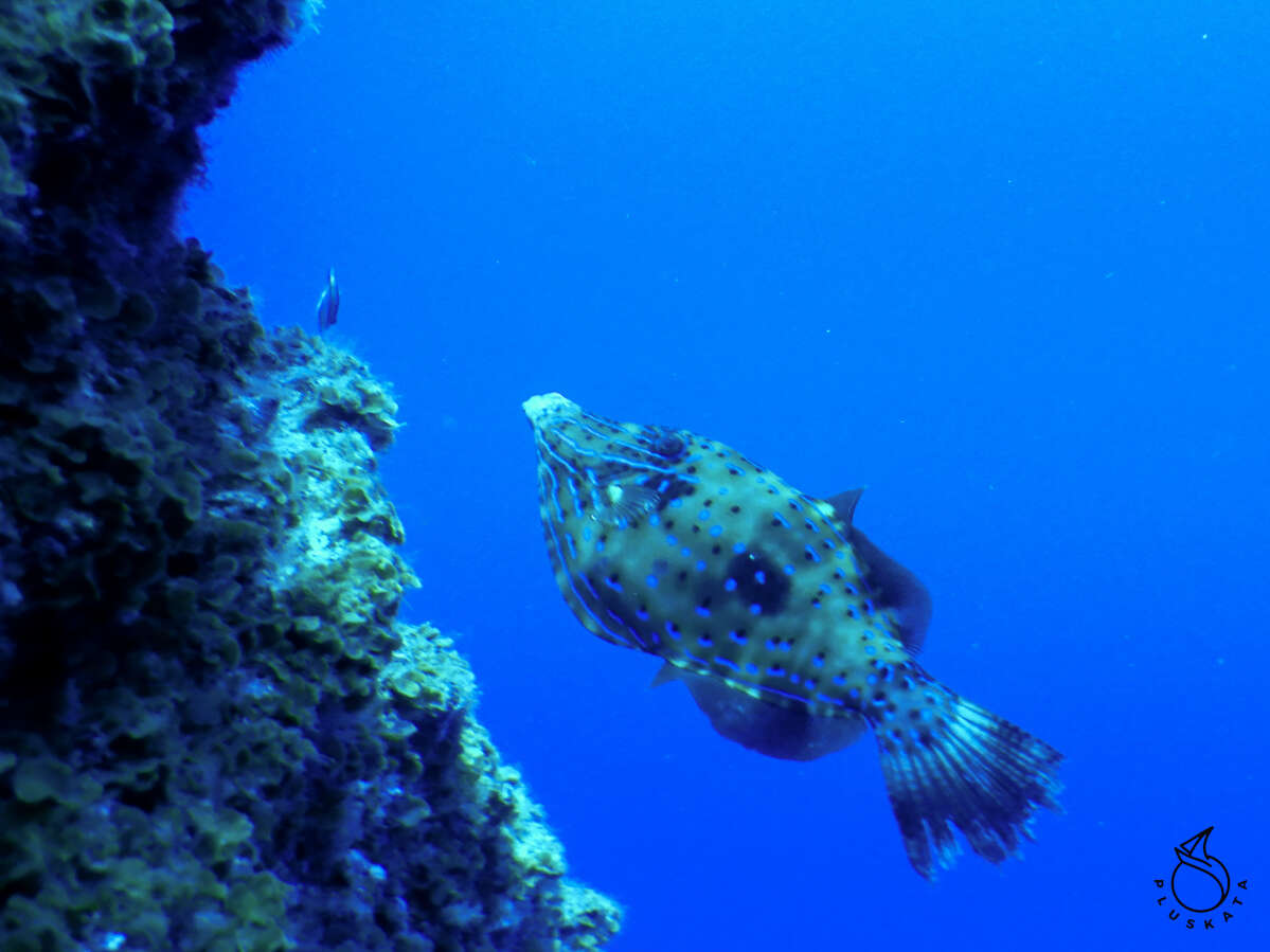
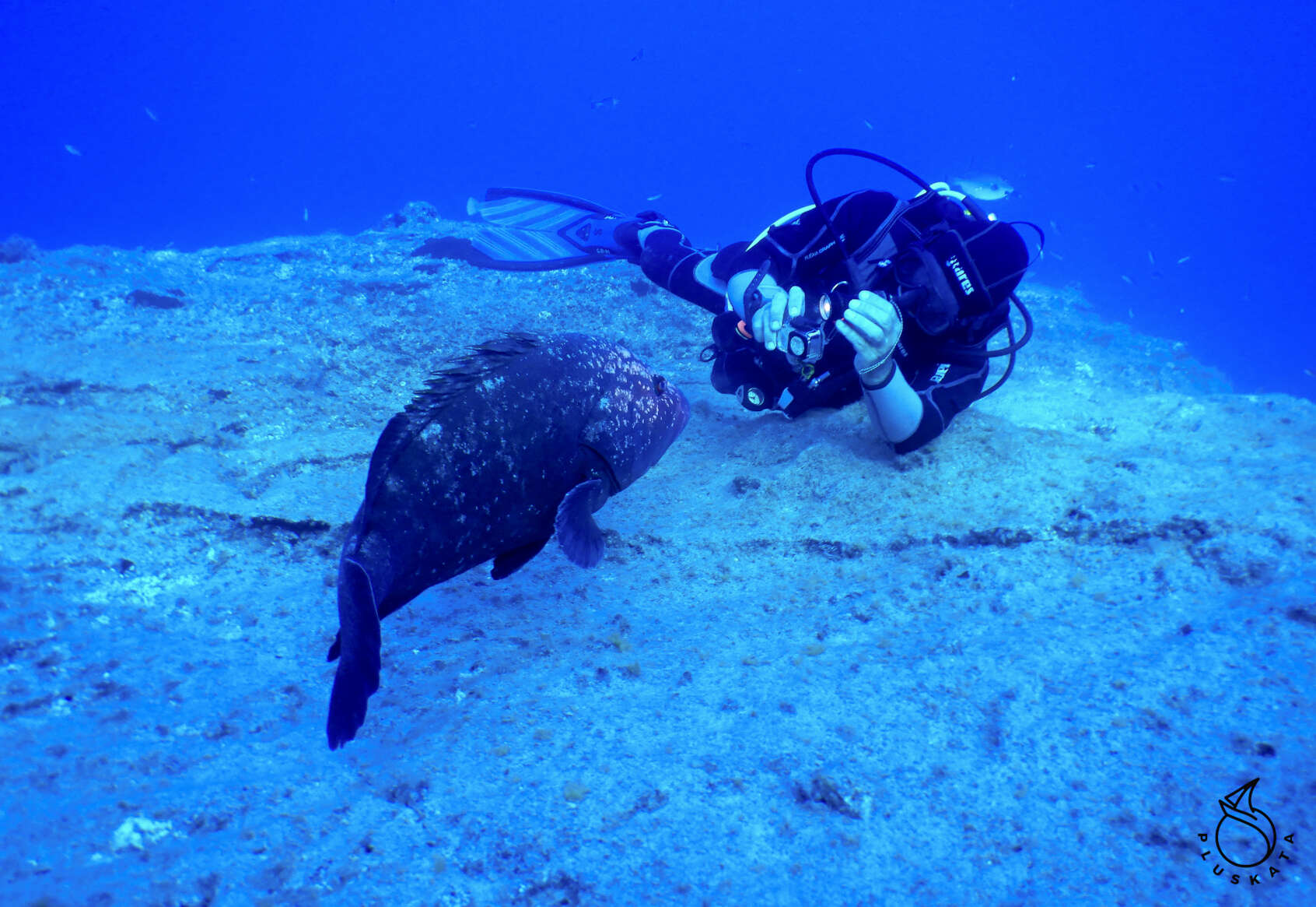
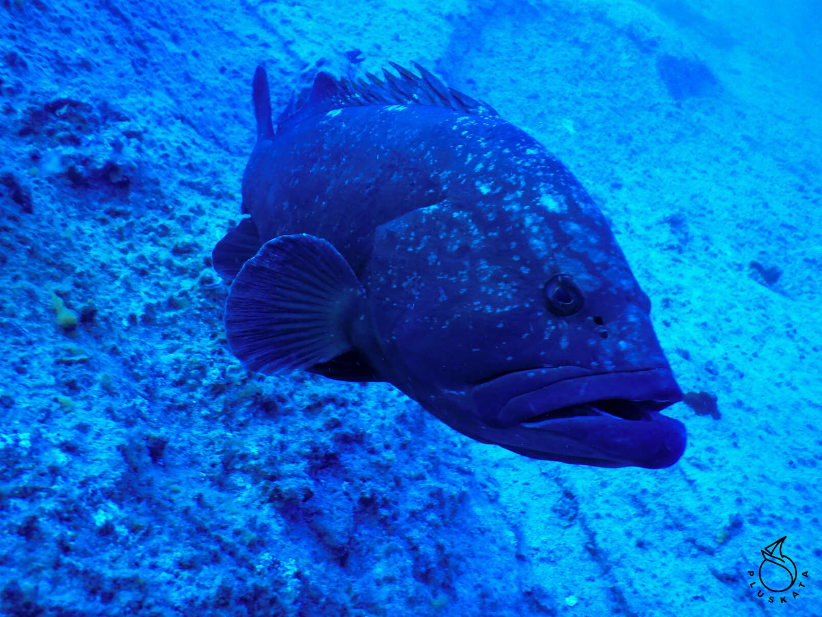
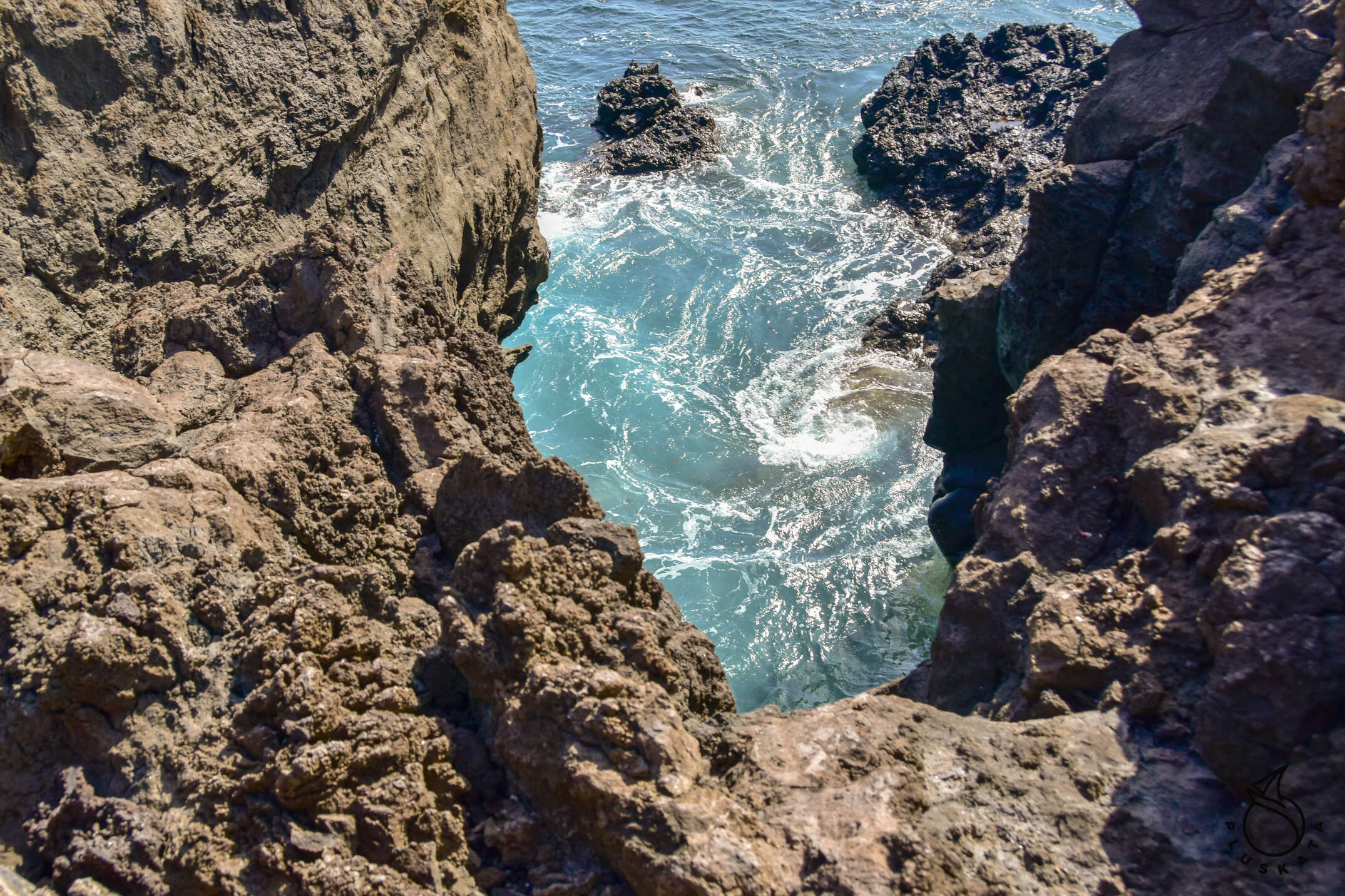
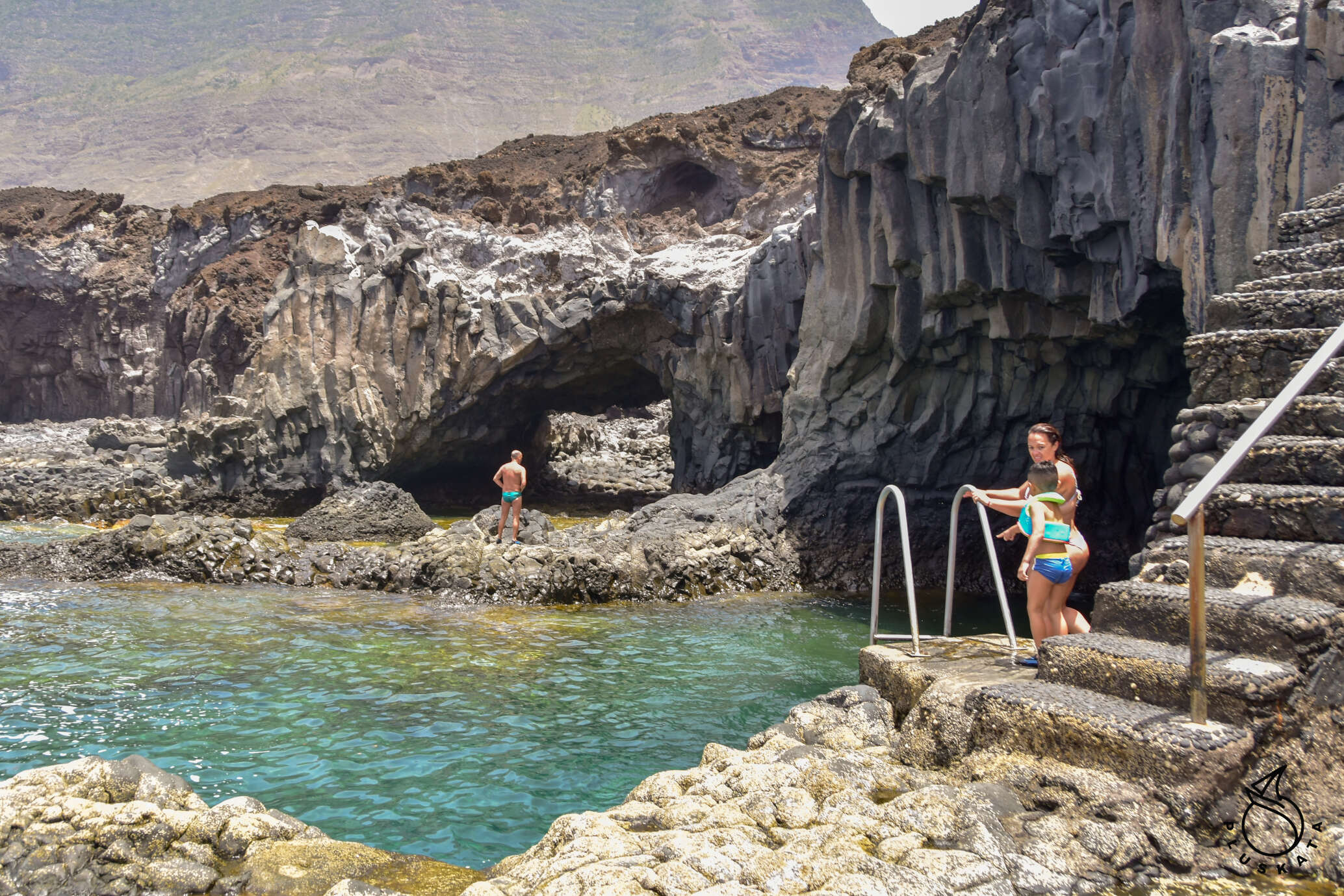
The next day is diving in the place of Bojon – this time the visibility is excellent, a lot of fish, moray eels, we meet a small shark floating high, colorful fish, various groupers, the only inconvenience is a fairly strong current. We descend to 23m. The next place is Punto Las Canas – also beautiful with a lot of sea animals, but fortunately with a much weaker current. We swim into the caves and watch the underwater life there.
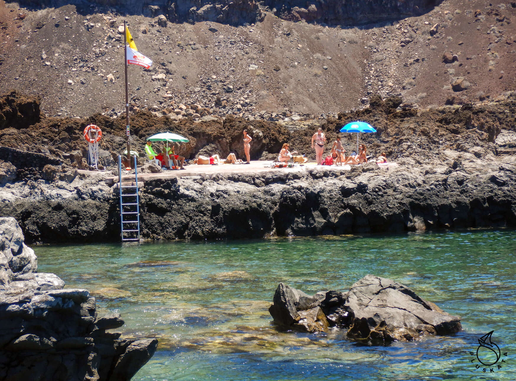
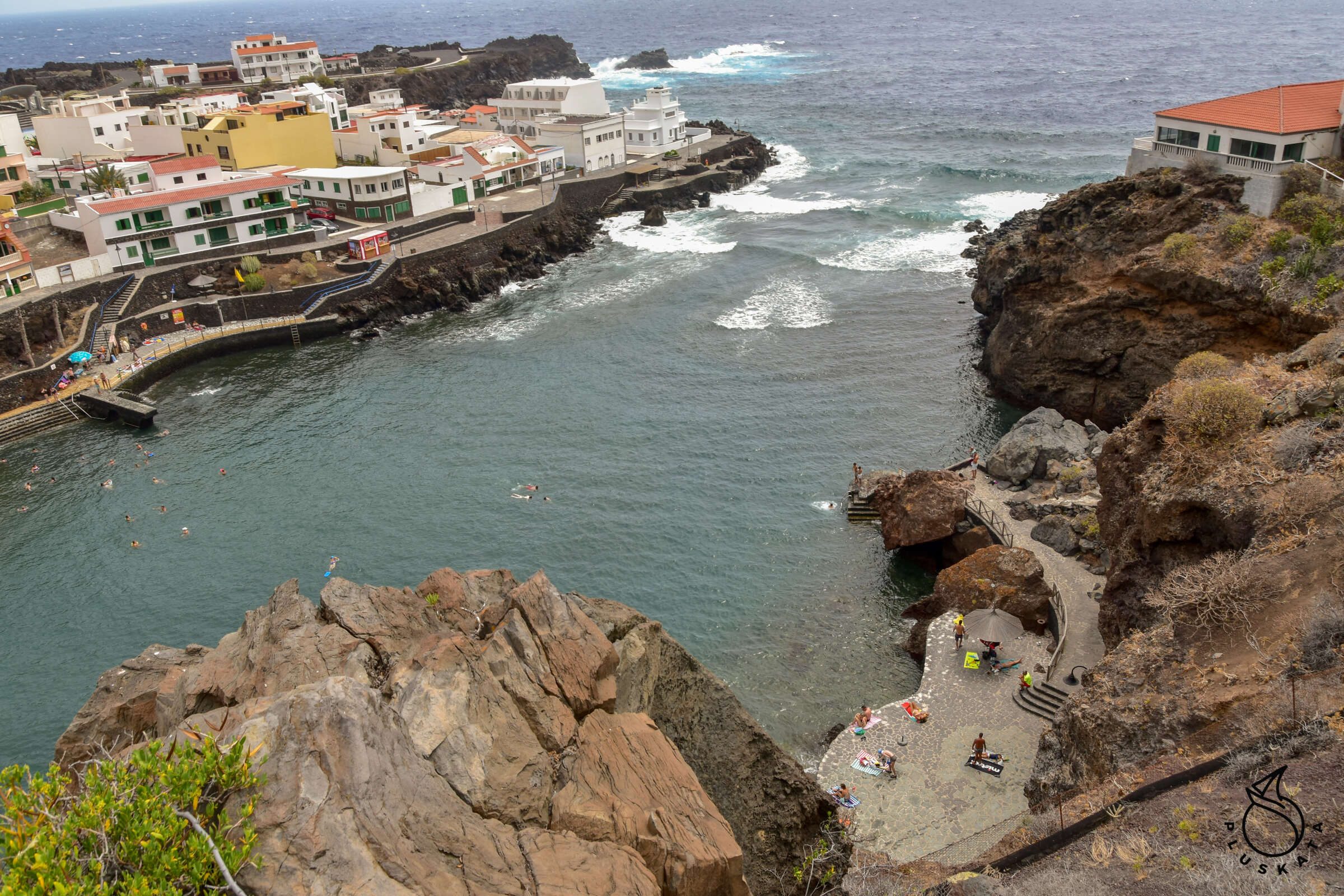
After diving, we go to see the Taracon swimming pool in natural lava pools with ladders and lifeguards, then we go to a recommended restaurant with Guachinche, or rather Bimbachinche Las LAPAS, i.e. local tapas. The menu is painted on the table.
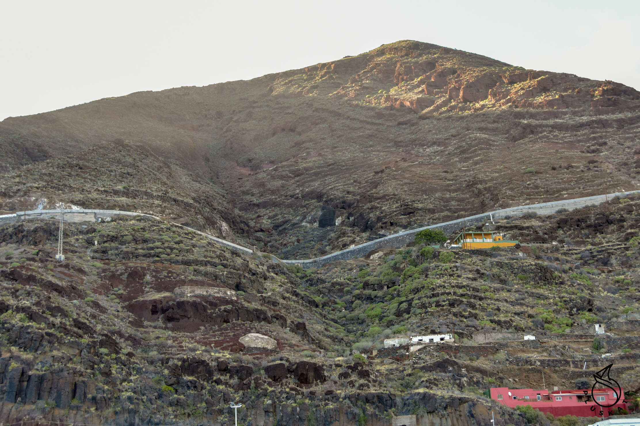
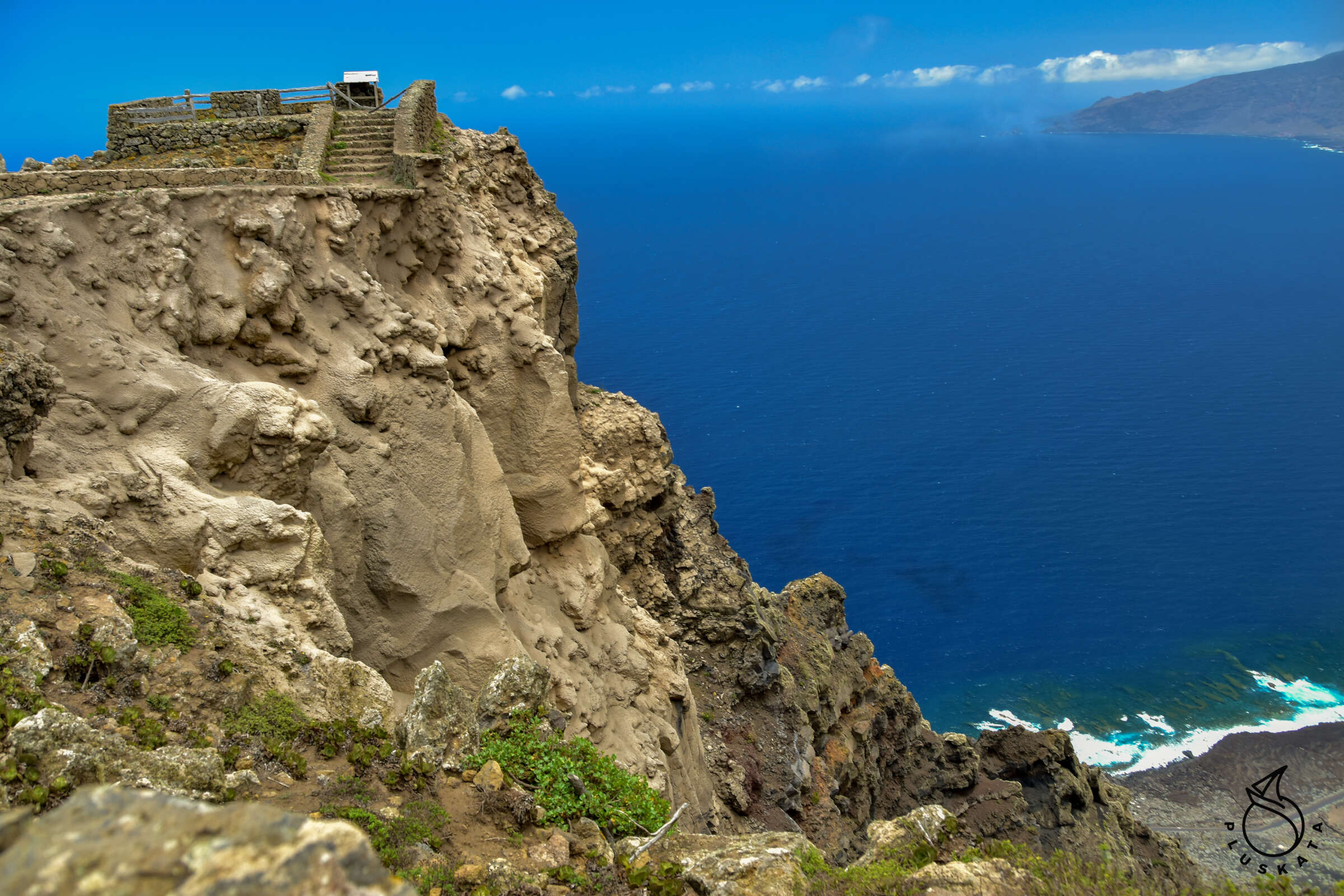
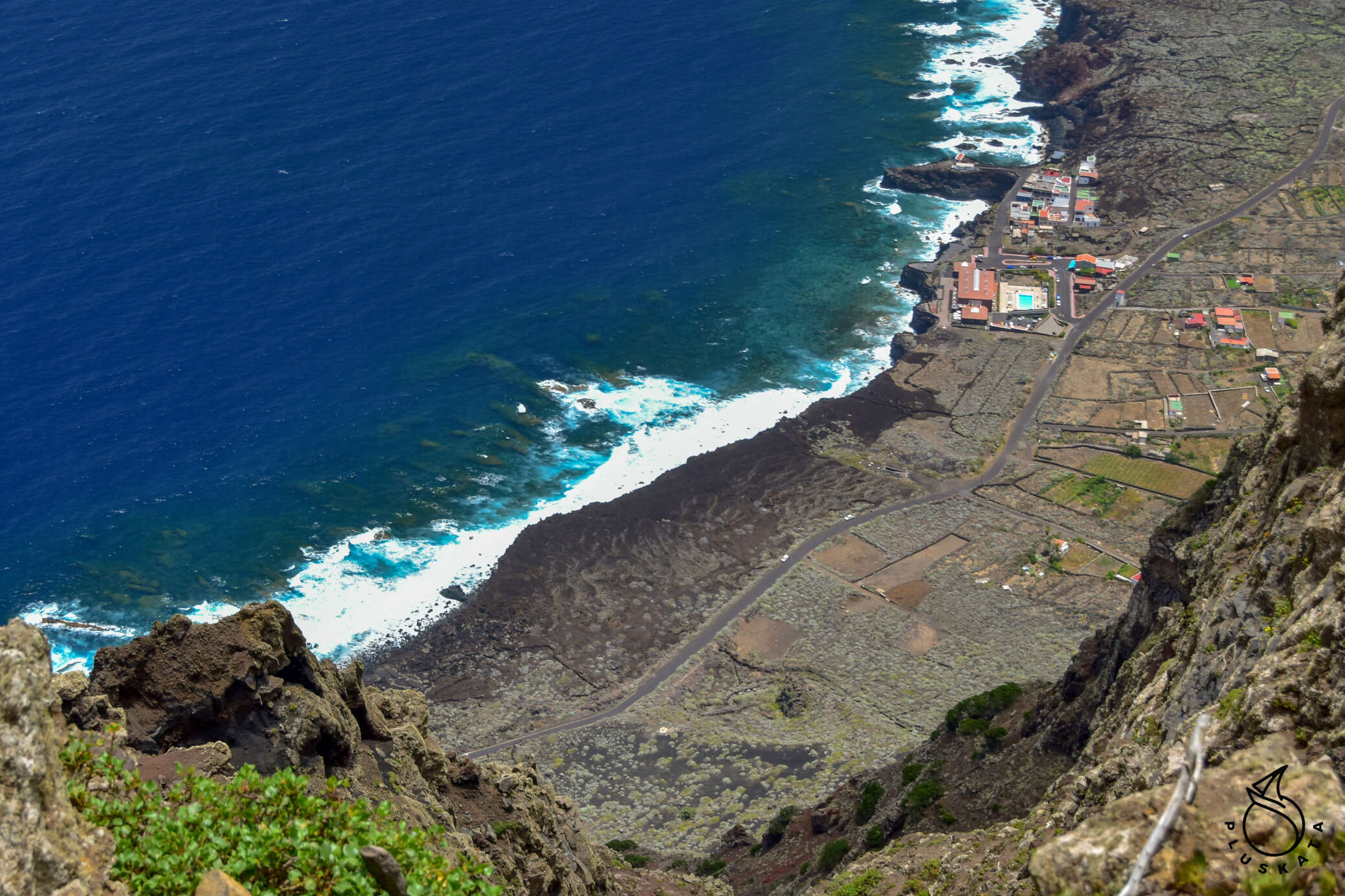
On our way back, we go to Mirador del Isora with a beautiful view of Las Playas.
Sightseeing
We start the first day of sightseeing with Hoja de Morcillo – a beautiful camping site in the middle of the forest. There is a barbecue area (several stands), a washroom with running water, toilets, a children’s play area and a miniature of EL Hierro with points of interest marked.
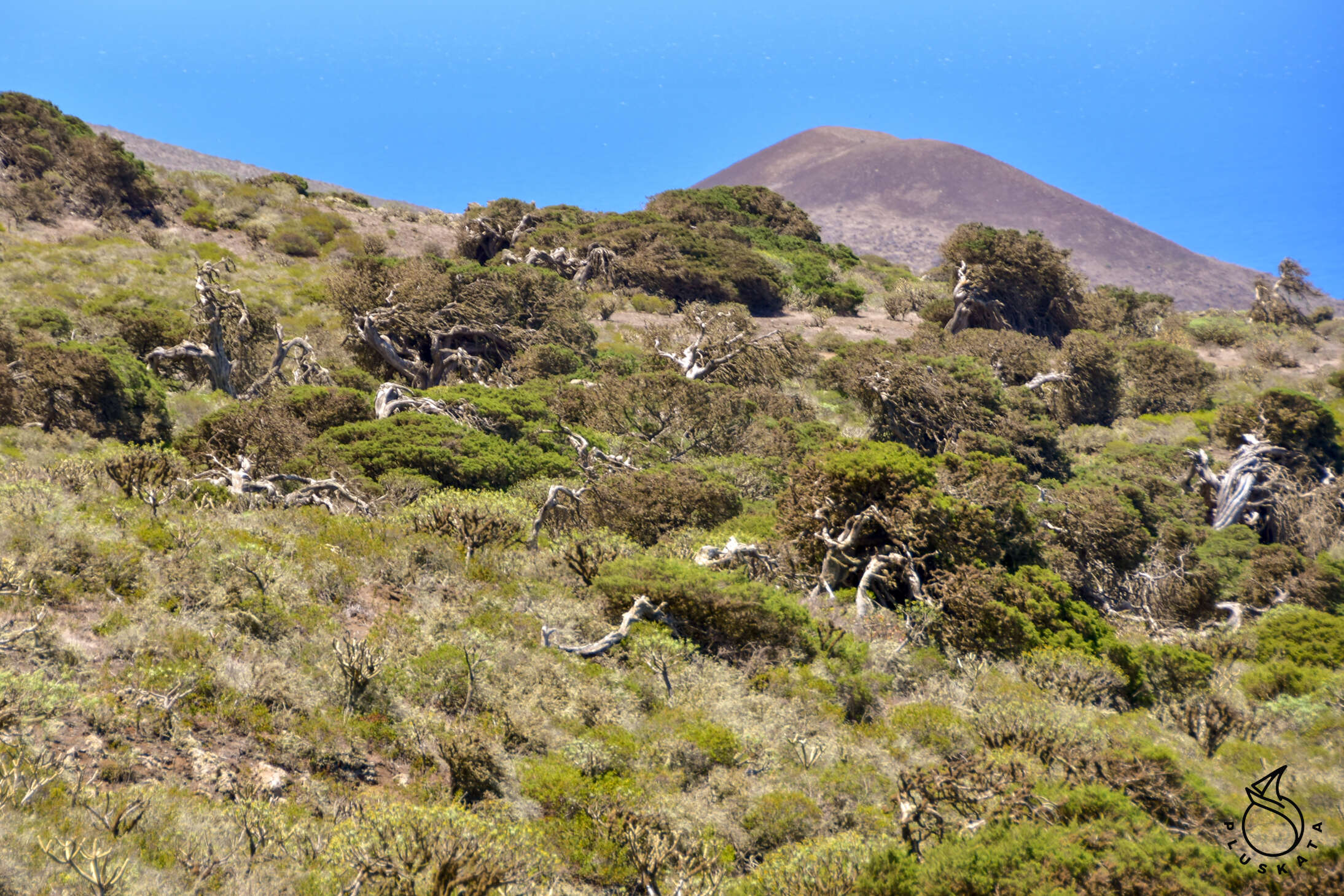
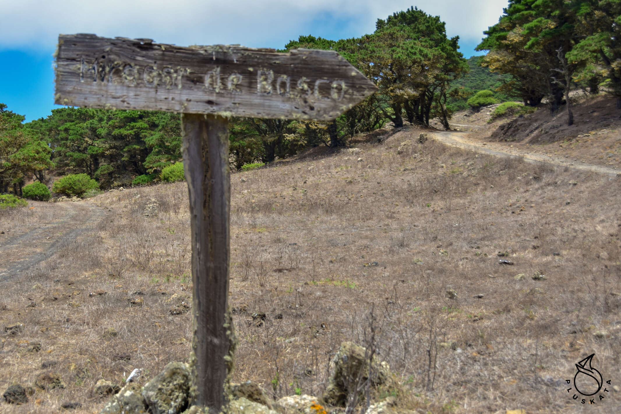
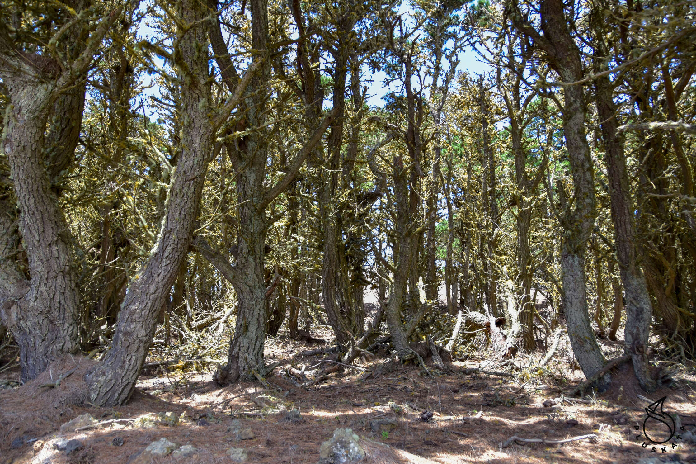
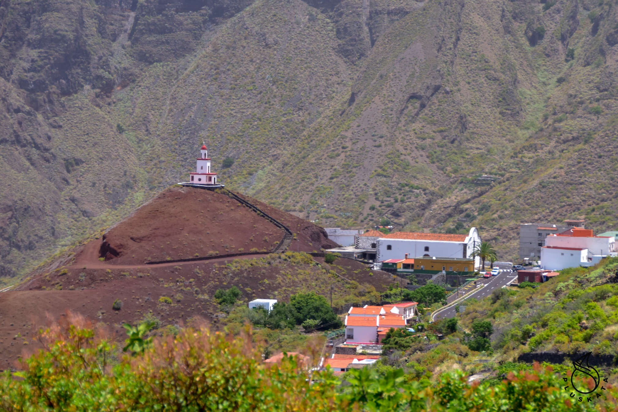
From there we go to the Centro de Interpretacion de El Julan, which is a museum of petroglyphs – the writing of the former inhabitants of the island (Bimbache), which has not yet been translated. Entrance costs €5 per person. Then, visiting Mirador de El Julan, we go to see the Sanctuary de Nuestra Senora de Los Rayes. It’s tiny but nice and freshly painted white. We take a gravel road to El Sabinar, a place with a twisted coniferous tree (juniperus turbinata) – the symbol of El Hierro. We make a walking trip to the Bascos viewpoint – a beautiful road among twisted trees. The entrance to the point itself is closed (the safety barriers are broken). This point can also be reached by car via a gravel road from the other side.
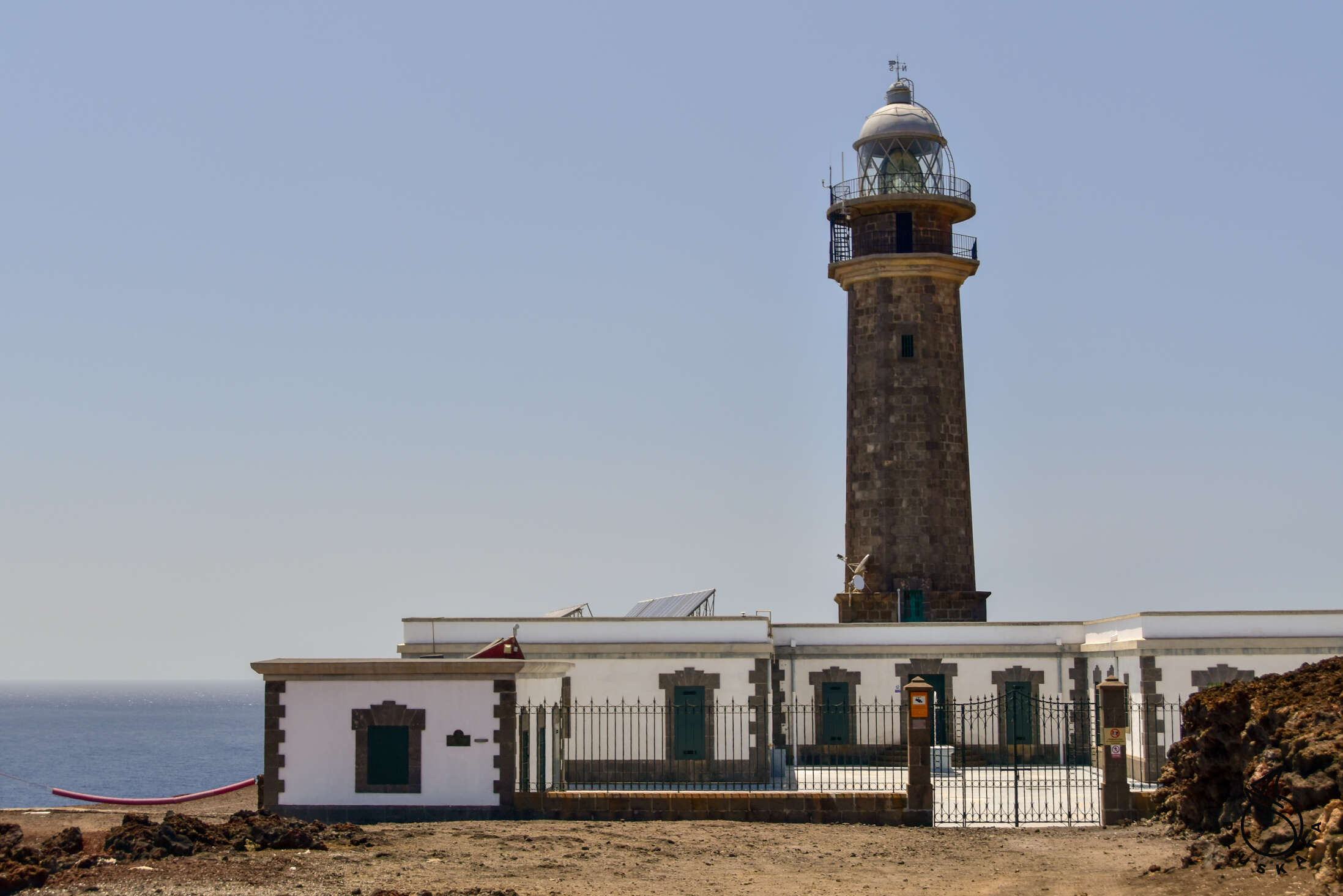
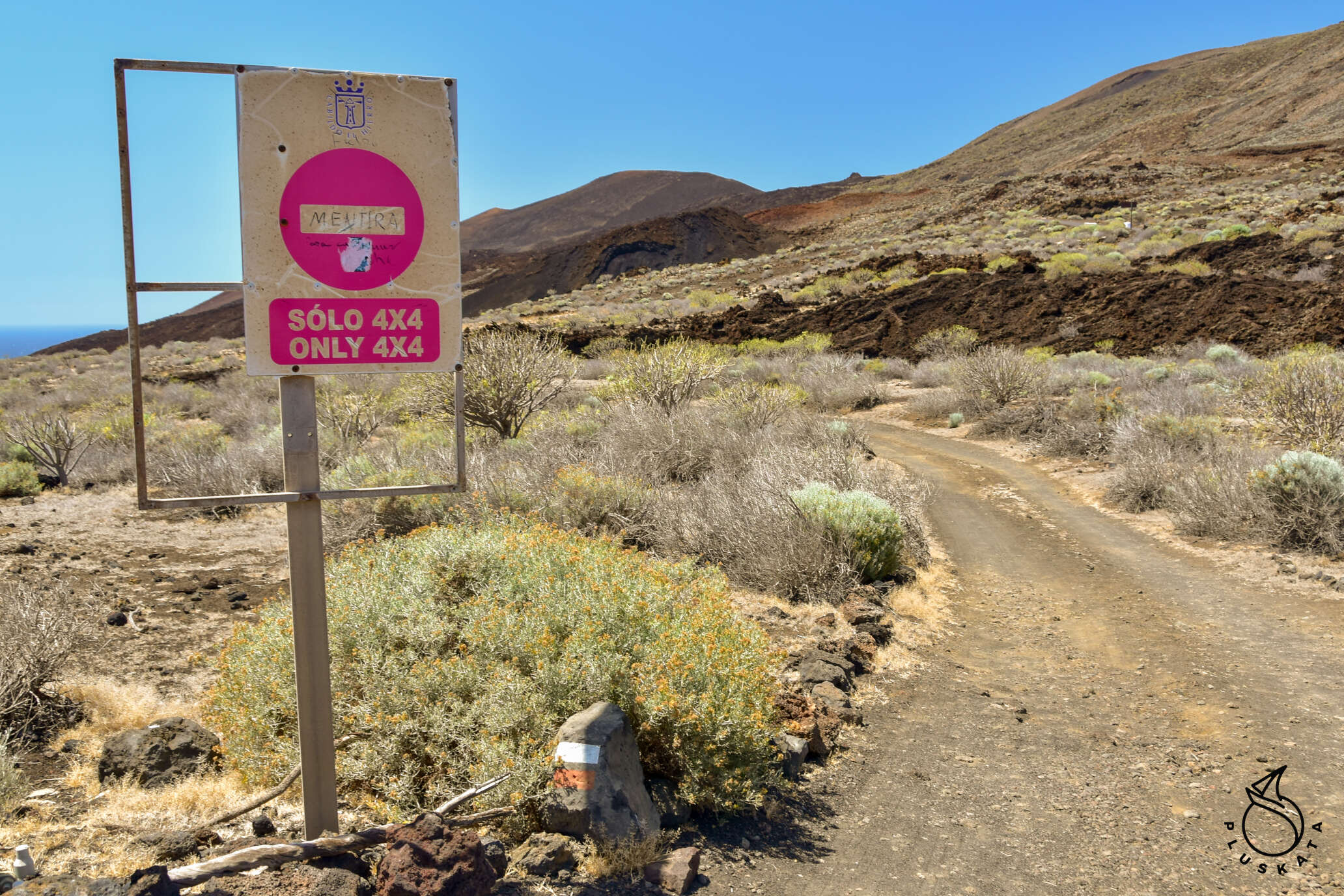
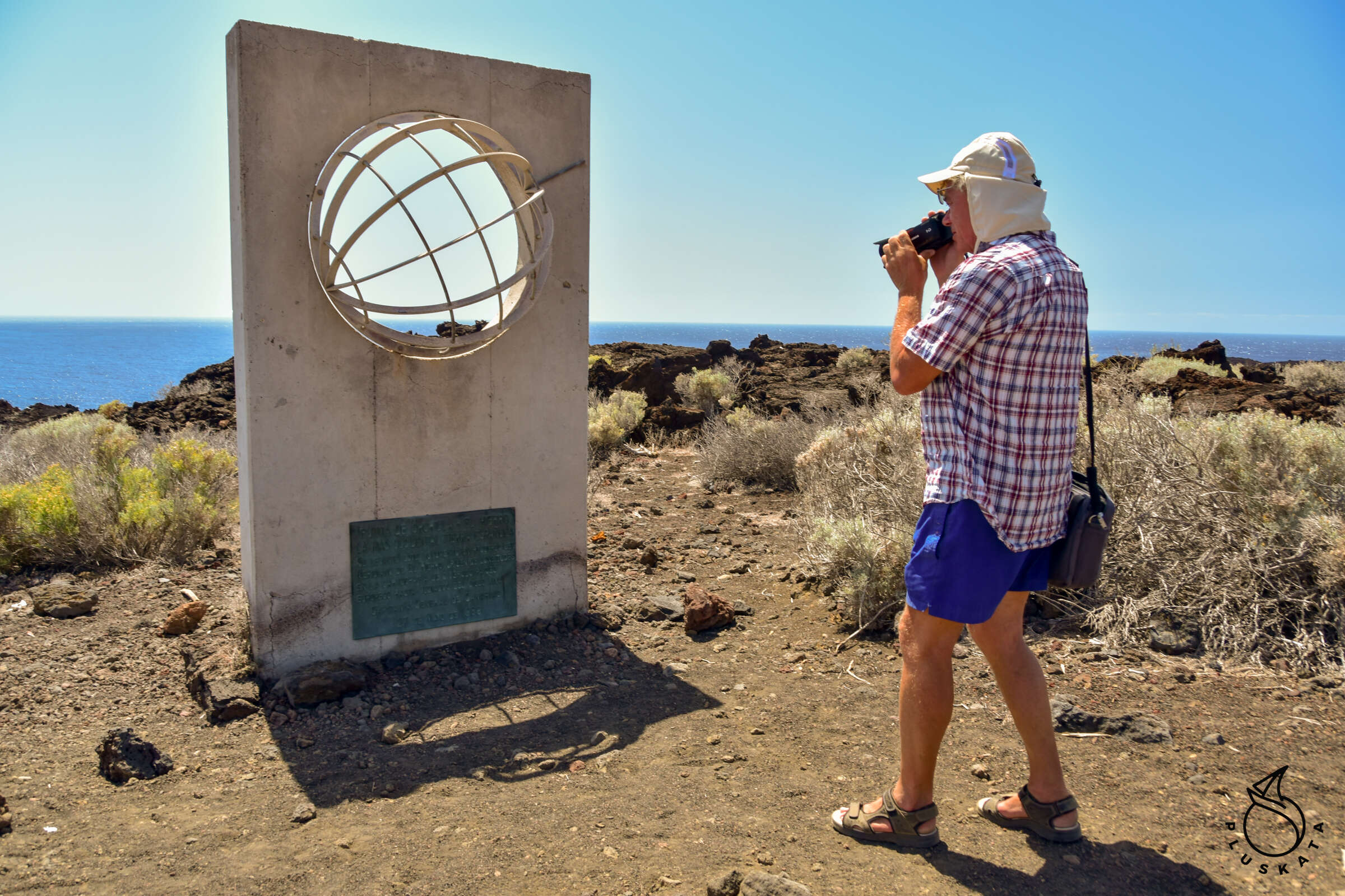
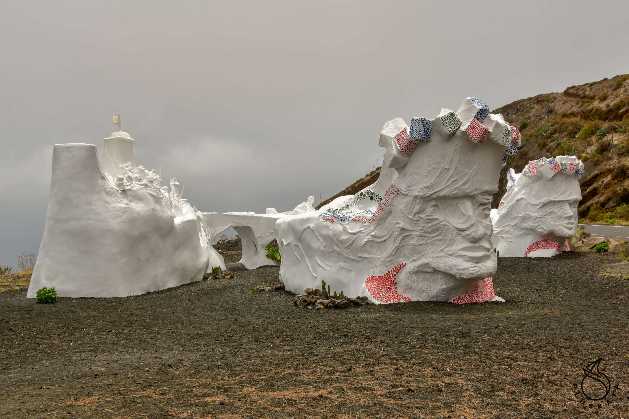
The next point is the Faro de Orchilla Lighthouse and the de Orchilla swimming pool a bit further – beautiful lava pools again, but I wouldn’t recommend swimming there. Both can be reached by car. The lighthouse area is fenced and closed. We also decide to see the old meridian 0 (valid until 1884) it is the westernmost tip of Spain (the Canary Islands, even though Spain belongs to Africa). There is a memorial with a small plaque on the site. This place can only be reached by an off-road vehicle, or on foot (we don’t have an off-road vehicle, so we chose the second solution).
We return to the main road, stop at the Lomo Negro viewpoint overlooking the black plateau and then turn to El Verodal – a very nice viewpoint.
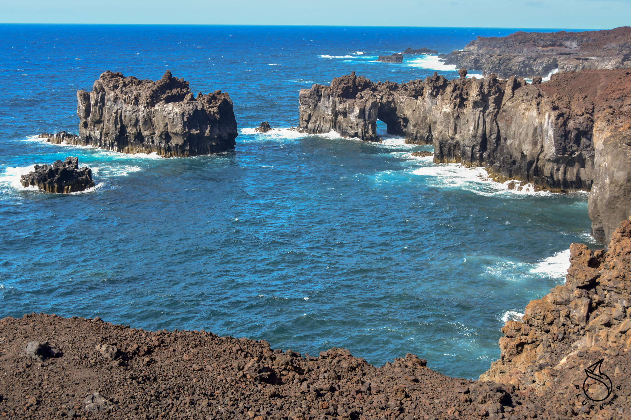
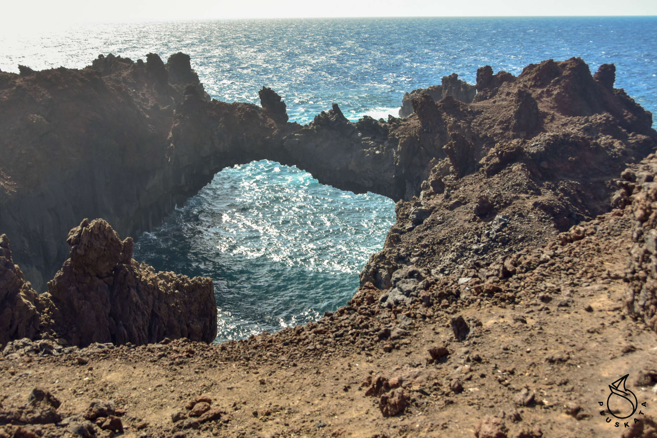
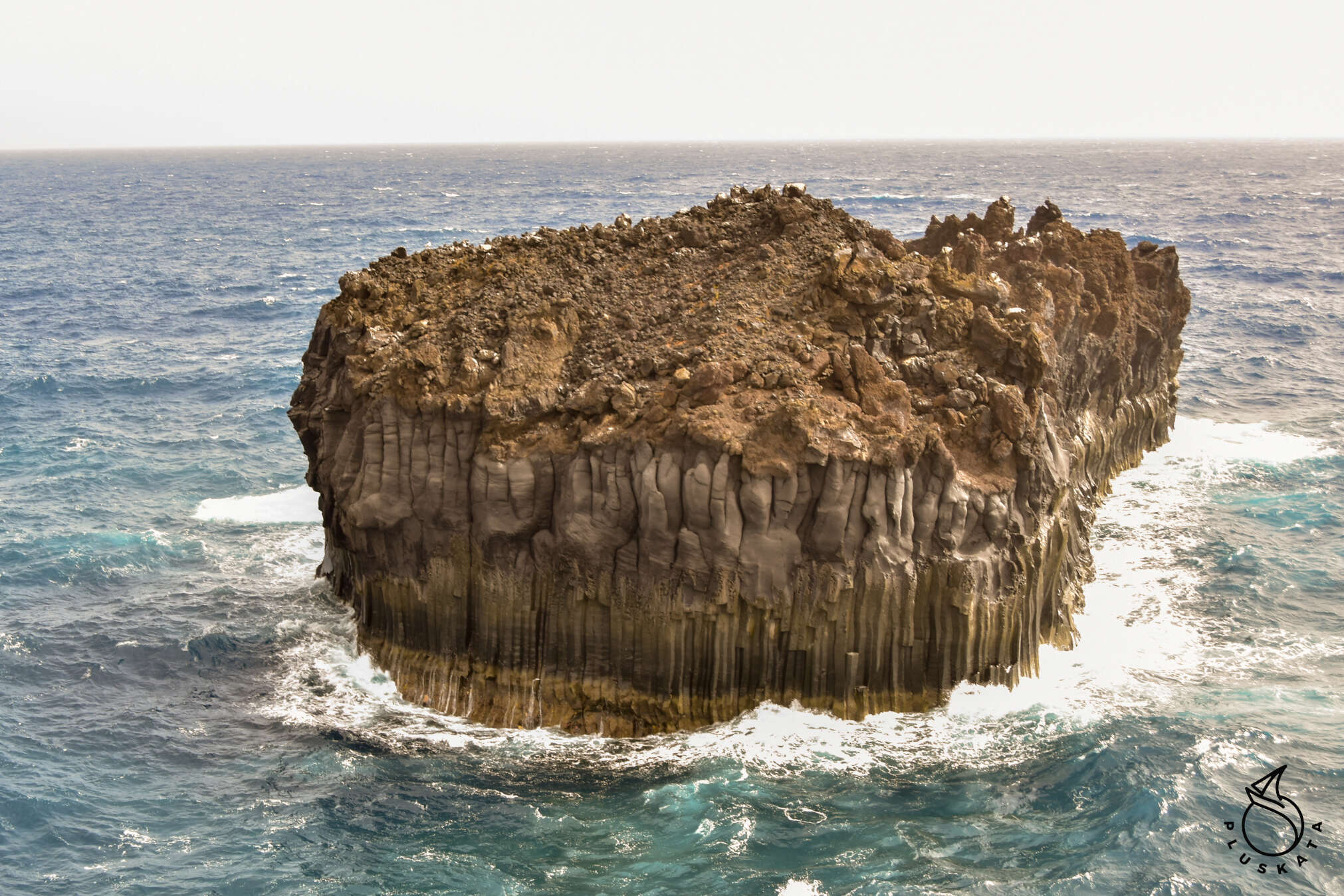
Then we go to Arco de la Tosca – a place with pretty arches washed out by water.
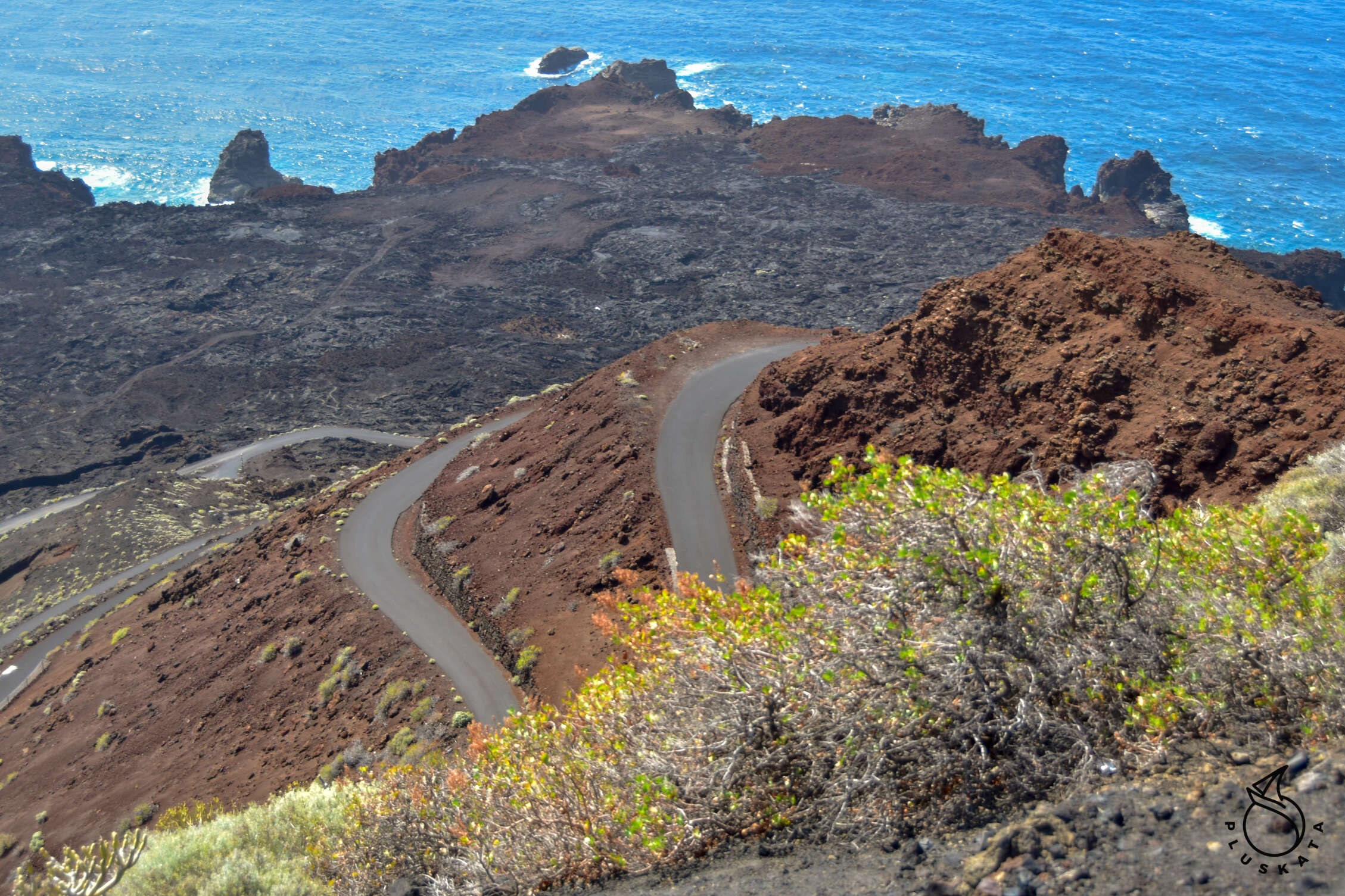
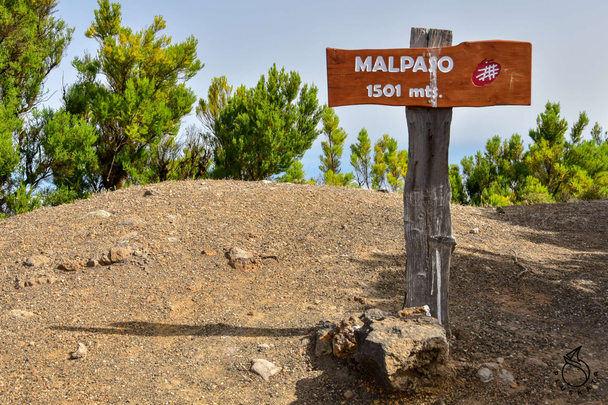
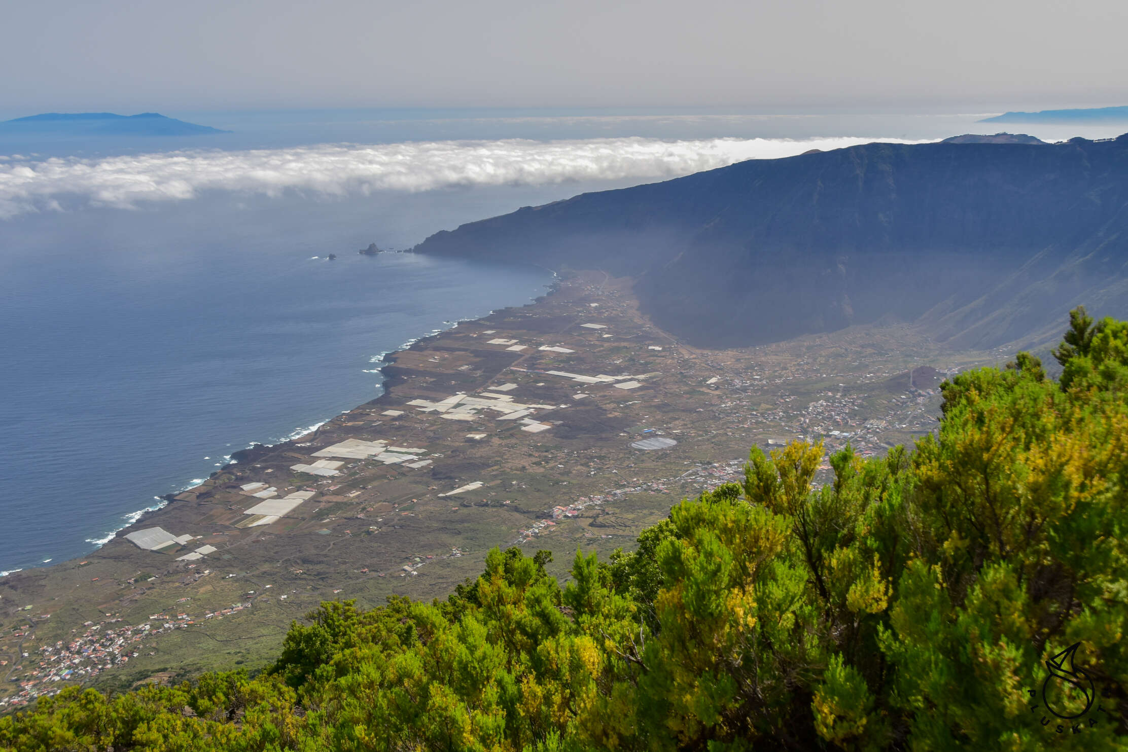
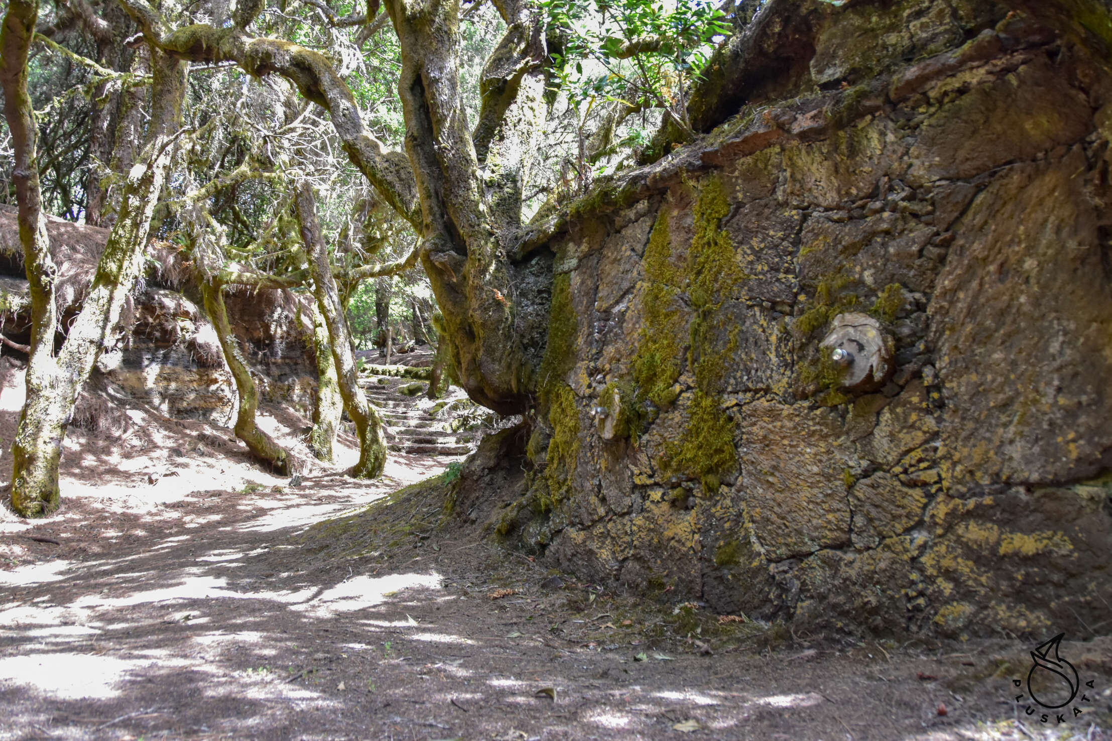
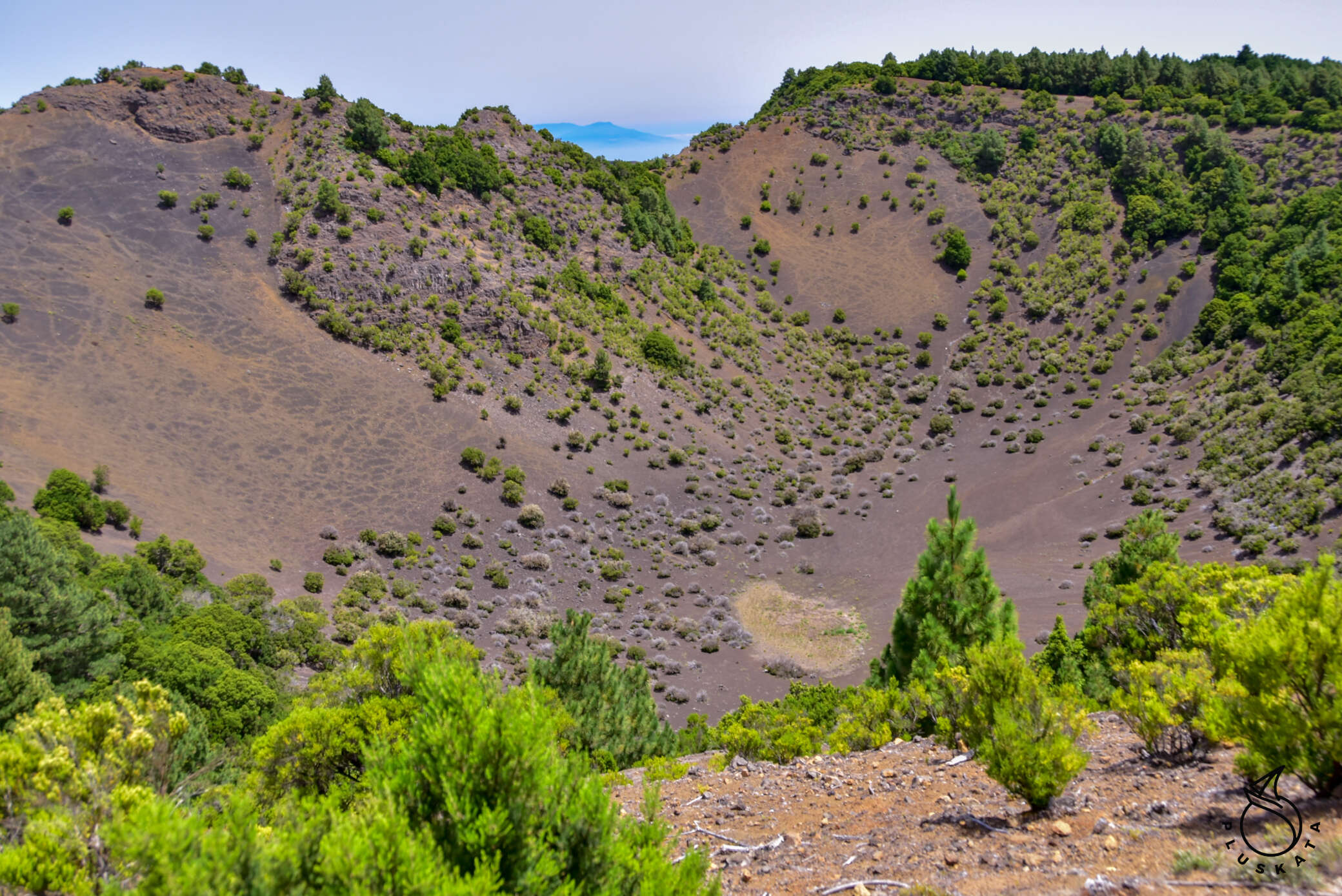
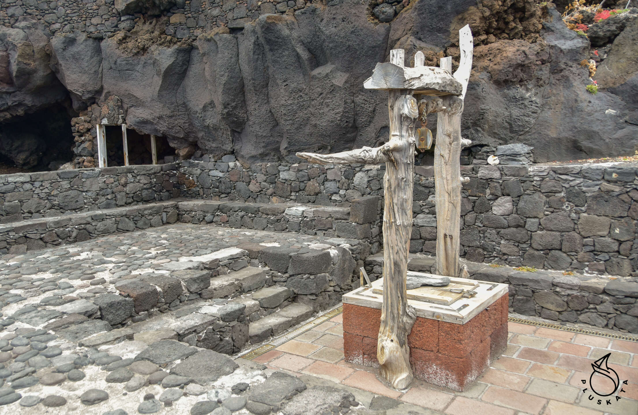
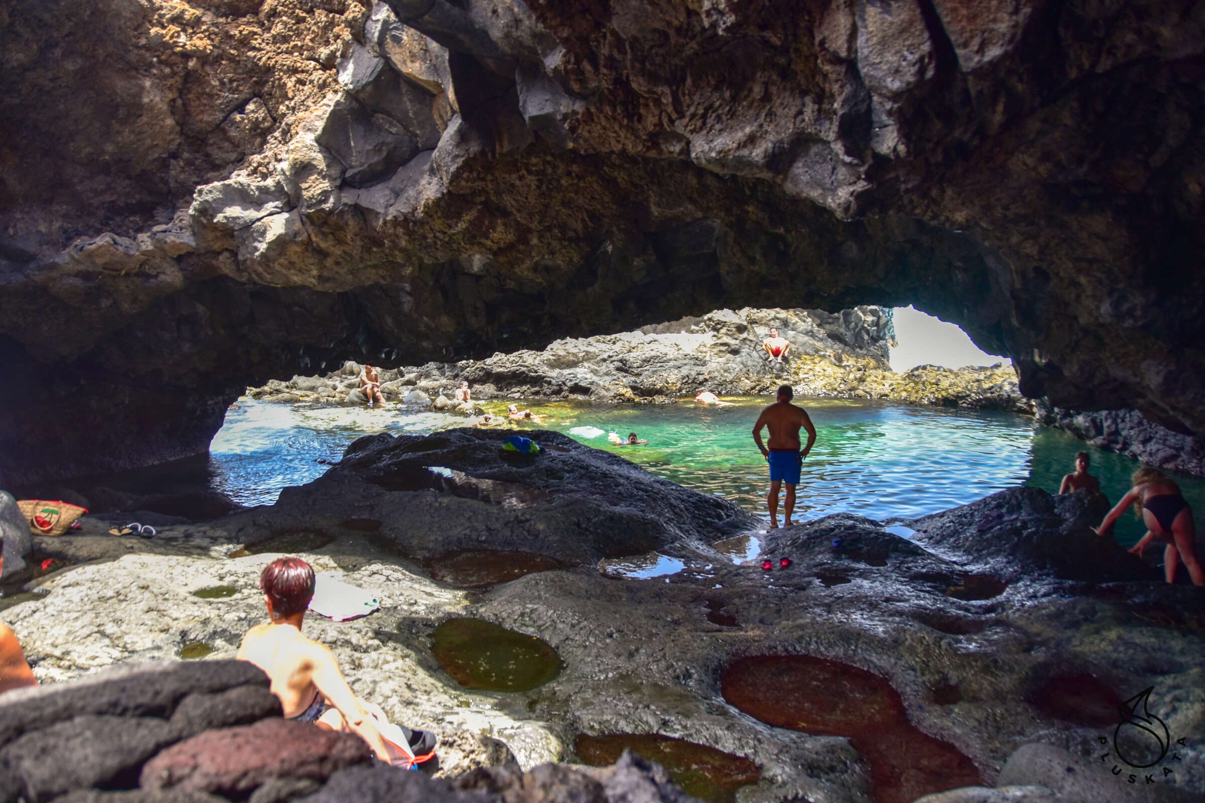
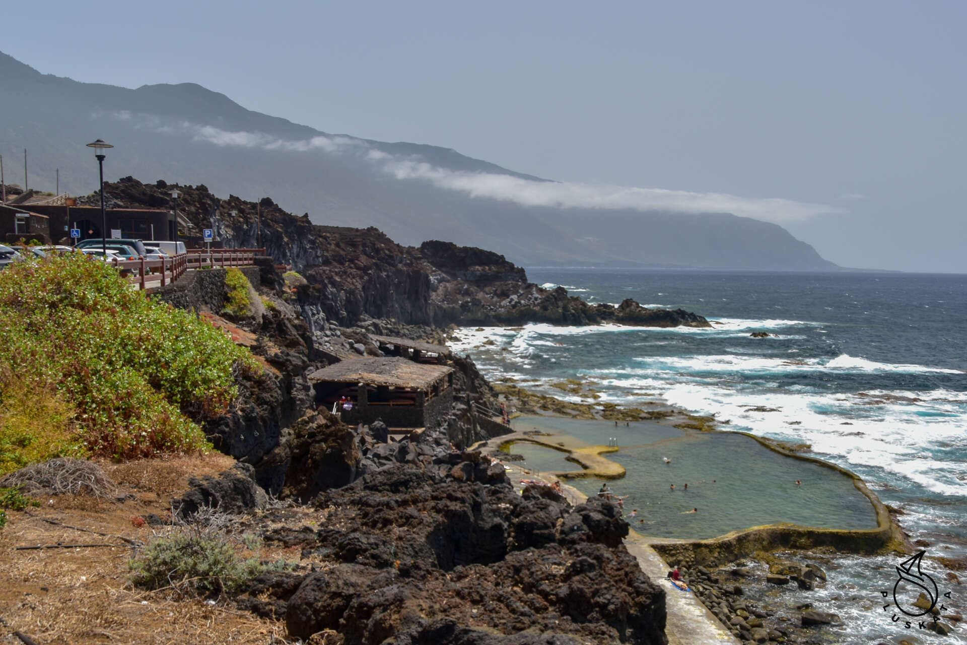
Another day of sightseeing – this time we decide to climb the highest peak on the island – Malpaso 1501m above sea level. You can get to the top by car – the road is partly gravel, but the Opel Corsa makes it. From the top, you can see 4 islands: La Palma, La Gomera, Tenerife and El Hierro. Descending from the top, we visit the La Llania mirador (you have to walk a bit from the parking) and the Fireba mirador with beautiful views of the El Golfo valley. Then we go to Pozo de Salut – the town where the source of mineral water was discovered – now the well at the spring is padlocked, and a sanatorium has been built next to it. The next points are Charco Azul and La Maceta – bathing areas in natural lava pools – very picturesque. Each has ladders to enter the water and a lifebuoy with a rope hanging on the shore. In Charco Azul you can enter a small grotto, and in La Maceta there are large pools with a lot of people, but at the top there is a plaque next to the cafe describing the formation of successive rock formations on the shore.
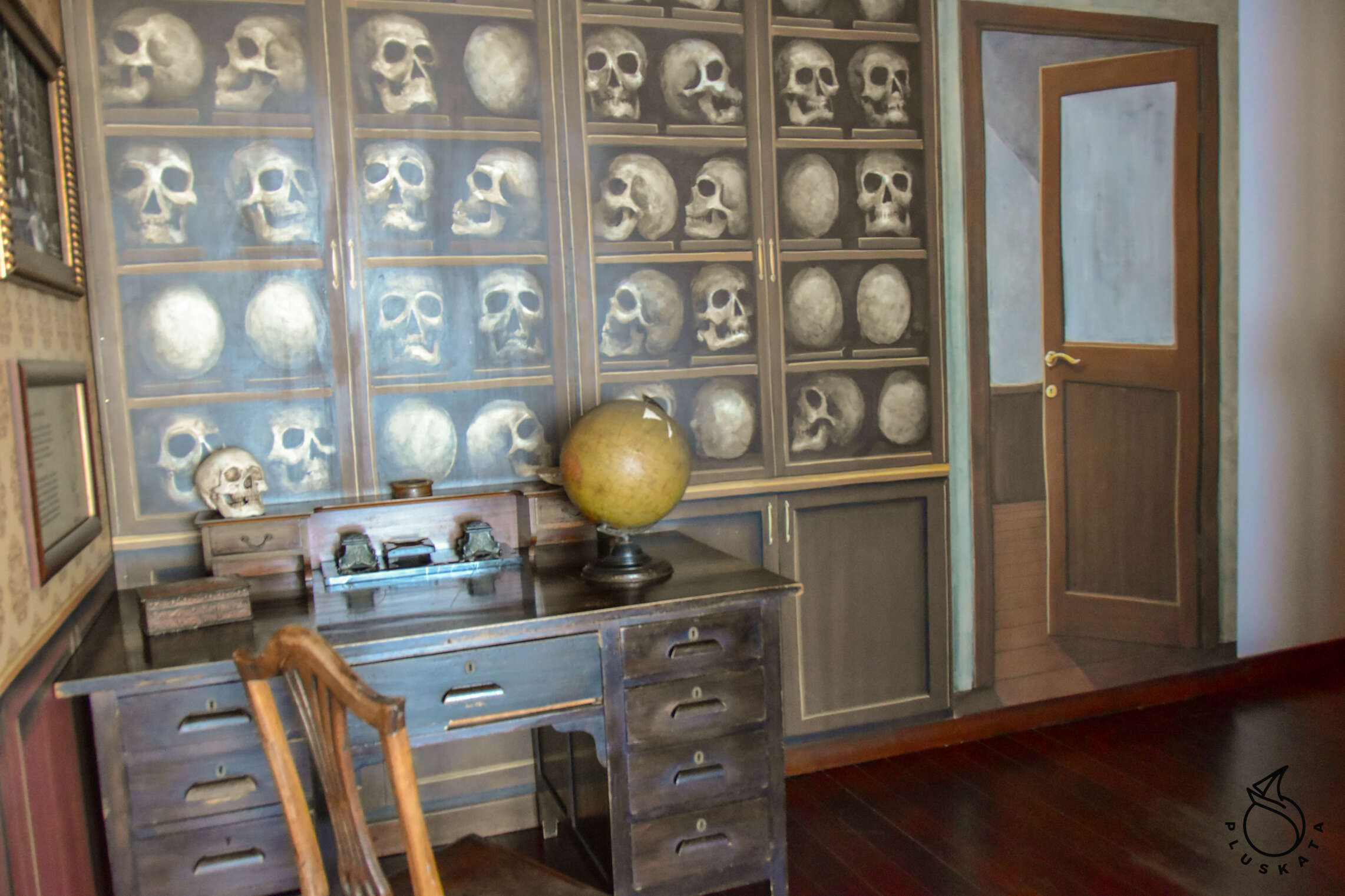
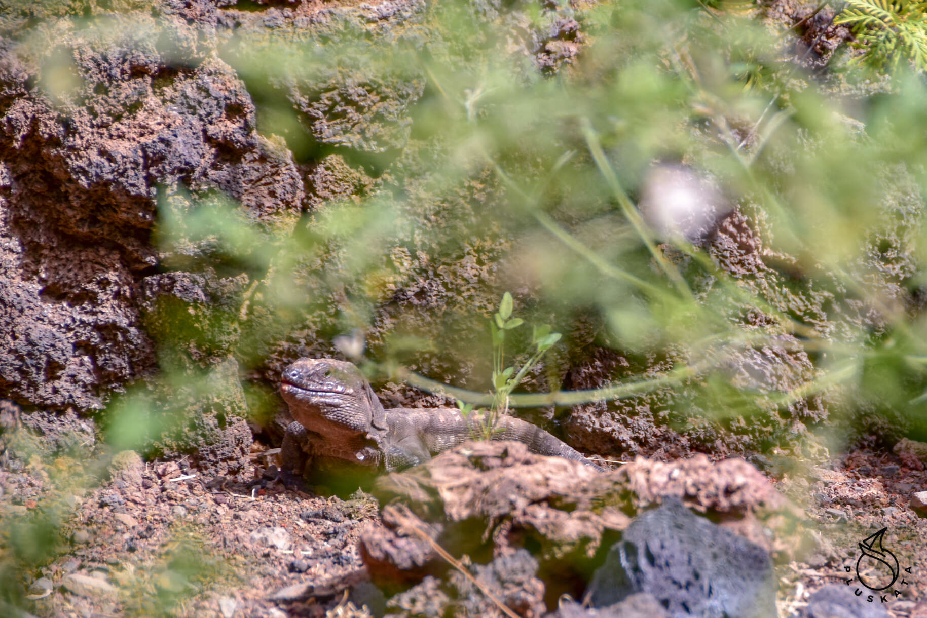
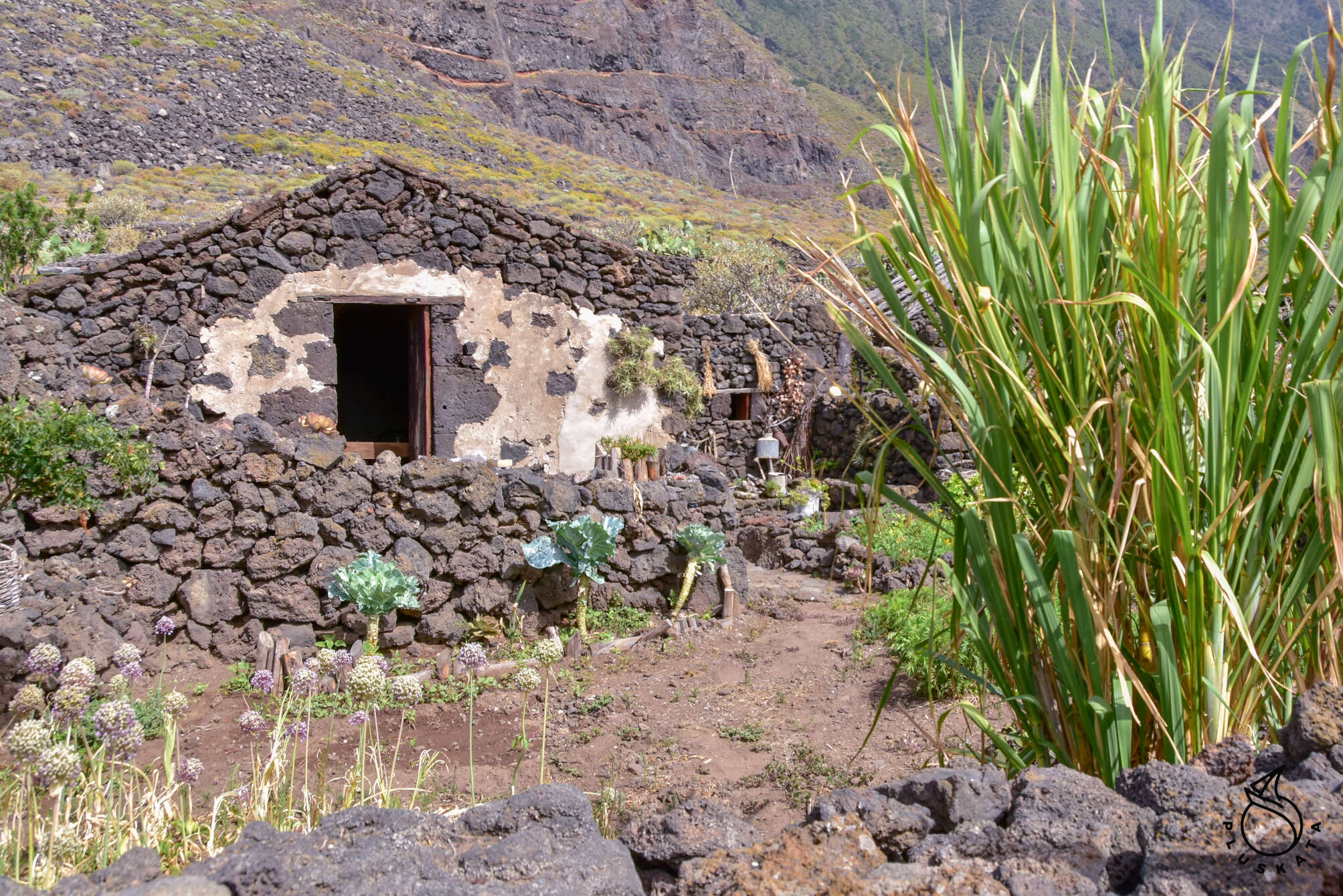
We decide to visit Ecomuseo de Guinea and Lagartario (reproduction center of lizards) . Entrance to both is €8.5 per person. Ecomuzeum is actually an open-air museum with houses of local residents (Bimpache) from different times – from caves to quite modern houses with equipment. Lagartario is visited with a guide, the lady speaks Spanish, but we understand most of it, and the inscriptions on the posters are also in English. In large terrariums you can see lizards – only males, because females are very nervous and do not like visitors. The Ecomuseum is open until 6 pm. Then we go for lunch to the bar recommended by the guide in La Fontera.
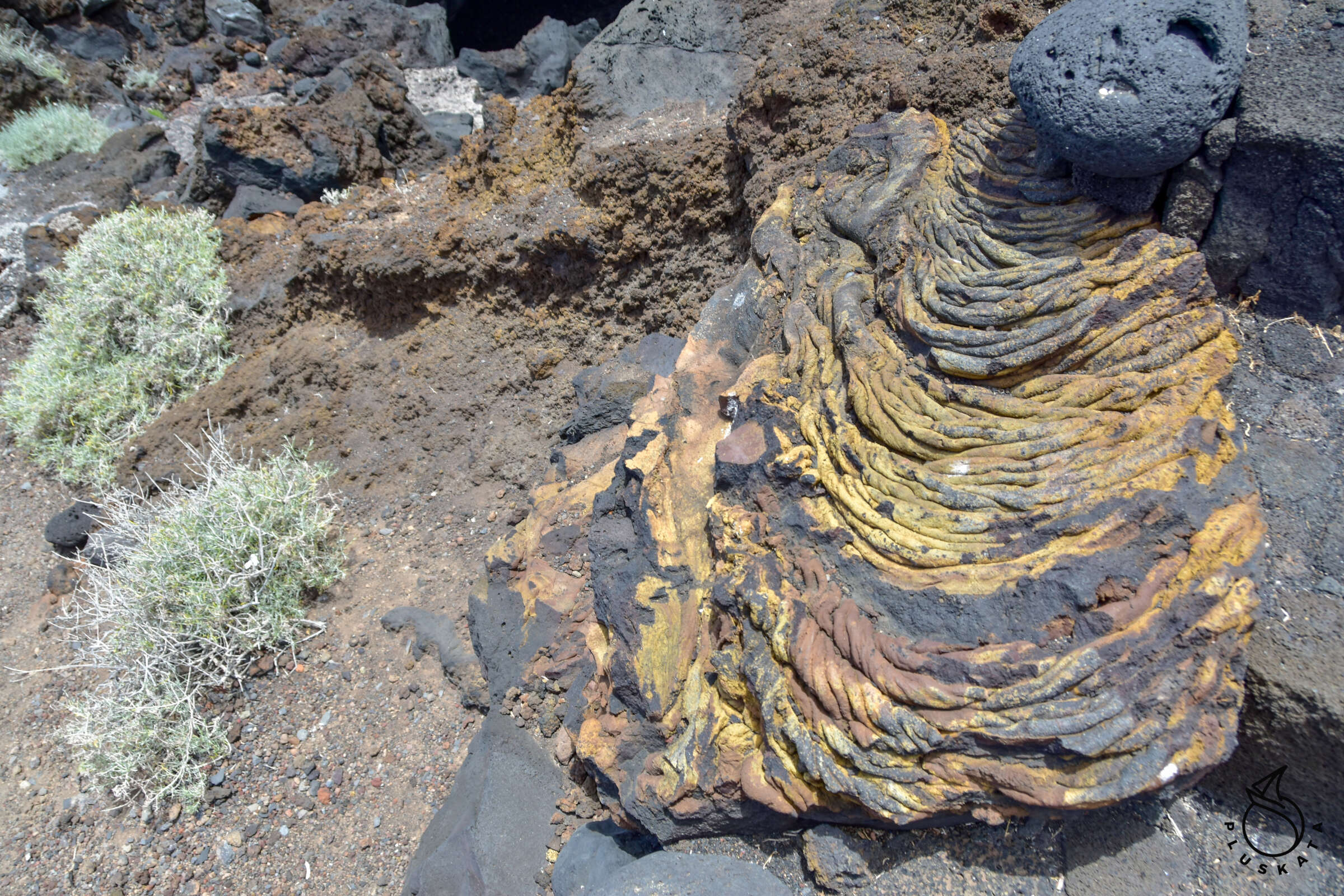
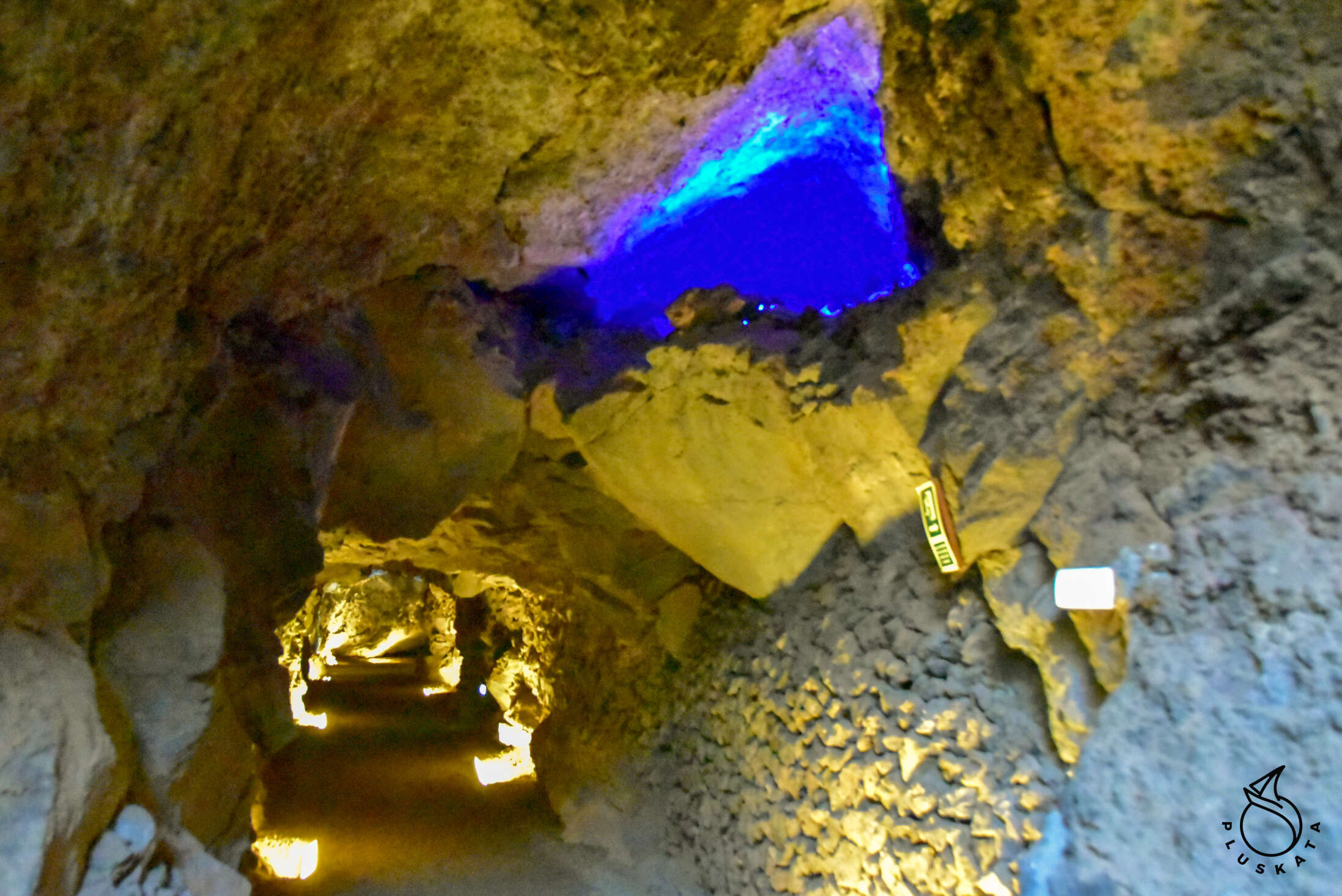
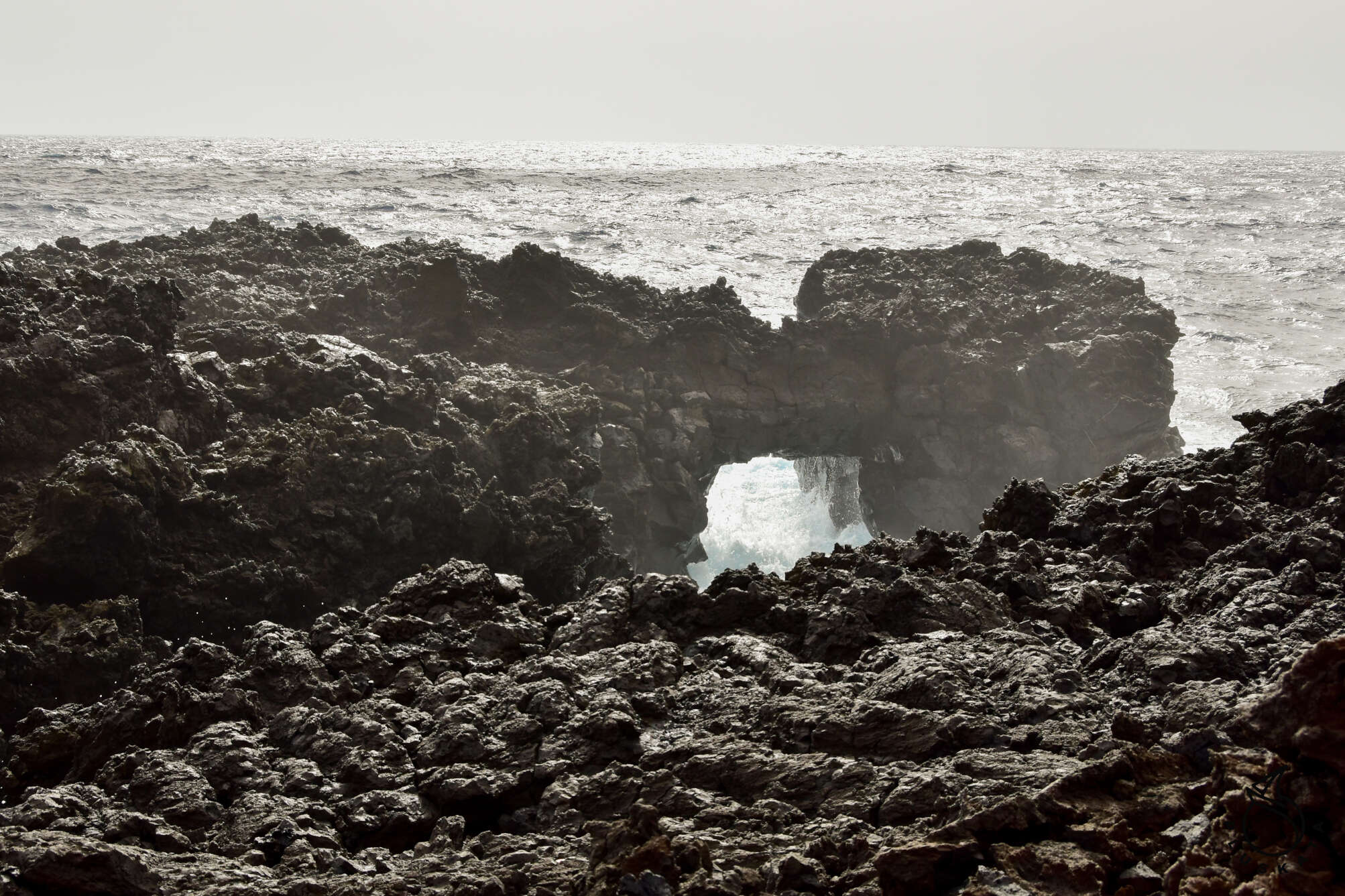
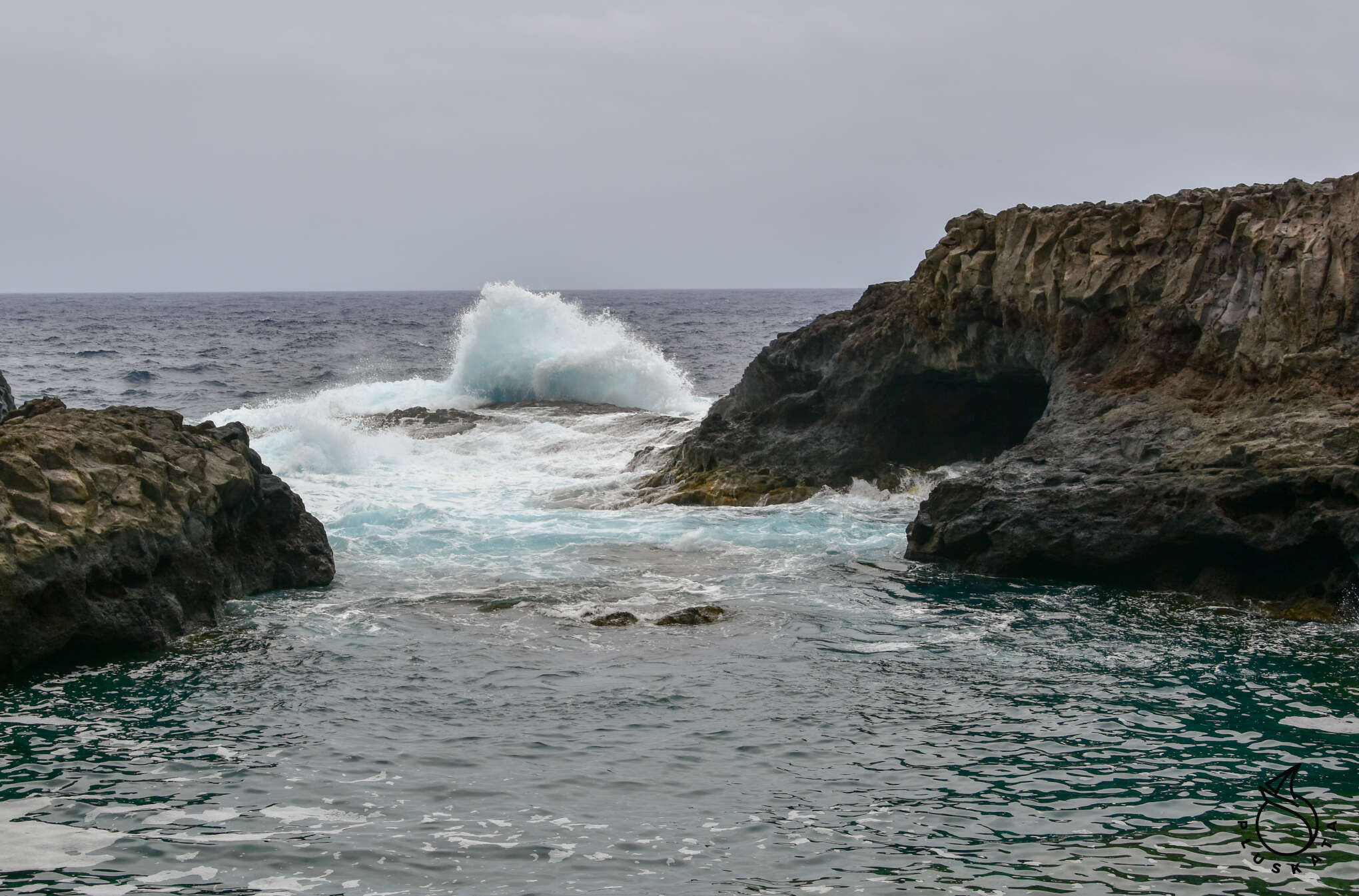
In the morning of the next day we go to Tamaduste on the north-eastern end of the island – it’s not far from the marina – just behind the airport. From there, we set off on the trail along the coast – the whole thing is about 2.5 km and is very scenic. You can see various rock formations in different stages of erosion (or rather waterlogging). You have to go there before noon, because then the rocks are beautifully illuminated by the sun.
The construction of the trail was financed from EU funds. We reach the end of the trail and return along the same road. You can return to the “wild” path to the city, but it is much less picturesque.
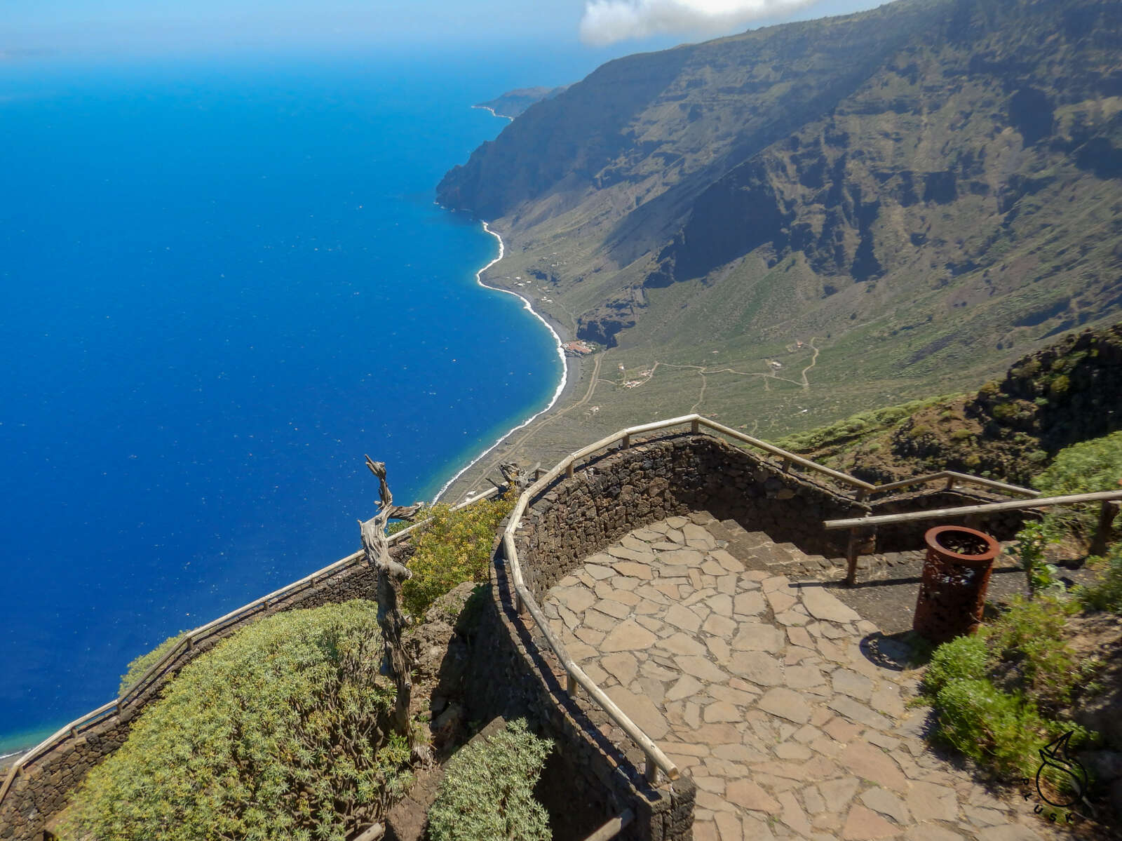
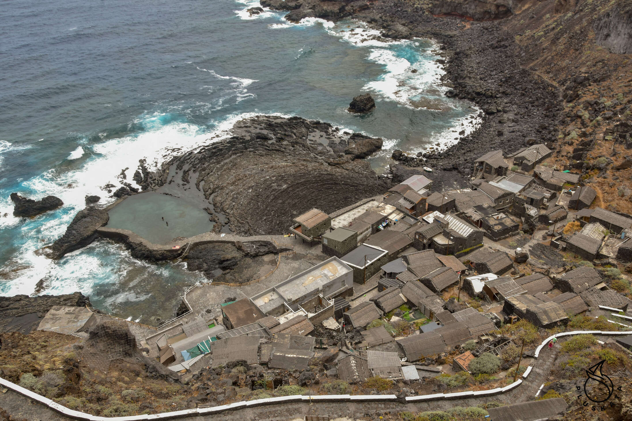
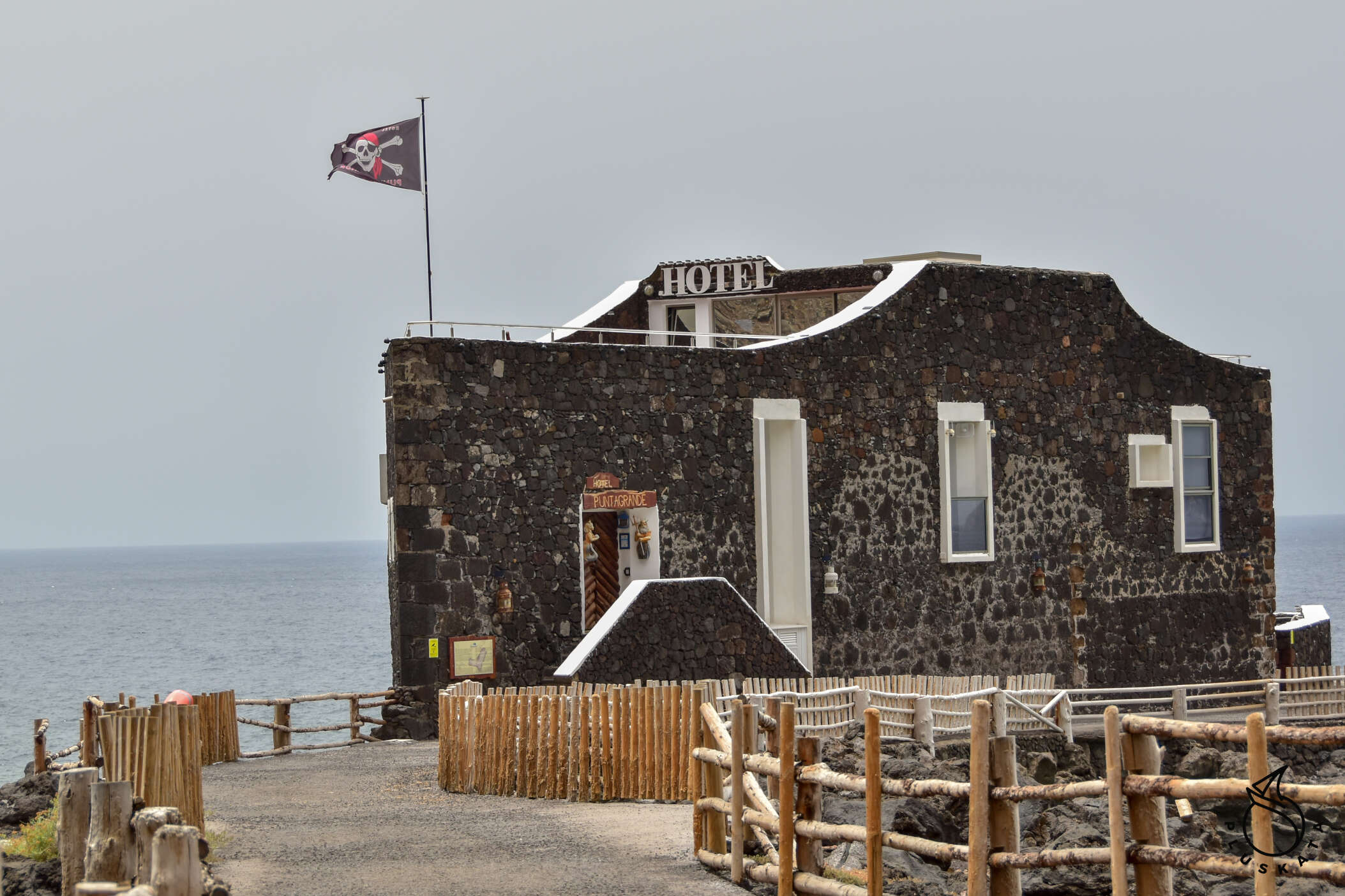
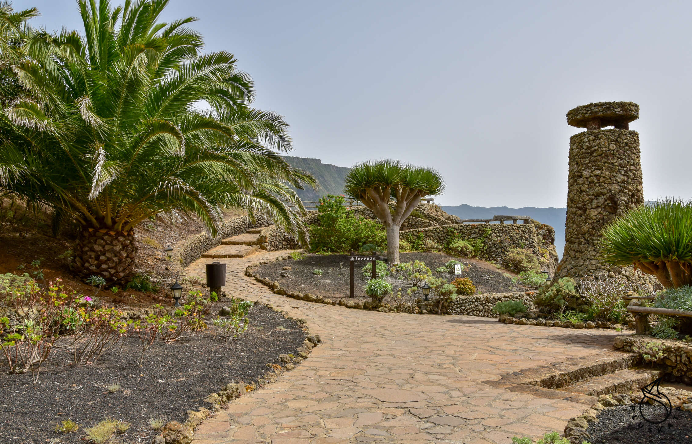
Then we go to see the “baths” of Charco Manso and Pozo de La Calcosas – beautiful lava pools, partly in caves. Then we see the smallest hotel in the world (until 1989) in Las Puntas – unfortunately it is closed – it can be visited until 1pm, by appointment. From Las Puntas we go up to La Pena, where there is a viewpoint designed by Cesar Manrique. It is nicely designed with a stunning view of the El Golfo valley.
Practical information
On the island, you can fill any cylinders (they must have a valid certificate) – you pay for a kilogram of gas. The filling point is about 1 km from the marina in the direction of Las Playas (before the tunnel) at Punta del Bajio. Can only be filled with butane.
Toilets and showers have been launched in the marina (you need to have a card – deposit 10 €). There are card readers at the gates to the platforms, but they do not work yet.
Car rental (cicar) is open during the ferry arrival time, so it is best to book the car for 20:30 (except Saturdays).
The ferry cafe is open from 8 a.m. to 10 p.m. (except Saturdays), it has internet (it doesn’t reach the piers), you can buy some simple bar meals, beer, drinks from the fridge.
You can also return your car keys at the cafe (they have a special box).
The nearest grocery store is in Timijiraque and the larger market is in Valverde.
There is a bus to Valverde 5 times a day (ticket is bought from the driver €1.35 one way)