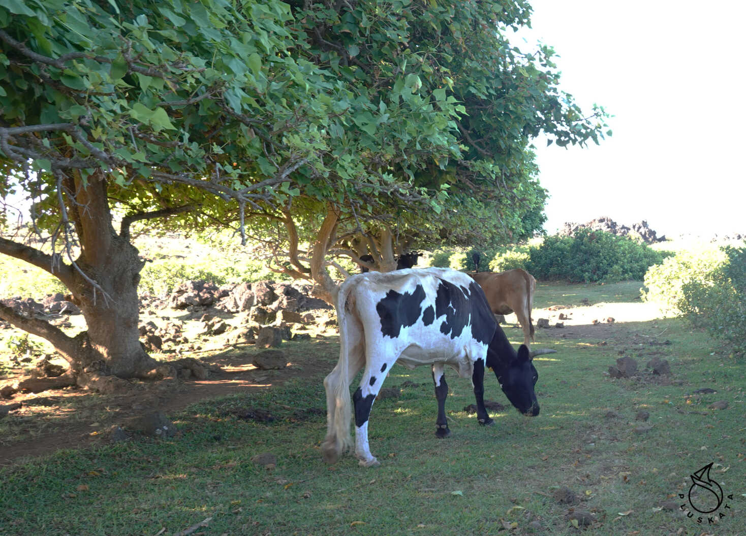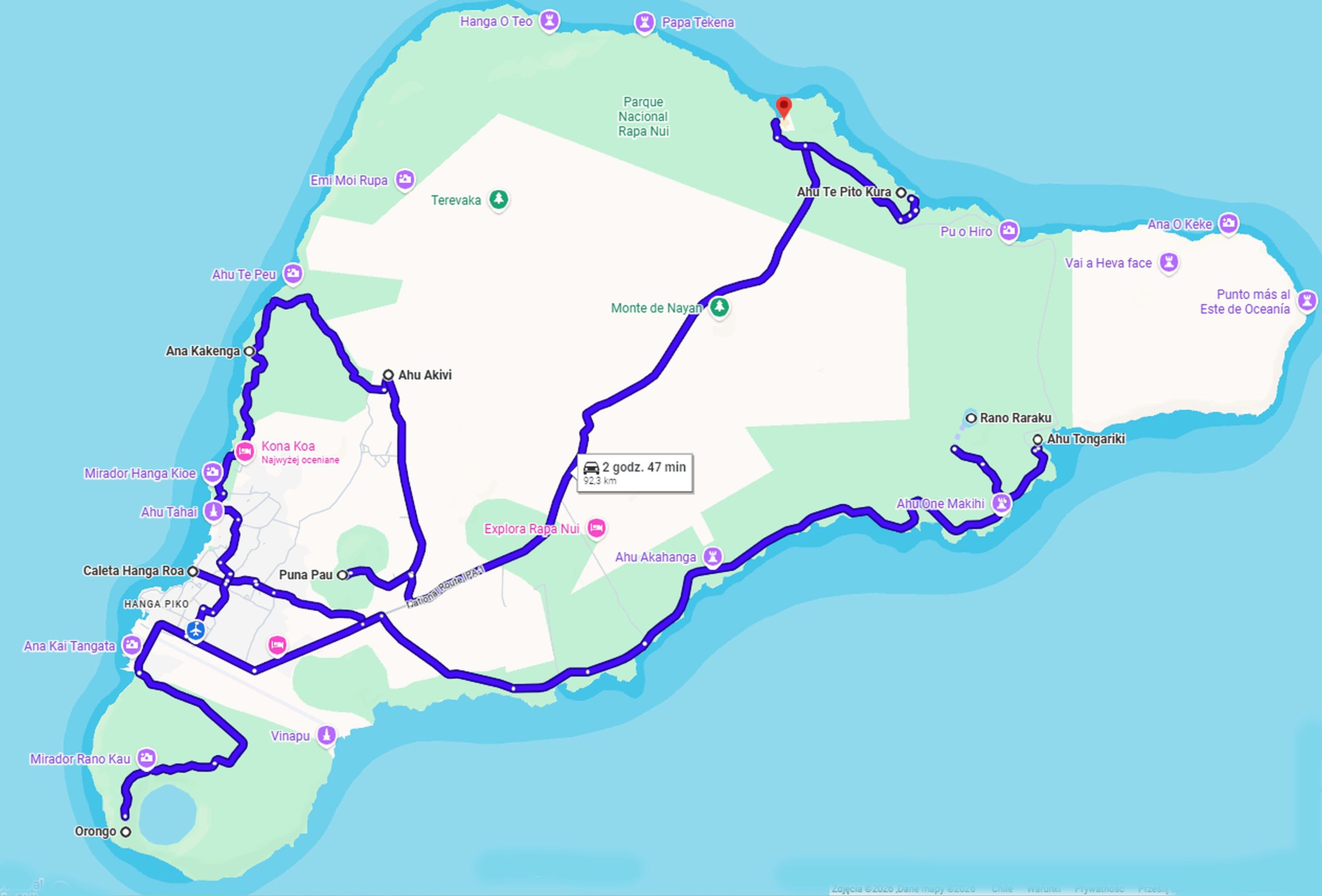
Rapa Nui National Park
Guided tours are mandatory. You can book a tour through one of the numerous travel agencies or hire a private guide (a slightly more expensive option, but highly recommended). We chose Martin Hey (a local guide). You can suggest your own itinerary. We list the points of interest and divide the trip into two days and two tours, for a total of four days of excursions. The total cost for one person is 270,000 CLP (including coffee, sandwiches, drinks, and fruit).
To enter the park, you need to purchase a ticket for 95,000 CLP per person. You can buy it online on the park website: https://rapanui.tur.com. It’s best to print it out – they will then stamp it at the ticket inspection points.
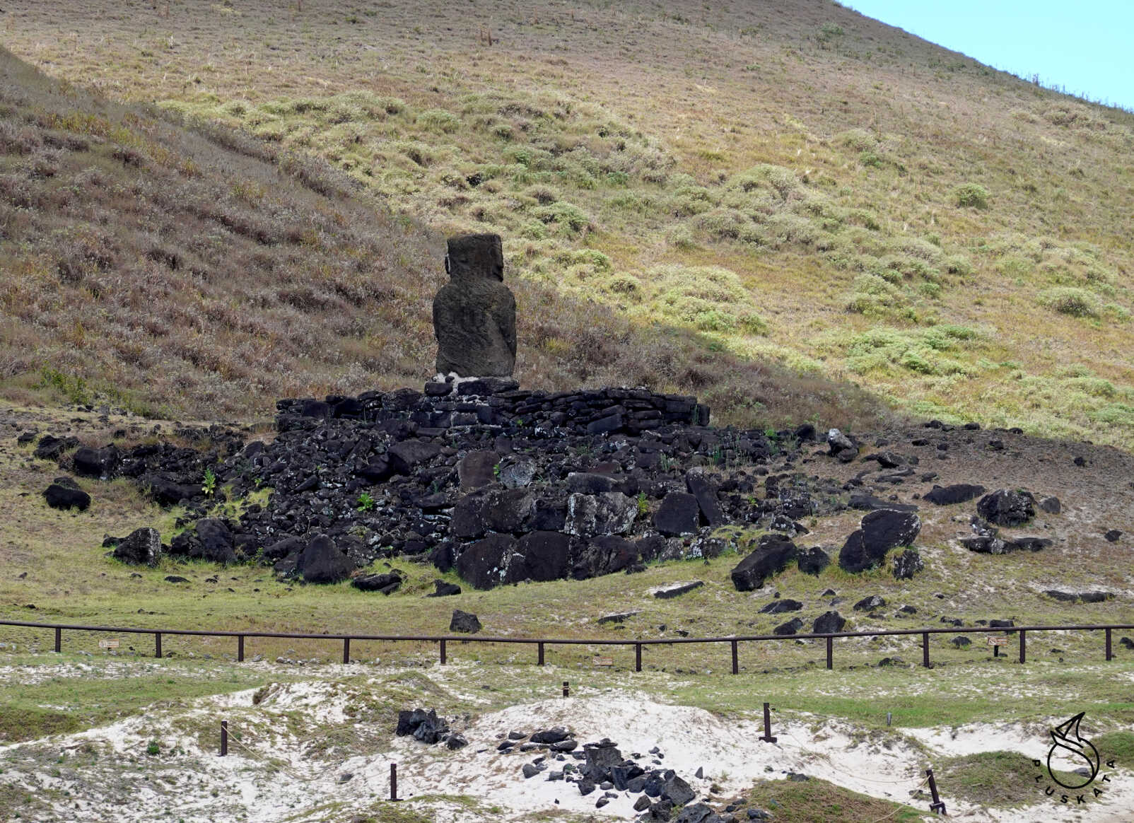
Ahu Tahi
The only entry point accessible without a park ticket – accessible from Hanga Roa – about a 15-minute walk. It’s a good place to watch the sunset. In the evening, you can see crowds of tourists watching the sunset from a yacht.
This is one of the oldest sites on the island, dating back to around 700 AD. Between 75 and 200 people lived there. A single moai, also the oldest statue on the island, stands here. It stands 4.5 meters tall and its name in Rapa Nui means “place where the sun sets.” Ahu Ko Te Riku: Also a solitary moai, but complete with original elements, and most importantly, the only restored one with white and red coral eyes. Ahu Vai Ure: The most photographic site. It consists of five moai statues facing away from the sea, on a platform, and its name in Rapa Nui means “dark water.” Its distinctive feature is that the sun sets through the statues.
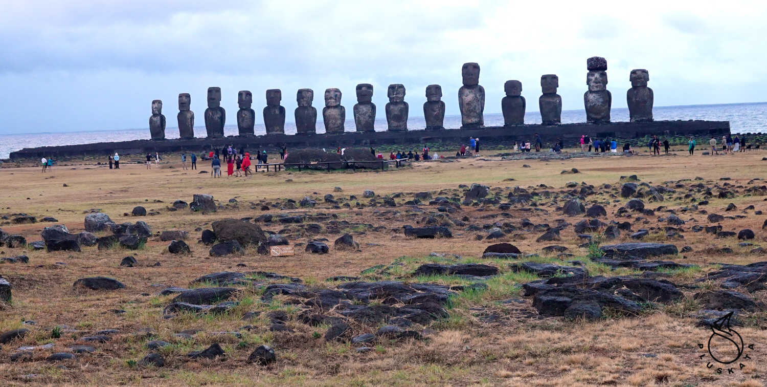
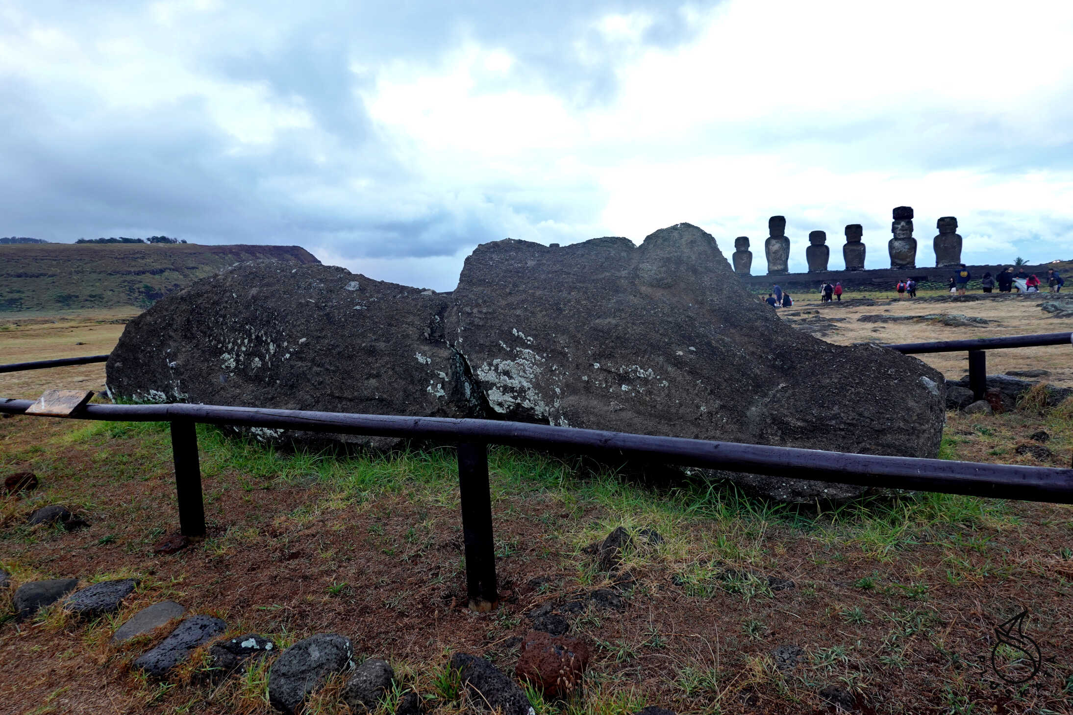
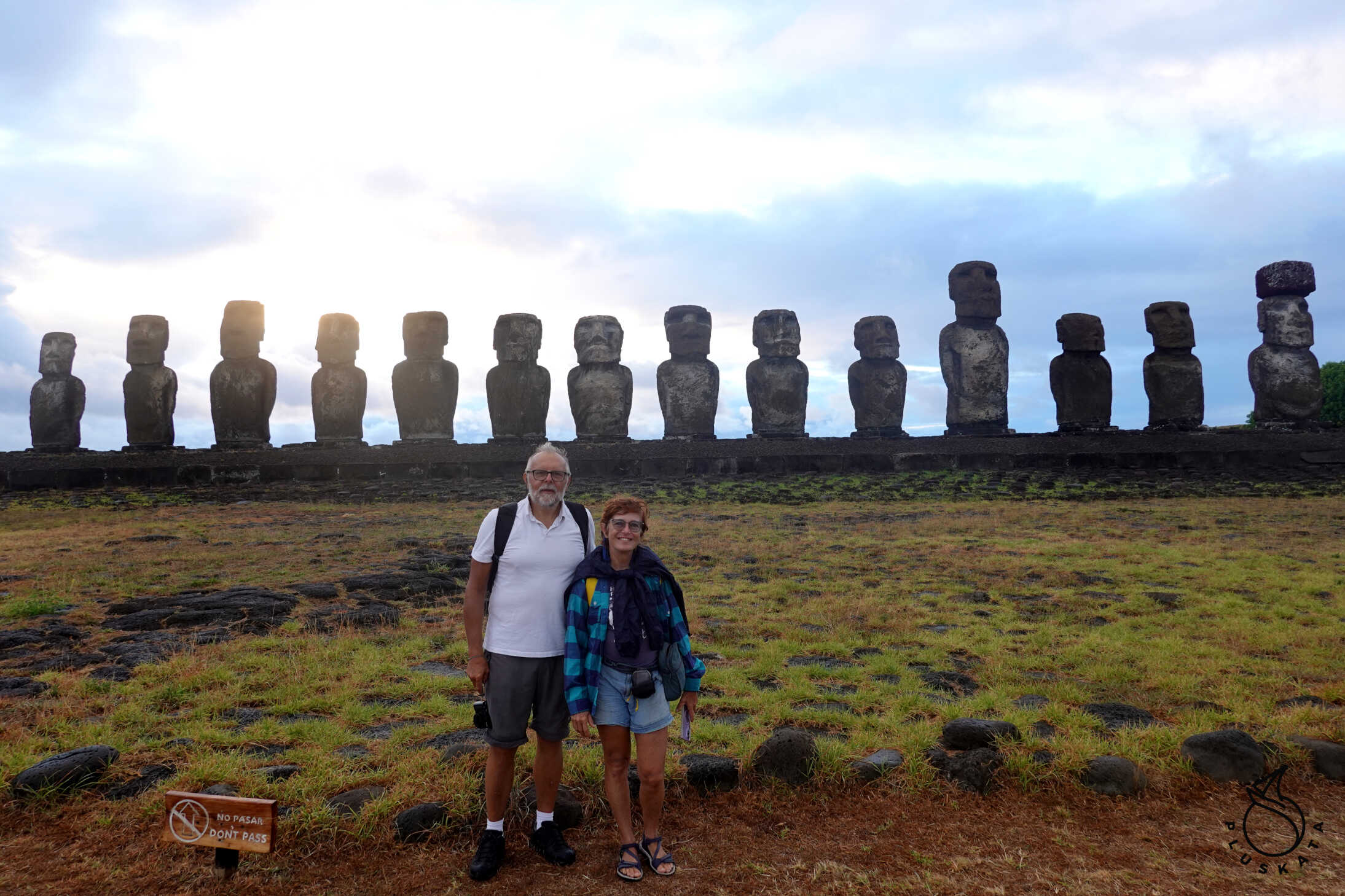
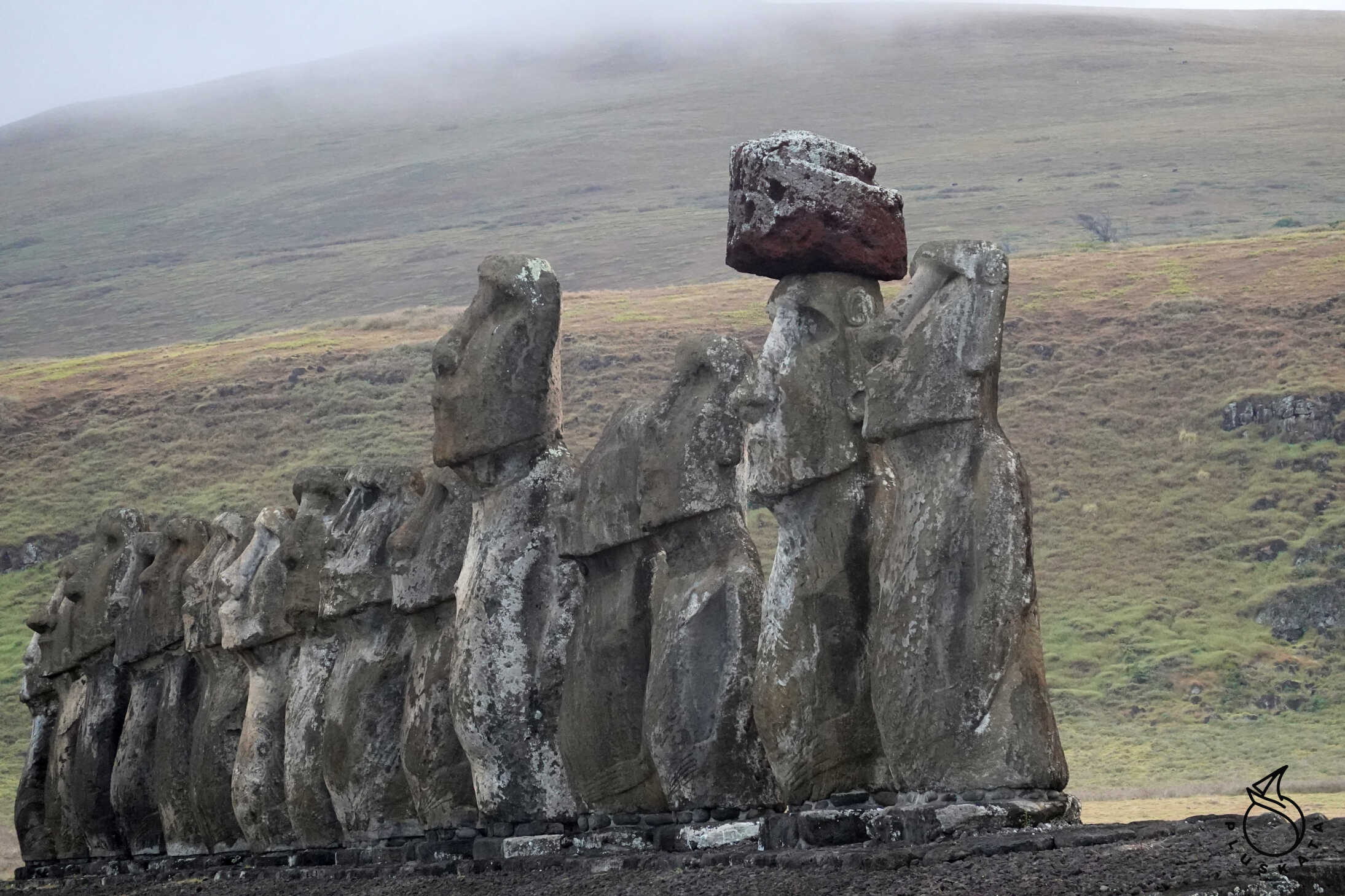
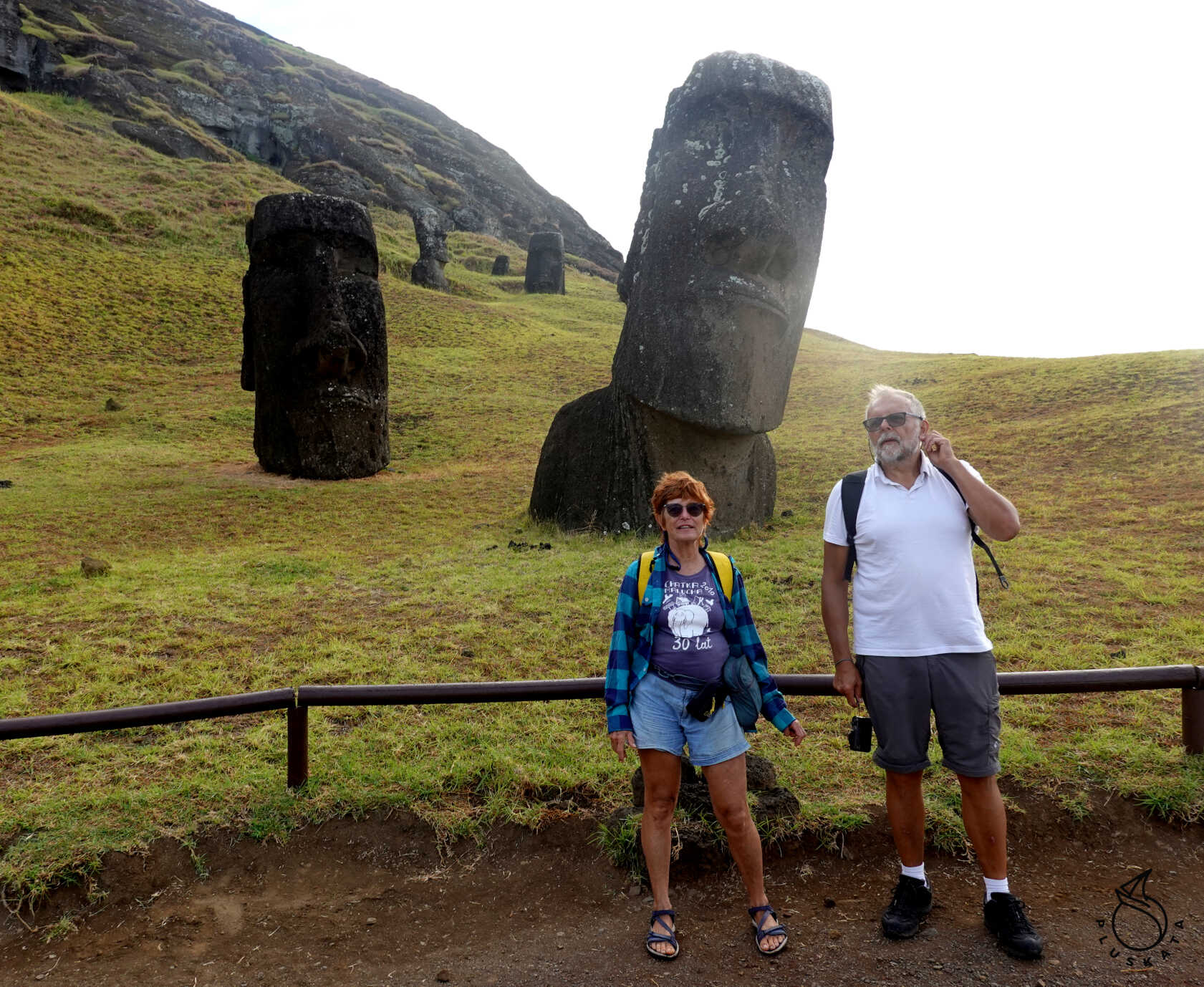
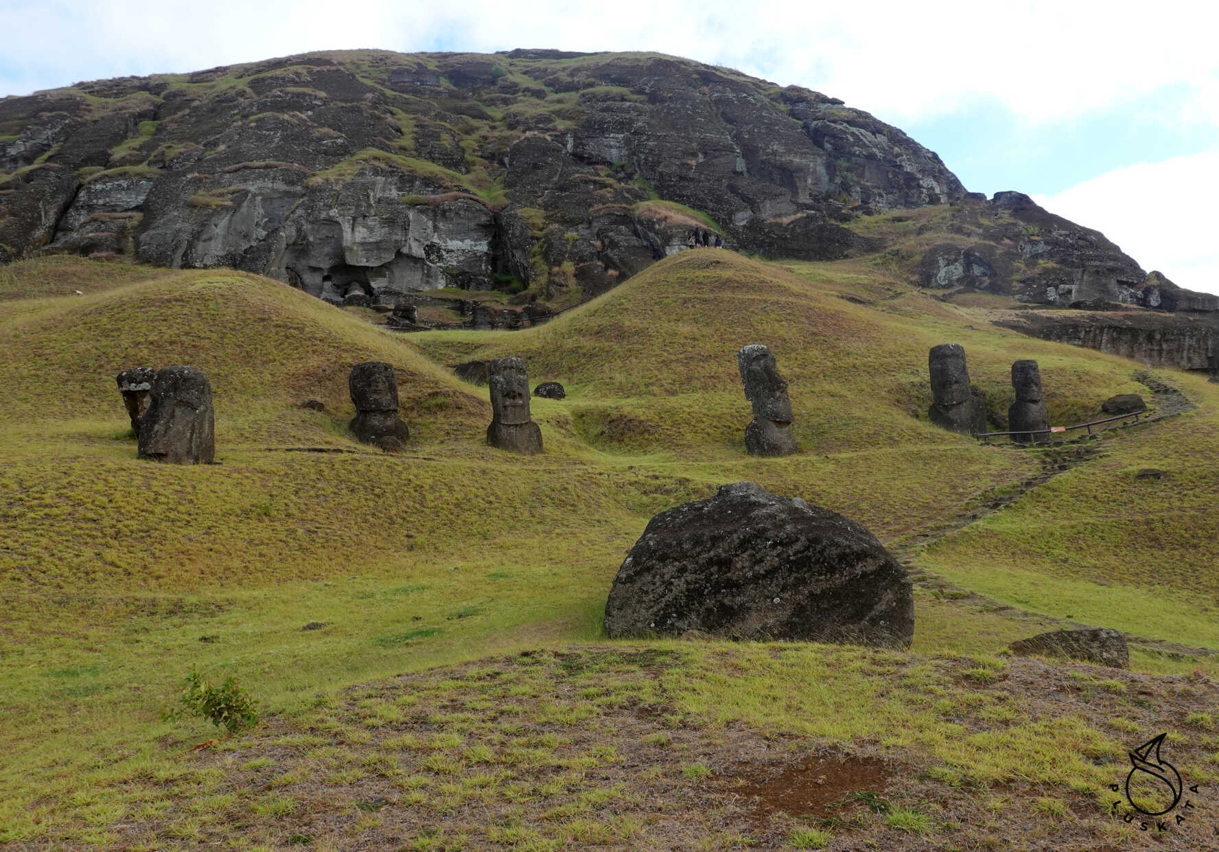
Ahu Tongariki
This is the largest ceremonial site on the island. It consists of a group of 15 statues. It’s an ideal place to watch the sunrise. Unfortunately, it was raining and the sky was overcast when we arrived. All the moai face the village.
The history of Tongariki is a blend of mythical tales, inter-clan warfare, and tribal settlements dating back to the 10th century. The extensive esplanade in front of the ahu contains the remains of houses called hare paenga, old hearths called umu pae, and petroglyphs carved into the volcanic rock, reflecting the significance of this remarkable site.
Unfortunately, as with other ceremonial platforms on the island, the moai were knocked off the ahu during violent clashes between island clans during the decline of the Rapanui culture. This period is believed to have begun after 1500 CE and reached its peak in the late 17th century.
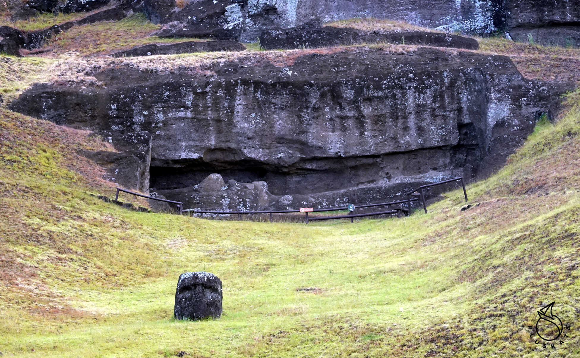
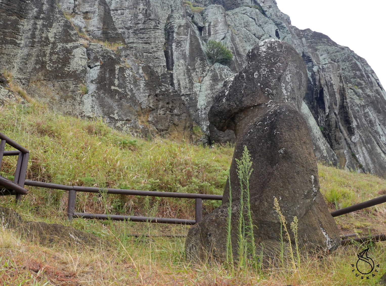
Rano Raraku
Rano Raraku is the quarry where almost all of the 1,000 statues found on Easter Island were carved. It was here that the moai were carved and then moved to ceremonial platforms (ahu) located along the coast, honoring their ancestors.
The quarry, which is over 800 meters long, contains numerous empty niches from which the statues were excavated and moved to the ahu. However, many statues still remain at Rano Raraku. Between the completed statues resting at the foot of the volcano and those still on its outer and inner slopes, a total of 397 moai have been counted. This is the area of the island where the largest number of statues is concentrated, accounting for almost 40% of the total.
The statues still found on the upper slopes of the quarry are in all stages of development, allowing us to deduce the method used in their construction.
The first step was selecting the appropriate area for the work. Sometimes, the sculptors had to climb to sites at the summit or with extreme inclines. There, the rock was carved into a rectangular block. Later, to facilitate work with the material, a narrow, half-meter-wide corridor was carved around the block, where the sculptors were stationed. Using basalt tools called toki, the tuff was cut to shape the moai. All the figures were carved on their backs, whether they were horizontal or vertical. The first step was carving the face, with particular attention to the nose, which served as a reference point for maintaining the sculpture’s symmetry and proportions. Next came the neck, torso, arms, and hands. Next, the sculptors worked on the sides of the statue, inserting material underneath until a narrow strip of stone ran along the column, like a ship’s keel.
While the statue was supported by stacks of stones like a wedge, holes were drilled in the keel until it was completely cut and freed from its niche. Some statues cracked during this process. Another challenging task was sliding the statue down the steep slope without damaging it. It appears that tree trunks and ropes made of plant fibers were used to support the moai, and channels were dug into the ground to maintain balance during descent. Despite this, many accidents occurred, as evidenced by the remains of torsos and broken heads that dot the hillside.
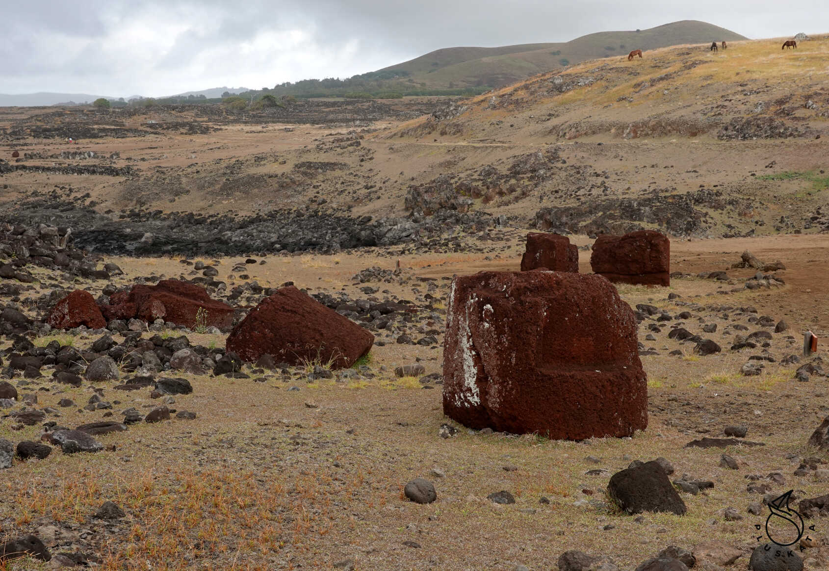
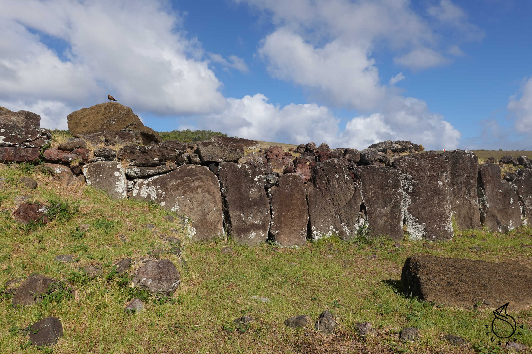
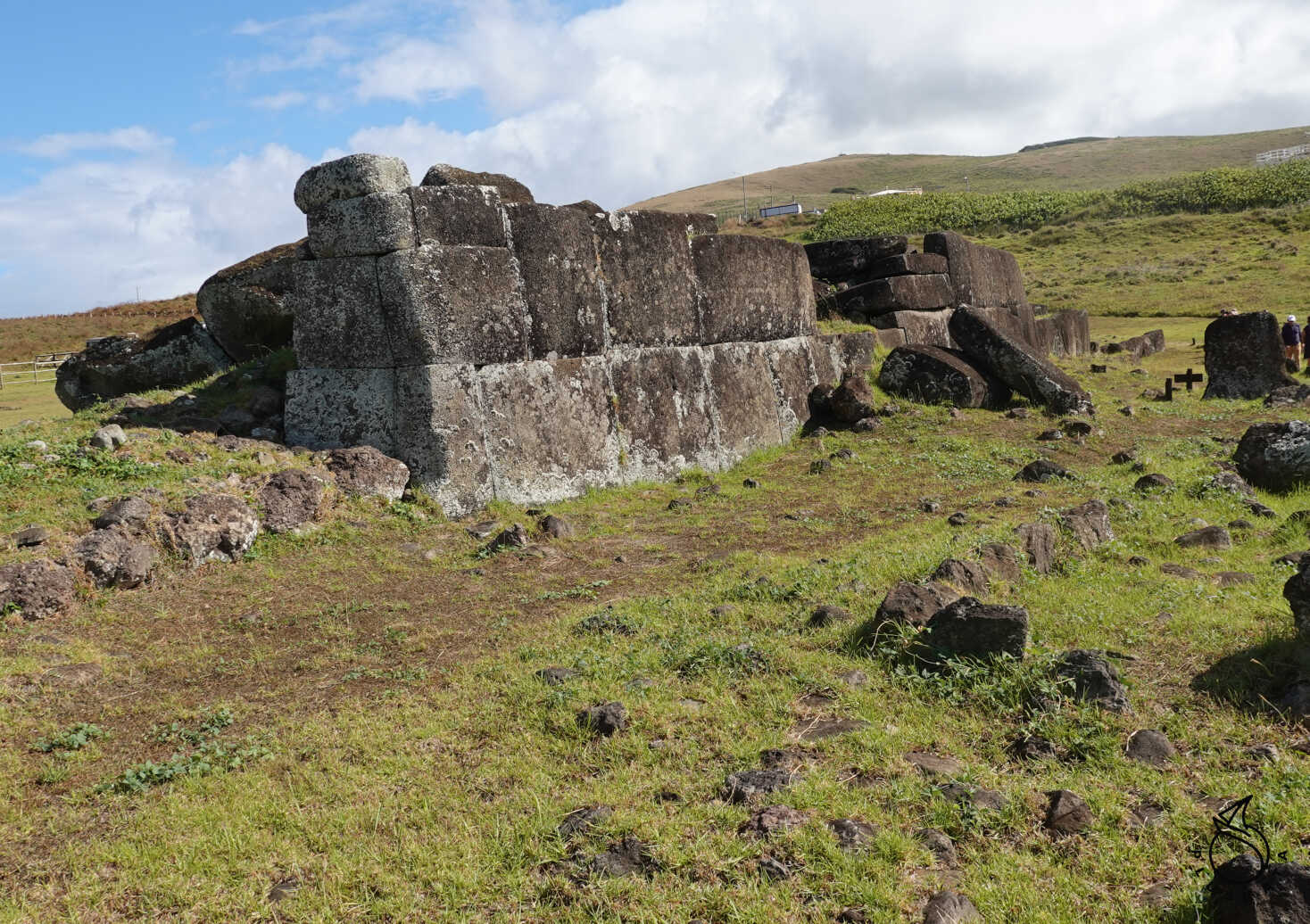
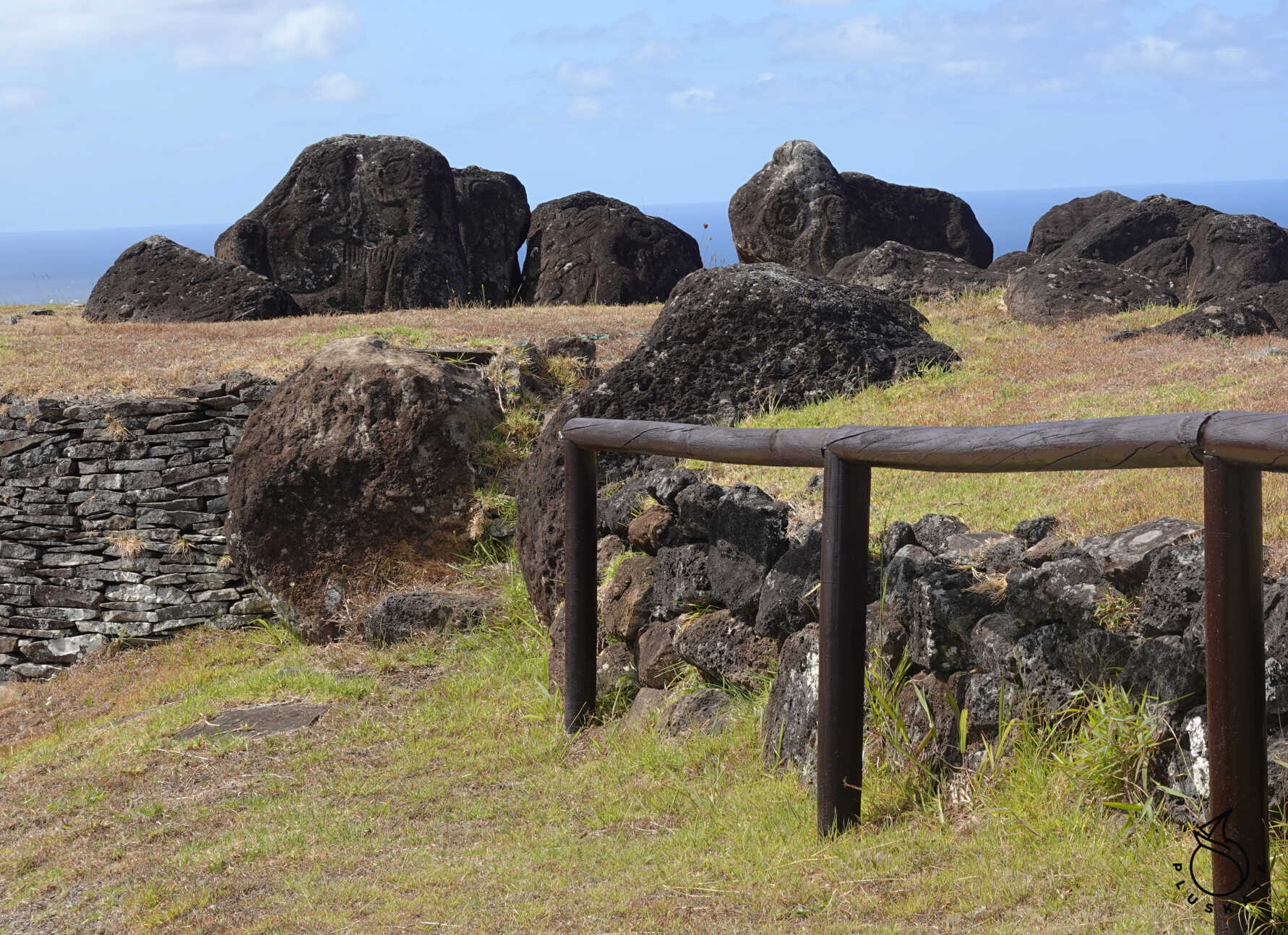
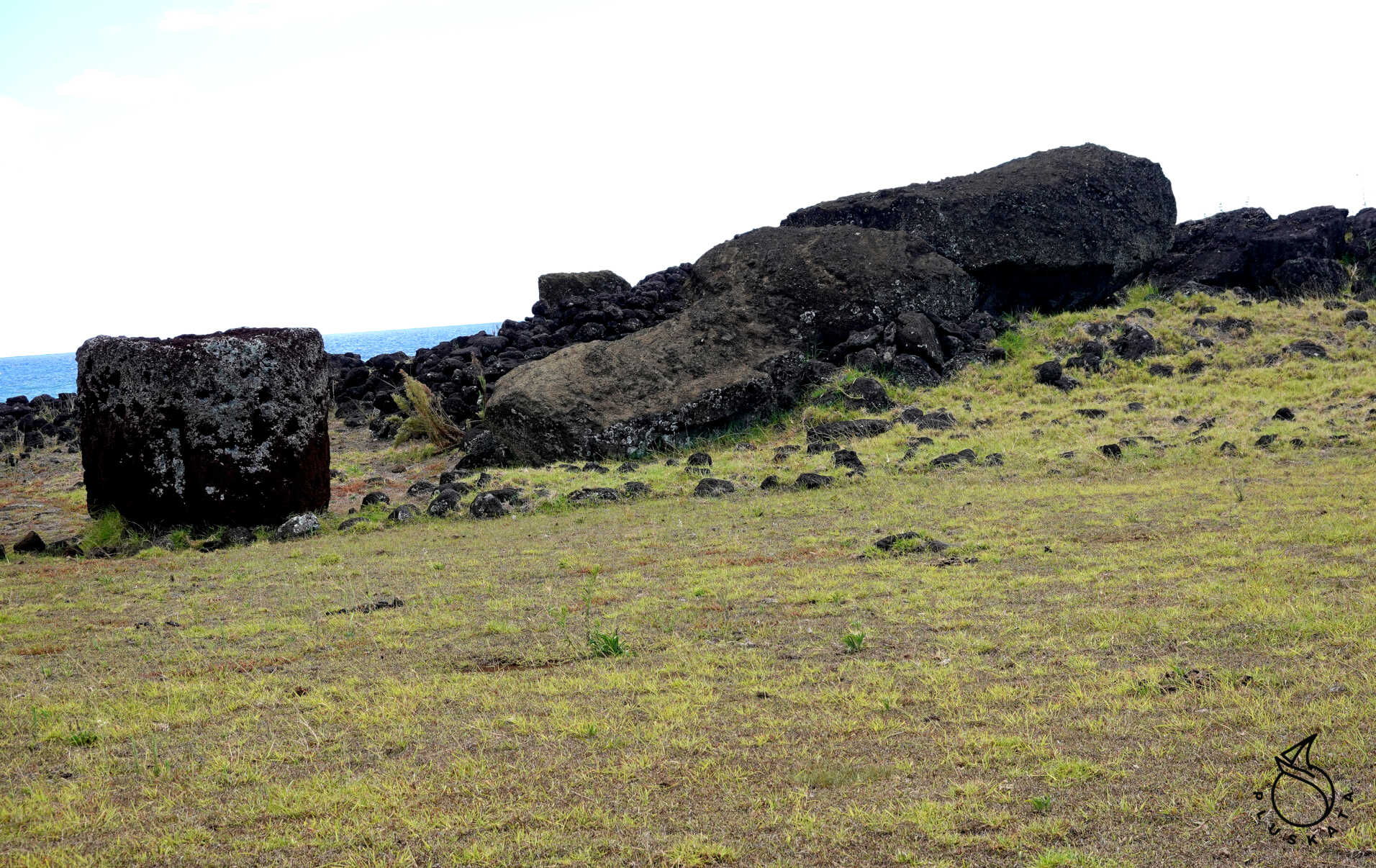
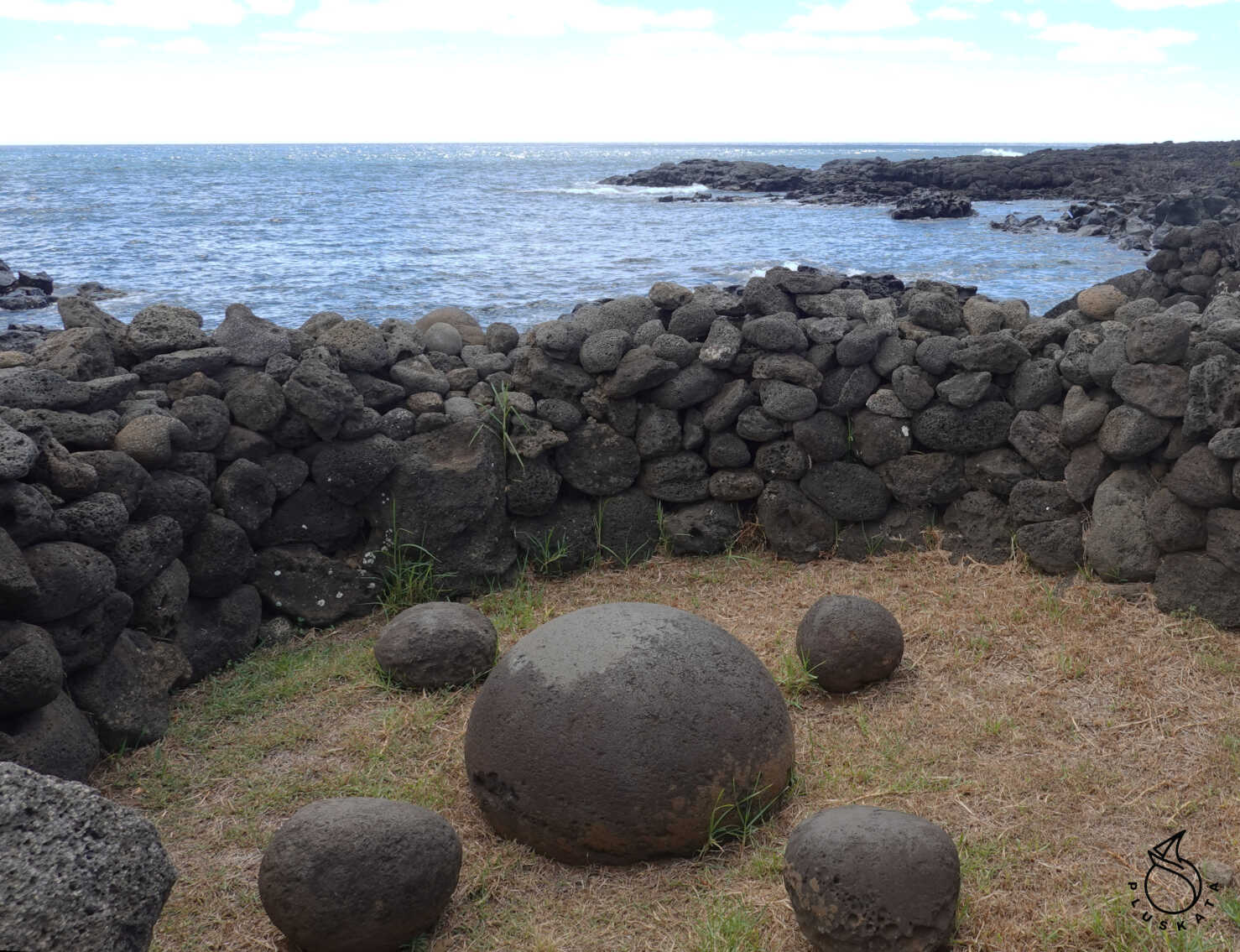
Ahu Angahanga
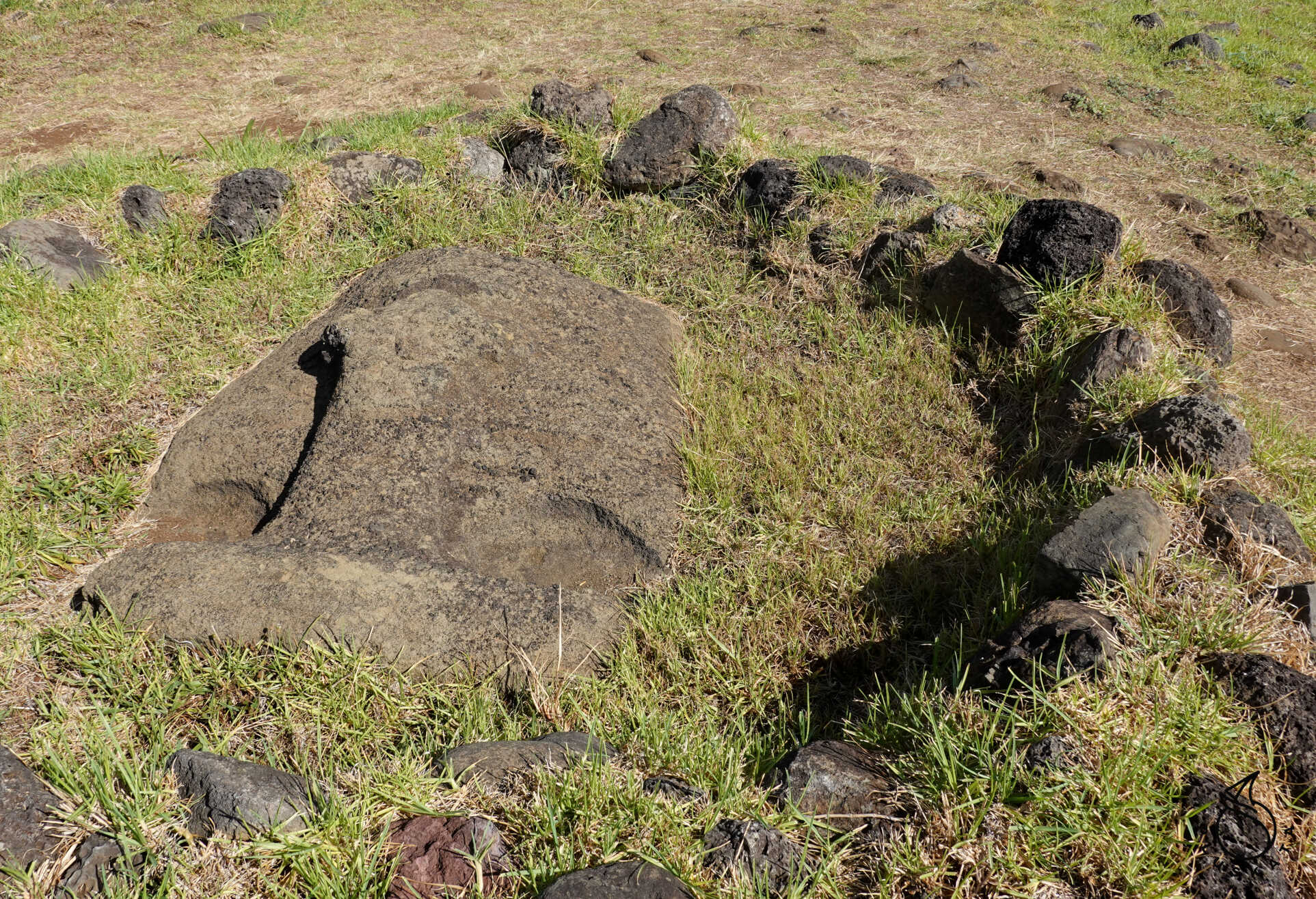
Anga, also known as Aka Hanga, is home to the remains of an ancient village located near a small bay (hanga) on the island’s southern coast. At the entrance to the enclosure, after passing through the wall, lie the stone foundations of several hare paenga, or boathouses, so-called because of their elliptical shape, resembling the ship in which the ancient inhabitants lived. In front of each house is a small square paved with round sea stones (poro nui). Very close to the houses are several umu pae, or old stone ovens used for cooking umu. Pae in the Rapanui language means five and refers to the number of stones typically used to build the oven.
To the right, facing the sea, is the small cave Ana Akahanga, whose entrance is reinforced with additional stone. Due to its width and shallow depth, this cave is a karava-type cave. It served as a temporary shelter, primarily for fishermen seeking shelter from the rain or spending the night there.
Ahu Akahanga stands on the left, just in front of the sea, a few meters from the rough waves crashing against the rocks. This large platform, 18 meters long, has not been restored, giving an idea of the condition of all the ahu during the island’s decadence.
Vaihu
About 150 meters from the entrance to the complex lies an ancient settlement, consisting of a large ceremonial platform. This large ahu, whose rear retaining wall is semicircular, measures 86 meters long and 12 meters wide and supports eight statues, which currently lie prone on the ground. Surrounding the ahu are pukao, or headdresses made of red volcanic stone, which crowned the statues. Ancient agricultural practices can be seen in the restored settlement. Vina Paku
At Vinapu, the statues take a back seat, as what sets this site apart is the excellence of the construction and sculpting techniques developed in the construction of Easter Island’s ahus, or platforms. Here, visitors can admire a stone-cutting technique found nowhere else in Polynesia and that has given rise to numerous theories about the origins of the island’s population, linking it to the Inca culture of South America.
The main ahu, also known as Vinapu I or Tahira, located on the left side of the road, houses six statues lying face down, with three pukao on top. Its orientation, like that of many other platforms on the island, is linked to the position of the stars, and in this case, it points east of the winter solstice.
At the rear, facing the sea, lies another buried moai, from which only the head protrudes. Its figure is heavily eroded, and its eye sockets are uncarved, suggesting it never reached the platform.
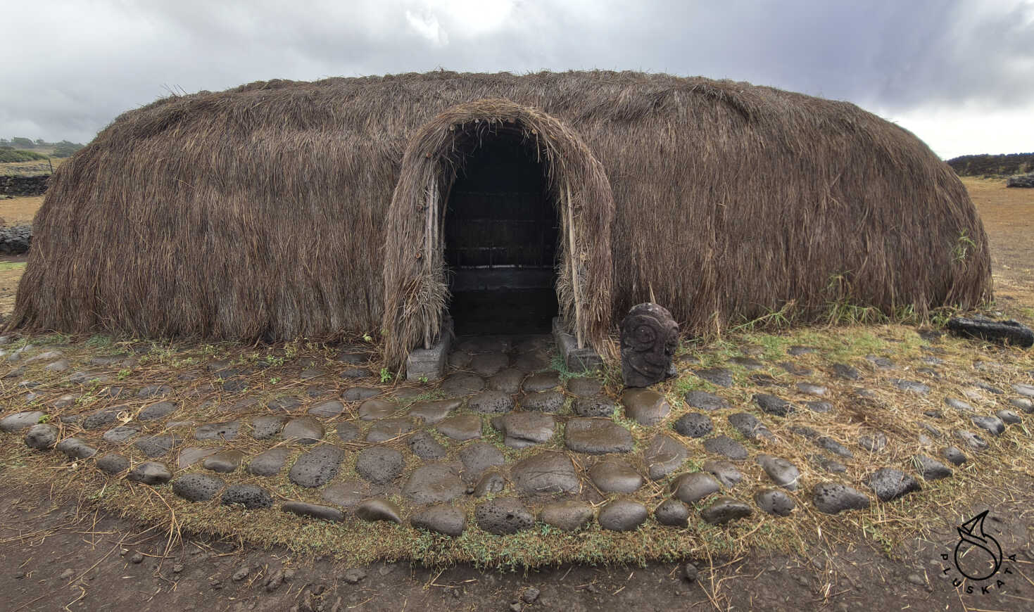
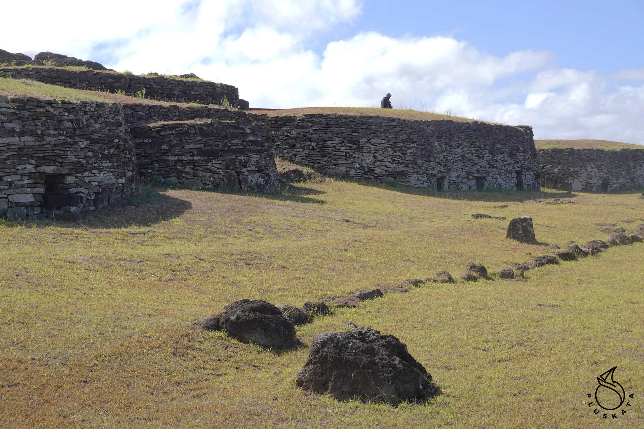
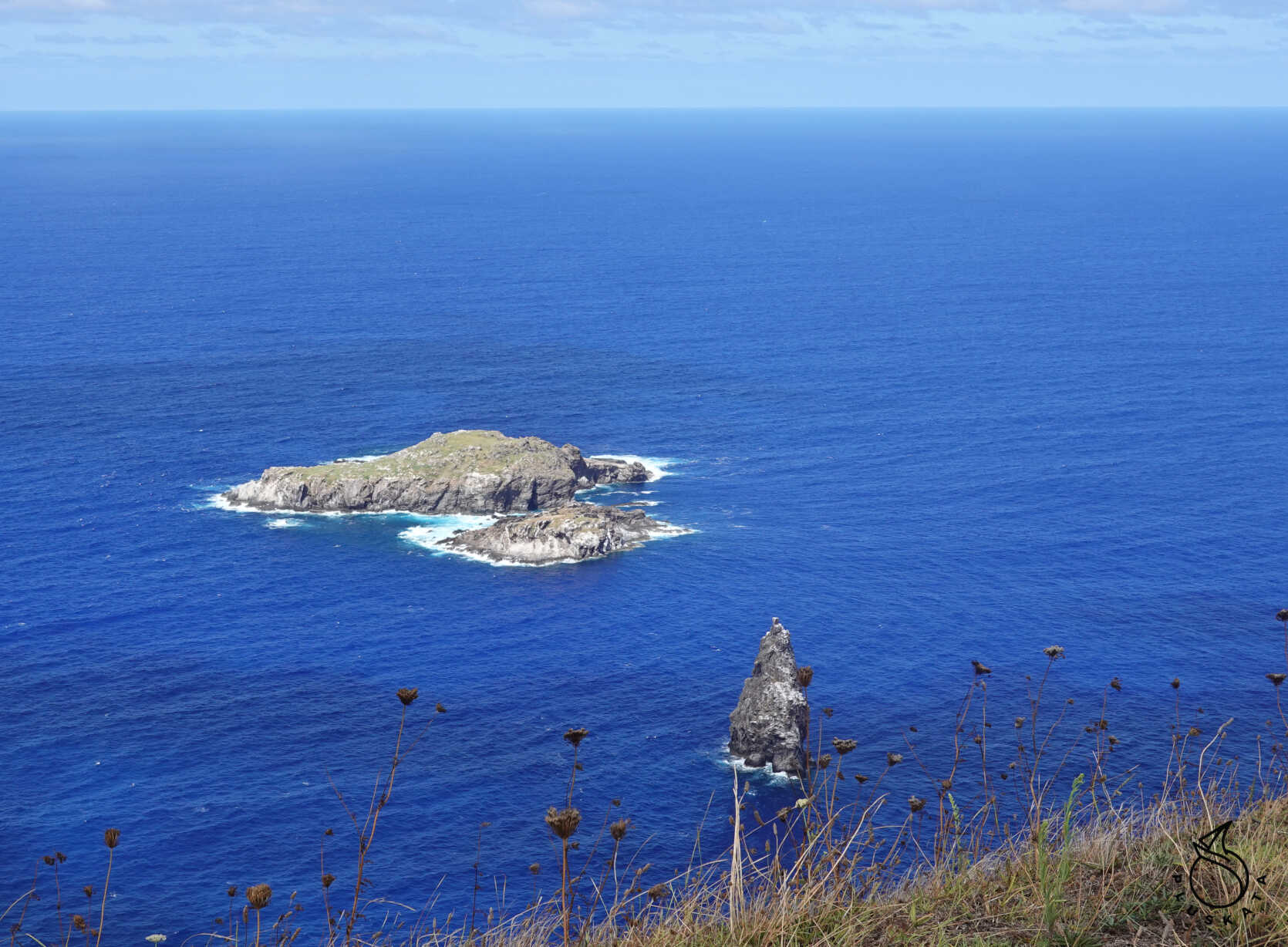
Orongo
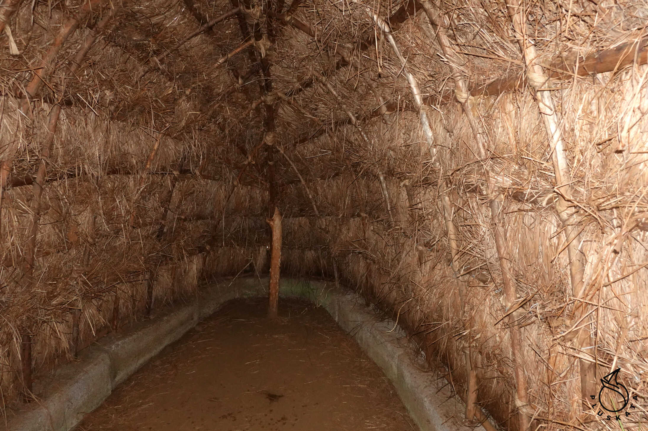
The village of Orongo was seasonally inhabited by chiefs and leading figures of ancient tribes who hoped to collect the first sacred egg of the manutara bird in spring.
This was a religious festival honoring the creator god Make Make, which culminated in the Tangata Manu competition. During this time, participants lived in houses specially built for this purpose and characterized by their unique architecture.
The first stone houses in Orongo were likely built around 1400 CE on a rock outcrop that rises where the village center now stands.
Over time, and especially during the Tangata Manu ceremony, 54 houses were built on the crater rim, creating three independent complexes facing the sea.
According to tradition, as the ancestor cult symbolized by the moai was abandoned and the prestige of the old political and religious order grew, rival tribal groups arose, seeking to seize power. By the end of the 17th century, it was determined that the best way to gain power was through an annual competition in Orongo, in which the winner enjoyed a series of rights and privileges over their rivals for the duration of their term. With the arrival of spring, the most powerful groups organized to participate in the competition. They met in the large village of Mataveri and then, at the appropriate time, traveled to Orongo. Each clan elected a representative, called a hopu manu.
Contestants had to descend the Orongo cliff and swim to Motu Nui using reed platforms called pora. There, they had to wait for the arrival of seabirds until some of them laid the first manutara egg. The winner announced the result to his team, which immediately made his leader Make Make’s chosen tangata manu of the season, a position he would hold until the following spring.
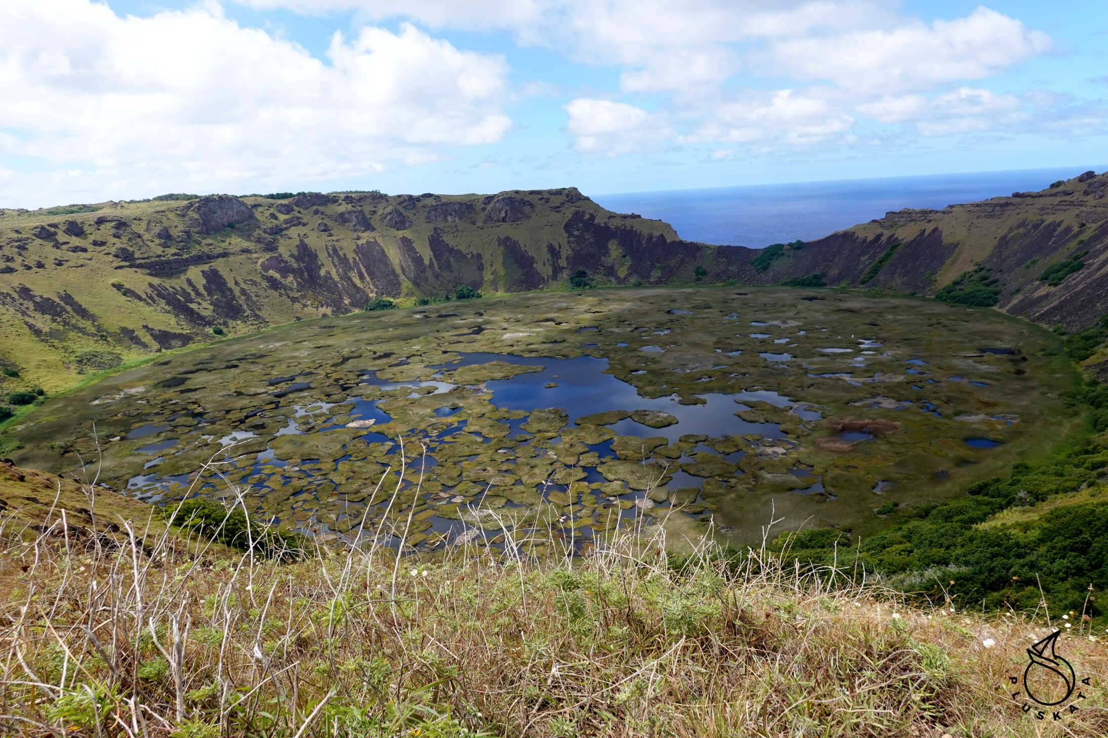
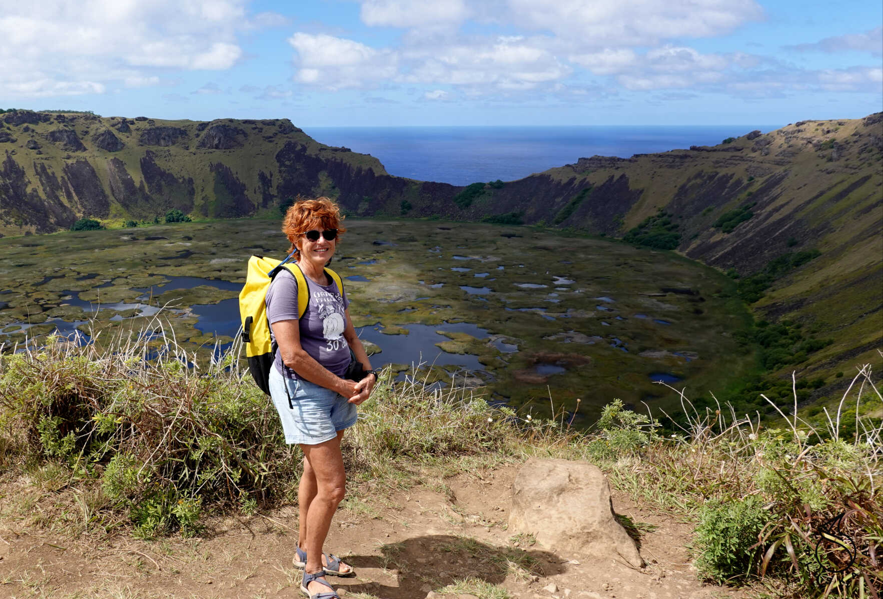
Rano Kau
Rano Kau, also known as Rano Kao, is the largest volcano and one of the most beautiful and impressive natural sites on Easter Island. The feeling of vastness and silence, interrupted only by the rustle of the wind, the distant roar of waves and the occasional
The vibrant squawking of seabirds makes Rano Kau one of the favorite and unforgettable tourist destinations. We drive up to the viewpoint overlooking the Rano Kau crater.
Ahu Angahanga
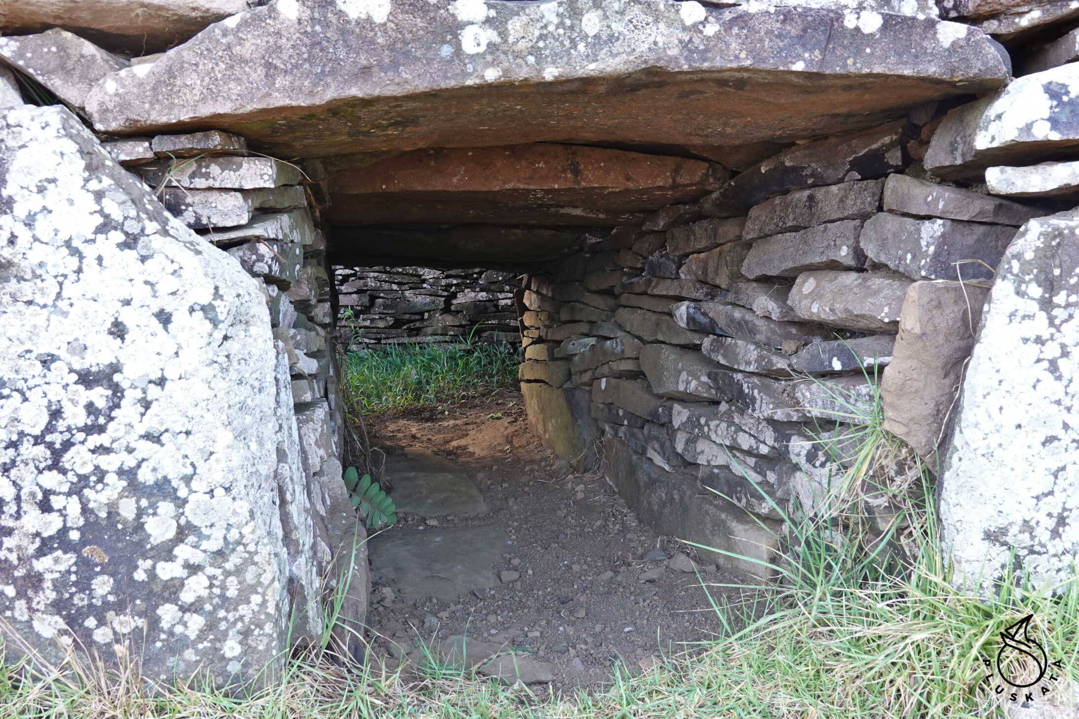
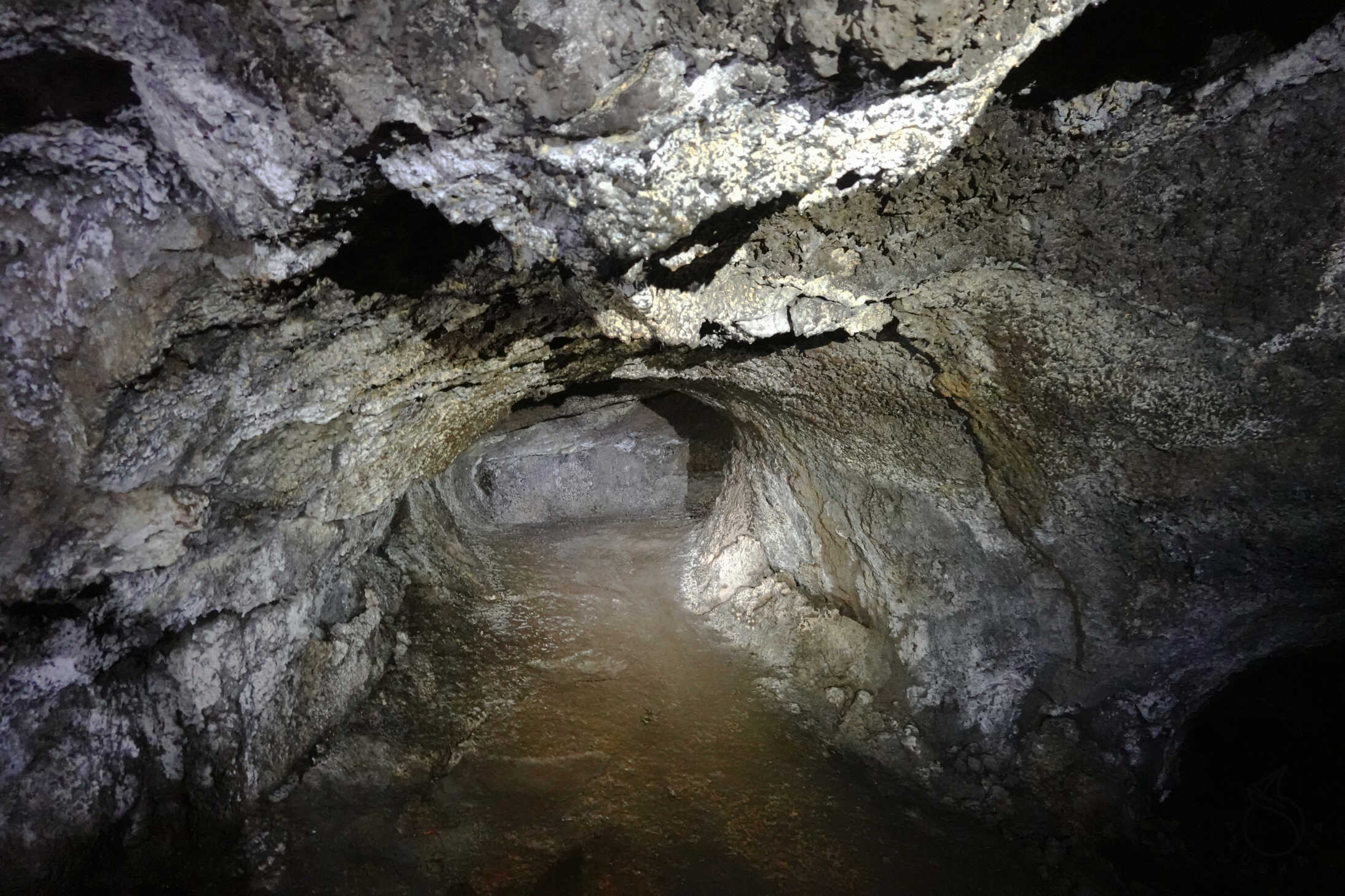
Ana Kakenga is a volcanic tunnel approximately 50 meters long, formed thousands of years ago when still-molten lava still flowed underground. This cave served as an Ana Kionga, or refuge cave, during the battles that took place centuries ago between the island’s various clans.
In the only accessible entrance, camouflaged in the ground, you can see slabs (paenga) that were used to reduce the width of the cave’s natural entrance. This created a rather narrow passage, allowing for better defensive control against potential invaders.
At the end is a large room where the path divides into two diverging corridors, ending in two openings in the cliff face. These two large, natural windows, 30 meters high, were created by the lava flow flowing towards the sea. Ana Te Pahu
The ancient inhabitants used this cave as a dwelling, taking advantage of its width and easy access. This is evidenced by the remains of umu pae (old stone ovens) in which food was cooked. Holes in the ceiling, created by the collapse of the material, prevented smoke from accumulating inside.
One of the main chambers of Ana Te Pahu served as a water reservoir, as the frequent rainfall typical of a subtropical climate seeps through the rocks and collects inside. This allowed the inhabitants easy access to water and saved them the hassle of traveling to more remote natural wetlands.
This natural pool was particularly useful when Ana Te Pahu served as a refuge. It was here that the ancient Rapanui hid during intertribal power struggles and during a series of pathetic slave raids organized in the mid-19th century.
Ahu Akivi
Ahu Akivi is located in territory associated with the powerful Miru clan, one of the most powerful tribes. The moai are believed to have been placed about 150 years before first contact with Europeans, suggesting that at that time, considered late, there was still the political stability and economic prosperity necessary for the construction of a structure of this caliber.
The moai of Ahu Akivi are the only statues on the entire island that face the sea, as the others have their backs to the ocean. And while this is true when viewed from a perspective, they are oriented similarly to the rest of the platforms, meaning their faces face the esplanade stretching before them, where the nearby village once stood. Therefore, the Akivi images were placed, like the others, to watch over the villagers and protect them through the influence of their mana, or mystical power.
Puna Pau
Puna Pau is a small extinct volcano located about 7 kilometers northeast of Hanga Roa. The Puna Pau crater contains a quarry of red slag (scoria), which was once an important source of raw material for the island’s inhabitants. Red slag (hani hani), as it is called in the Rapanui language, is a type of volcanic ash with high porosity and low hardness, which has a reddish color due to the presence of iron oxide in its composition.
It is believed that one-third of the Puna Pau crater was used to produce all the pukao. It is also believed that various working groups formed in the quarry, competing for their own production areas. Puna Pau seems to have been considered a secret and sacred place. Its hidden location from other parts of the island, the almost silent production that took place inside the crater, and its particularly prized red color contributed to its seclusion and mysticism.
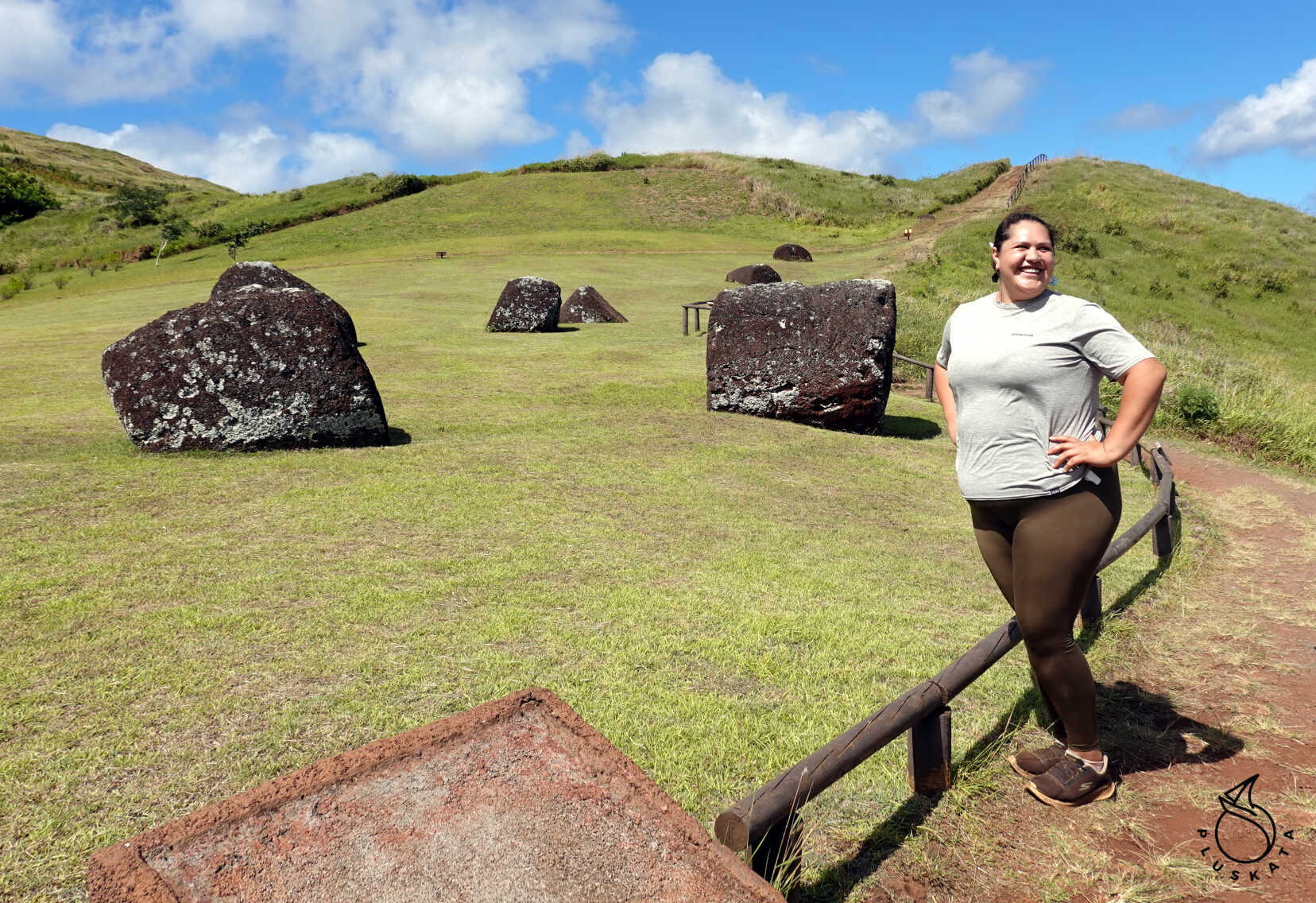
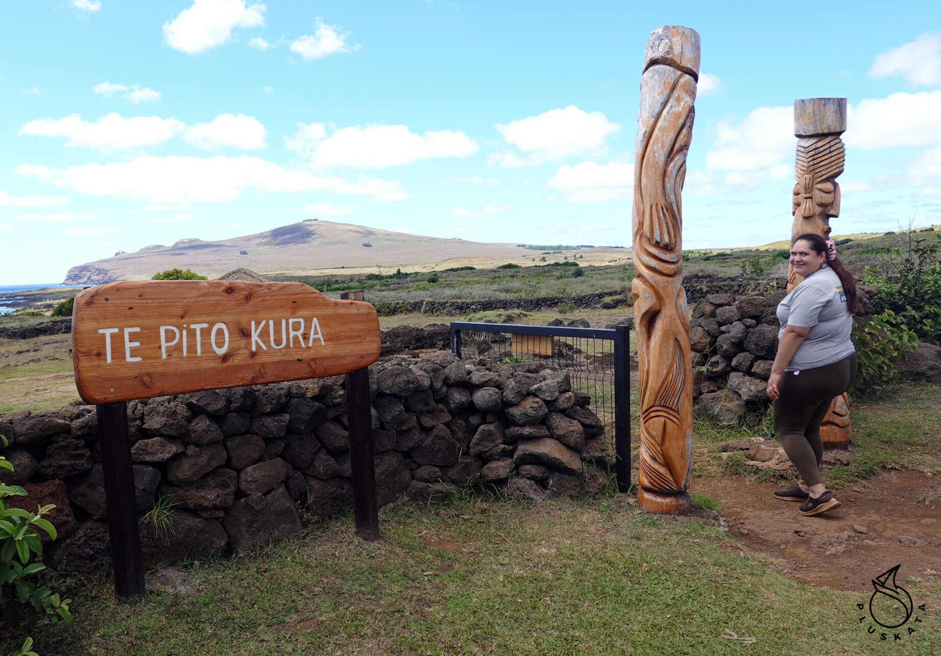
Te Pito Kura
Te Pito Kura is an archaeological complex located opposite La Pérouse Bay, about two kilometers southeast of Ovahe Beach. In this ceremonial center stands an ahu or paro, whose sole moai, named paro, remains in the same spot where it was demolished almost two centuries ago. The paro moai represents a milestone from the period in which these statues were created, as it is the largest moai to be transported from the Rano Raraku volcano quarry and successfully erected on an ahu, or platform. Its dimensions are spectacular: the ears measure 2 meters, its height reaches 10 meters, and its weight is estimated at over 80 tons. The moai lies facedown, its body split in half by the impact. In front of its head is a gigantic pukao, measuring almost 2 meters high and weighing approximately 10 tons, also considered one of the largest headdresses carved and transported from the Puna Pau quarry.
Next to the ahu, a few meters away, is a large, oval stone with a diameter of 80 centimeters. The term Te Pito Kura means “the navel of light”, and some people connect the name of this place with the special properties of this rock and with one of the names by which it is known on Easter Island – Te Pito Te Henua, meaning “the navel of the world.”
This extraordinary stone, formerly known as Tita’a hanga ‘o te henua, was, according to legend, brought by boat from Hiva, his homeland, by Hotu Matu’a, the founding king of the Rapanui people. This rock, nearly spherical and smooth, is said to concentrate a magnetic and supernatural energy called mana.
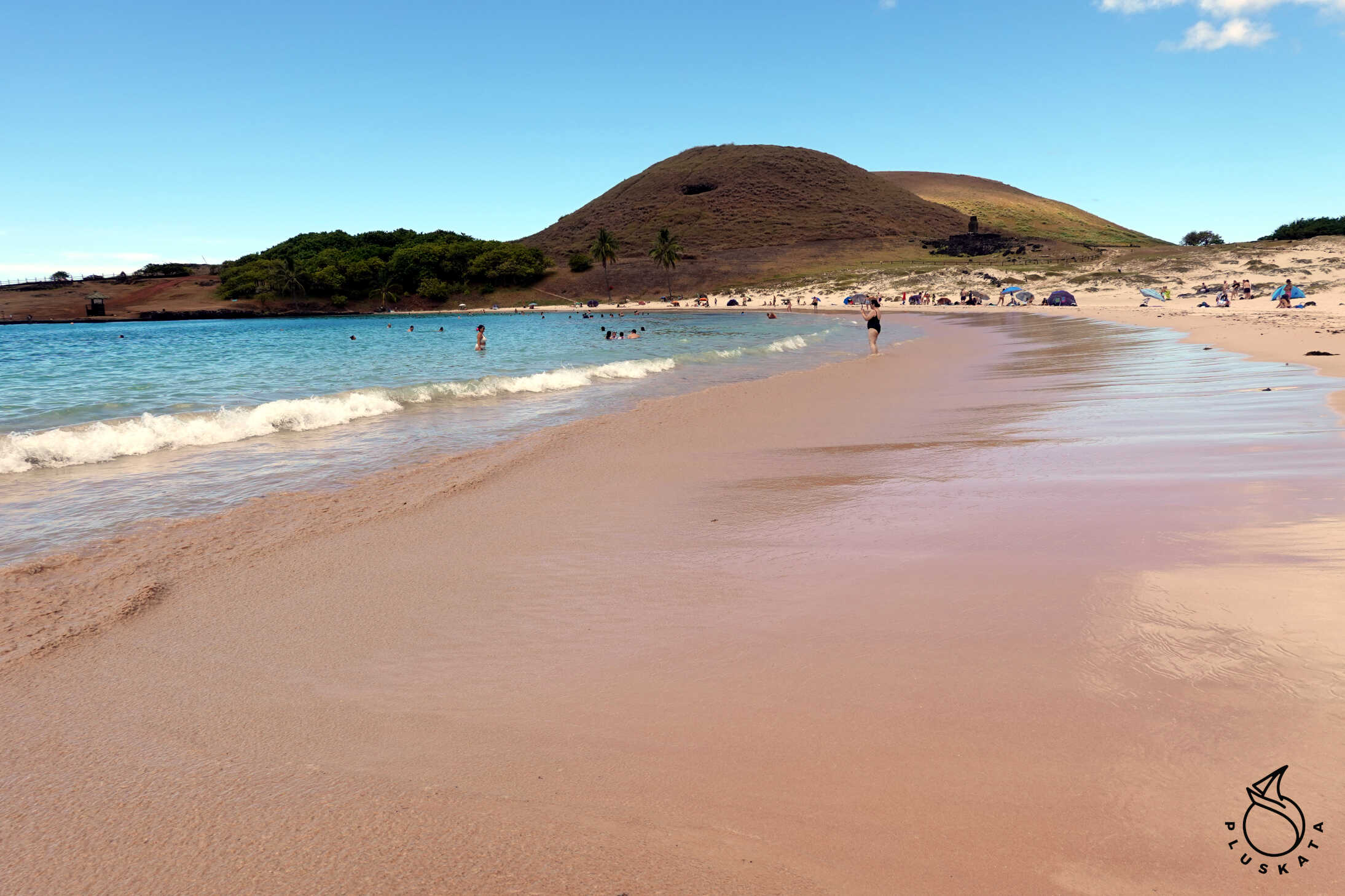
Anakena Beach
Anakena, the main beach on Easter Island, is the epitome of a paradise beach. Its white, fine coral sand, crystalline turquoise sea, calm waves, and coconut palms (brought from Tahiti decades ago) make it the perfect place for rest and relaxation.
Anakena is not just an idyllic beach; it is considered the cradle of Easter Island’s history and culture. It was here that the island’s first king, Ariki Hotu Matu’a, landed with his people and founded the first inhabited city, which gave rise to the Rapa Nui culture.
Ahu Ature Huki
To the right of the large plaza overlooking the sea, at the foot of Mount Maunga Hau Epa, stands Ahu Ature Huki. It houses a single moai, the first to be erected on the island in modern times. The idea originated with the famous Norwegian explorer Thor Heyerdahl, who wrote about his stay on the island in 1956 in his book “Aku Aku” and encouraged several islanders to erect a statue to test his theories.
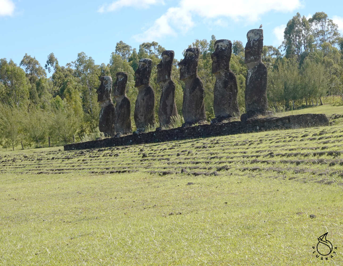
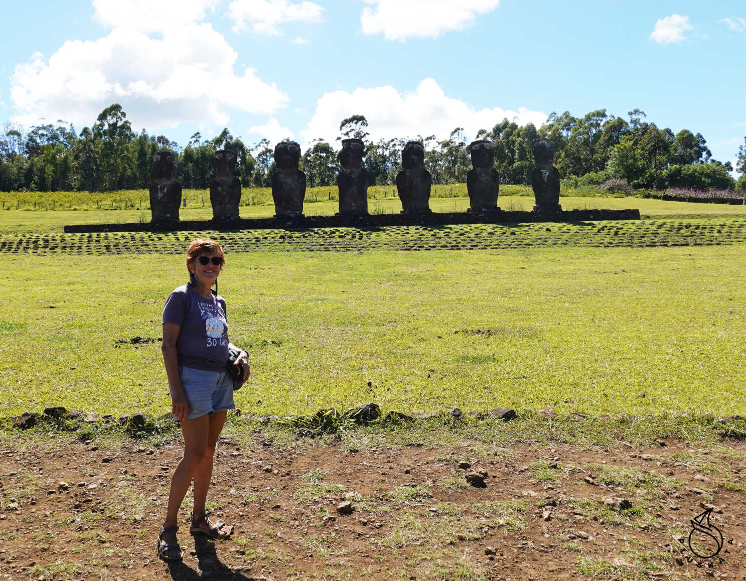
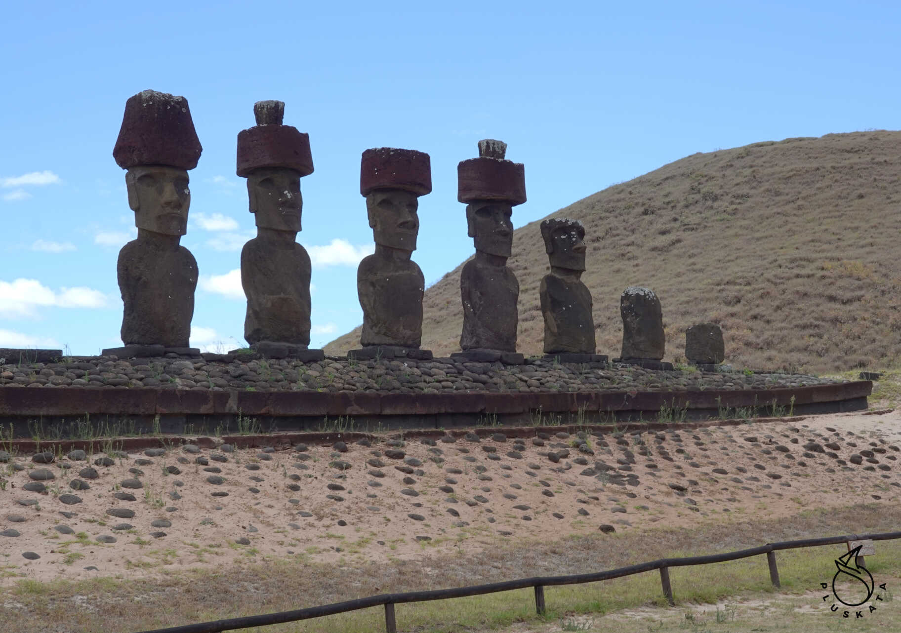
Ahu Nau Nau
The most impressive platform, dominating the center of the landscape, is Ahu Nau Nau. The seven moai, re-erected after a restoration by Sergio Rapu’s team in 1978, are distinguished by the intricacy of their facial features and the details carved on their backs. This is one of the best-preserved platforms on the island, because after being cut down, they remained hidden beneath the sand, protecting them from the elements.
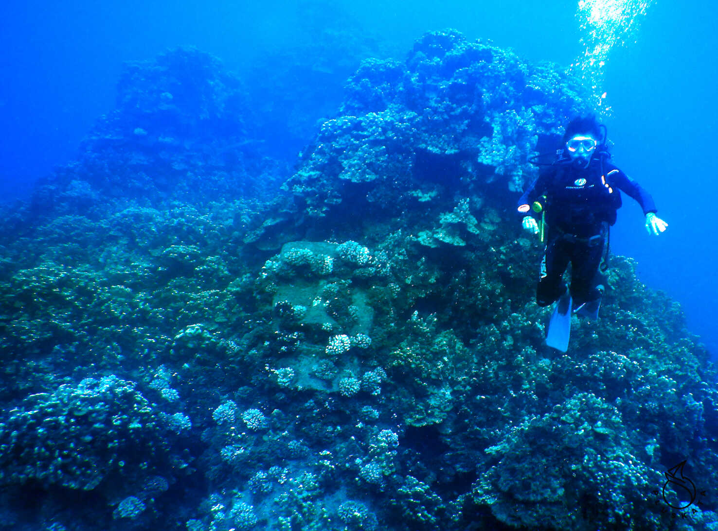
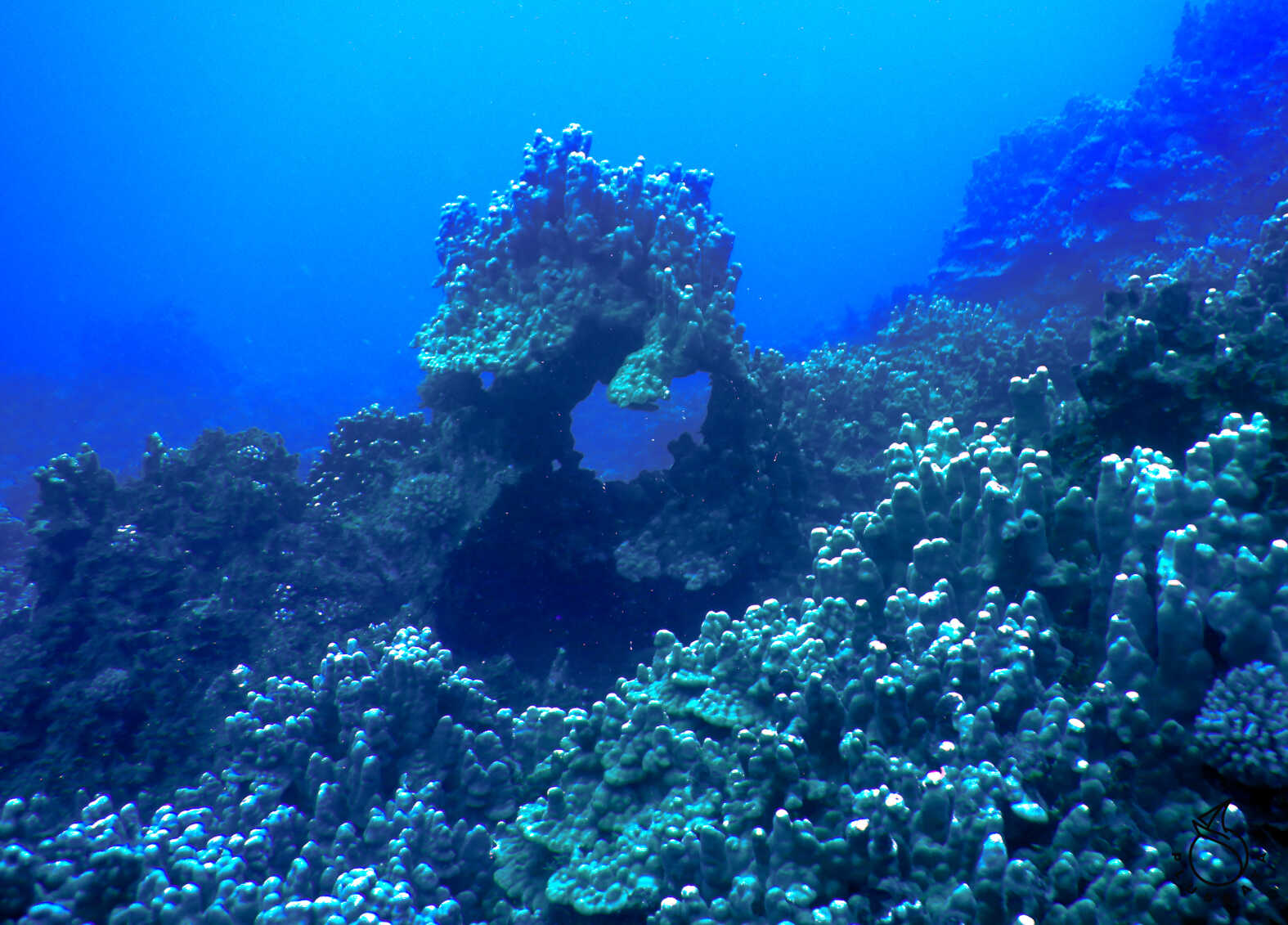
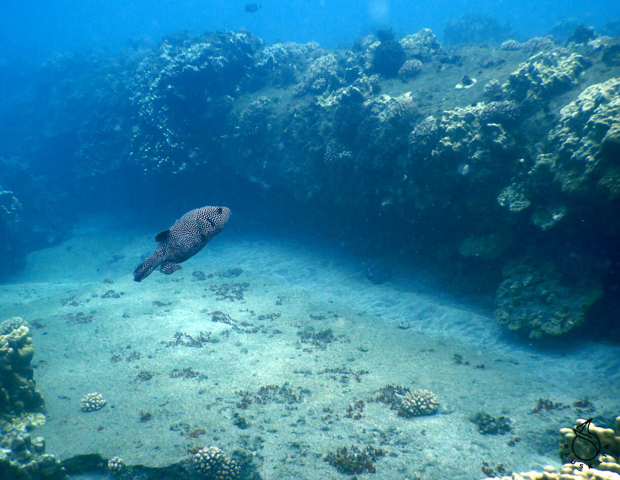
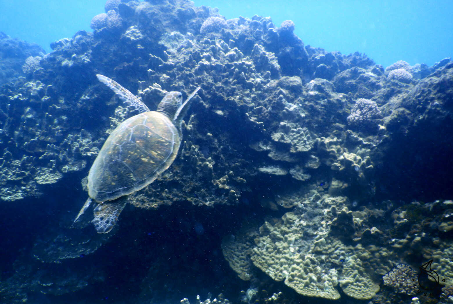
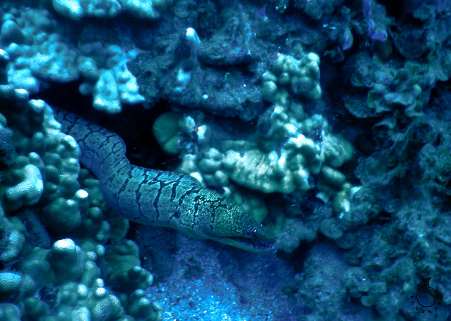
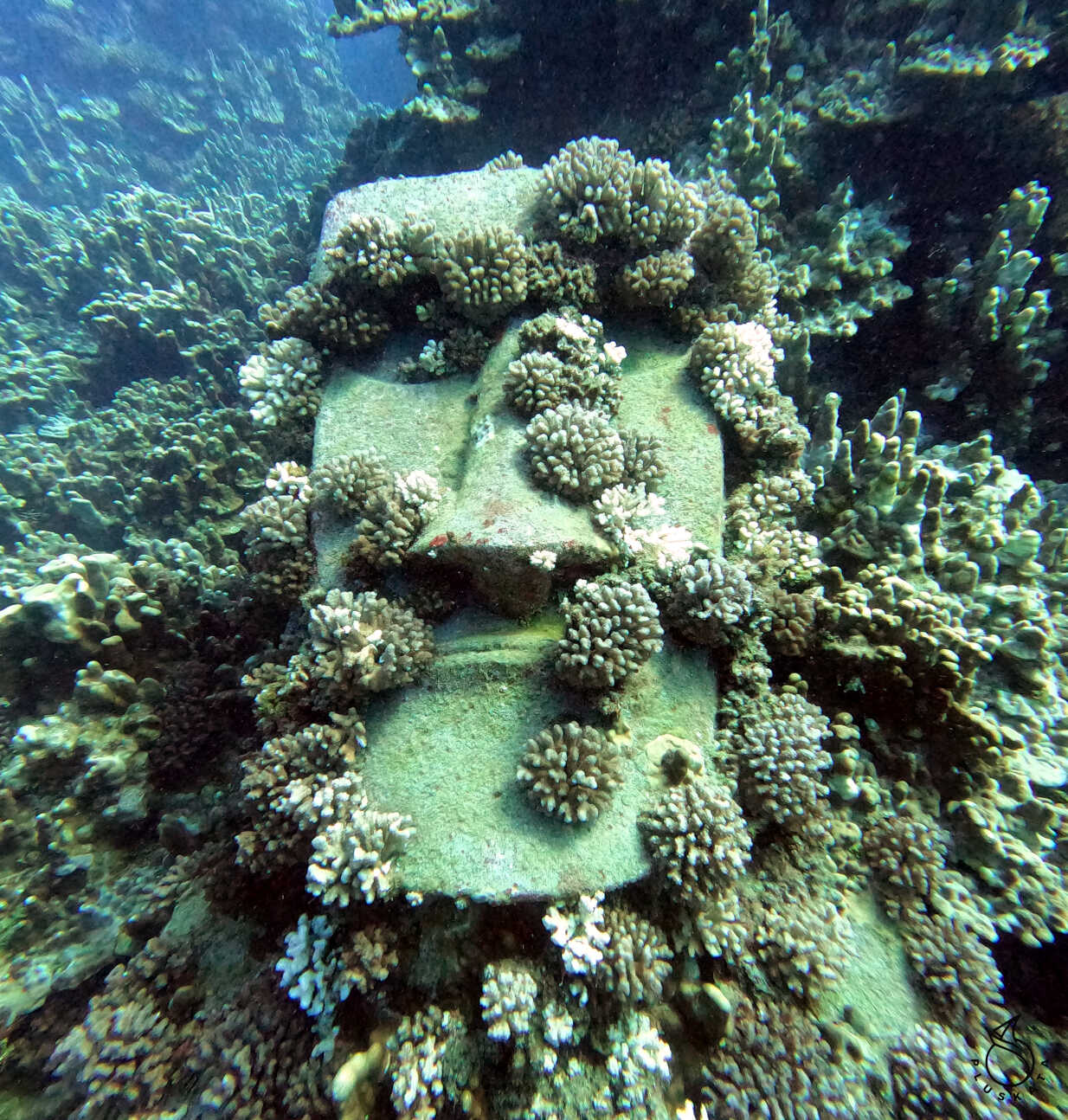
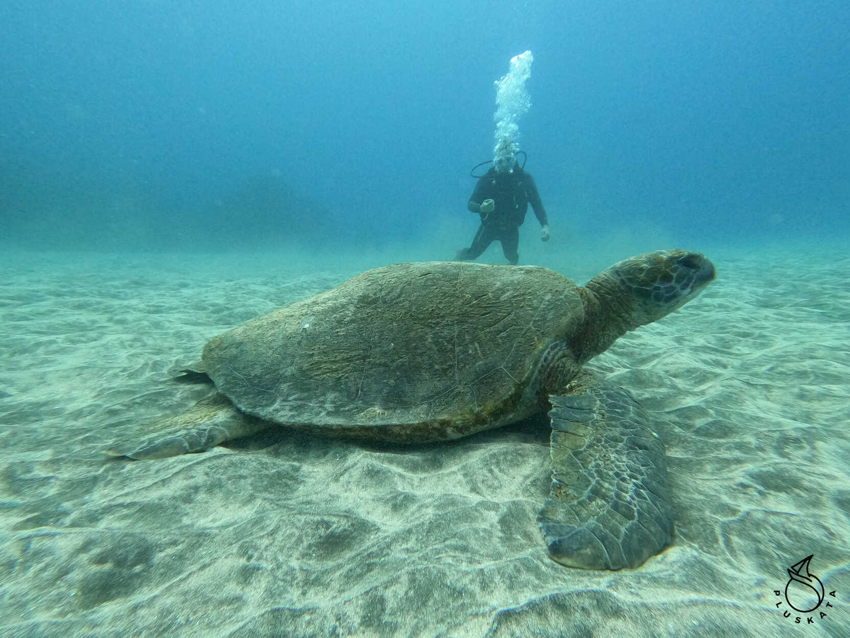
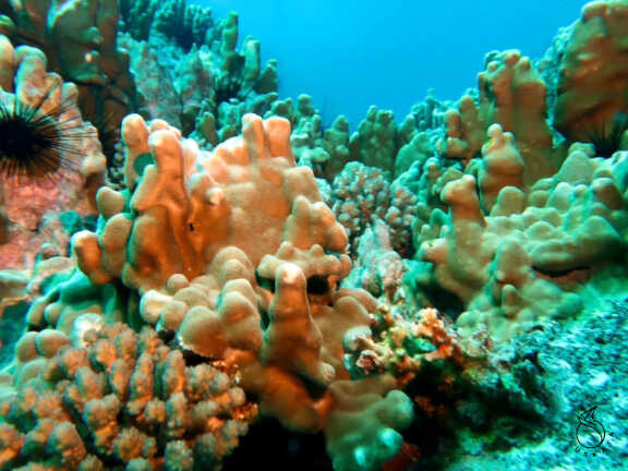
Diving Rapa Nui
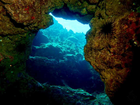
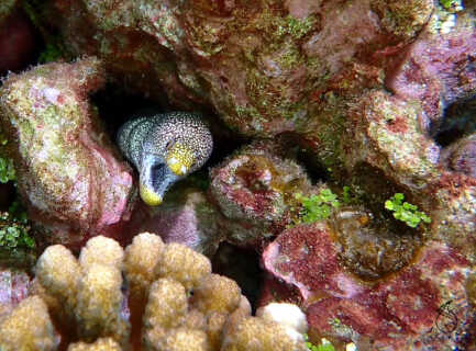
We choose the Rapa Nui Diving Center. One dive costs 50,000 CLP (about $60). The package includes full equipment (wetsuit, fins, BCD, tank, mask, computer – if desired). We take a boat out to the bay – there are three dive sites. We dive Moai Paea (about 25m). There’s a sunken artificial Moai there – sunk about 15 years ago and is an attraction for divers (you can touch it). The second site is Place Manavai, about 19m – a beautiful coral reef.
Between dives, we return to the center, drink coffee, and eat cookies.
Rescue Expedition to Isla Salas y Gomez
At the end of January, one of the island’s residents disappeared while diving. We were asked to help find the body. According to their calculations, it may have drifted onto Salas y Gomez Island.
We set off on March 6th at 8 a.m. The day before, they brought us food for the entire trip. According to the plan, it would take us about 5-6 days.
Our friends who had just arrived to sail with us will remain on the island, while we pick up four people from the island. A doctor, two indigenous Rapa Nui people – the missing man’s family – and the owner of a grocery store are sailing with us. They all speak English, some of them speaking English, but they are very cheerful, play guitar, and sing beautifully. And they are excellent cooks.