Date: March 14-April 28, 2026
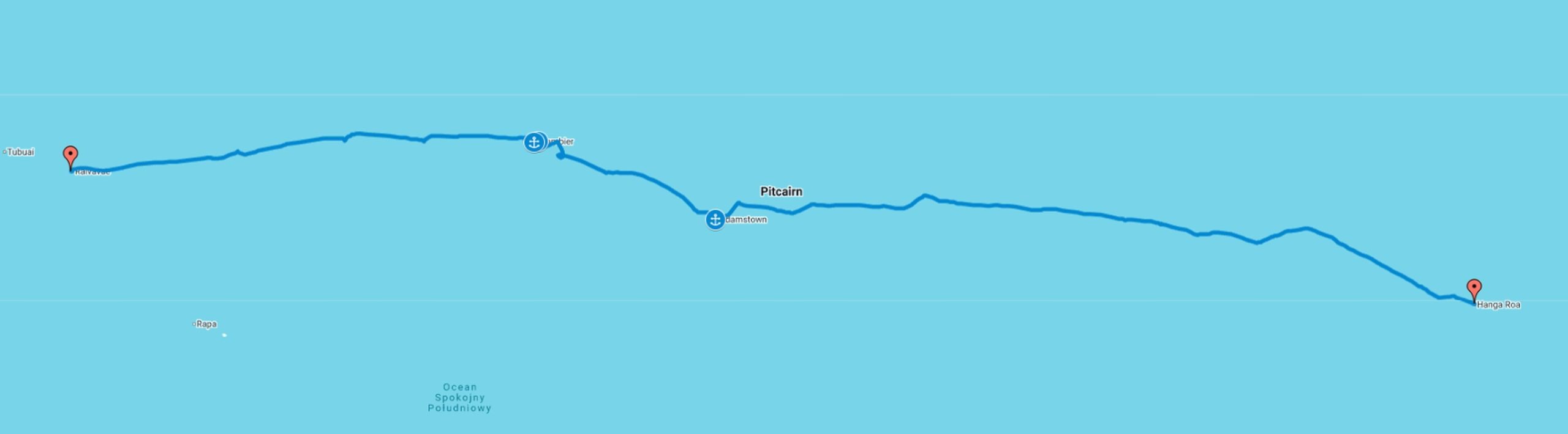
Route: Hanga Roa-Pitcrain-Mangareva-Rivavare
Miles/Hours: 2217NM/499h
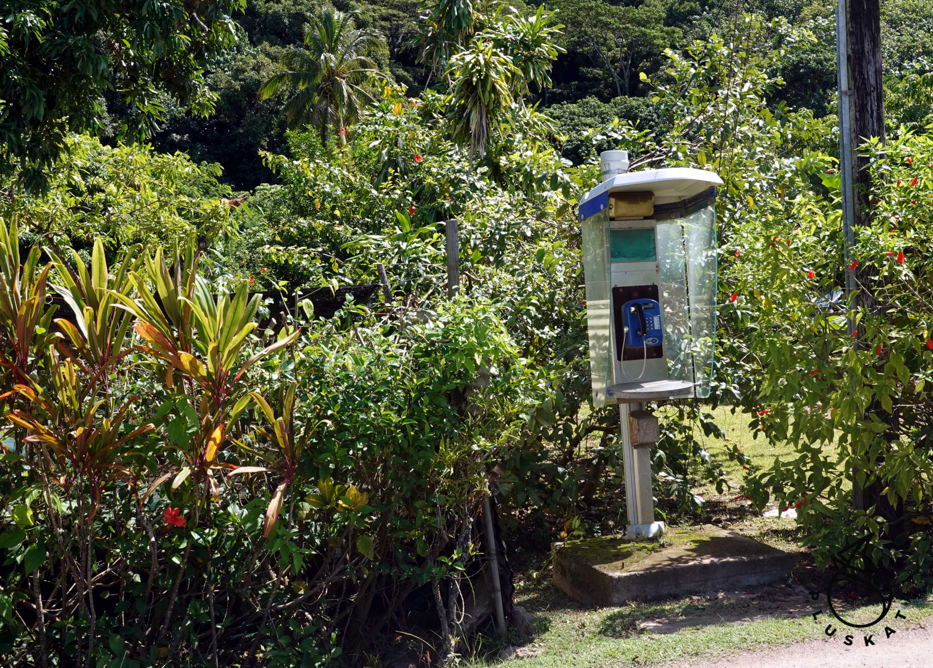
Easter Island
Supplies
It’s worth buying local vegetables and fruits – they have plenty of avocados, mangoes, tomatoes, onions, and various citrus fruits. The stores have some dairy products and a fairly good supply of other groceries (most arrive by ship from Chile). Surprisingly, the prices are quite affordable, more expensive than in Panama, but cheaper than on the ABC islands.
Check-in
The procedure is simple – you go to Armada and pay for your stay – we paid around 9,000 reso, or about $10. We receive payment confirmation on a valid official receipt. You can pay by card. Then we arrange to check-in on the yacht – they arrive on time.
The Route to Pitcarin
We set sail just after sunrise, around 8:30 AM. Initially, the wind is light, but from astern, so we raise the genoa. In the afternoon, Tomek polishes the windows (finally, we can see something through them), and the rest of the crew washes the deck.
Day Two – Sunday
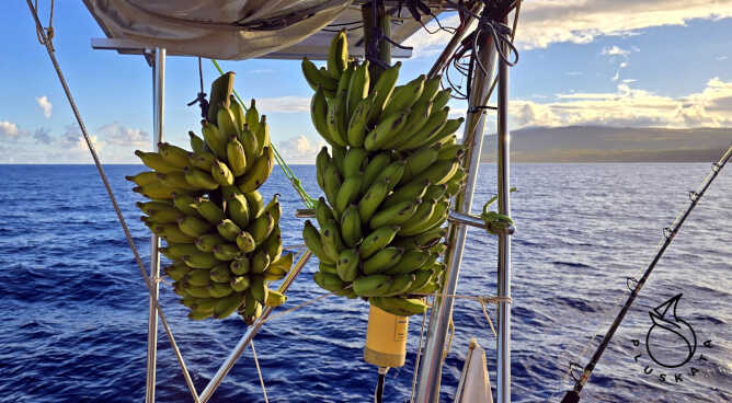
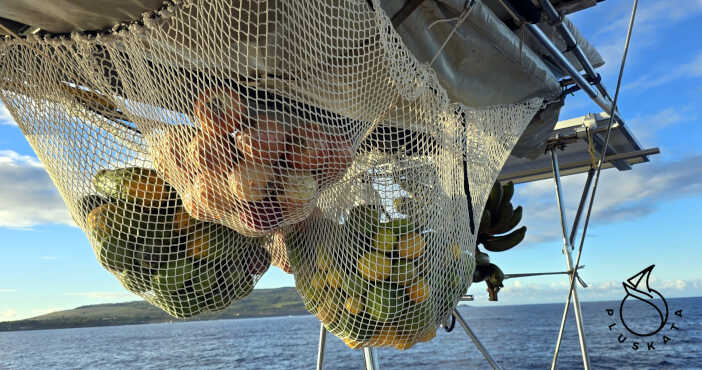
The wind is still from behind, but gusts reach 25 knots. We reef the genoa. At 11:00 AM, we turn back the clocks to 10:00 AM and sail west. The fruit we donated is slowly starting to ripen – it’s very tasty and preservative-free. There’s a huge amount of it, but maybe we’ll manage to eat it before it spoils.
Day Three – Monday
The wind picks up to 35 knots overnight, so in the morning we switch the genoa to a jib. For lunch, we have bananas and a tomato and avocado salad. One of the bunches of bananas has turned yellow, so we have a whole drawer full of sweet bananas. So, we have bananas for second breakfast, lunch, and afternoon snack. We sail 125 nautical miles in 24 hours.
Day Four – Tuesday
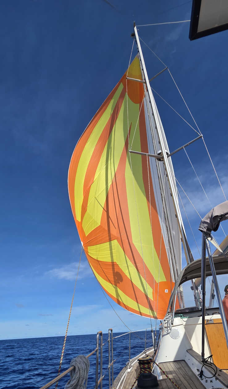
This time the wind weakens, so the genoa returns to favor.
Day Six – Thursday
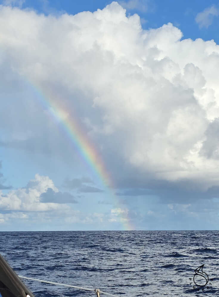
A little sun, a little rain. Even a rainbow appears. The wind is relatively constant, the swell is decreasing, so we get down to various yachting tasks. Tomek tests the new anemometer, and I sew a sprayhood – the thread it was sewn on didn’t withstand the prolonged exposure to the sun.
Day Seven – Friday
The morning watch inspects the deck and finds several flying fish on deck every day (unfortunately, they’re already dead). We take down the last bunch of bananas, peel them, and put them in a drawer. We have bananas for at least another four days.
Day Eight – Saturday
Today, for the first time in a long time, there are sandwiches for breakfast, not banana pancakes 🙂 and meat for lunch. Day Nine – Sunday
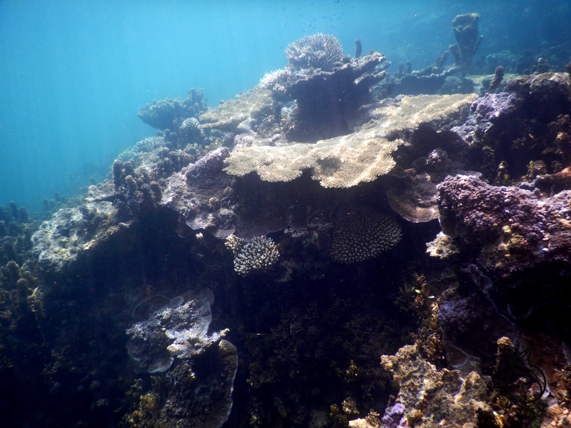
In the morning, we pass the first island in the Pitcarin archipelago – Ducie. It’s an uninhabited atoll. Cruise ships sometimes come here (one was here before us) to admire the beautiful beach and coral reefs.
Day Twelve – Wednesday
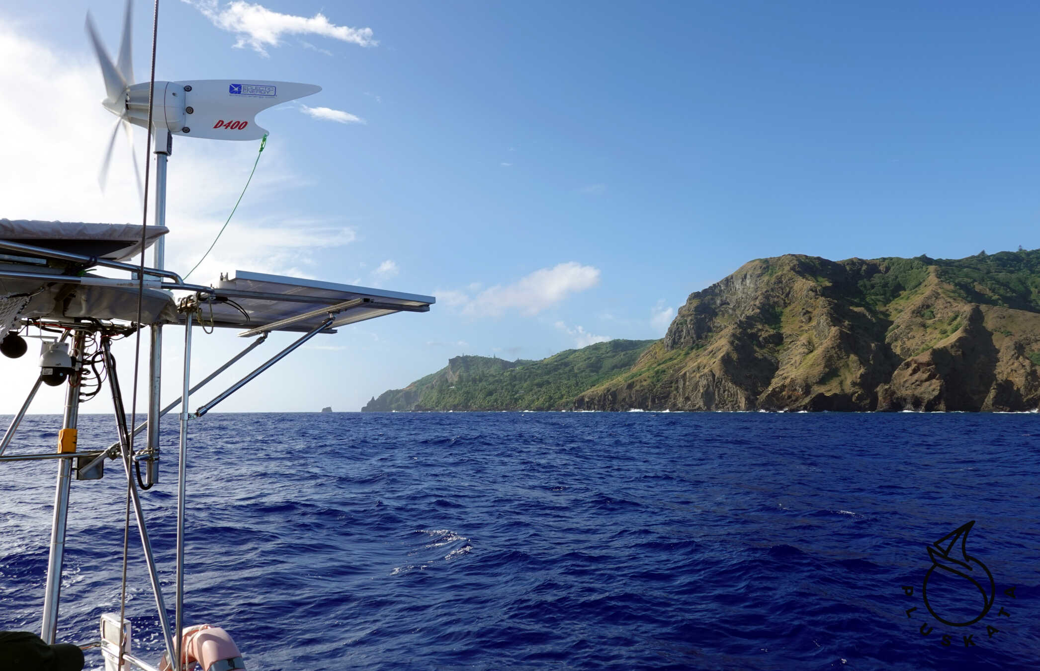
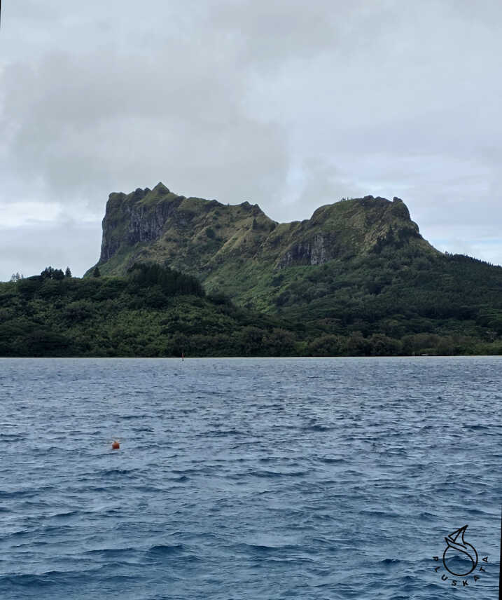
We reduced speed for the night to reach the island before dawn. In the morning, we see the island – it’s high and has beautiful cliffs. Port control recommends a western anchorage, but they can’t arrange a water taxi due to the high waves. We drop anchor and wait until tomorrow.
Pitcarin
A lonely island in the Pacific, famous for being the home of mutineers from the HMAV Bounty. The island is home to about 50 inhabitants – descendants of the mutineers. There are two anchorages – one at Bounty Bay near the town, and the other on the western shore of the island. Before arriving, call the VHF on channel 80 and ask which anchorage you’d like to anchor at. It’s best to do this during business hours, especially during daylight hours. The time zone on Pitcarin is UTC-8.
You can also send an email or try WhatsApp (the Harbor Master’s daughter has WhatsApp).
Western Anchorage
Due to the strong easterly wind and heavy swell, we decide to anchor on the western side of the island. Here, we’re sheltered from the waves. On the first day, we tried to call a water taxi (from the harbor master on VHF channel 80), but he claimed the main harbor was too crowded and no boats would leave. On the western side, there’s a small harbor (actually a stretch of waterfront) sheltered from the waves.
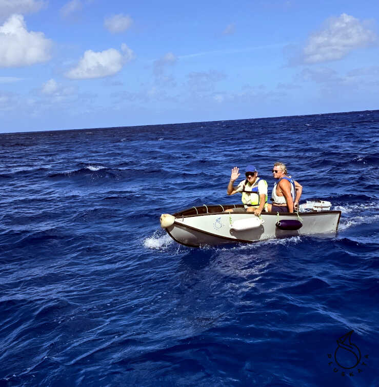
The next morning, we arranged with the Harbor Master to pick us up from this harbor at 11:00. We launched the boat, and Tomek drove us ashore. Entry and Exit Check-in
Upon reaching Adamstown, we fill out paperwork, get our passports stamped (entry and exit), and are promised ZARPE for the next day.
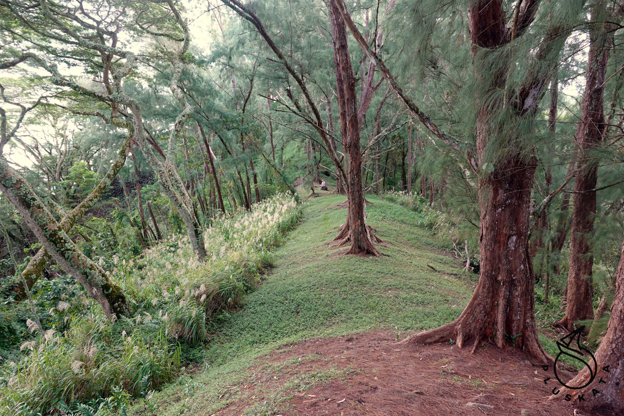
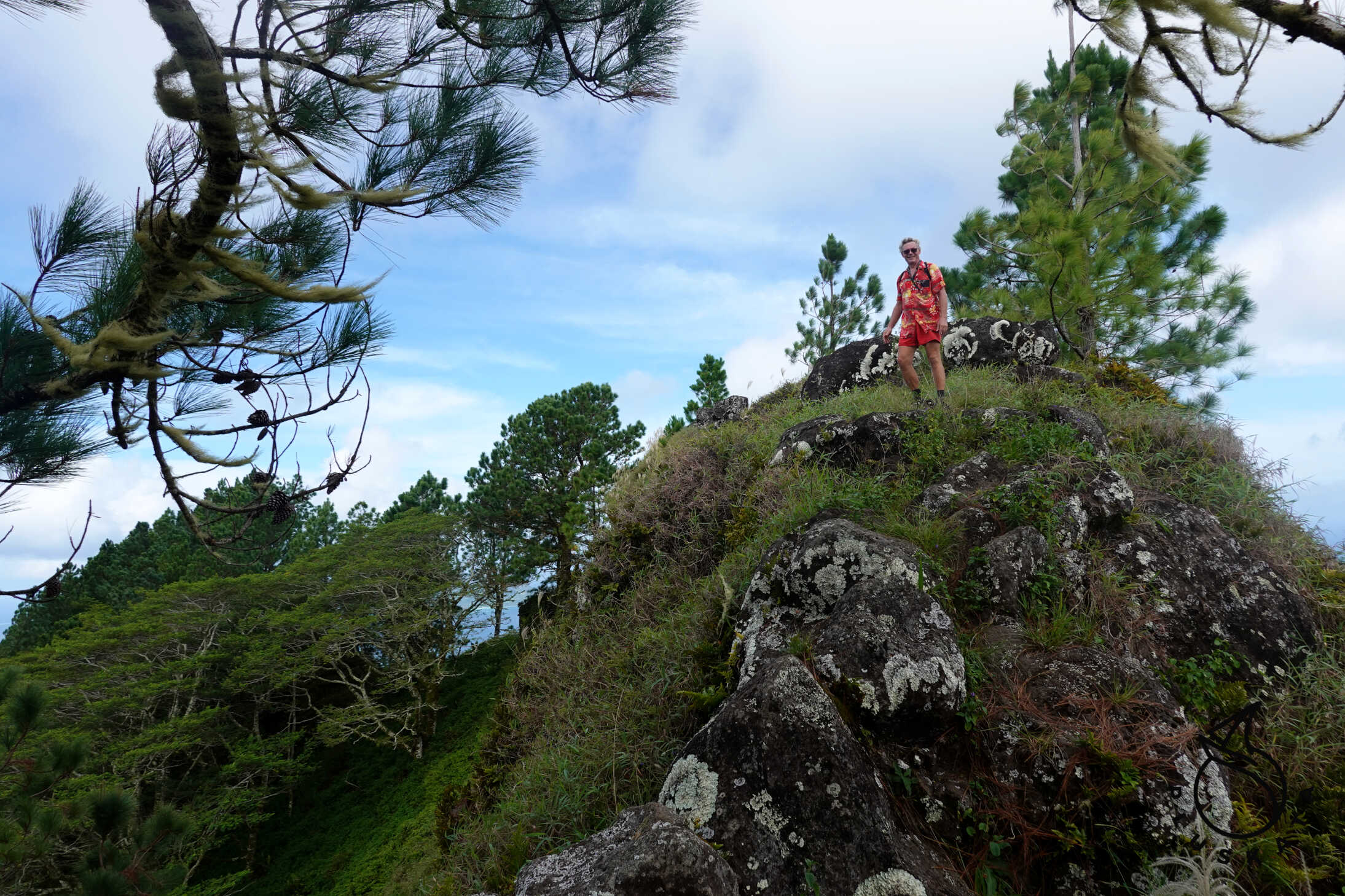
Exploring the Island
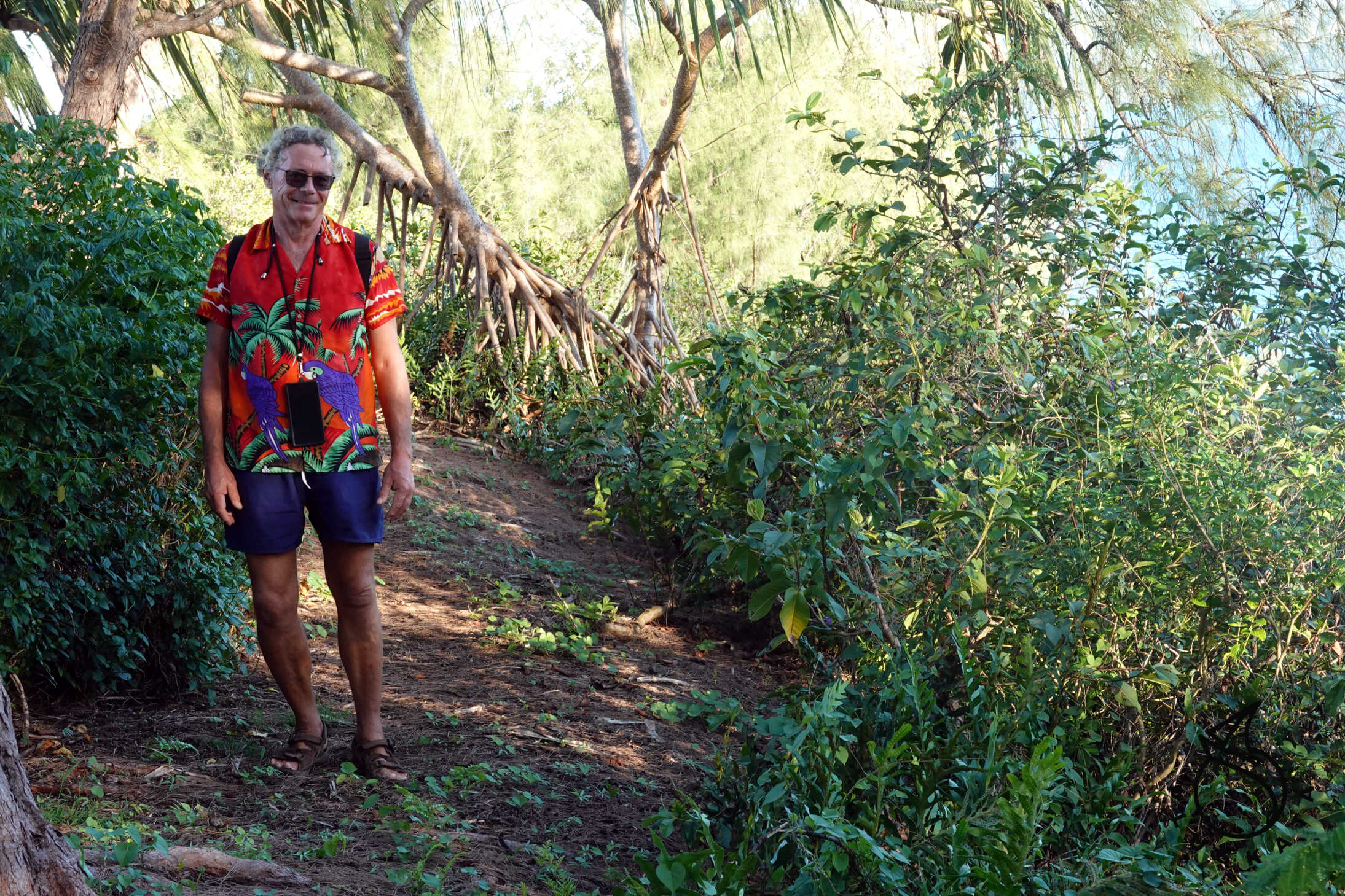
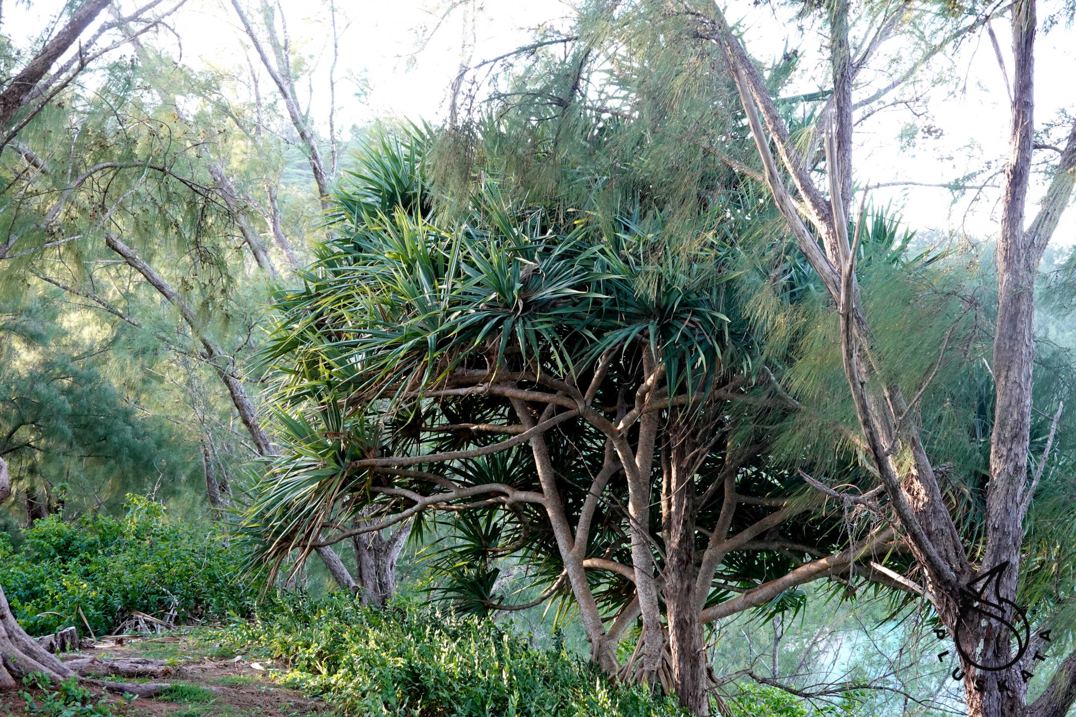
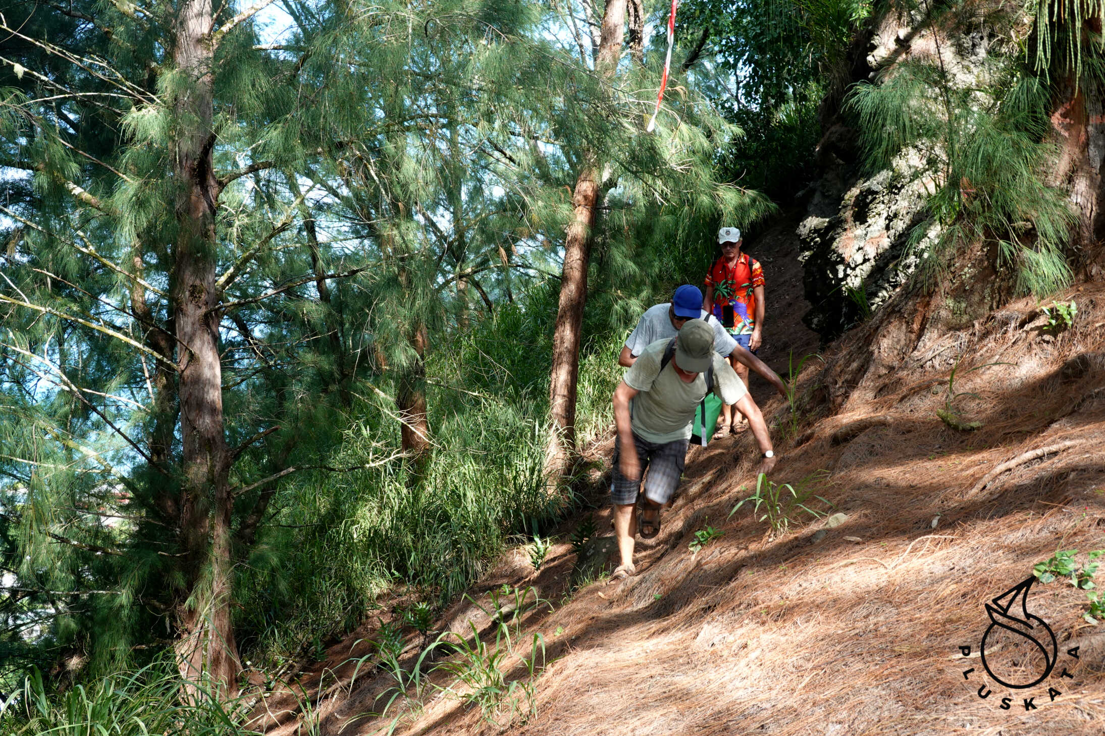
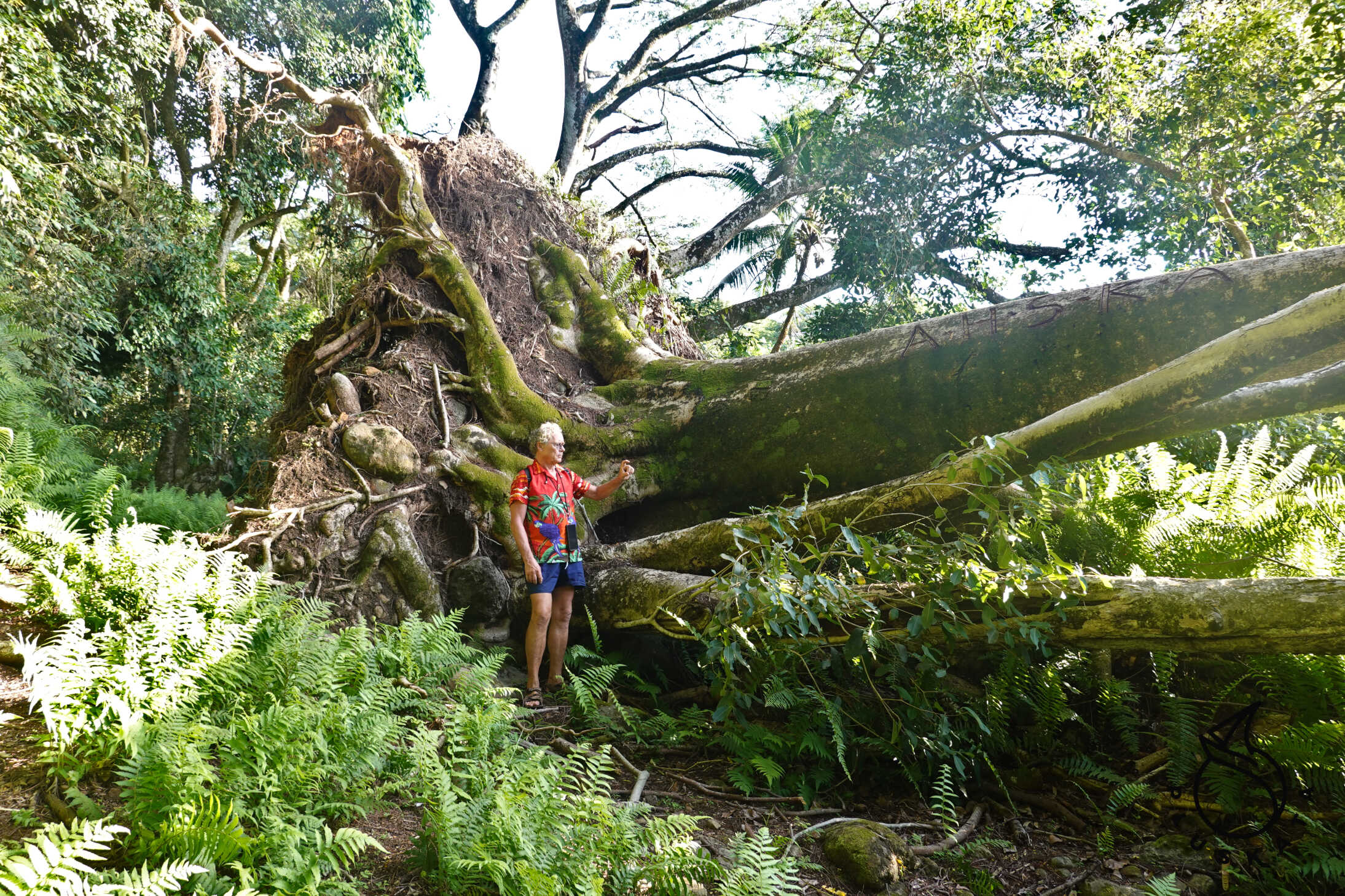
The entire island measures 4 km x 2 km. Numerous hiking trails, ranging from 1 km to 7 km, lead around the island. All are well-marked, with signposts at every intersection, and numerous information boards along the trails. The only town is Adamstown, named after the last “rebel” who lived in 1814 when an English ship arrived on the island and found Adams, a group of women, and children – all speaking English.
We arrange on VHF channel 80 to be picked up from the west shore.
We split into two groups. We row our boat ashore to Western Harbor Landing – a small port on the west shore, from where we travel by foot to the city. The road is muddy and steep; on foot, although it’s less than 4km, it would take about two hours. We arrive at the “city center” and complete the entry and exit formalities. We’re given a guide to the island – an American who decided to settle here permanently. The tour begins at the shop, next to the post office and the island’s cashier (there we pay for check-in – 100 NZD per person, lunch (25 NZD per person), and a fruit box for 55 NZD). There’s also a bank fee for card payments (the cashier enters your card details on the website – you need to have online payments enabled for this).
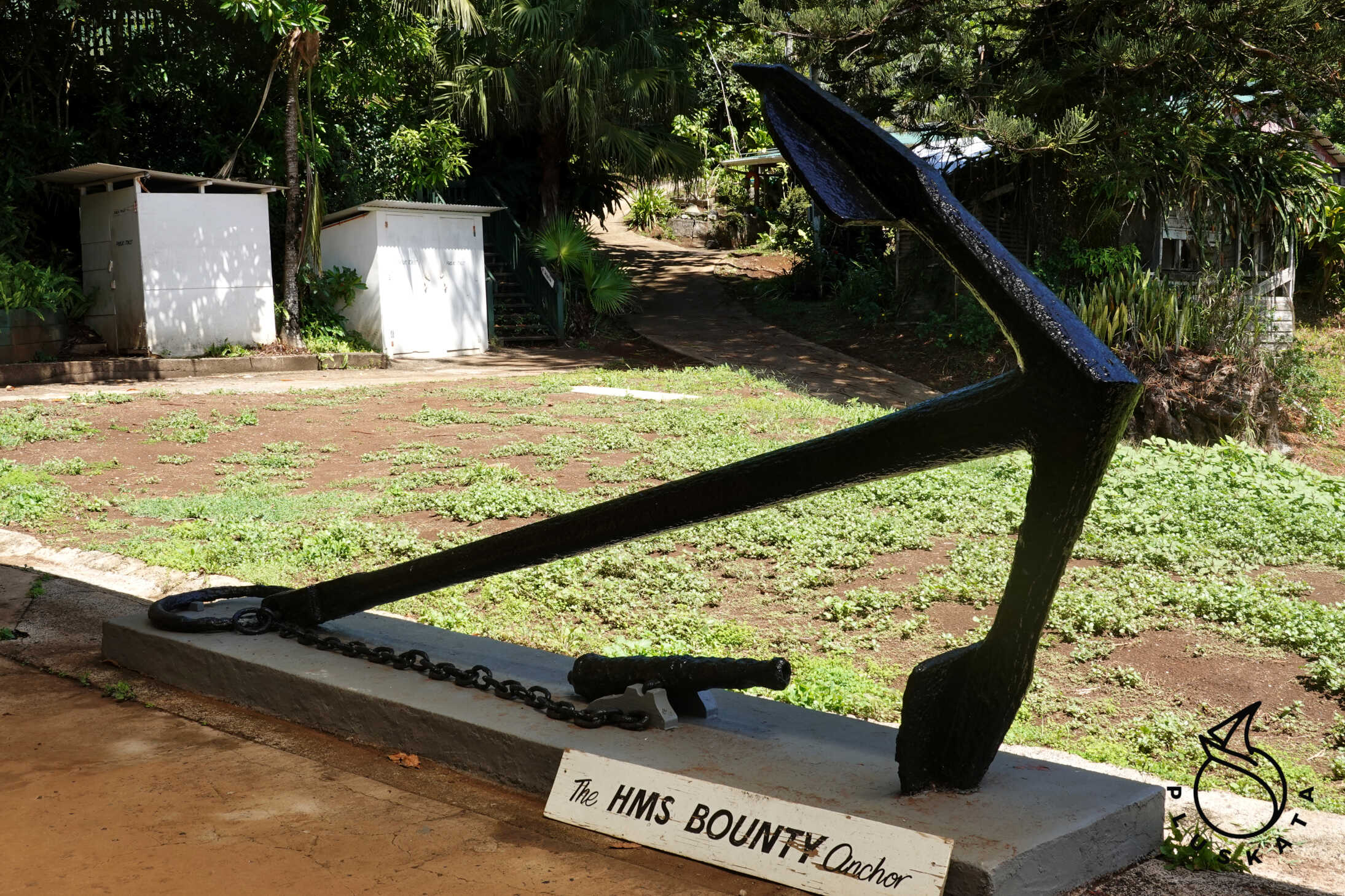
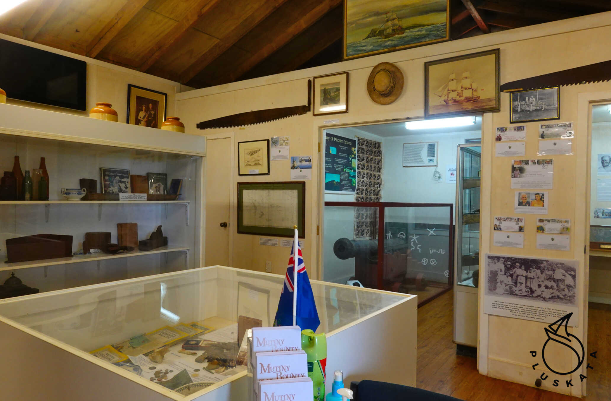
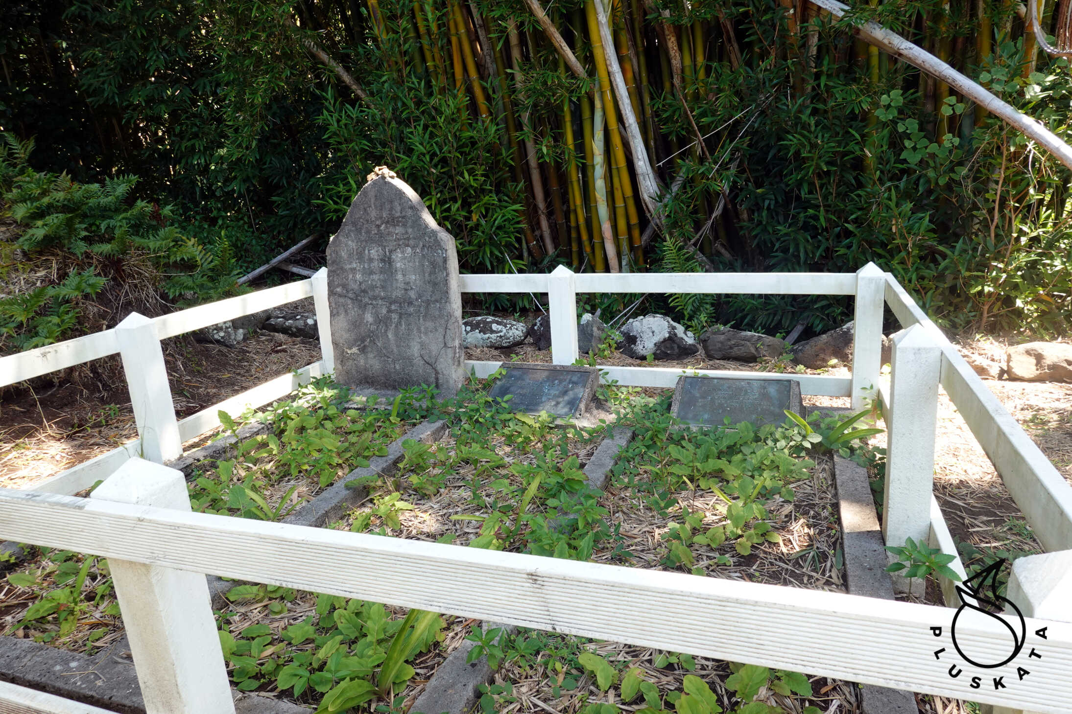
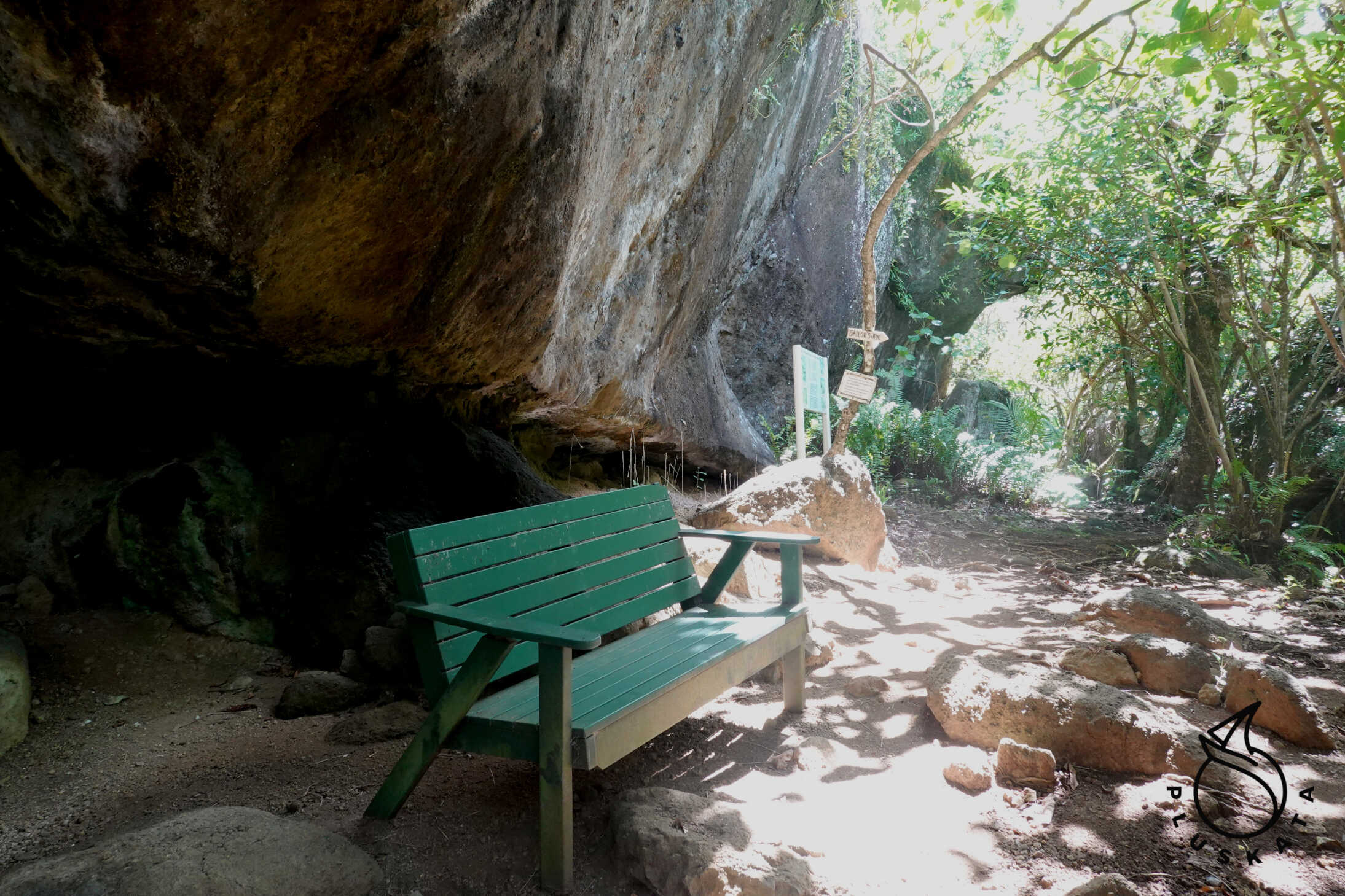
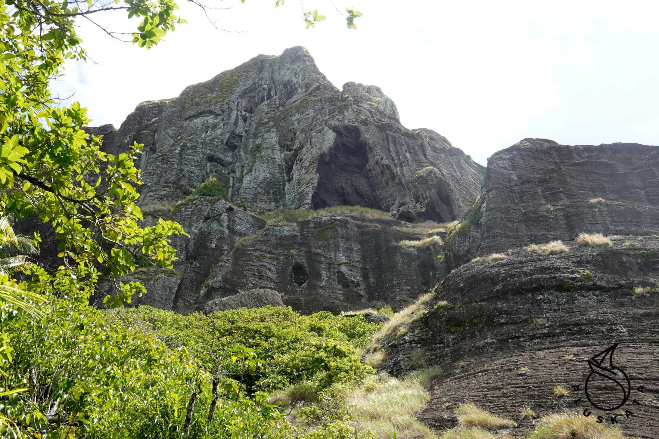
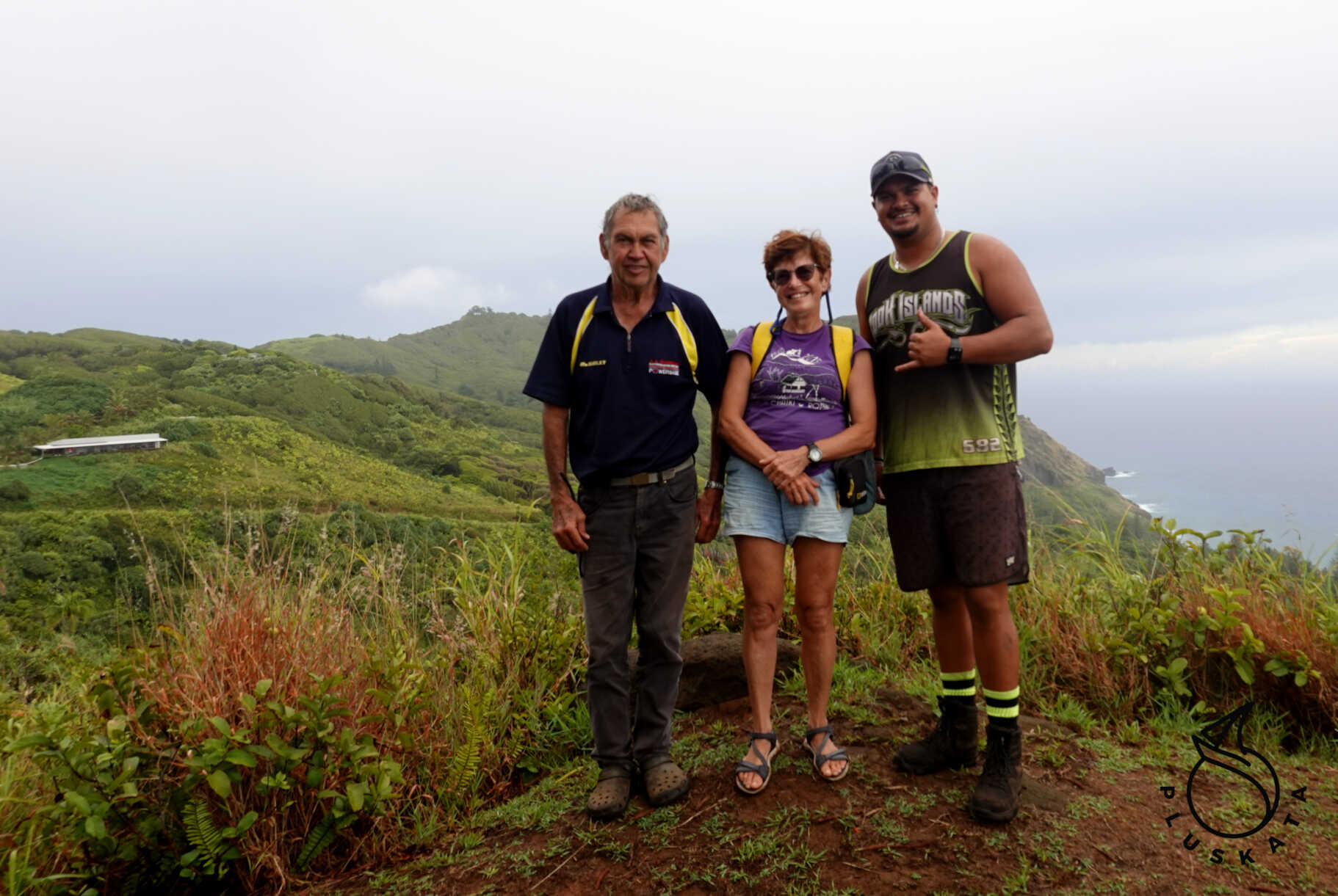
Next, we visit Adamstown Square with the Bounty anchor, and next to it is a church (7th-day Adventist). From the square, we go to see the museum with Bounty memorabilia and more. You go to the museum with a guide who has the keys – Mark, an American who came to the island with his family two years ago and decided to stay. He shows us around the island, we see the school (from the outside), the grave of Adams, his wife, and daughter, and then along the eco-trail to Christian’s cave. We don’t go to the cave itself because it’s raining, and the muddy path after rain is dangerous. We also stop at the local cemetery.
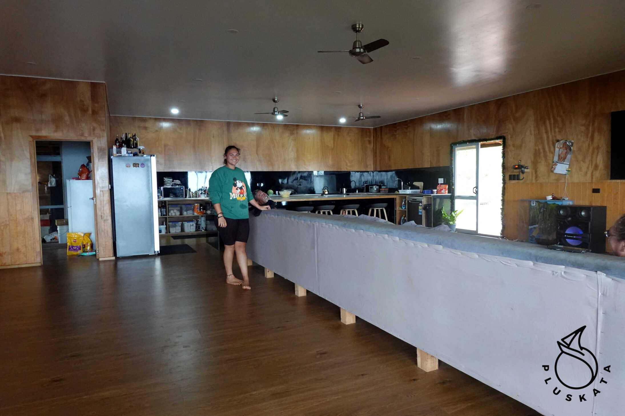
On the island, we meet a doctor from Poland who came here on a contract. He lives in a large house with several bedrooms and a large living room. We chat about the island, living conditions, and various other details.
At 3 p.m., we go for lunch: there’s a wide variety of food – chicken, corn fritters, baked pumpkin, pasta with cheese sauce, cauliflower with broccoli, and for dessert, homemade cake with ice cream. Delicious.
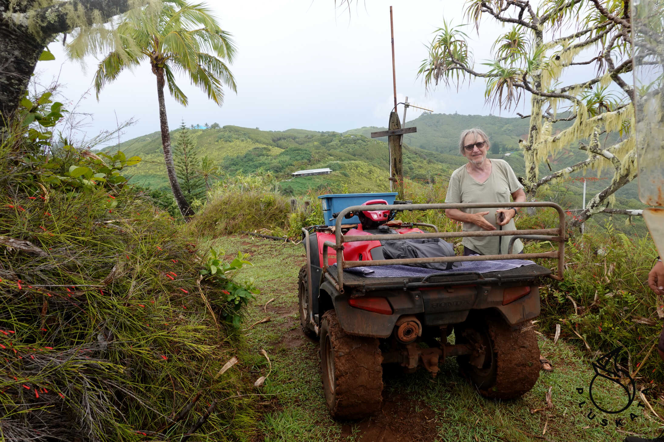
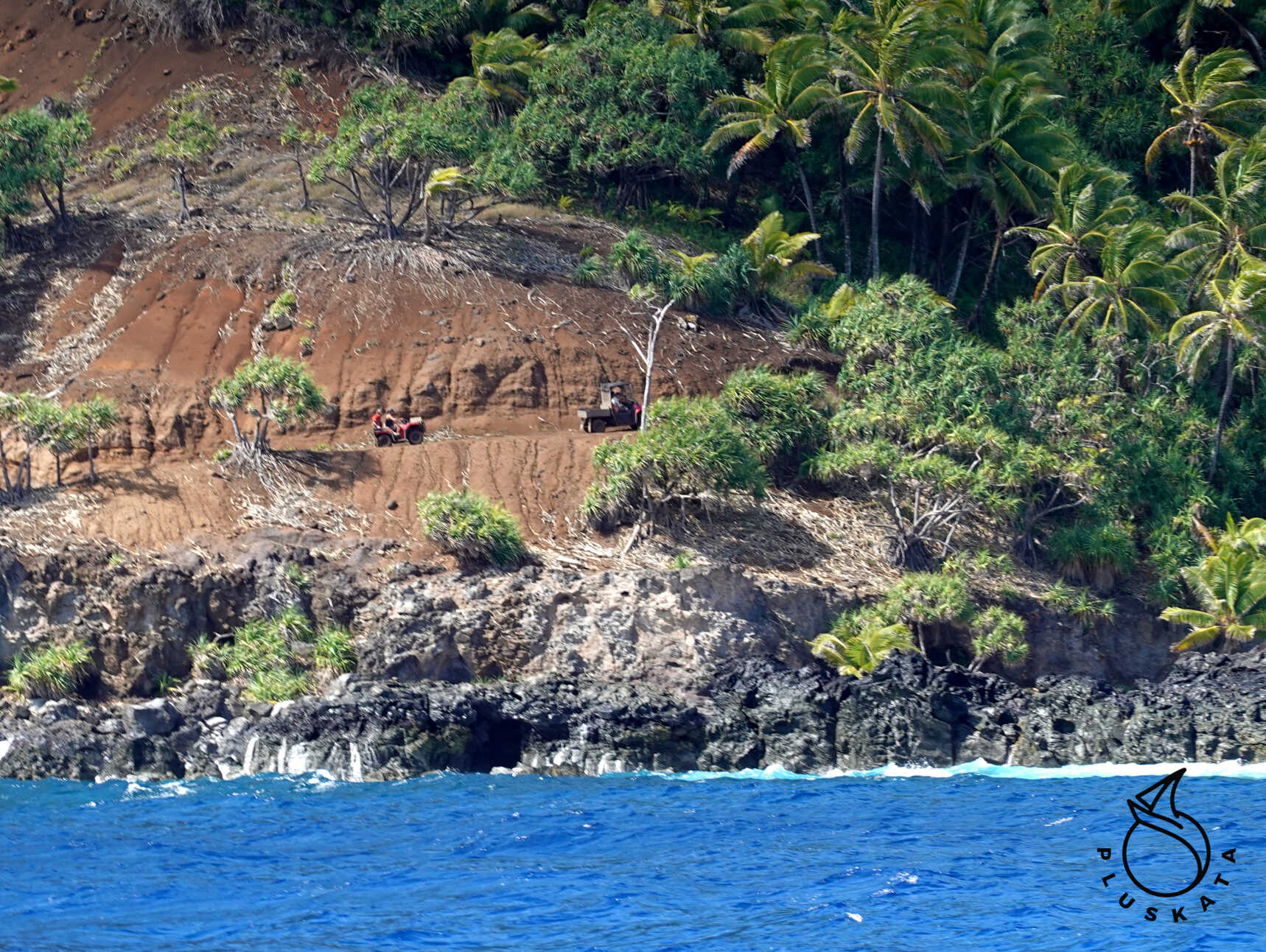
After lunch, they drive us to the west shore by quad bike, stopping at the viewpoint at The Landing Point along the way, before returning to the boat.
The next day, two more people go on a tour of the island. They explore a bit more, have more time, and the weather is better. They also visit St. Paul’s Pool – a natural rock pool. On the way back, they stop at The Highest Point – the highest point on the island – on the way back to the port at Adamstown – it’s indeed inaccessible in this wind direction.
At the launch of the dinghy, the boys have a little adventure – the boat is swamped by a wave of surf. But luckily, it doesn’t wet the engine.
On Saturday, we clean the bottom and on Sunday, we set sail towards Gambier.
The Route to the Gambier Archipelago
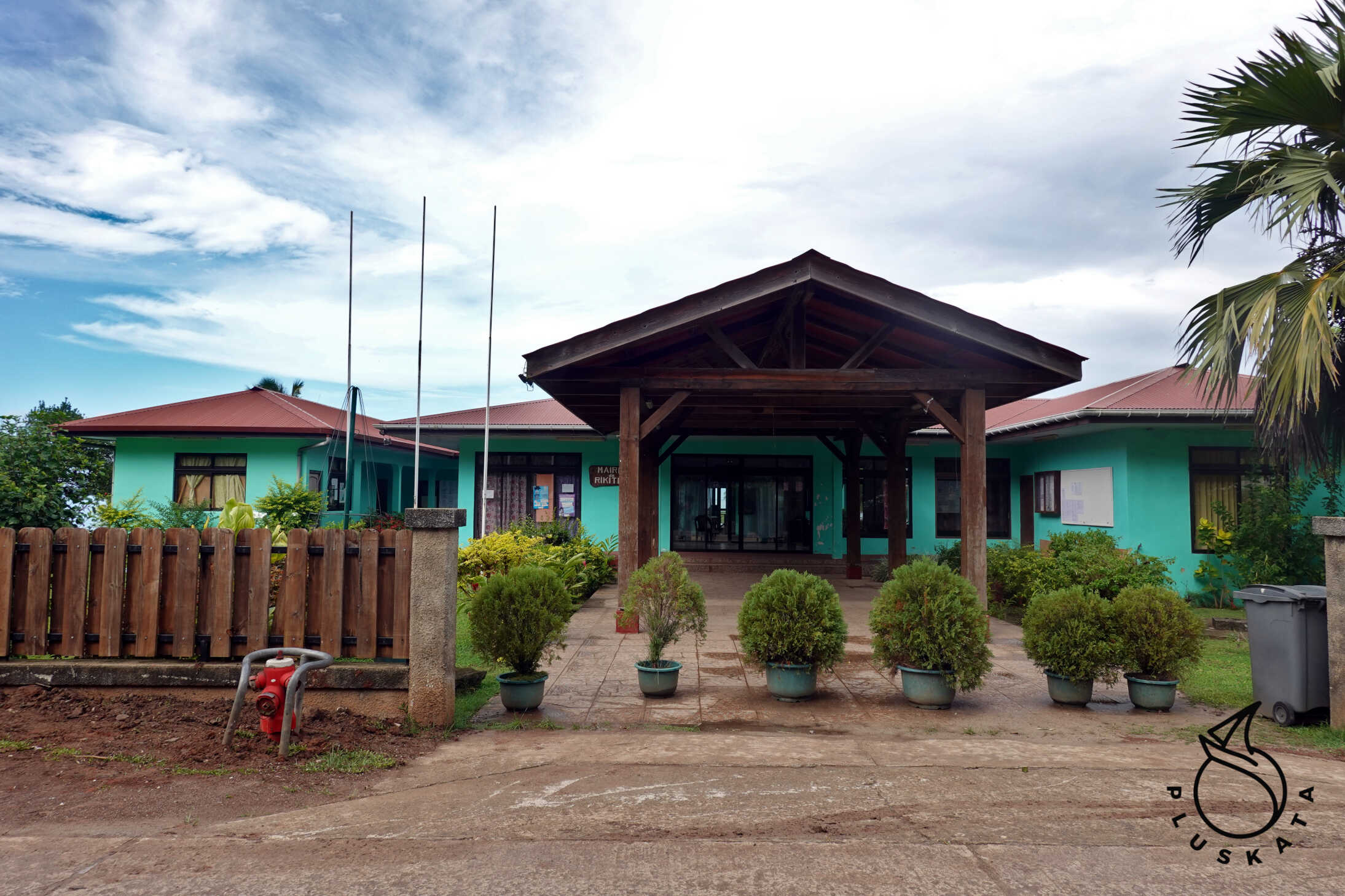
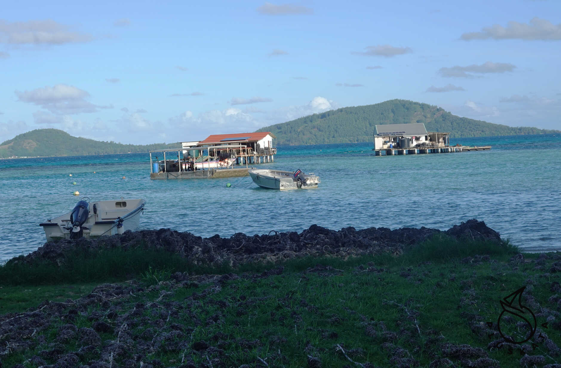
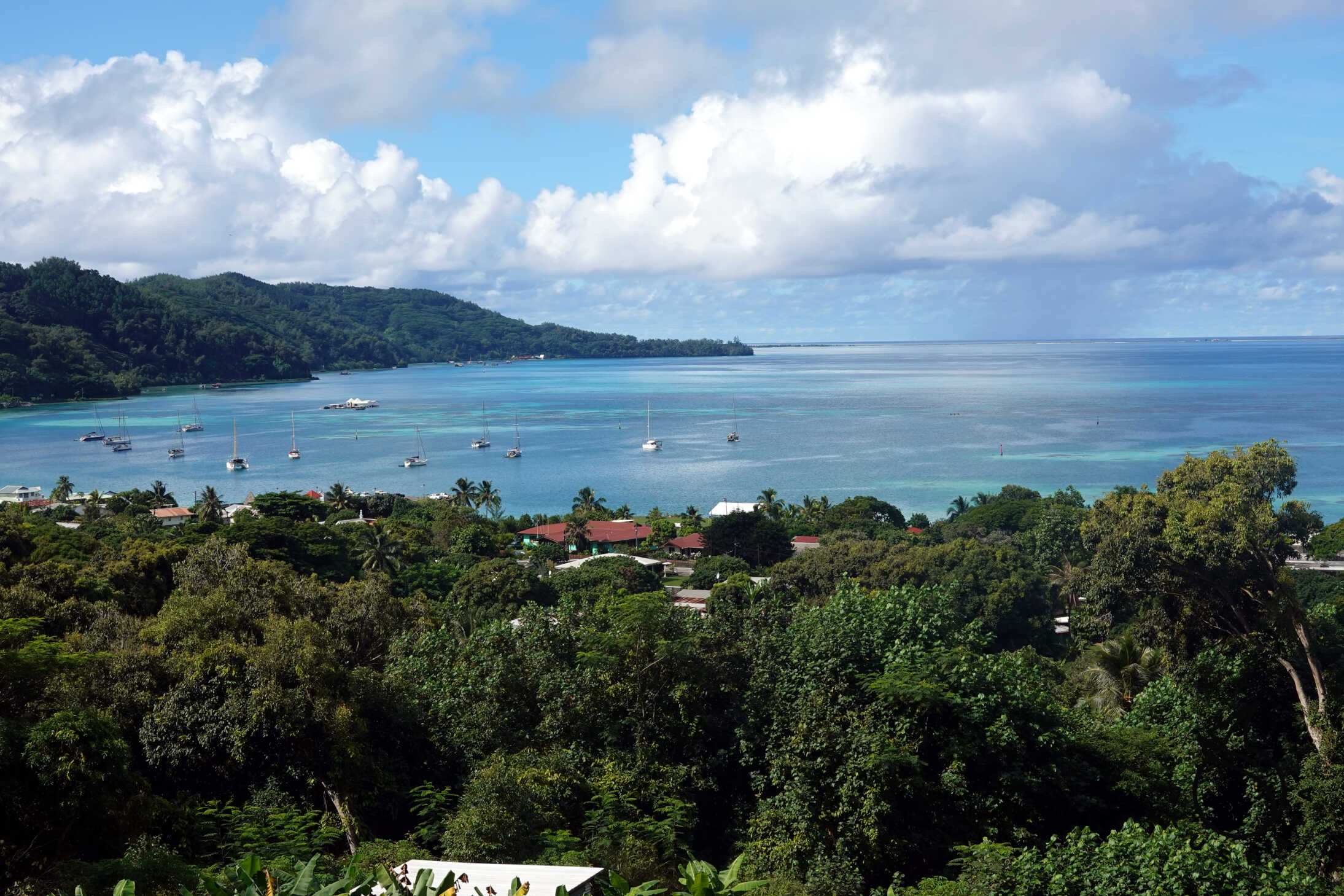
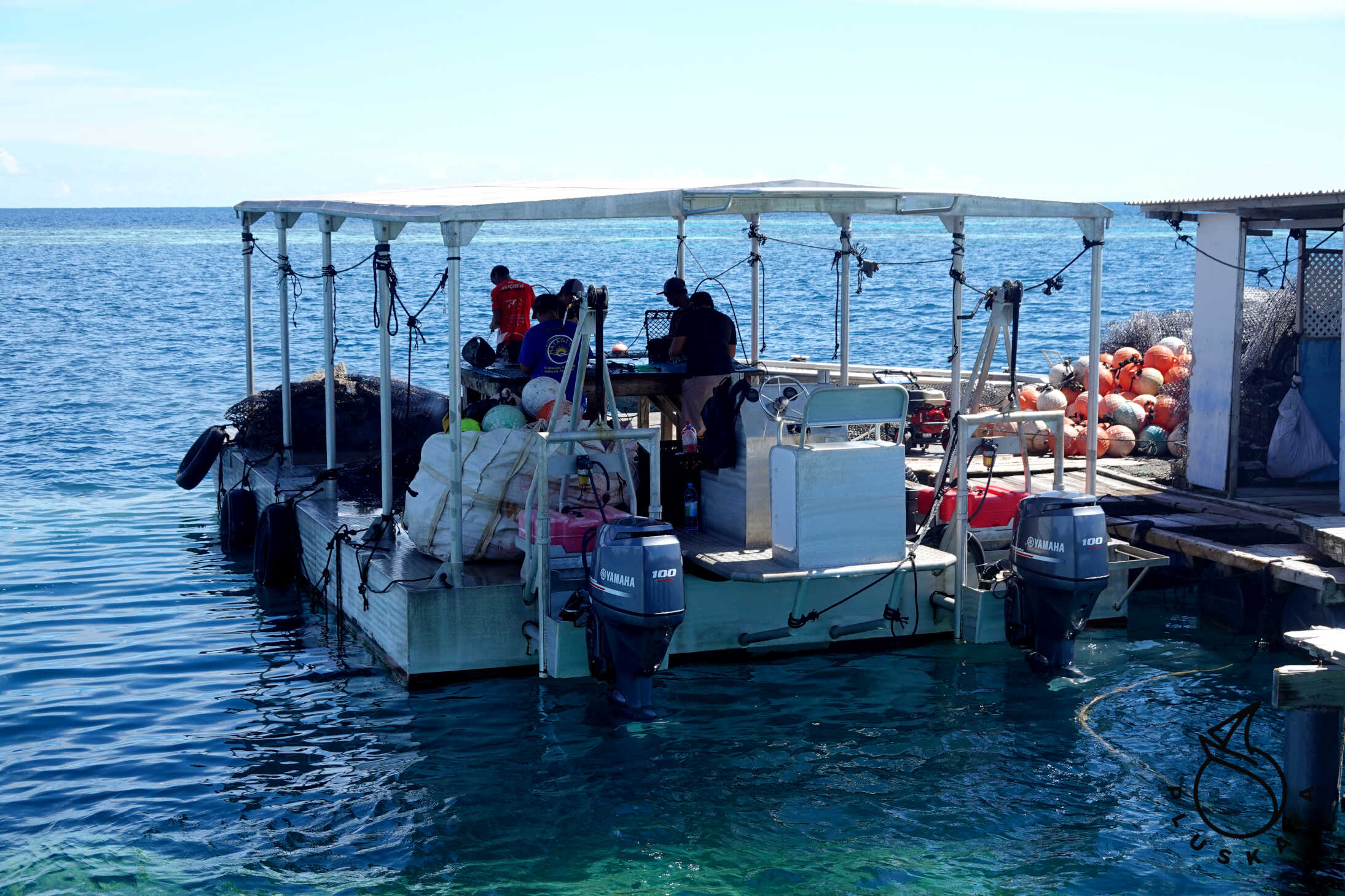
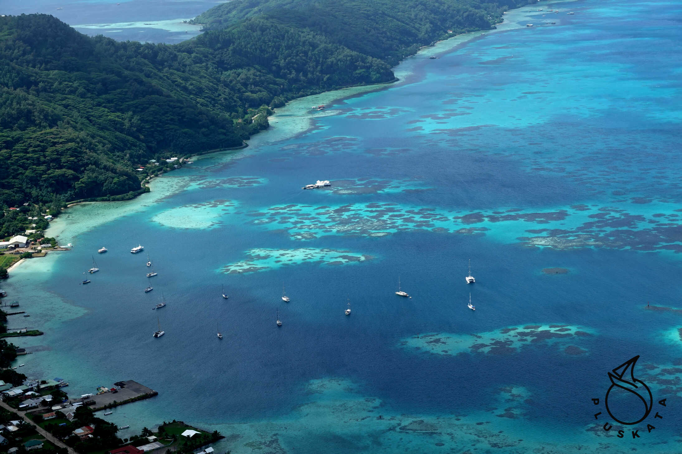
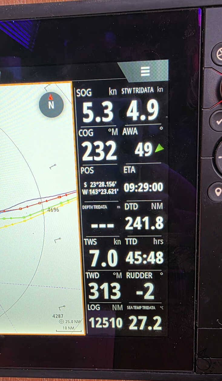
We have 290 nautical miles ahead of us. The weather is good, we’re sailing on a backstay with just the jib. About 40 nautical miles from our destination, a storm is building around us, so we turn on the engine and head in the opposite direction. After 3 hours, we’re safe and around 12 noon, we enter the Gambier Atoll. We sail through the atoll to the main island of Mangareva for about 3 hours. We pass entire fields of buoys in pearl farms – we have to slalom between them. Around 4:30 PM, we moor at the Rikitea anchorage.
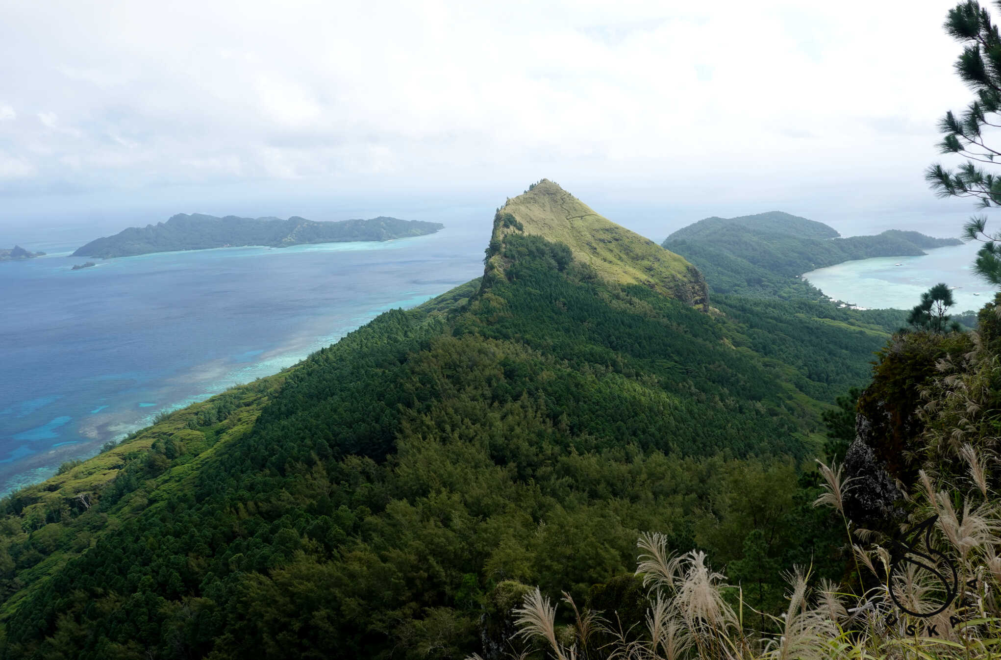
Margareva
The main island of the Gambier Archipelago, measuring 8×1.5 km. Most of the archipelago’s 1,400 inhabitants live here. Along the coast of Rikitea – the island’s main town – are several concrete jetties – access to some of the island’s main towns. Crews can be docked and disembarked, and there’s also a floating jetty at the main port where you can leave your dinghy.
Check-in
Before checking in, you must complete a form on the website “Declaration of entry and exit of pleasure vessel” (demarche.numerique.gouv.fr). After completing this form, you’ll receive a number that must be shown at the gendarmerie station. All crew members are required to check in. The official will stamp your passports and record your check-in number. For EU citizens, the duration of your stay in French Polynesia is unlimited.
Boarding takes place in the gendarmerie building behind the post office (the yellow building visible from the water). A new building is being built next to the old building, and the entire team is in the process of moving in. The office is open Monday through Friday from 8:00 a.m. to 12:00 noon and from 2:00 to 6:00 p.m., Saturdays from 8:00 a.m. to 12:00 noon and from 2:00 to 5:00 p.m., and on Sundays and public holidays from 9 a.m. to 12 p.m. and 3 p.m. to 5 p.m.
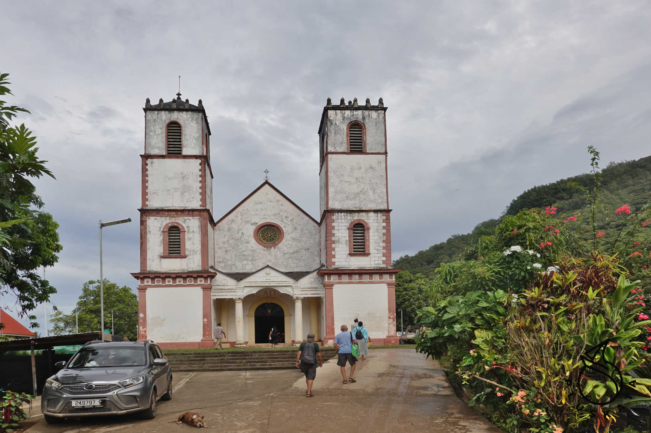
Rikitea
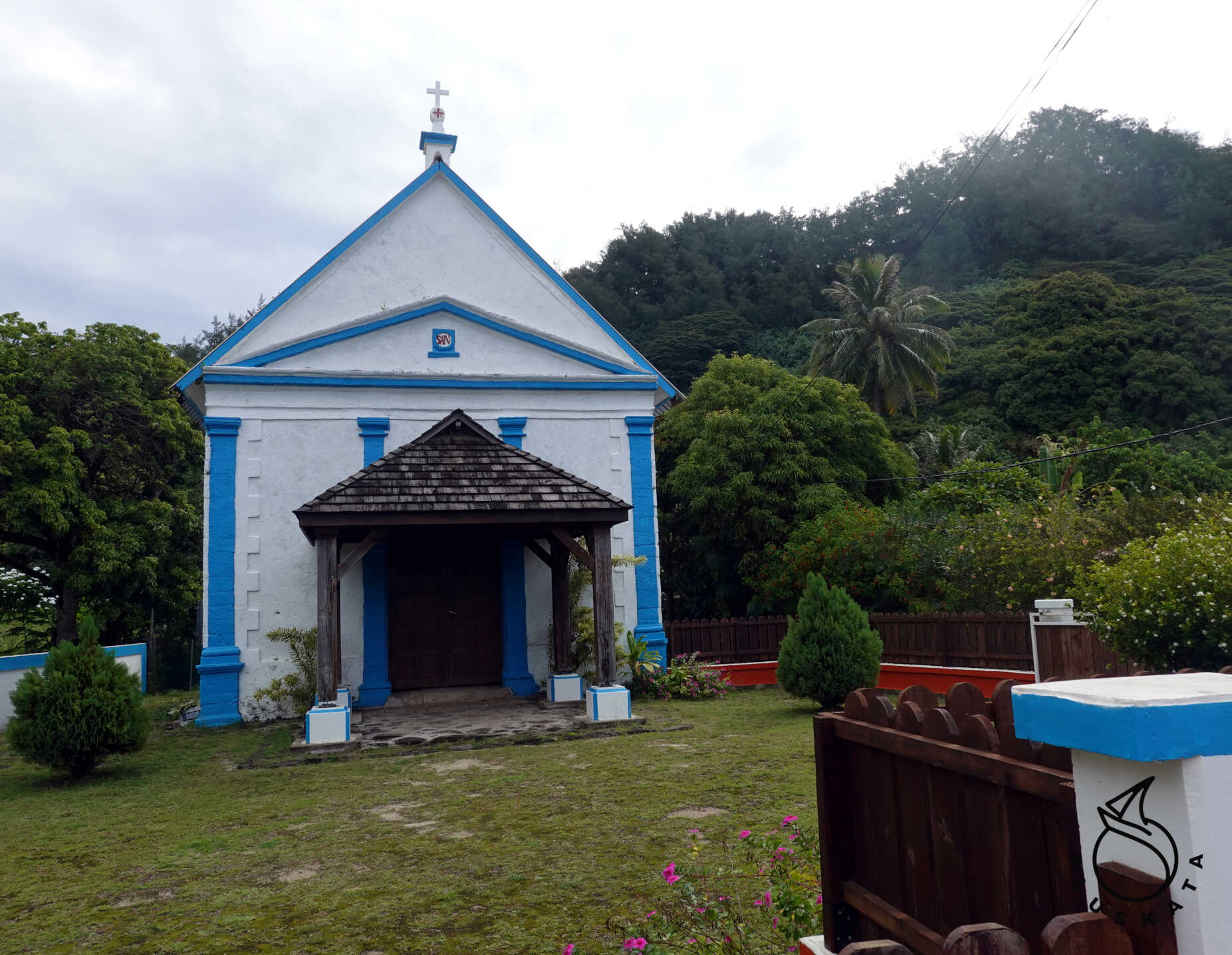
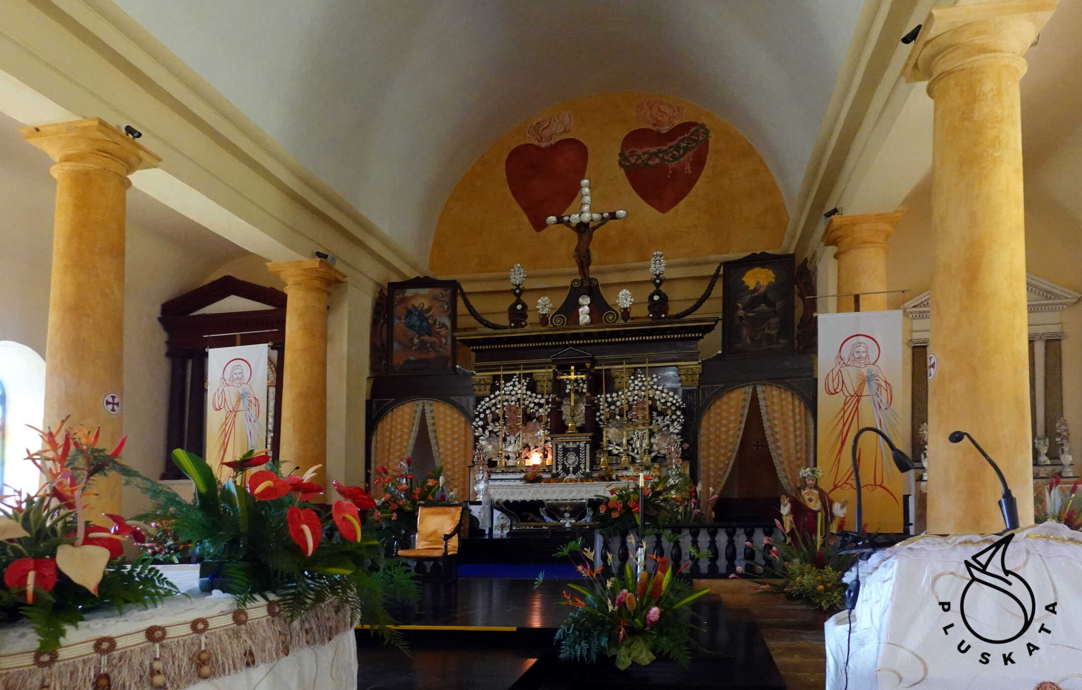
The largest village on the island. It houses several shops, a school, offices, and St. Michael’s Cathedral, also known as Rikitea Cathedral, built between 1839 and 1848 and restored in 2011.
The building measures 48 meters (157 feet) long, 18 meters (59 feet) wide, and rises to a height of 21 meters (69 feet). It can accommodate 1,200 people and is three times larger than the current Notre Dame Cathedral in Papeete. In fact, it remains the largest church in the South Pacific.
The structure is constructed of coral limestone and coral lime plaster, laboriously brought by rafts from quarries in Tauna, Tekava, and Kouaku. The two towers were built between 1847 and 1848.
The interior is richly decorated with masses. The altar is decorated with delicate mother-of-pearl engravings of oysters, set in black pearls.
Supplies
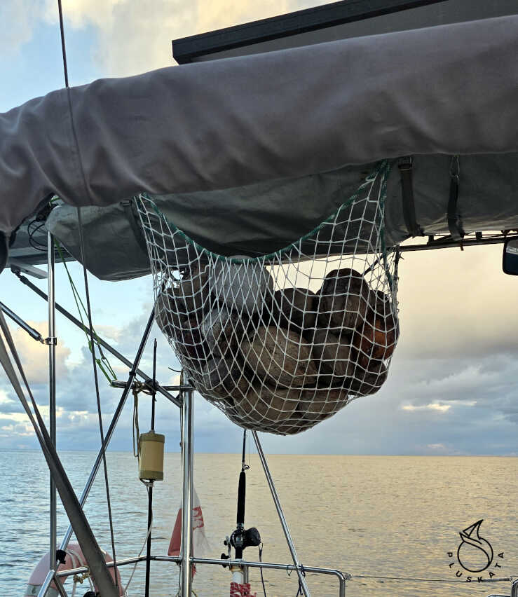
There are a few shops on the island, but the supplies are poor and everything is very expensive. The only relatively cheap items are vegetables and fruit (preferably purchased from private sellers), but only those grown on the island. Depending on the season, these include papayas, avocados, bananas, breadfruit (you can get these for free if you smile at the owner, if you pick them yourself), and coconuts (which are lying around on the street). There’s also a local fisherman who sells fish caught off the atoll, meaning theoretically without ciguetera. We bought 5 kg of mahi-mahi for 700 XPF. 1kg costs 3500 XPF.
Grocery stores are so-so, rather expensive, and vegetables that don’t grow on the island (e.g., onions, carrots) are only available via ship delivery. Card payments start at 2000 XPF.
Pubs
There are several pubs on the island, but all are open until 2 p.m. at most, and food must be ordered—ideally before 12 noon. Lunch costs around 13,000-15,000 XPF and comes in a takeaway container. The selection is limited.
Exploring the Island
We did several hiking trips around the island:
1. To the Mataiutea viewpoint at the tip of the island—it’s about 5 km one way along the shore, mostly on a concrete road. Beautiful views, everyone greets us along the way, and some even offer a ride. At the tip of the island, in the town of Atirikigaro, there’s a guesthouse called Chez Jojo. To reach the viewpoint, you walk about 400 meters, mainly along a path through a small forest along the peninsula’s ridge. At the end, you can see the lagoon, airport, and pearl farms.
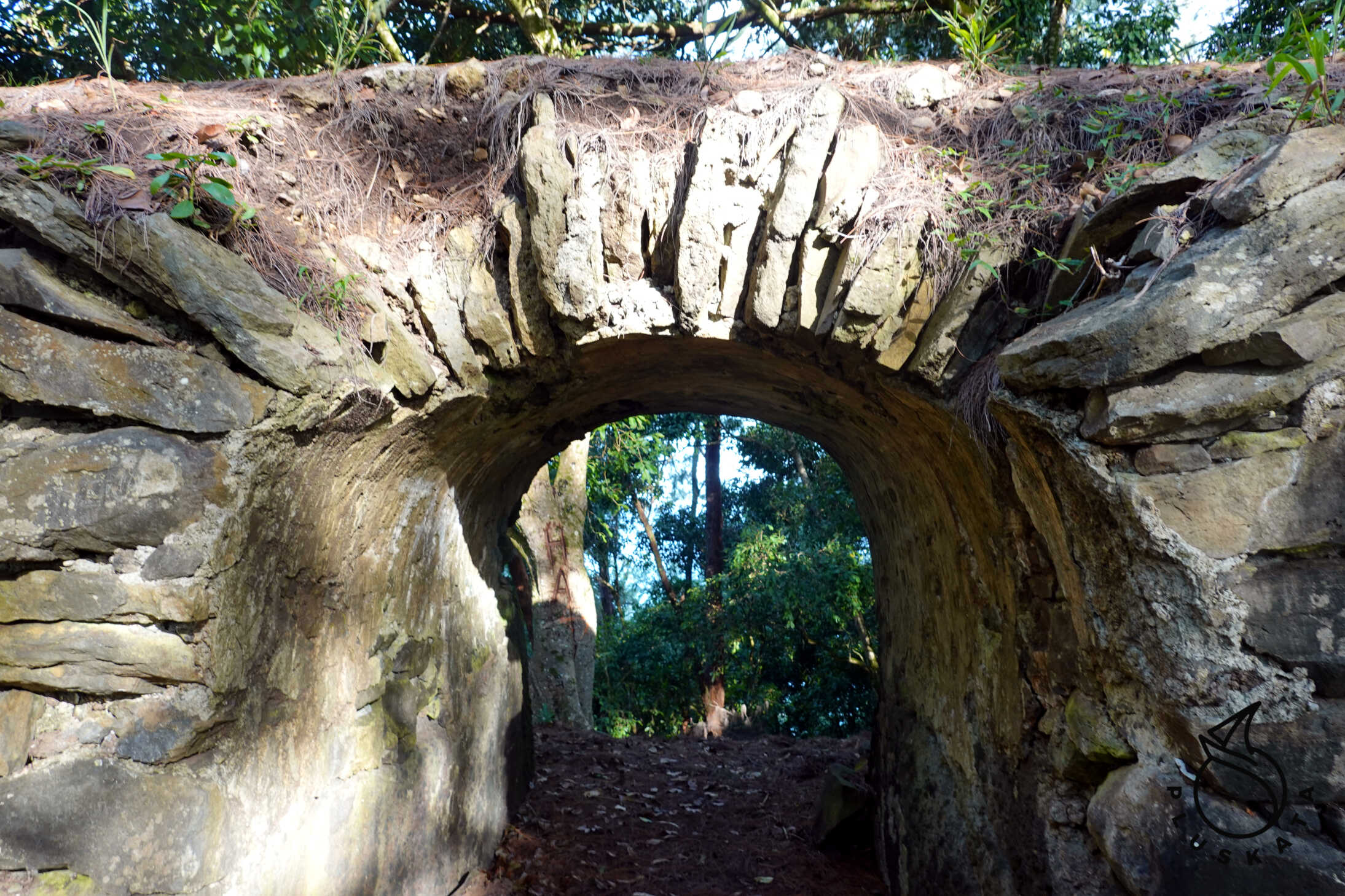
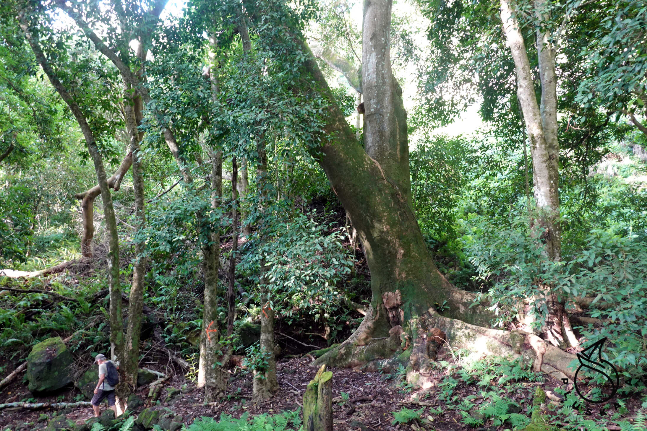
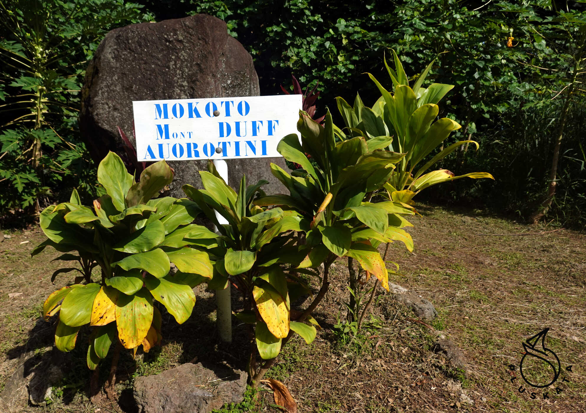
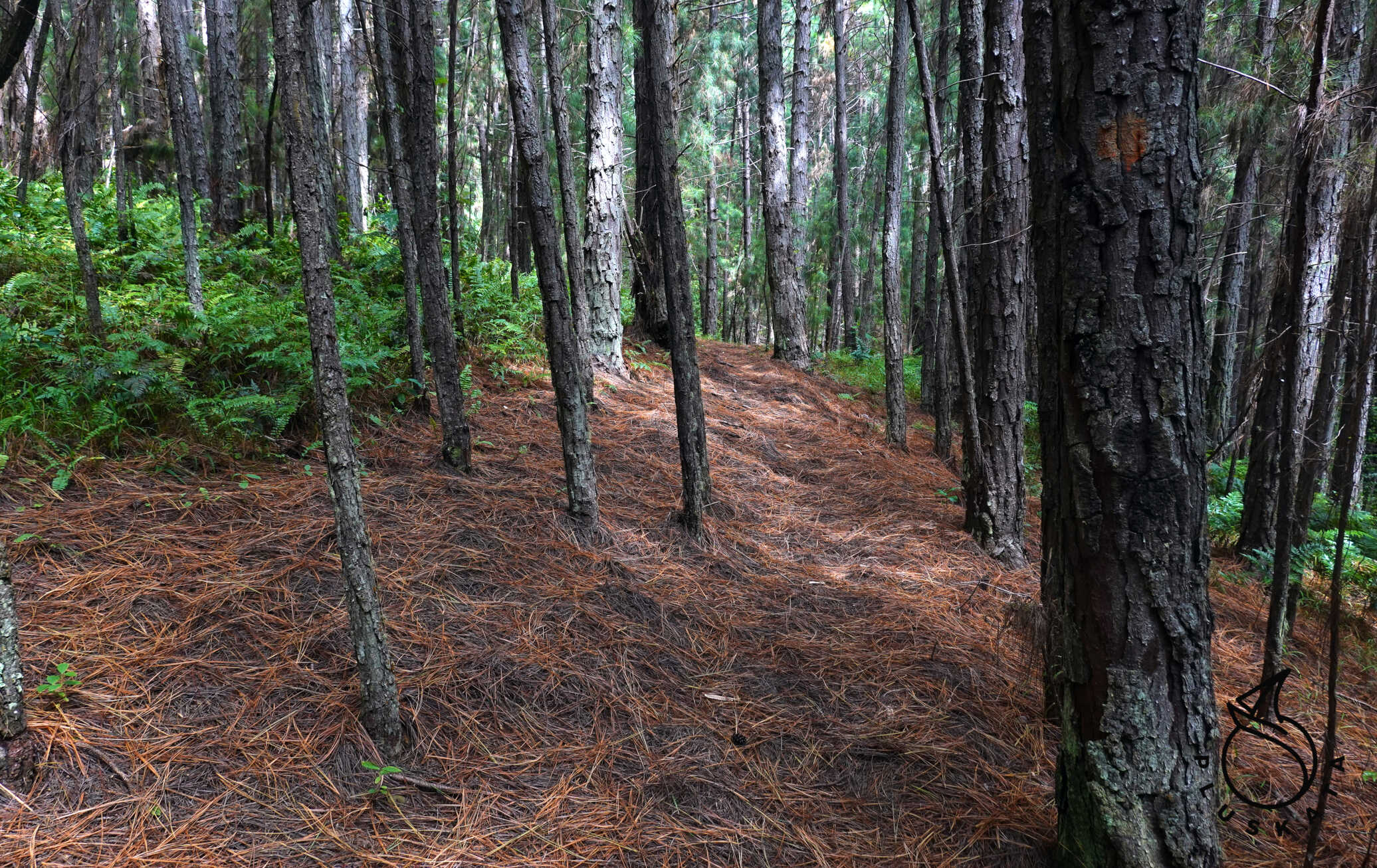
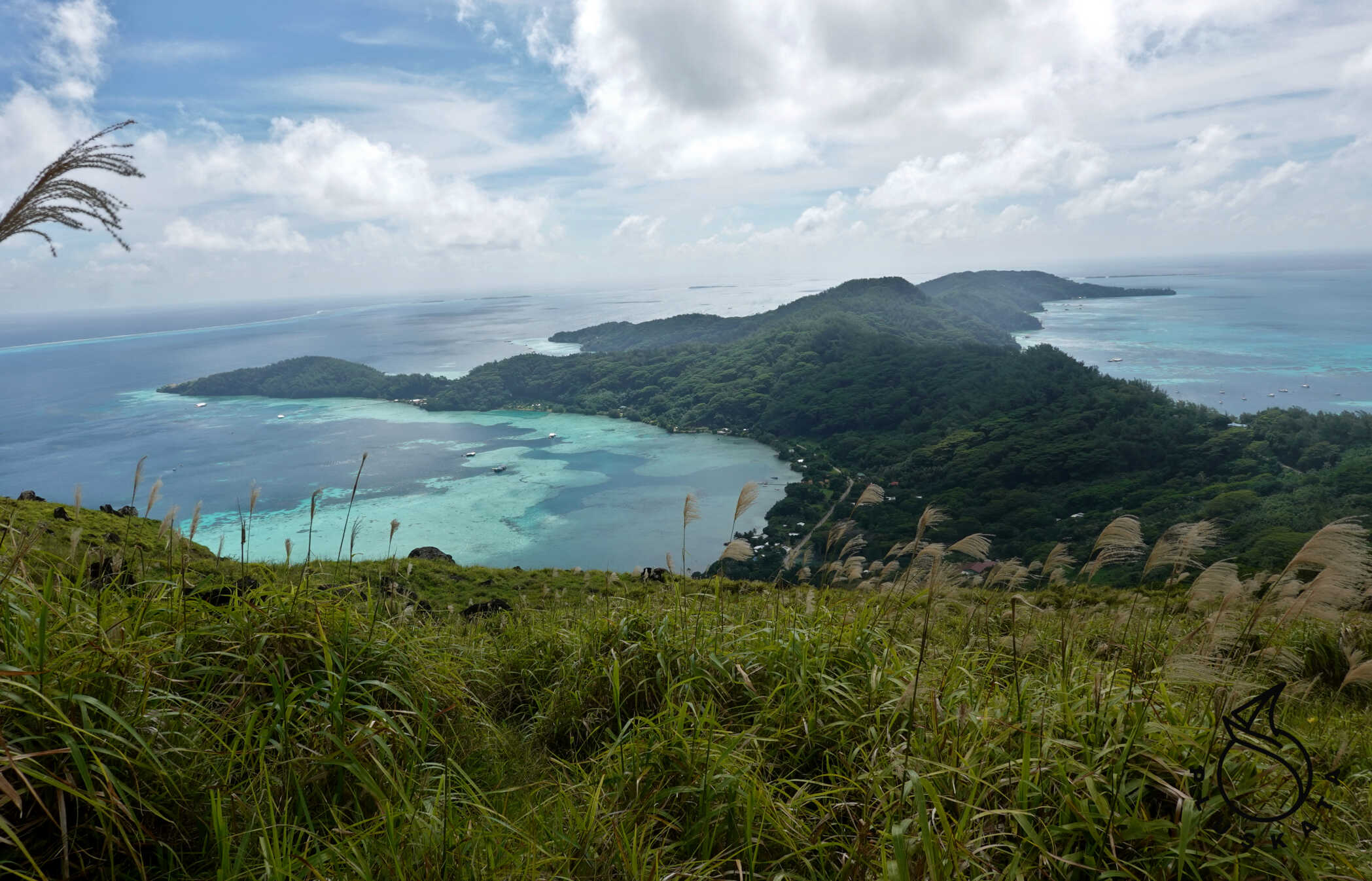
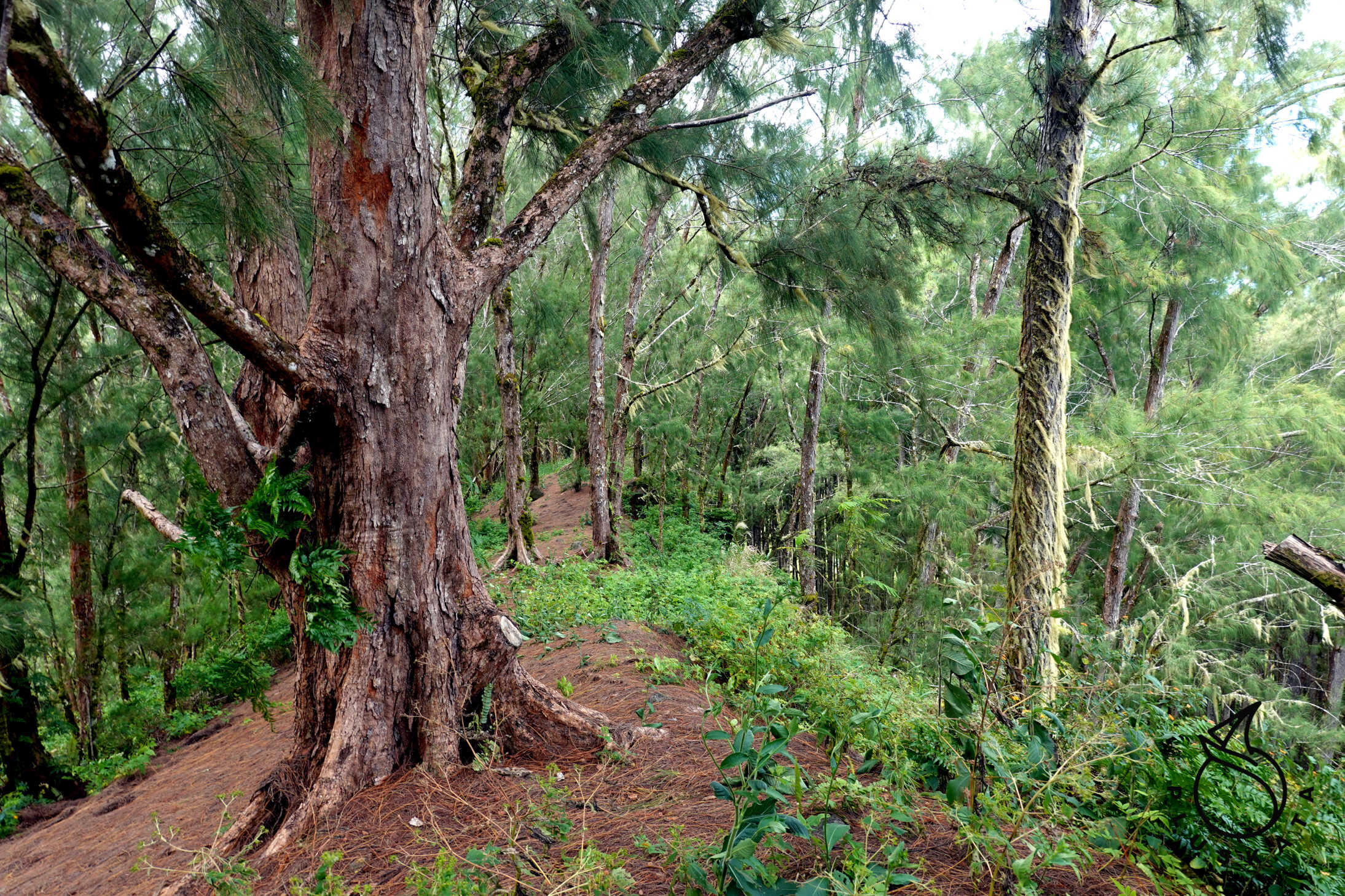
2. Hike to the other side of the island to Kirimiro Bay via the ridge and the triumphal arch. First, we take a concrete road up to the GSM relay station. At the station, we turn right and enter the forest. The path is sometimes difficult to see, but it’s there. The trail is marked with orange dots on the trees, and in places of steep descents or ascents, there are ropes with knots in very good condition. We follow the ridge up to the village of Kirimiro, where we descend to the triumphal arch and then return to the village by road. The total hike is about 11 km, but the terrain is quite challenging, although the forest on the ridge is truly magical. 3. A hike to the two peaks of Mokoto (423m) and Duff-Aurotini (441m). We ascend from the road connecting both sides of the island and return via Atituti and the Twelve Apostles Road. In total, we hike about 14km. The road to Mokoto first passes through a forest, mostly coniferous, before emerging into open space and climbing uphill. From the summit, there’s a beautiful view.
Then, along a ridge, we climb to the next mountain – the highest on the island. The last 100m of the ascent is held by ropes – the slope is steep, and the slippery grass makes it difficult to climb. Fortunately, there are ropes along the entire route – some of them have knots for a better grip. From the top, there’s another beautiful view of the entire island and numerous pearl farms. The descent to Rikitea takes almost two hours.
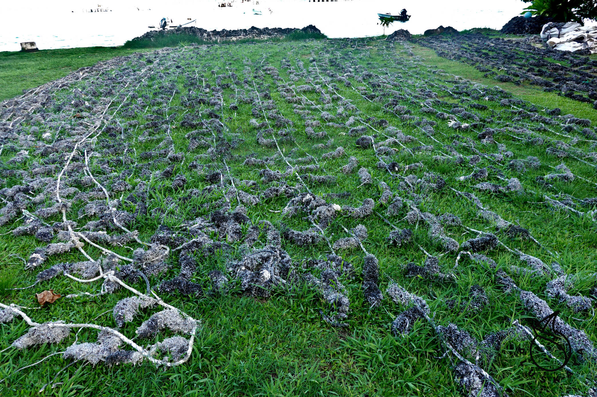
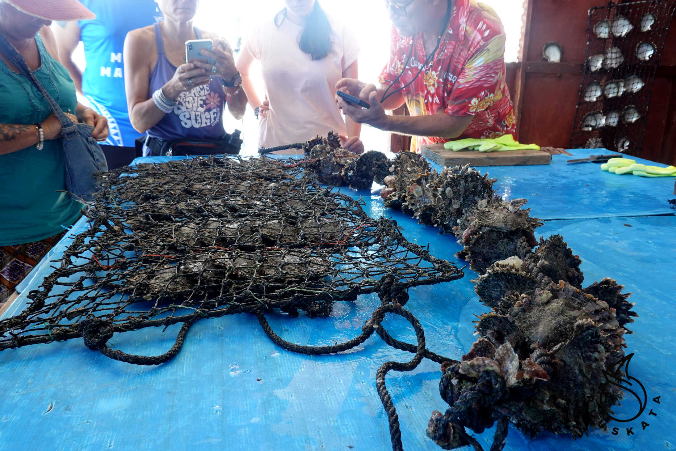
Nanihi Pearl Farm
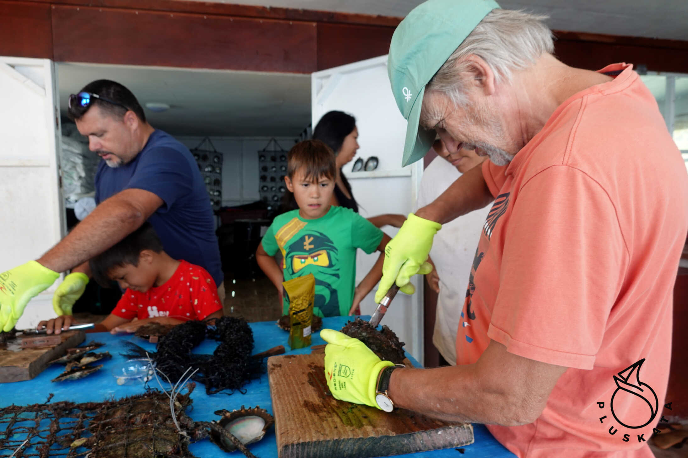
We’re taking a trip to a pearl farm on the western side of the island, at the tip of the Teaurogo Peninsula (Kirimiro Bay). We’ll travel by pickup truck from Rikitea to a bay on the other side of the island. From there, we’ll take a boat to the pearl production site.
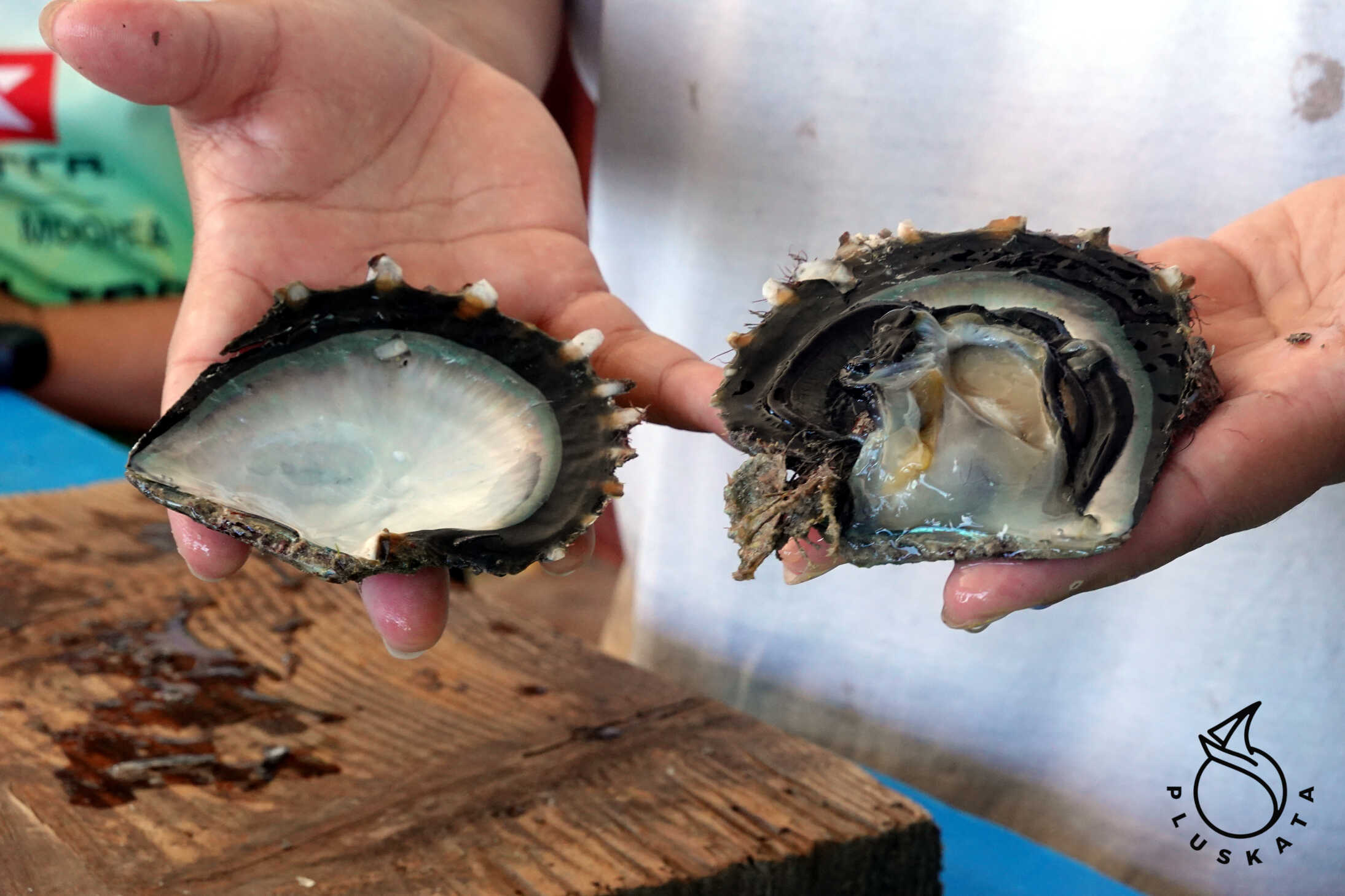
Gambier Black Pearls are world-famous. The waters of the Gambier Archipelago are exceptionally clear, rich in plankton, and provide ideal conditions for pearl cultivation.
These pearls are considered among the most beautiful and valuable in the world due to their exceptional luster, deep, saturated colors, and high quality. Their rarity and stunning natural hues make them highly sought after. Unlike other pearls, black pearls are naturally dark and undyed. They can occur in a wide range of colors besides black, including peacock green, eggplant, blue, silver, and gold. Pearl Production Steps:
1) Shell Production:
Dark plastic “powders” are used to cultivate the shells, resembling the places where shells would attach in nature. Young shells are released from their mother and attached to a ribbon. In ancient times, trees were used for this purpose, but today, plastic is more efficient and preferred by all pearl farmers. Plastic ribbons are reused.
2) Oyster Culture:
Young oysters are cut from plastic ribbons and placed in protective shells in water. This process consists of two stages, depending on the size of the shells. These shells are cleaned every three months with pressurized saltwater to ensure the shells remain healthy.
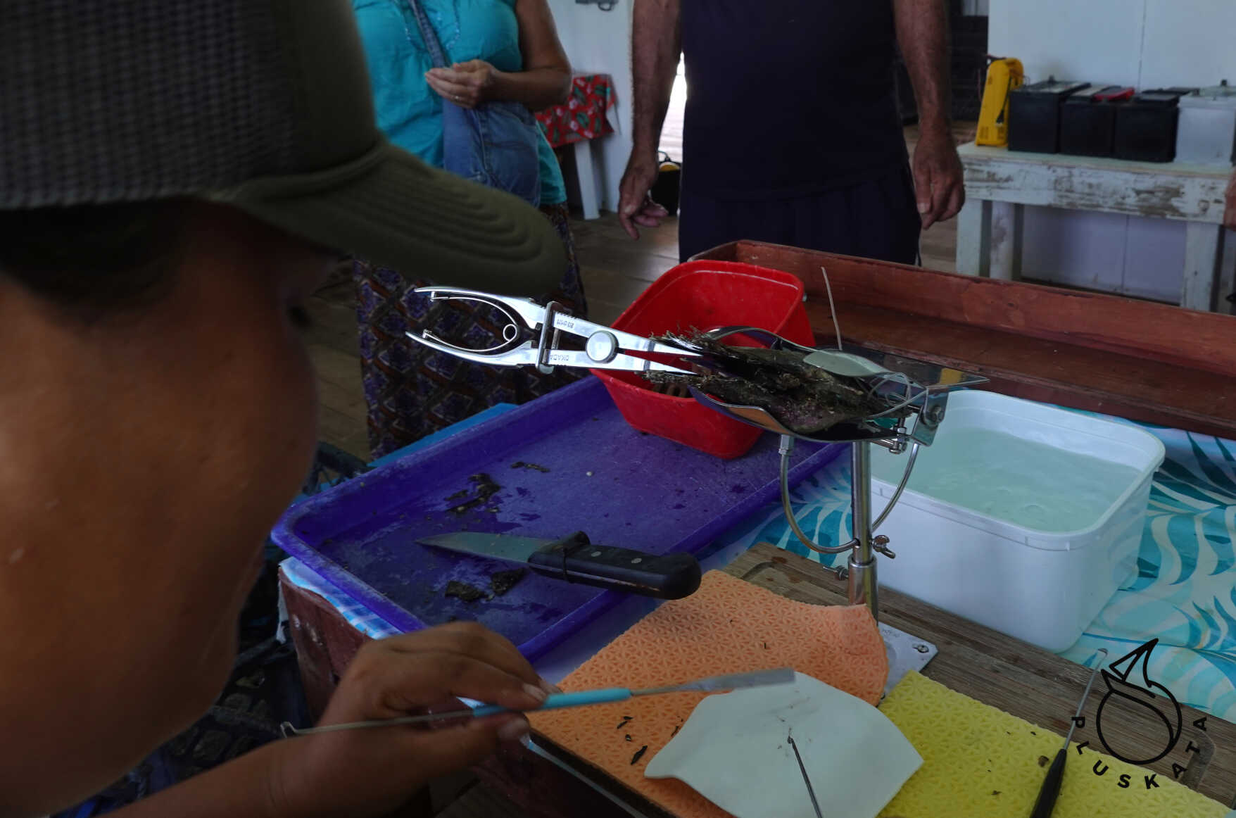
3) Pearl Implantation:
This process begins with a pearl embryo. The embryo is a round bead from another shell, which, along with mantle tissue, is inserted into the oyster, creating a pearl. The pearl embryo most often comes from the Mississippi River in the USA. The process of inserting the pearl embryo into the shell requires precise surgery.
Most of the meat inside the oyster is reused as fertilizer in the garden of the owners of this pearl farm. The only edible part is the muscle, which we sampled raw. It is delicious and has a delicate flavor.
The tour costs 8,000 XPF per person and includes a hand-dug pearl, a shell (if interested), a drink, and a slice of pomelo.
Taravai Island
The second largest island in the Gambier Archipelago. Currently, it has eight permanent residents. There is a guesthouse, a church, and two farms.
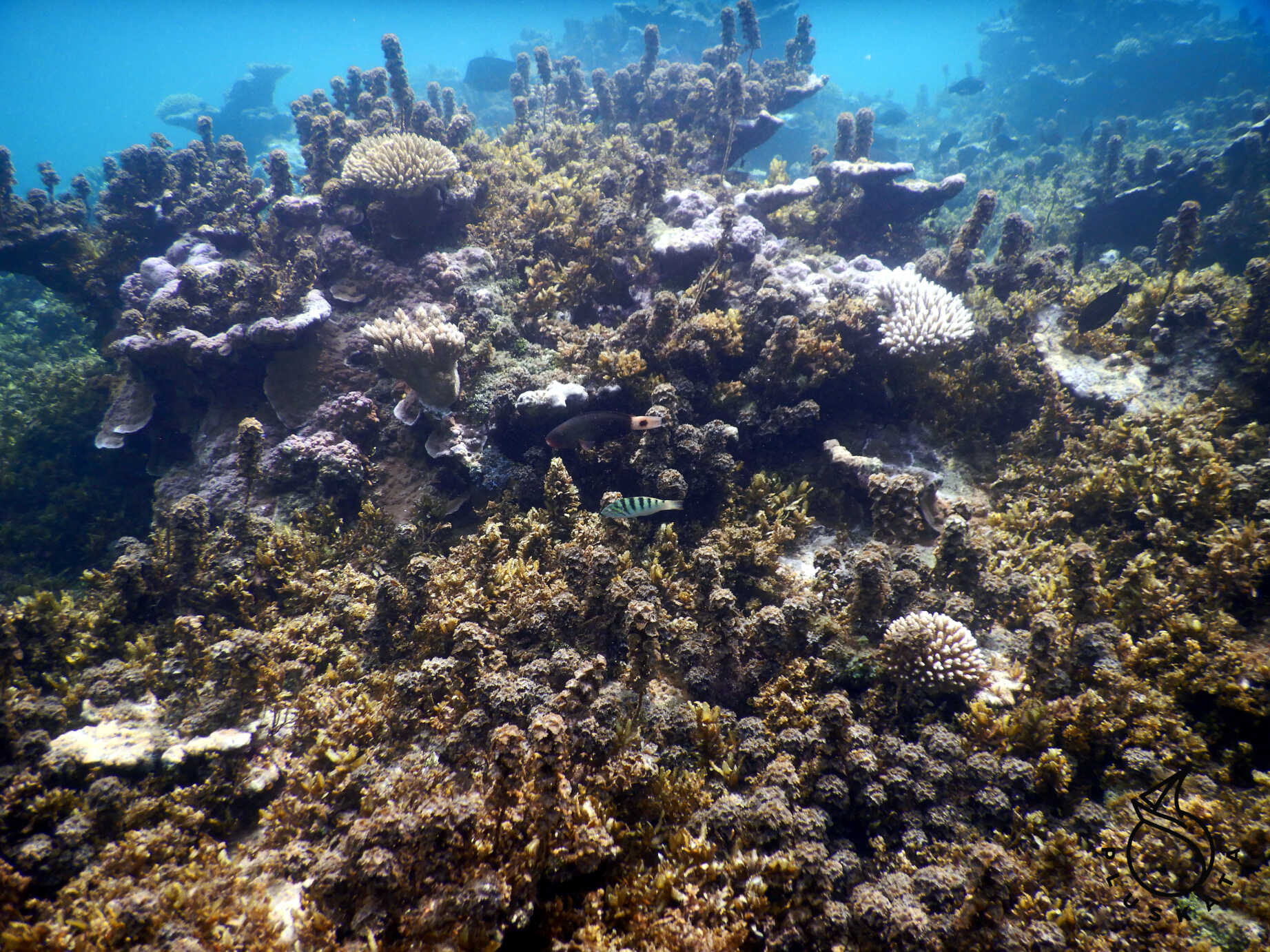
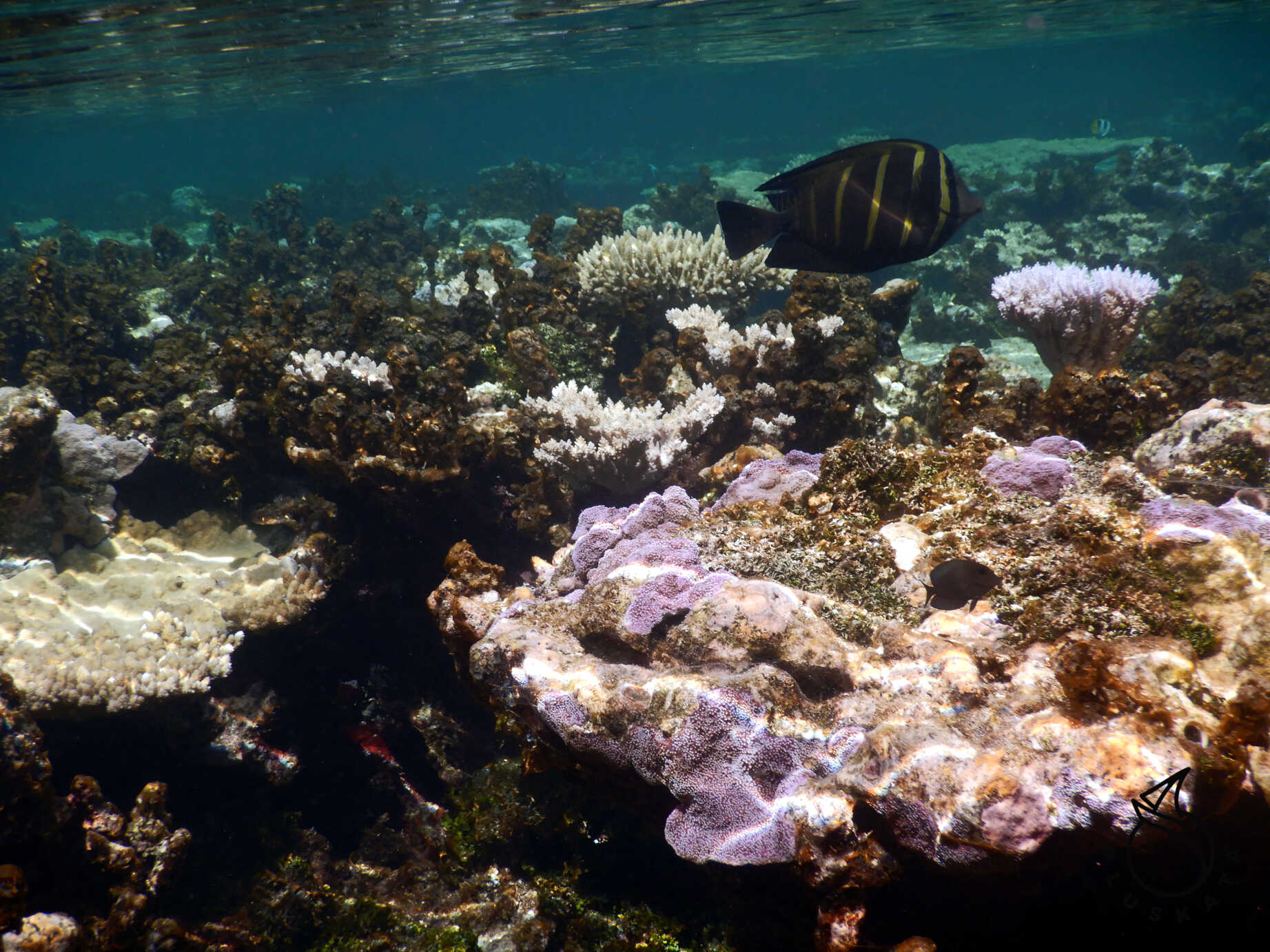
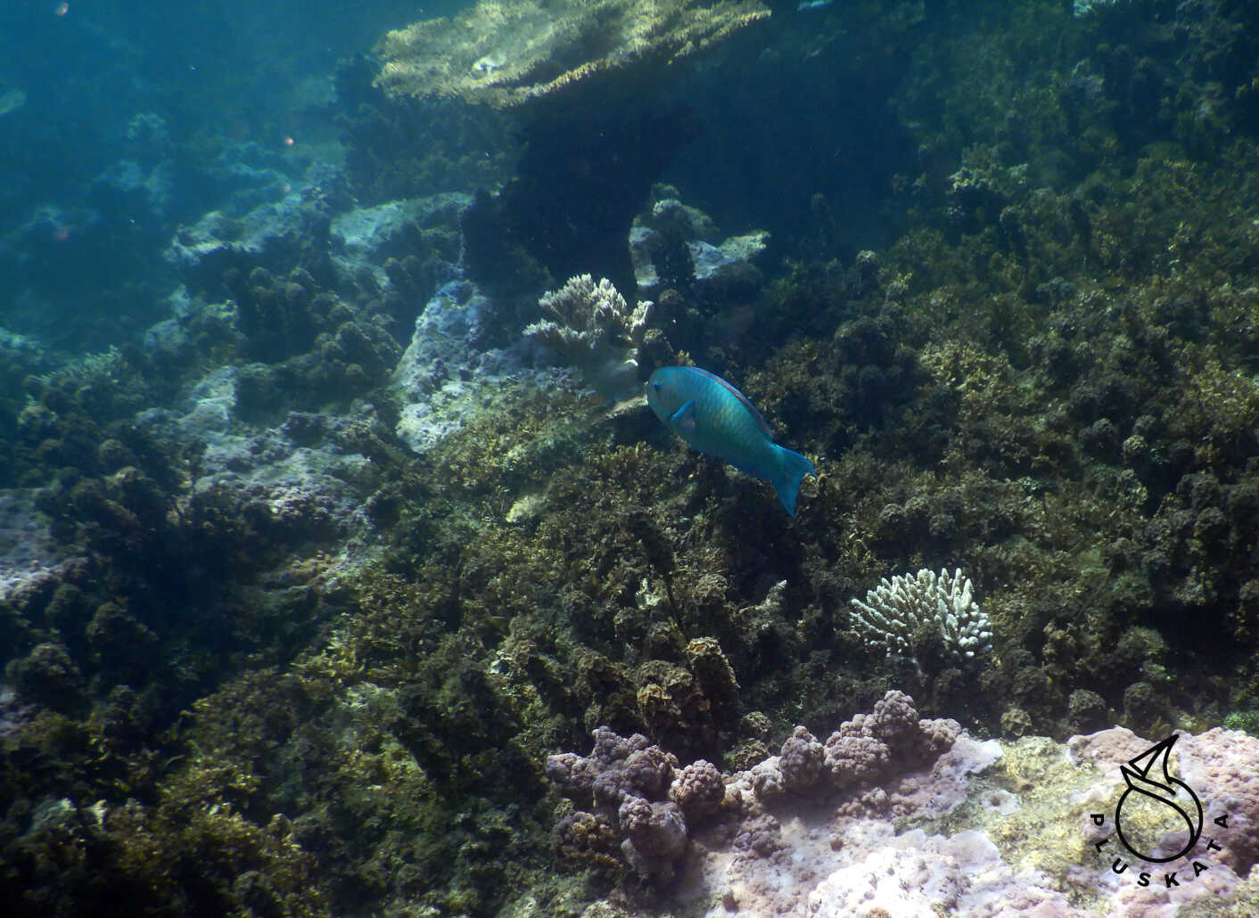
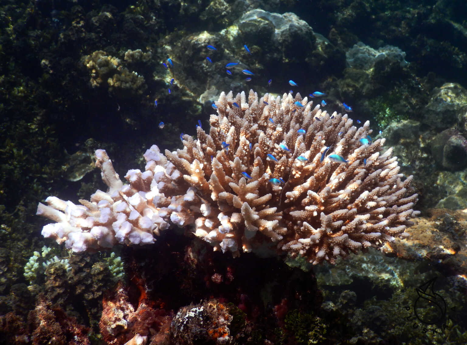
We anchor in Onemea Bay, a beautiful cove, at 13 meters on sand interspersed with rocks, but the anchor holds well. Excellent snorkeling conditions, a beautiful, colorful reef close to the water’s surface (sometimes even a little too close). Barbeque at Valerie’s
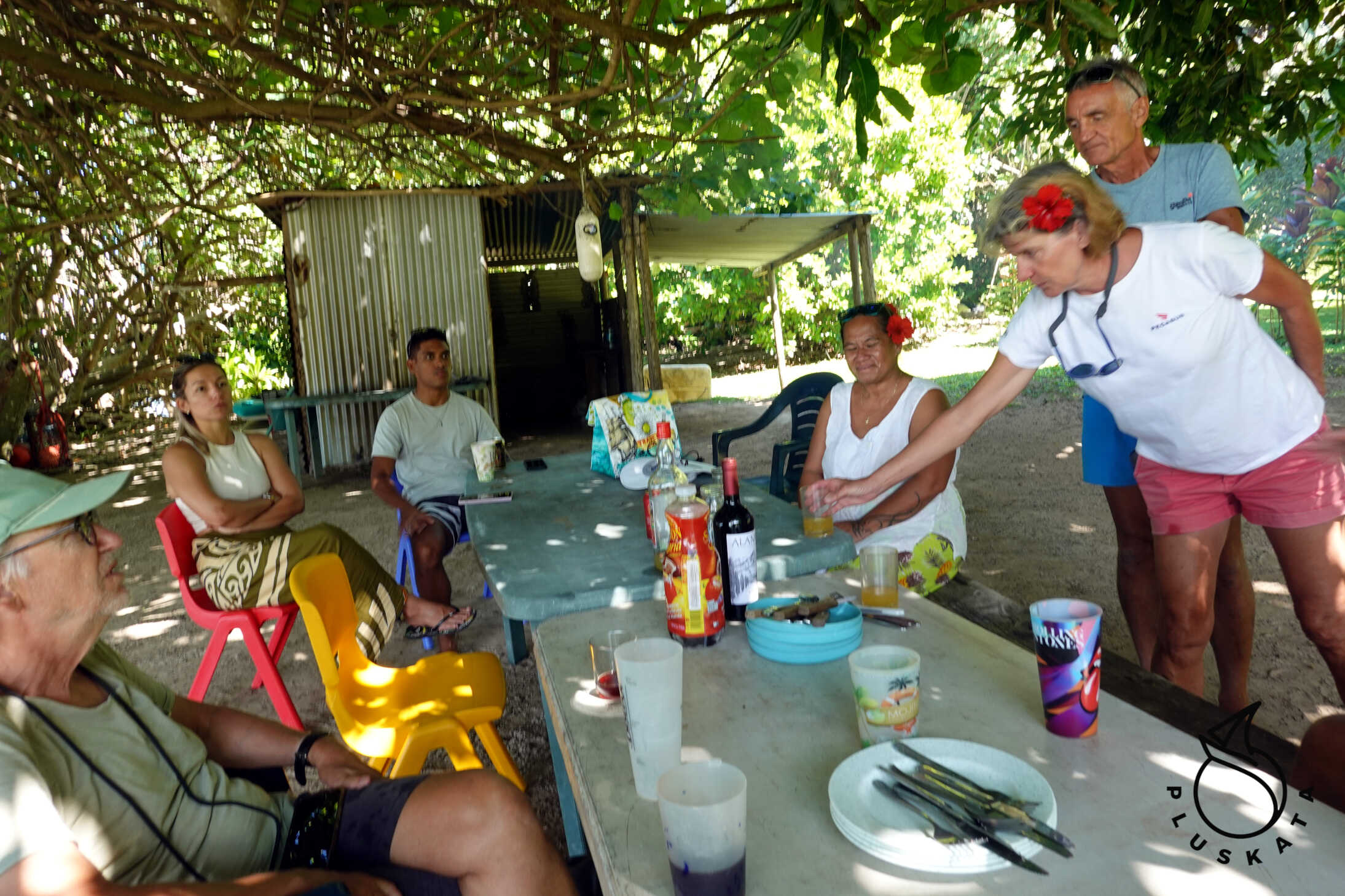
On Sundays, when the weather is nice Valerie and Hevre are having an outdoor barbecue. They start around 12 noon. They serve chicken served two ways, breadfruit, rice, and sauce. There’s also wine, beer, and whatever you bring, and coffee and cake for dessert. The total cost is 2500 XPF per person. We’re sailing on our “torpedo boat” for the BBQ. It’s about 4 nautical miles, so the journey takes about 2 hours each way, but it’s worth it. There are three other boats besides us – all French, but they sailed through the narrow passage in sailboats. Unfortunately, it’s too shallow for us. After lunch, everyone plays boules, but we have to head back to get back to our boat before dark.
The Road to Raivavae
We set off on Monday around 8 a.m. We motor through the lagoon and set up the genoa behind the barrier reef. The wind is about 9 knots, and we’re sailing at a speed of 3 knots, but at least we’re heading in the right direction. The wind is a bit fickle, sometimes blowing weaker, sometimes stronger. Unfortunately, after two days, it changes direction to the direction we want to sail and drops to 5 knots, so we start the engine. Everything is in line with the forecast. The following days we spend partly sailing and partly on the engine, until after five days on Saturday, the wind finally settled in, and from the right direction.
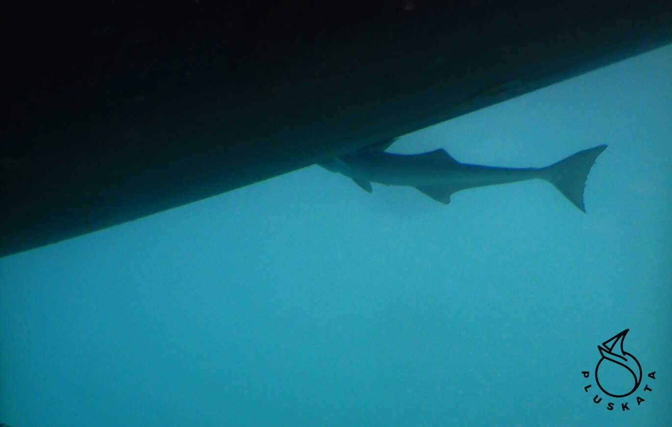
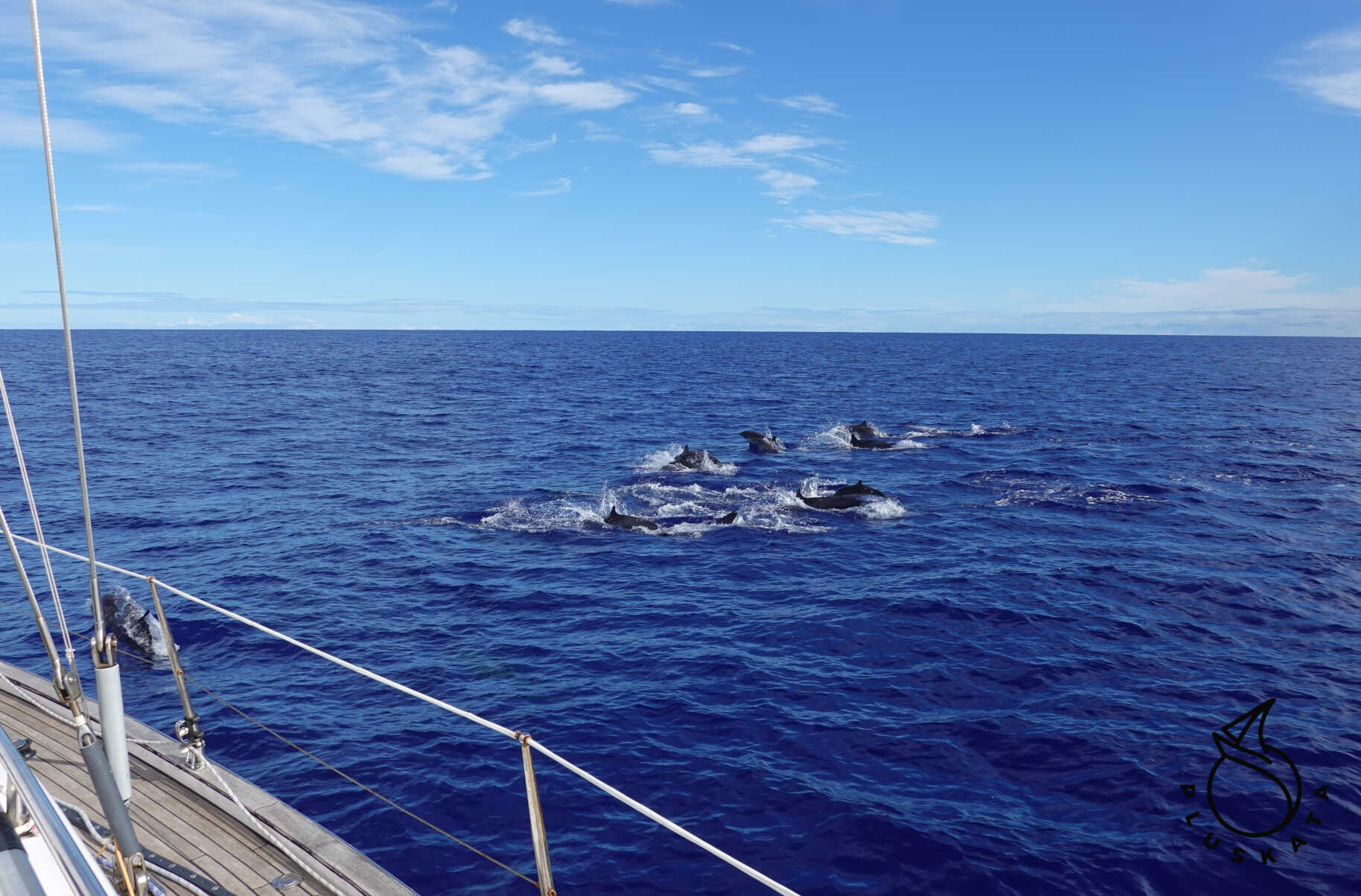
On Saturday, we sailed alongside a huge pod of dolphins – it lasted almost an hour, and there were dozens of them – a beautiful spectacle.
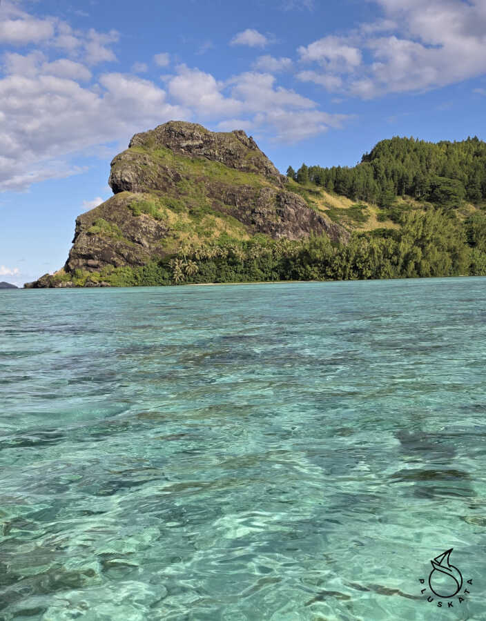
Raivavae
An island in the Australes archipelago. This is the only island in the archipelago where you must reserve an anchorage via the website https://escales.gov.pf/home . The maximum anchorage time is 72 hours. Only in the event of a breakdown or bad weather can this time be extended.
Arrival should be reported to the gendarmerie office, where all crew members should present themselves, along with their passports and yacht documents. One person at the station speaks some English. We show our passports and yacht documents, discuss our next destination and timing, and the gendarme arranges Janusz’s transport to the airport to pick up his wife. We also buy some oil for the S-drive transmission – unfortunately, we need to replace the S-drive seal, but that requires hauling the yacht out of the water.