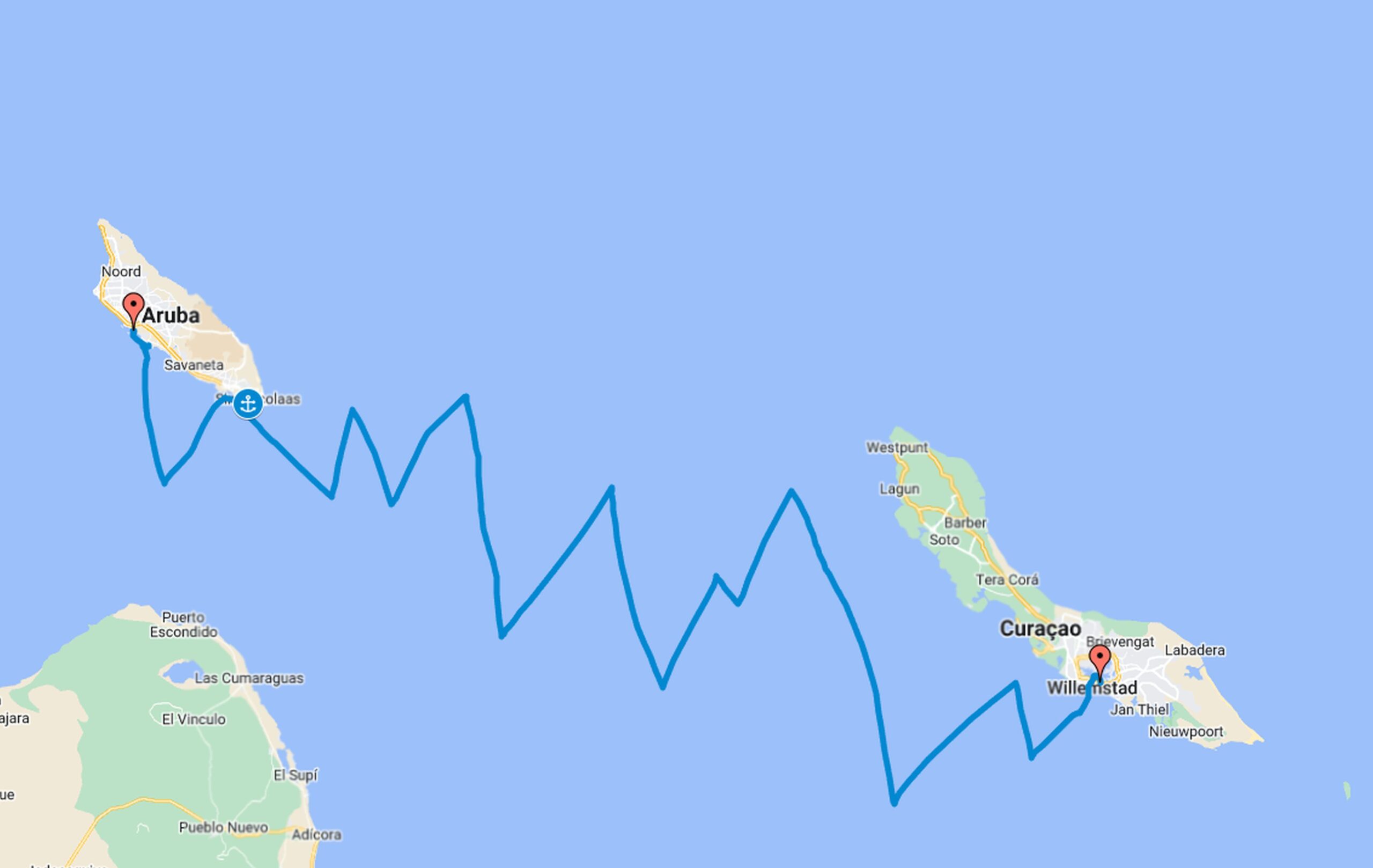
Route: Oranjestad (Aruba)-Willemstad (Curacao)
Date: 01-15/2024
Miles/hours: 168nm/38h
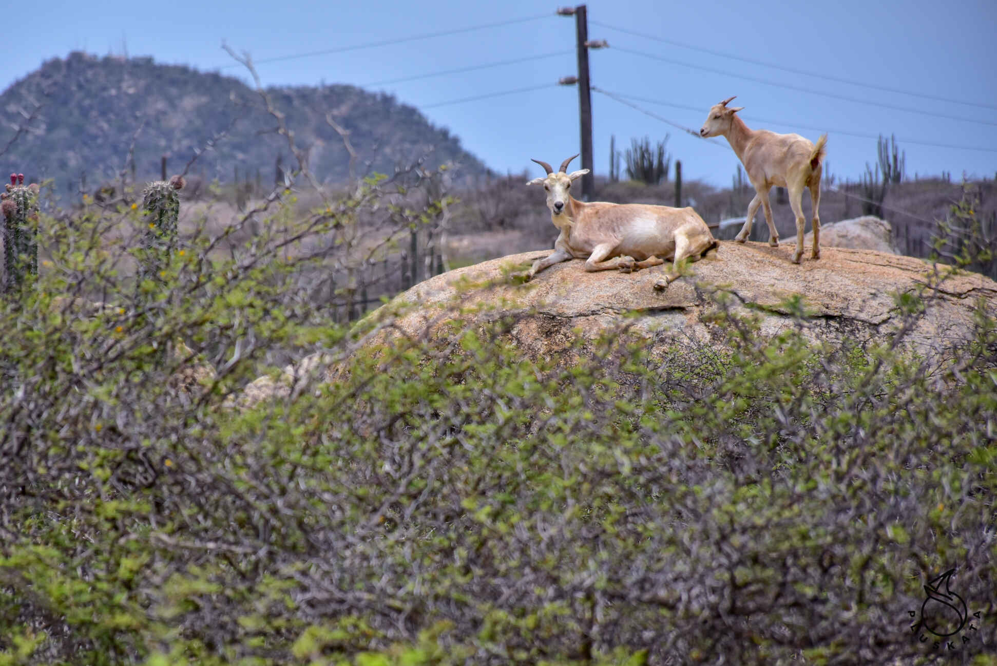
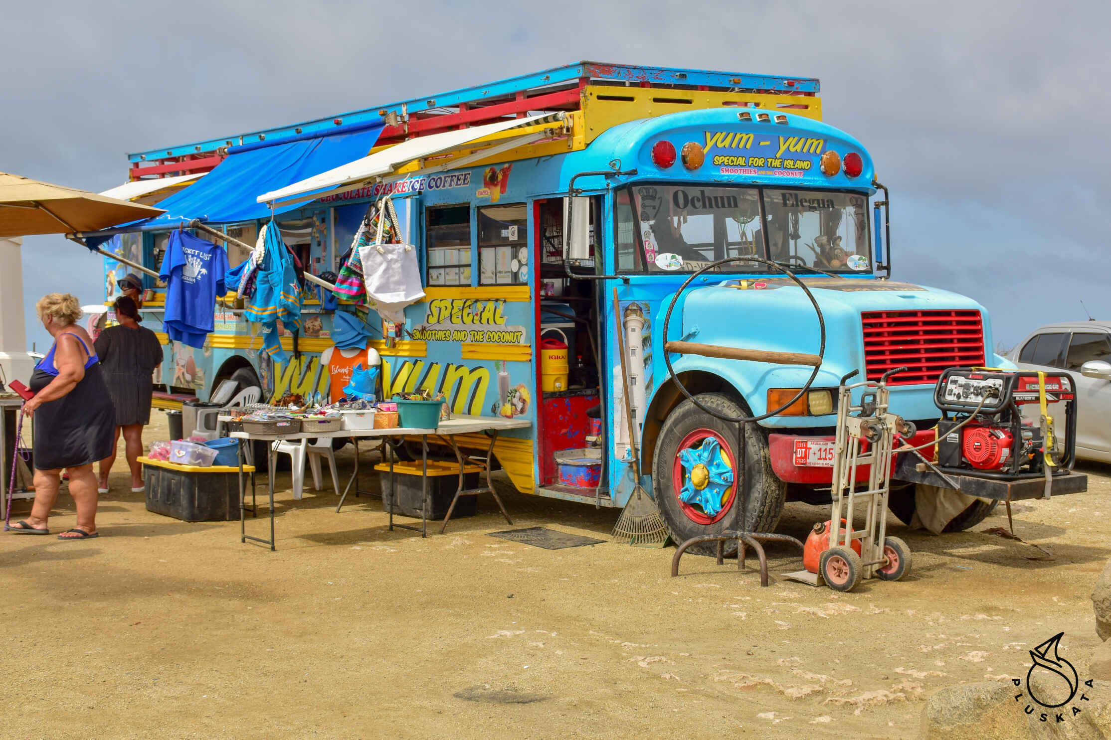
Interesting places in Aruba
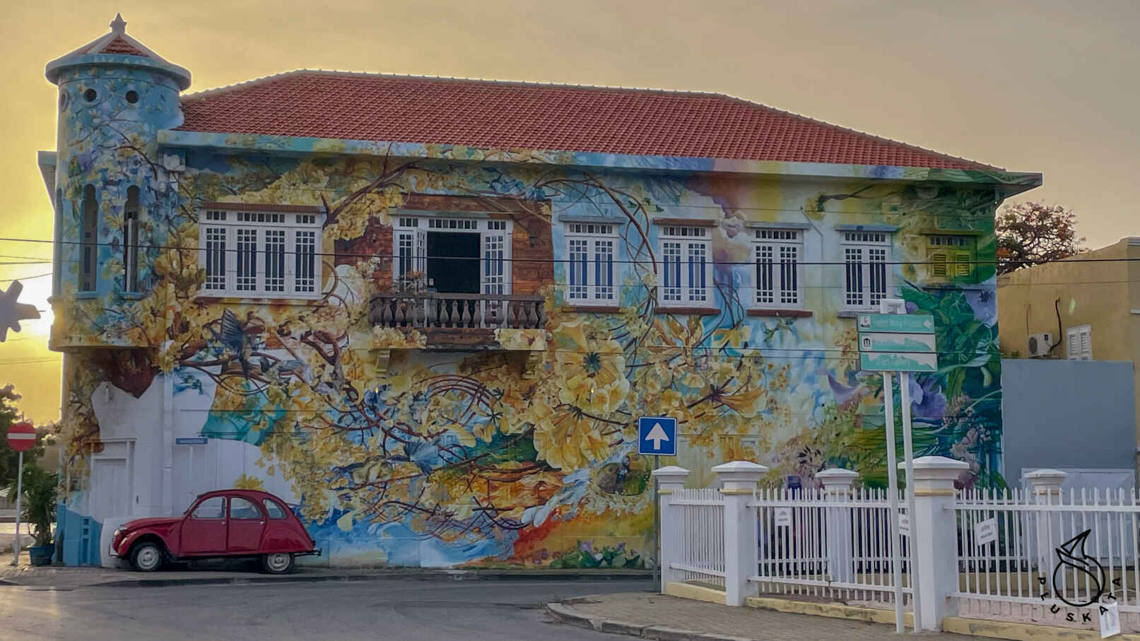
San Nicolas
A town in the south of the island. The Aruba Art Fair festival takes place here every year. This is a festival where artists from all over the world come to Aruba to paint beautiful murals. They are all beautiful. Some of them are old and disappearing, but the newest ones make everyone happy.
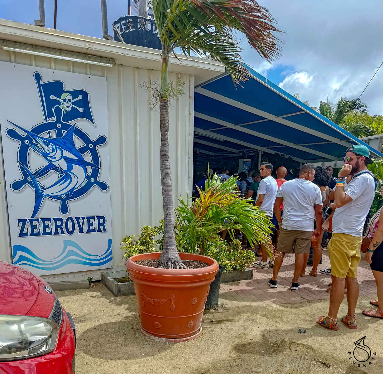
Zeerover
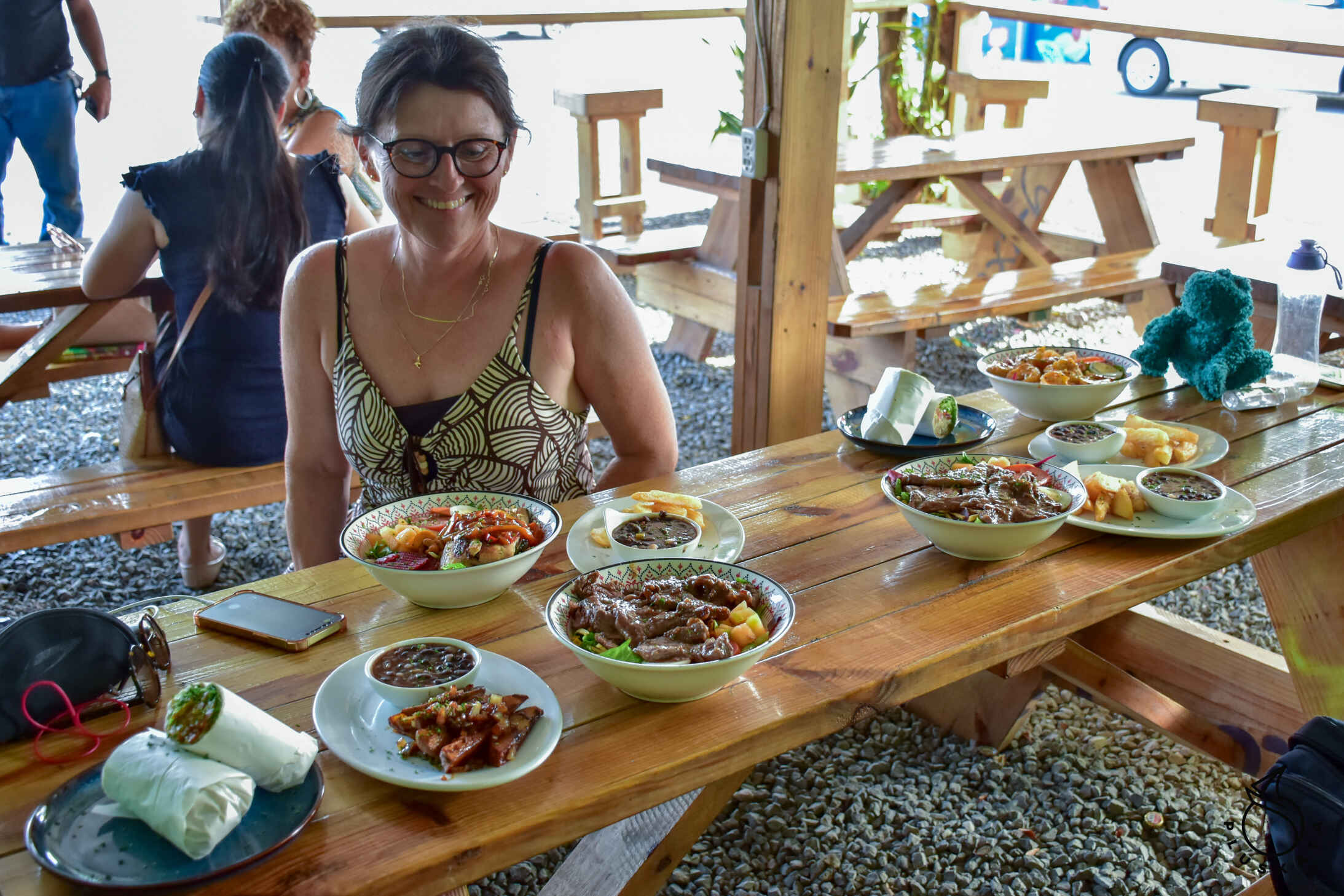
Great fish restaurant – the best in Aruba. There’s always a queue. The kitchen is open from 11 a.m. to 6 p.m. every day except Mondays. After standing in the queue (it’s best to be there before 12), you say what you want (fish, shrimps, fries, bananas, sauces), give the number of people (the service is calculated from this number) and the man takes out the ordered products and weighs them – the fish is of one type. – what they caught on a given day (catch of a day). Then we go to the cash register next door, pay and get a number with which we go to the table. After about 10 minutes, we get our dish – for dinner for 5 people we pay a little over $30, and everything is very tasty.
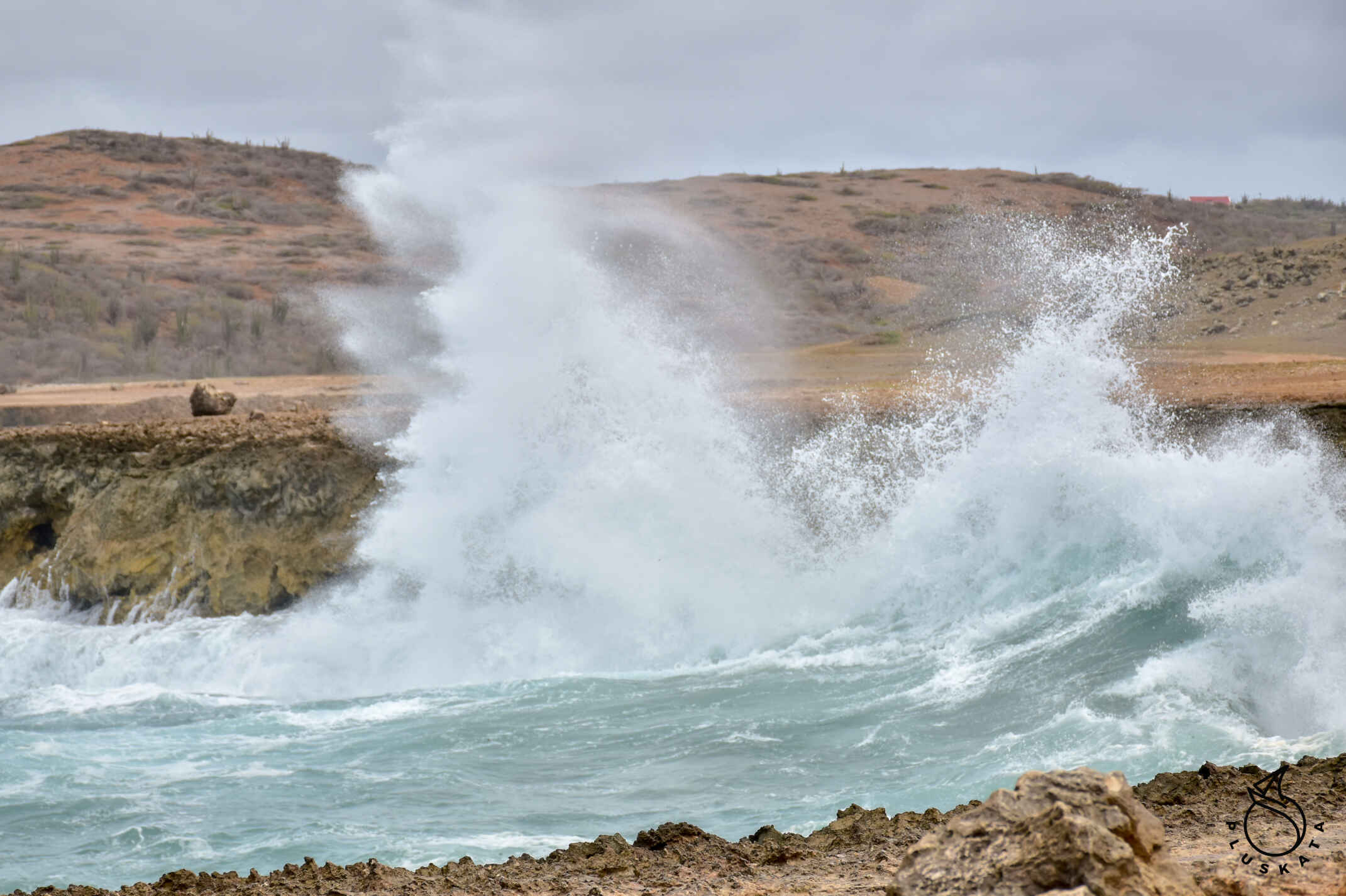
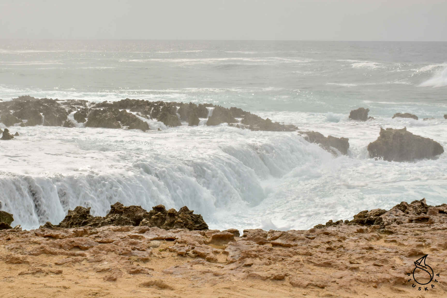
Westpunt Loop
At the northernmost end of the island (north of the California Lighthouse) there is a group of rocks on which the waves break in a very picturesque way, jumping a few meters up and flowing down, creating something like a waterfall. The view is beautiful. You can get there by a gravel road passable for a regular passenger car.
Beaches along the west coast
To the north there are many beautiful beaches from Druif Beach to Eagle Beach and from Palm Beach to Malmok. It is an 11-kilometer route of uninterrupted white sand and clear waters.
It’s worth diving with a mask, or just swimming and enjoying the blue water and white sand.
Check out clearance from Aruba
For the exit check-in, we sail to Barcadero and start the check-in first with Immigration (I fill out the same form as at the entrance, this time for exit) and then Customs – this time I fill out the form in the Sailclear application and the lady prints it out and signs it for me. This is much more efficient.
Aruba-Curacao road
We sail against the wind and against the current, so the planned distance of 70 miles becomes 168 miles, and the whole thing takes us almost 2 days. There are only zigzags on our route :-). Pluskata behaves bravely, although the opposite current (about 1.5 kn) means that we cannot swim sharply.
Curacao
Marina Curacao Zone
We have a reservation from July 10, but we arrive 4 days earlier – this works out for us due to the wind – it is supposed to start blowing more from Sunday. On VHF channel 12, we report to the pontoon bridge staff and ask them to open it, Port Control takes over the conversation and asks where we want to go, when he finds out that it’s to the marina, he calls them and says that there are no places, but we have a reservation, so finally, after calling the marina, they open the bridge for us.
The marina is very nice, costs $0.4 per foot per day + water and electricity according to the meter and $1 per person per day. There are public showers – quite good and clean. The gate to the marina is locked and the guard opens it on request. It’s mainly a shipyard – there are not many places at the piers, there is a large area for yachts taken out of the water, and work on the yachts is still ongoing.
Queen Emma Bridge Pontoon Bridge
A pedestrian pontoon bridge from 1888, also known as the Swinging Old Lady. At one end there is a lineman’s house and 2 engines, and at the other there is a hinge and a rail on which the other end of the bridge runs. When the bridge is open, two ferries take pedestrians to the other side.
Curacao check-in
Here, traditionally, first Immigration and then Customs. For immigrations you need to visit https://www.dicardcuracao.com/portal. It is an electronic residence card. Everyone should have it, but the official only asks if everyone has it and doesn’t check. All crew members with passports must appear for check-in, although the man checks the number and sometimes compares the person with the photo in the passport. The Immigration office is located at the other end of the canal (about 3.5 km from the marina), so a one-way walk takes about an hour. Then Customs, who, due to the renovation of the actual building, moved to the other side of the canal to a barracks behind the apartment building. Here, you had to complete the entry application in SailClear and provide the lady at the office with the application number. It would have gone smoothly if it weren’t for the struggle with the scanner – turning it off and on again helped.
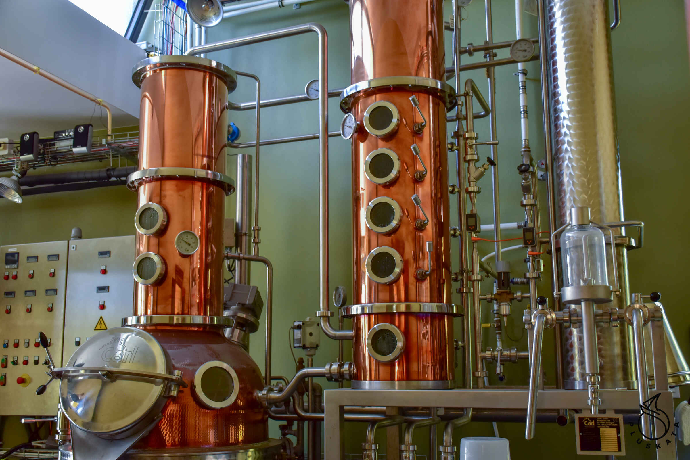
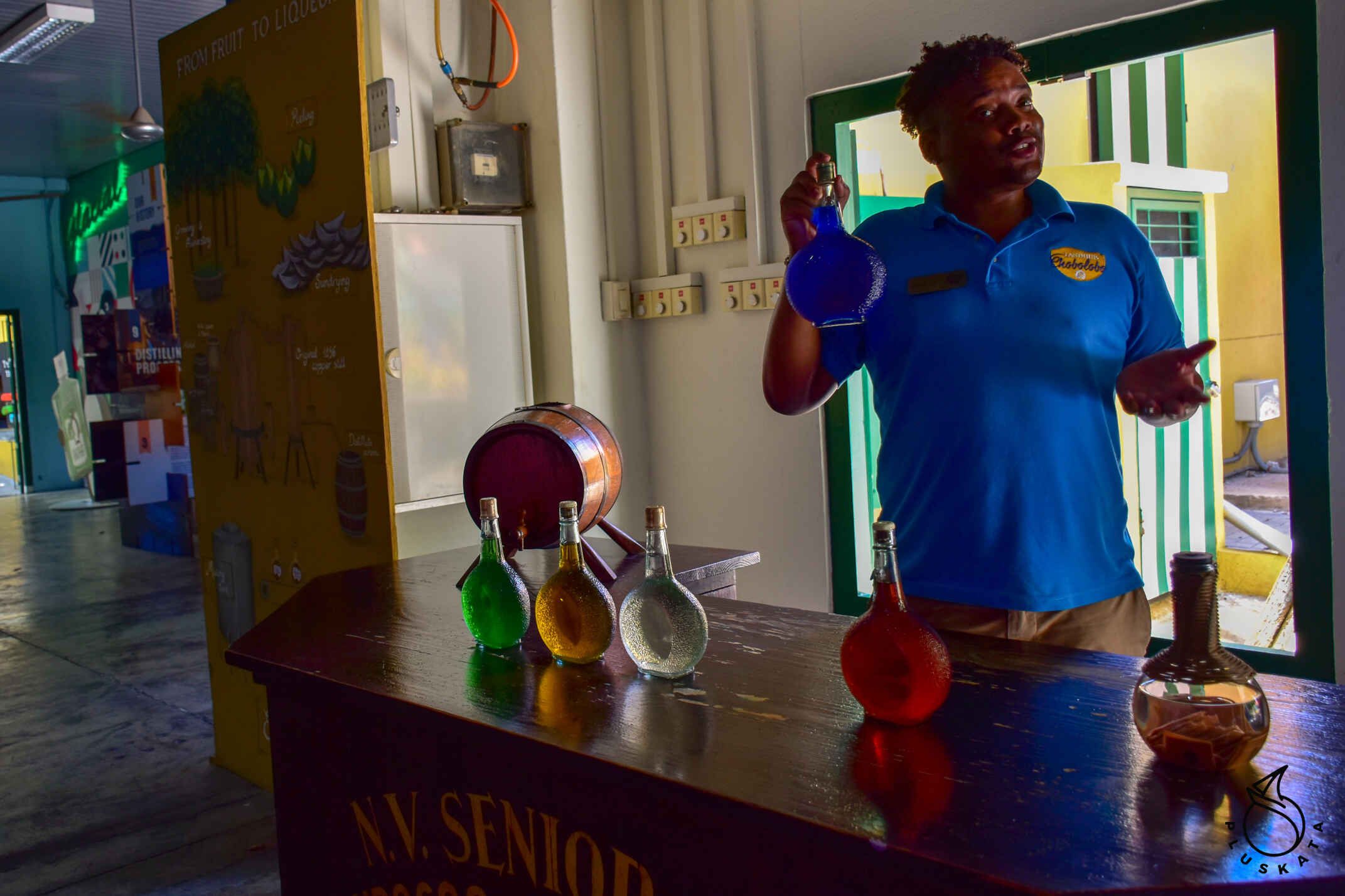
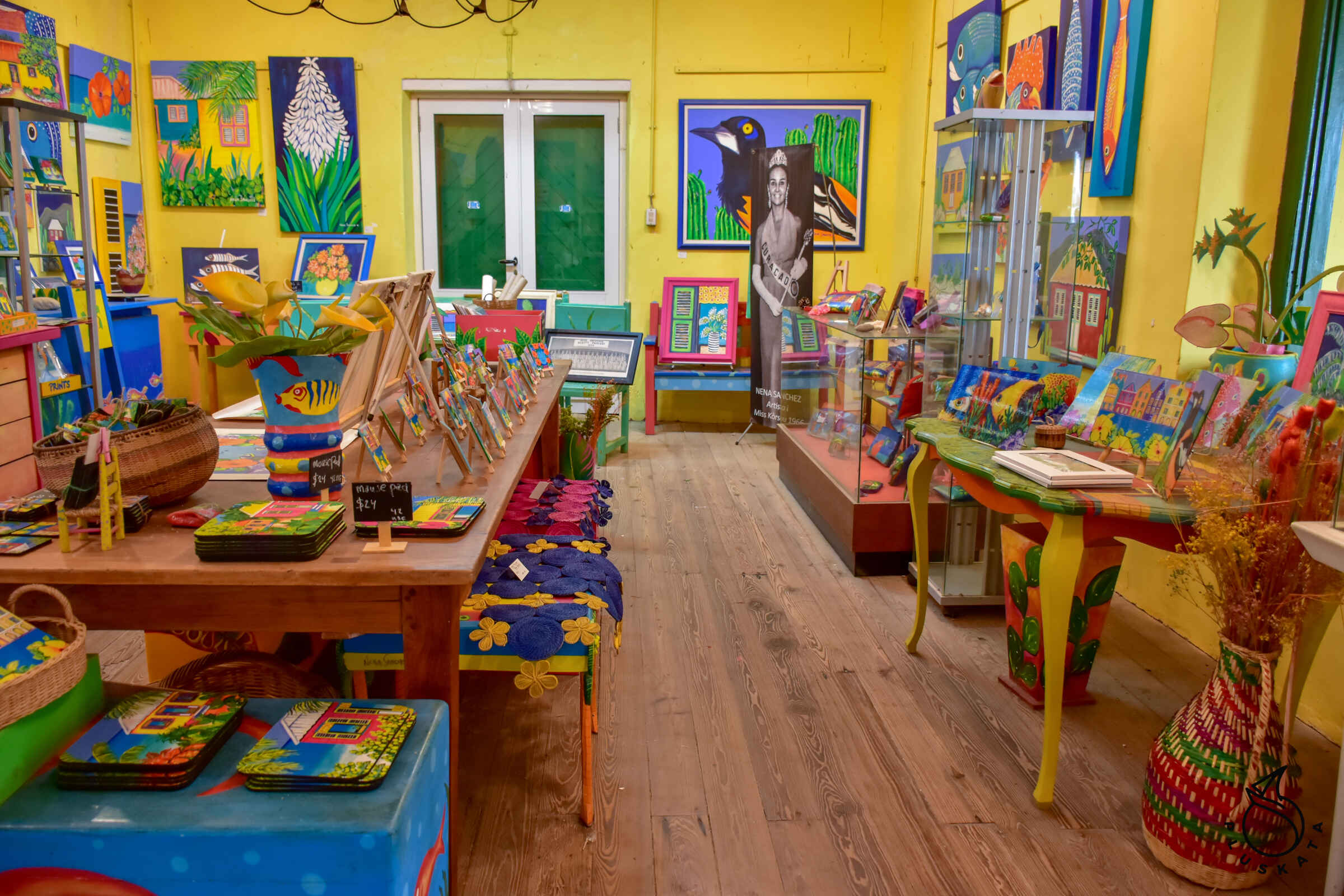
Curacao Liqueur Distillery
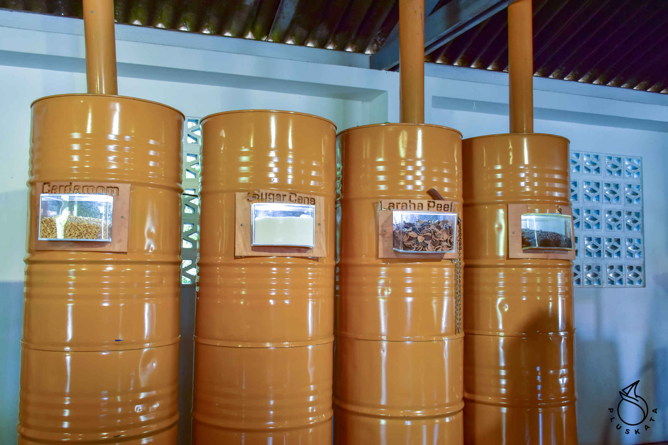
It is worth taking a guided tour to Landhuis Chobolobo. Tickets can be purchased at https://www.chobolobo.com/guided-tours – there are different options – we choose dancing with 1 cocktail. The guide speaks English. First, he tells the story of the creation of the liqueur – the distillery was founded by Jews who had to emigrate from Christian Spain, they noticed that oranges taste different in Curacao – the liqueur is made from dried bitter orange peels (Laraha) with various additives (cardamom, cloves, cane sugar and others) . Everything in bags is thrown into sugar cane spirit, and then sugar and water are added. The original liqueur is there transparent, and the color is obtained by adding food coloring, the taste remains the same. They also make coffee, chocolate and tamarind liqueur.
We look at the vats for distilling and soaking the skins. Original liqueur bottles are round at the bottom with a long neck. After visiting the distillery (this part is for tourists, the actual factory is next door and much larger), we go to try 3 types of liqueur (blue curacao, chocolate and tamarin) and then choose 1 cocktail from the menu – a full-size one (our ticket includes 1 cocktail). ).
Car rental
Finding a rental company using Google’s search engine is almost impossible – either they changed their address a long time ago and Google doesn’t know about it, or the hours are different than they say, or they simply don’t exist at that address. Finally, we find the rental company we found out about in the marina (GH car rental) and rent a car for the whole week.
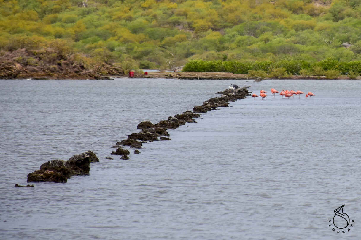
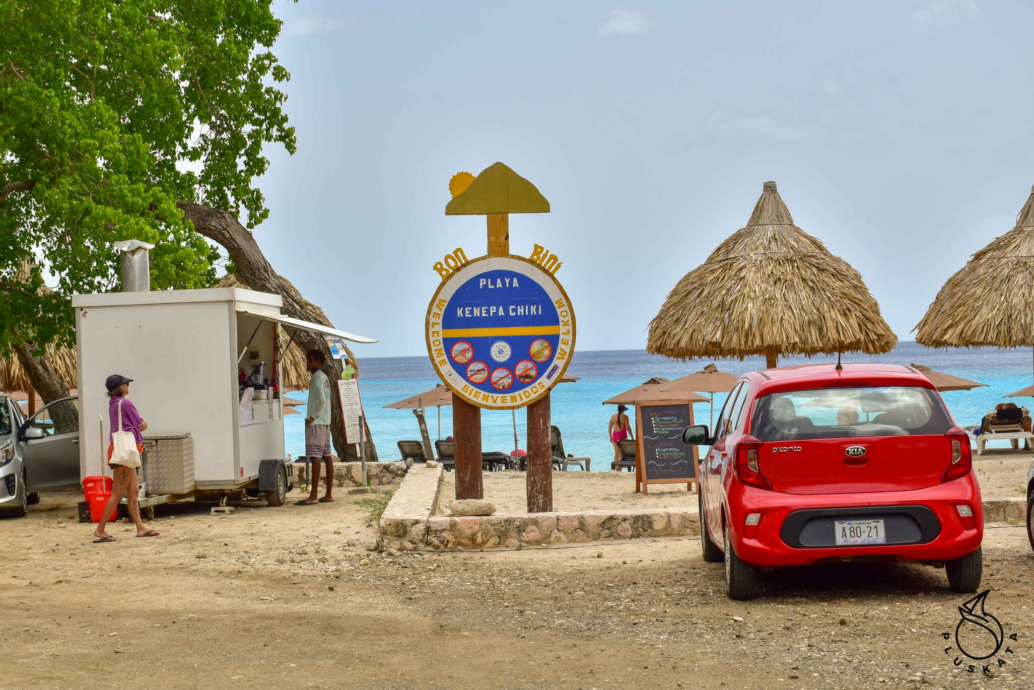
Salina Sint Michiel and flamingos
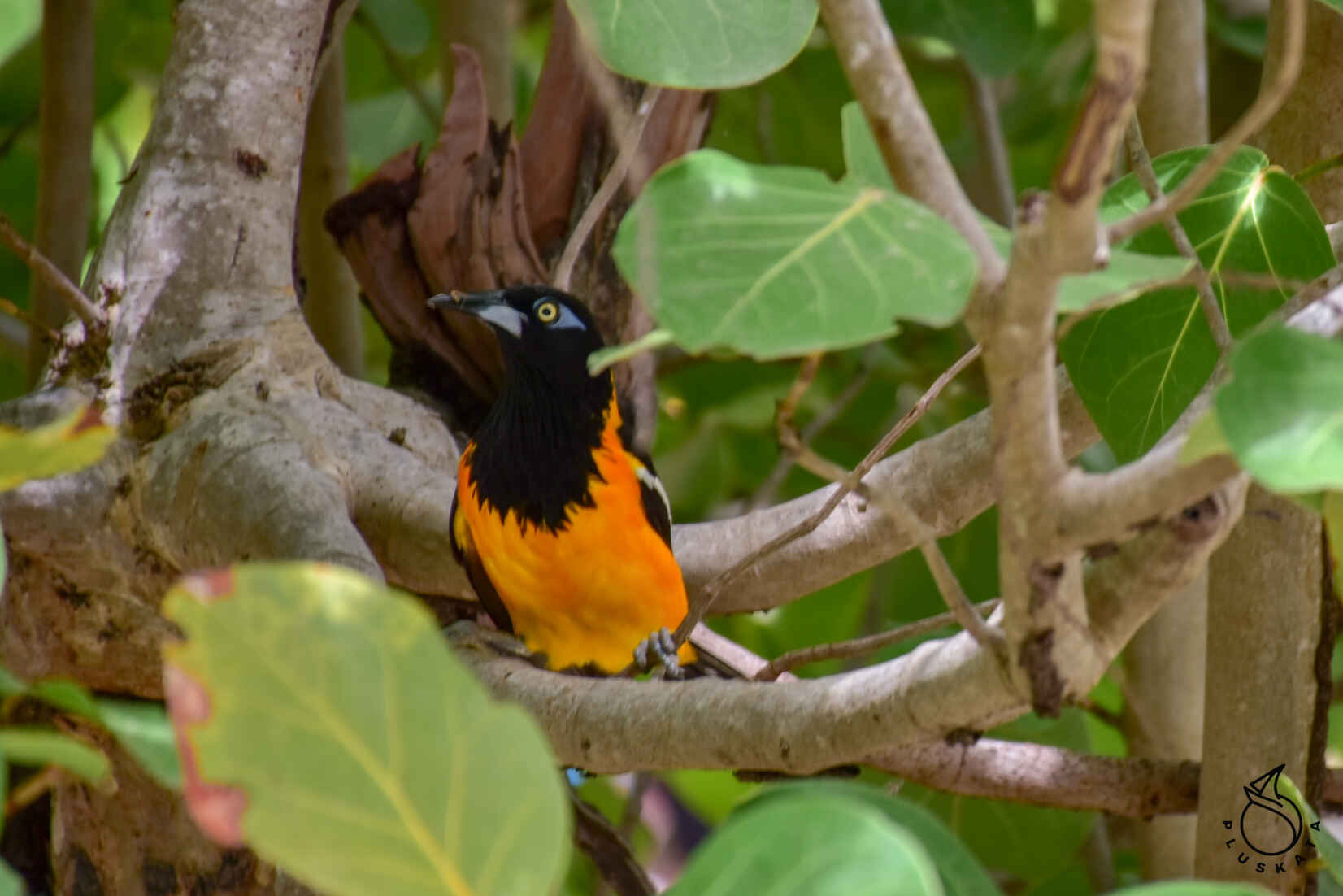
A salty lake with the remains of a former salt “factory” – there are remains of partitions (walls placed across the lake, which limited small pools for the evaporation of sea water. Flamingos have settled in this lake. We go on a walking trip around the lake, photograph flamingos (birds eat organisms containing carotenoids, which flamingos absorb and process in their bodies, creating a beautiful pink color).
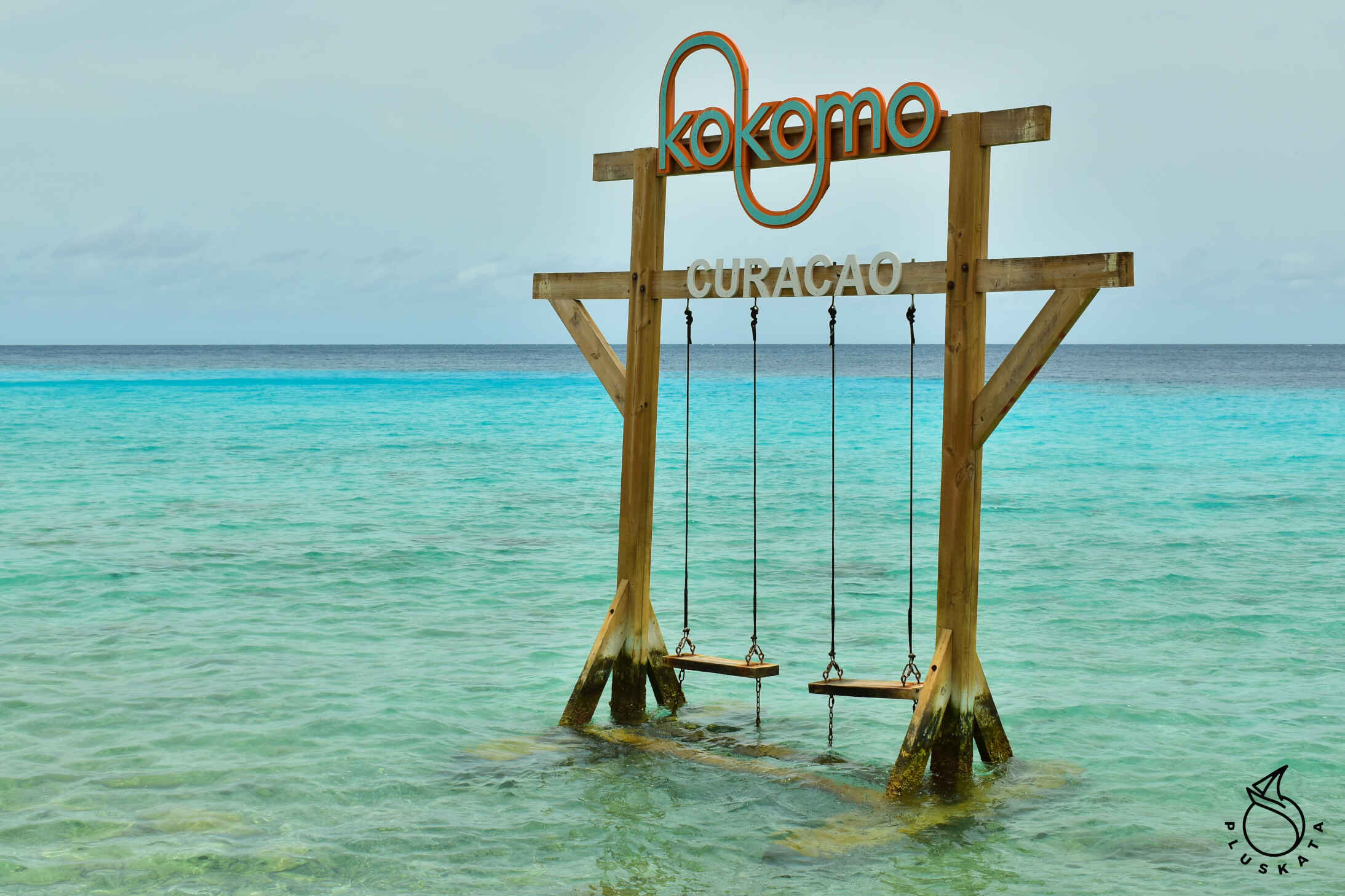
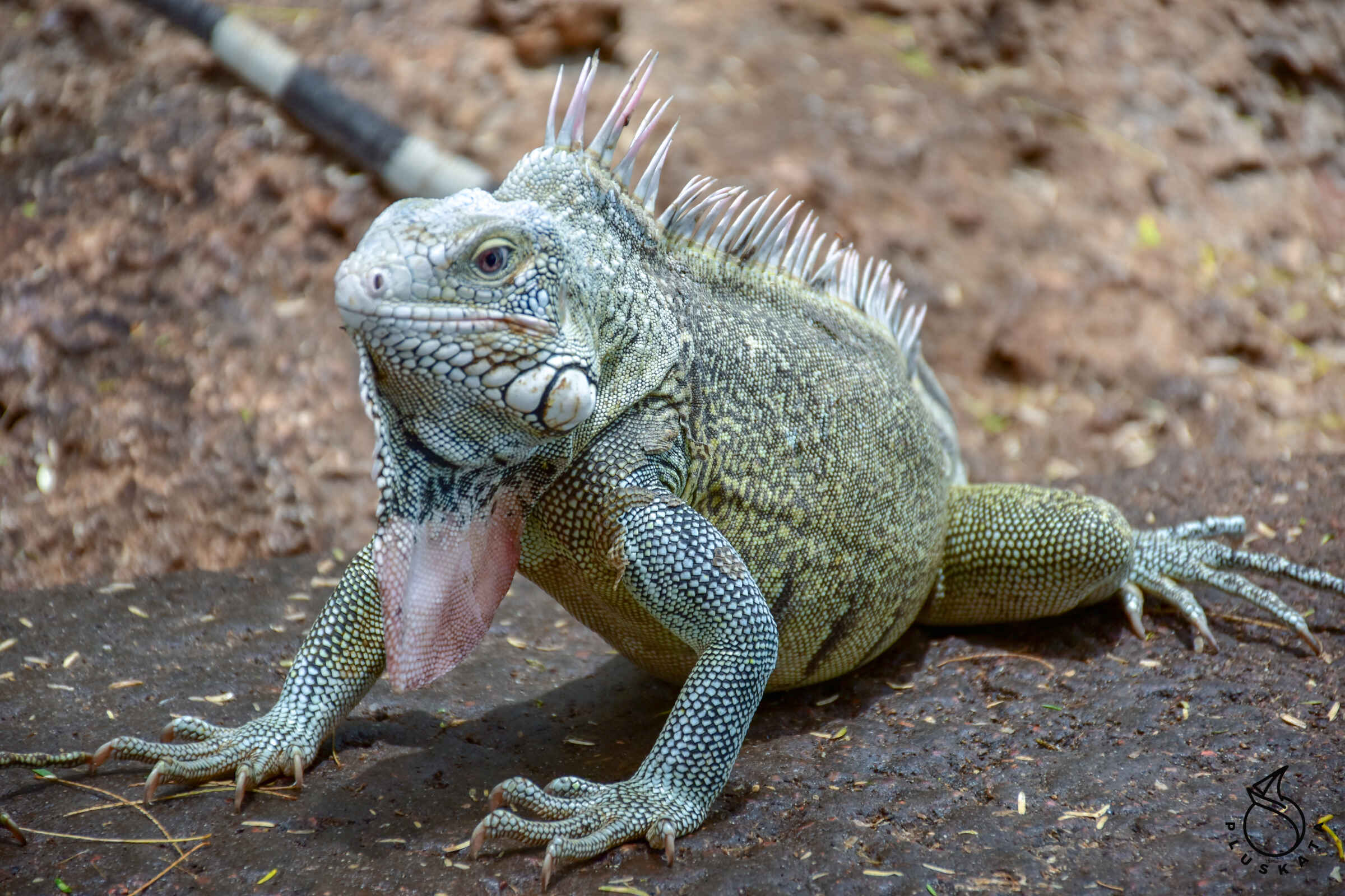
Kokomo Beach
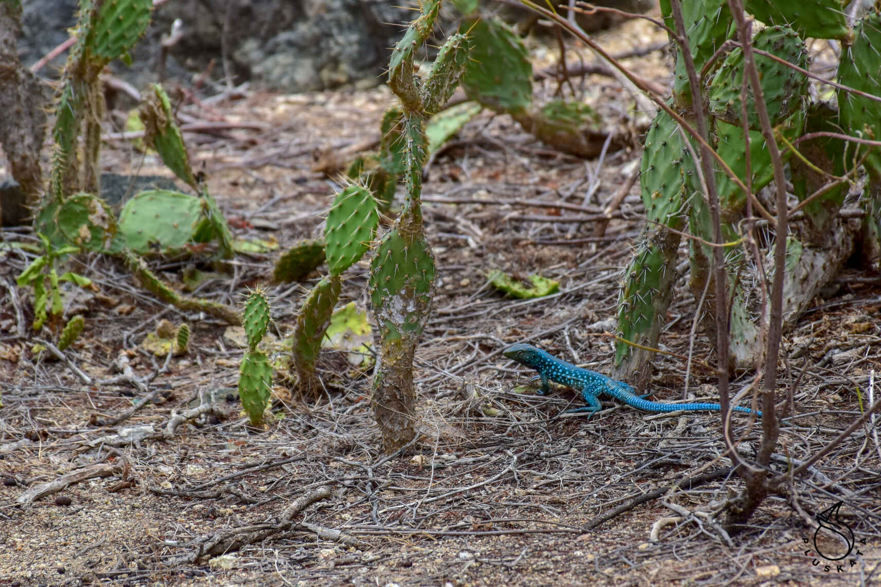
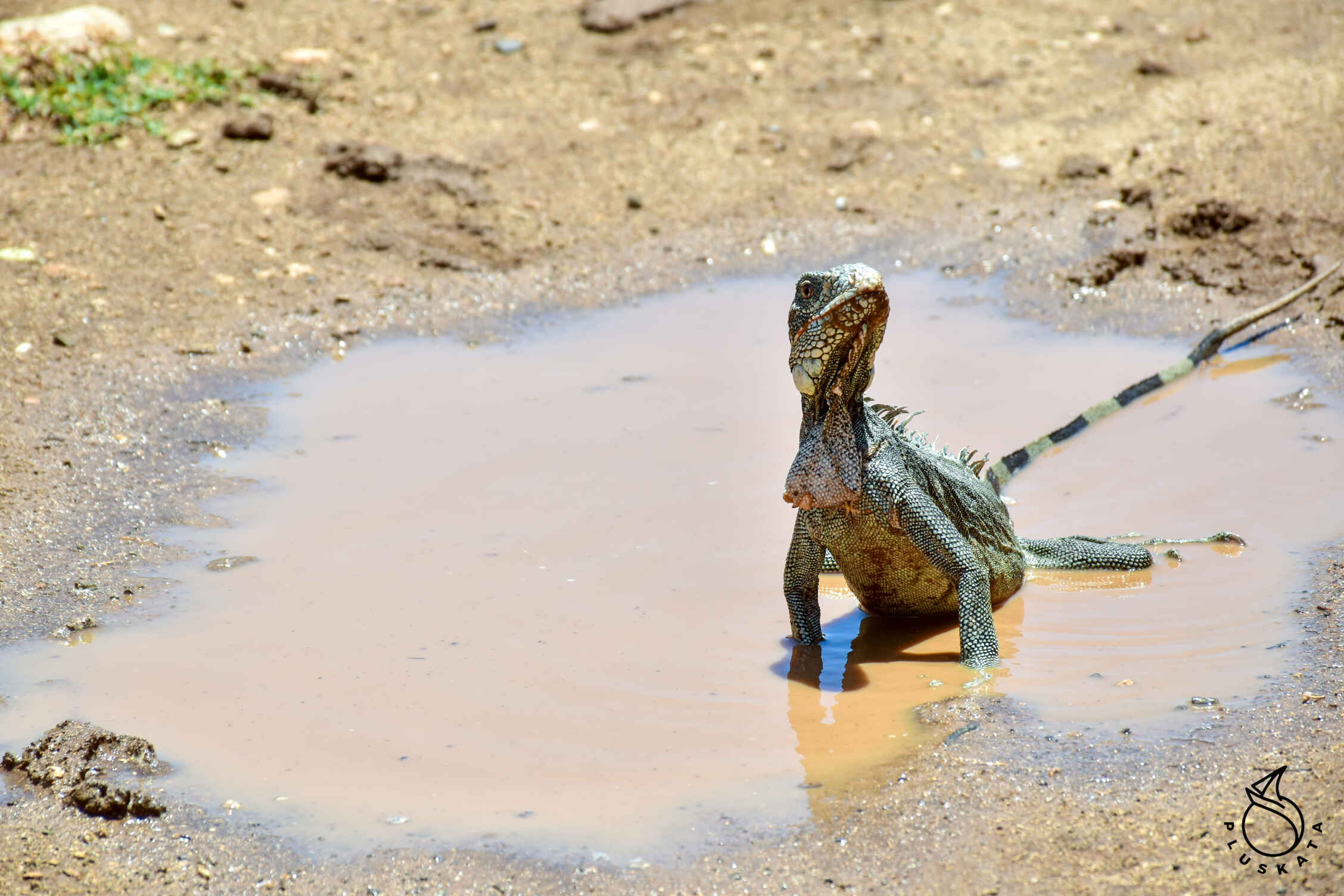
Nice beach with a characteristic swing. Iguanas live near the beach restaurant. They are greedy, they even bite the exposed fingers (drawing blood). They are not afraid of people and approach tables. You can stroke them. There are a lot of them, and there are also large local lizards.
We buy juices and coffee, drink and move on.
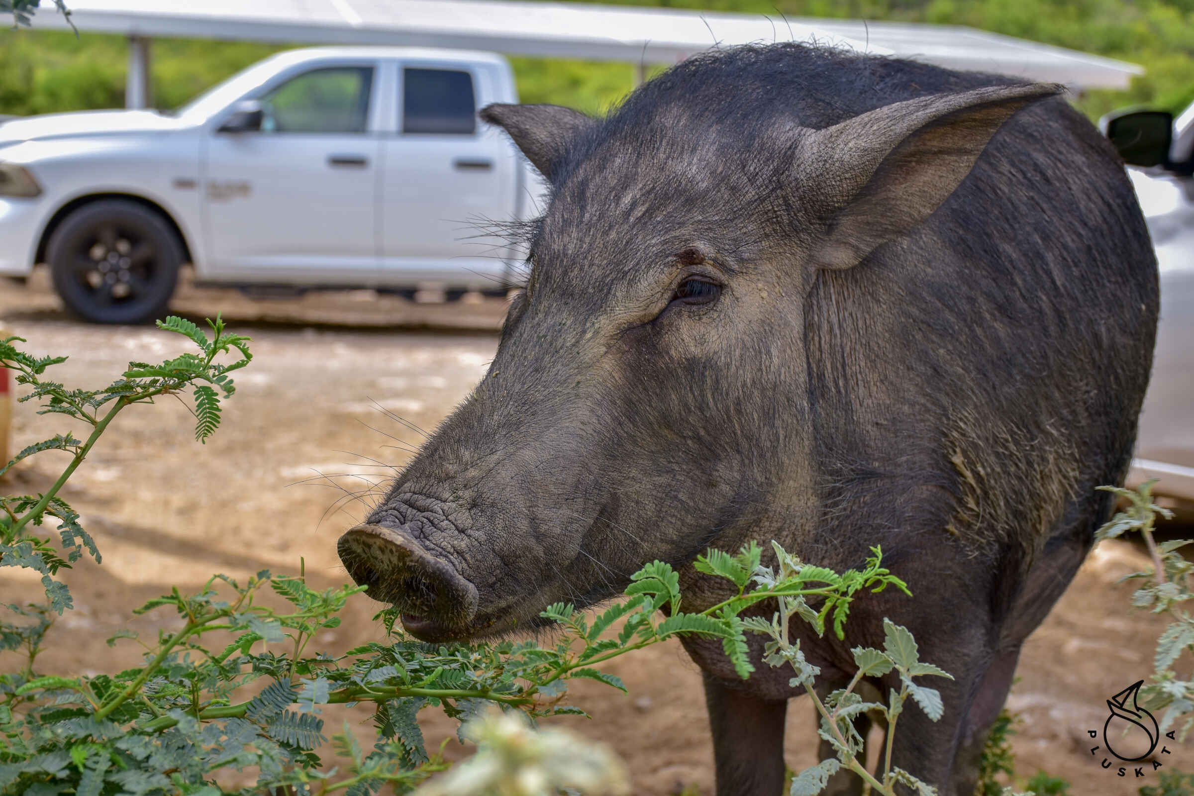
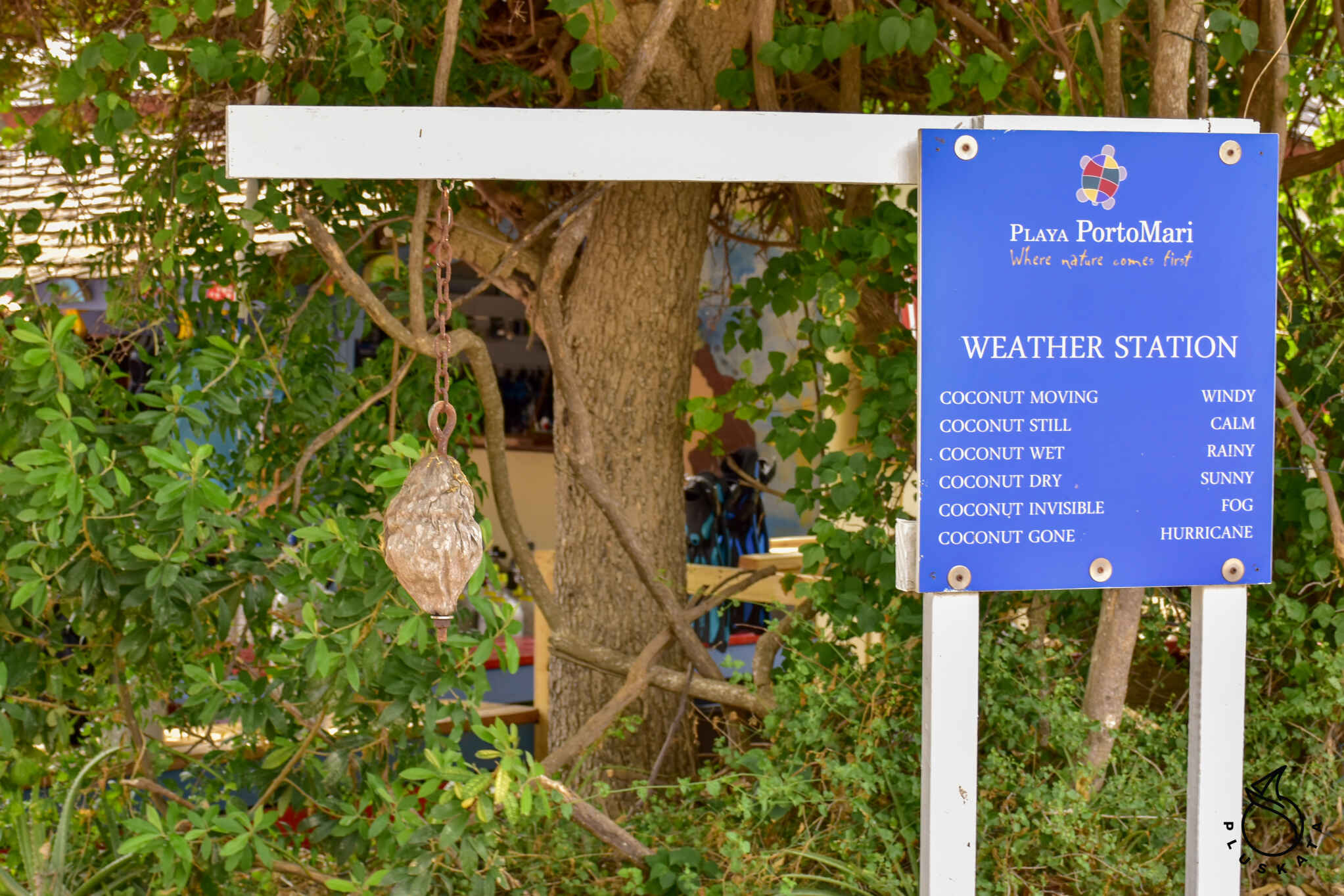
Playa Porto Mari
Paid beach (admission $3 and an additional $3 for a sun lounger) known for the fact that pigs bathe in the sea at this beach. Pigs roam the entire area, they are big and small, old and young (apparently they live permanently on a nearby farm).
Santa Martha Viewpoint
From the hill there is a nice view of the surrounding area, sea bays and nearby mountains.
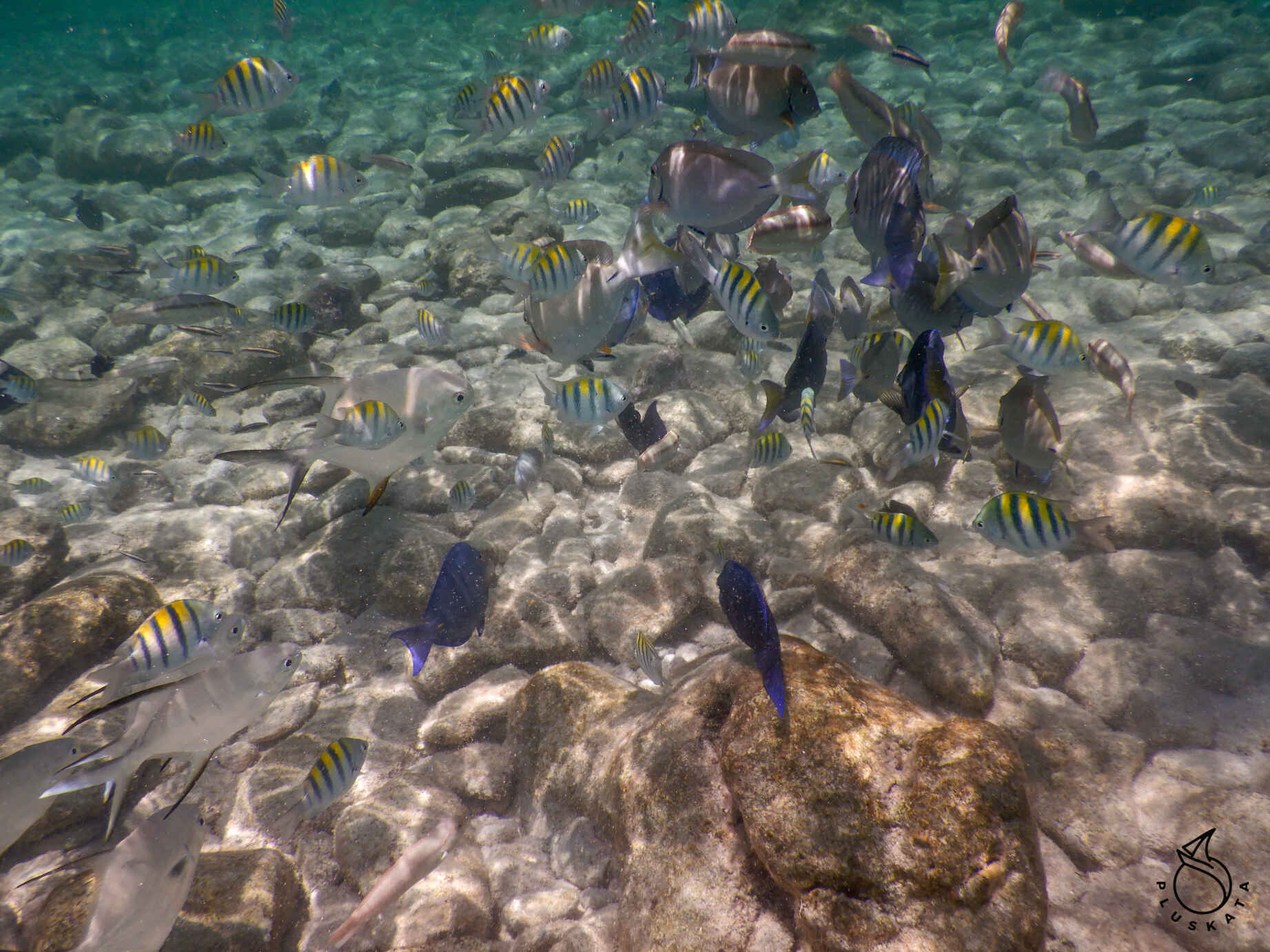
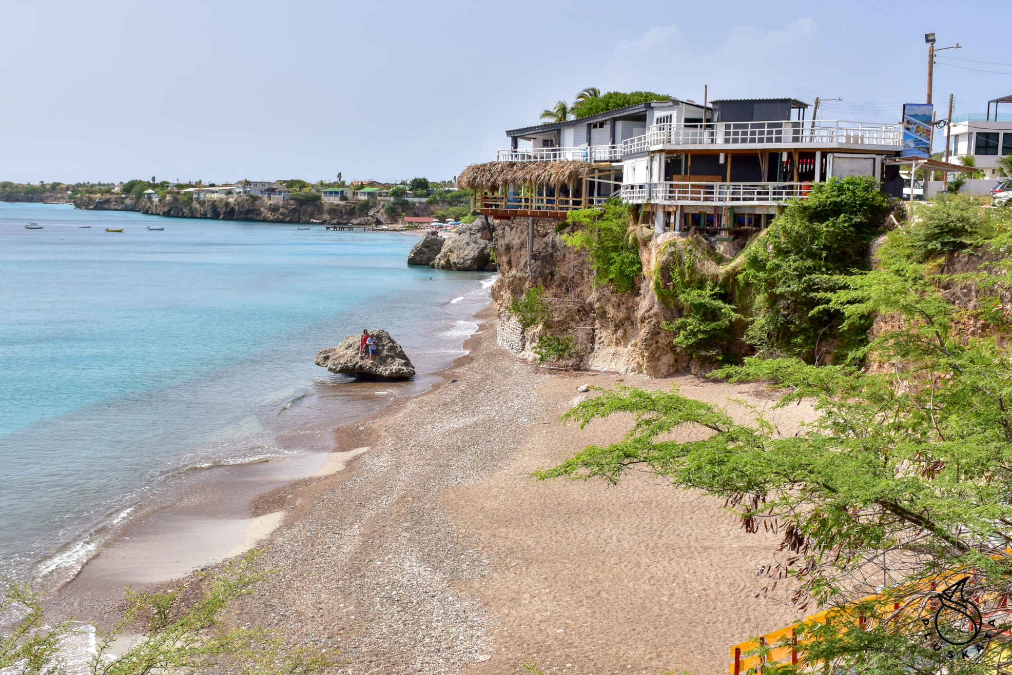
Playa Carara
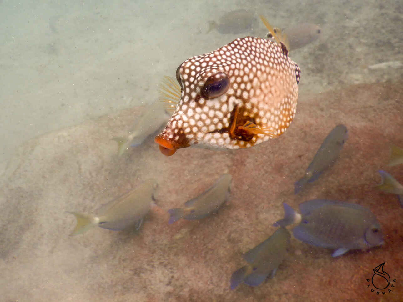
A very nice beach in a small bay with few people. Here we swim and snorkel. There are some small and large fish. This is also a diving site (but a little further from the shore).
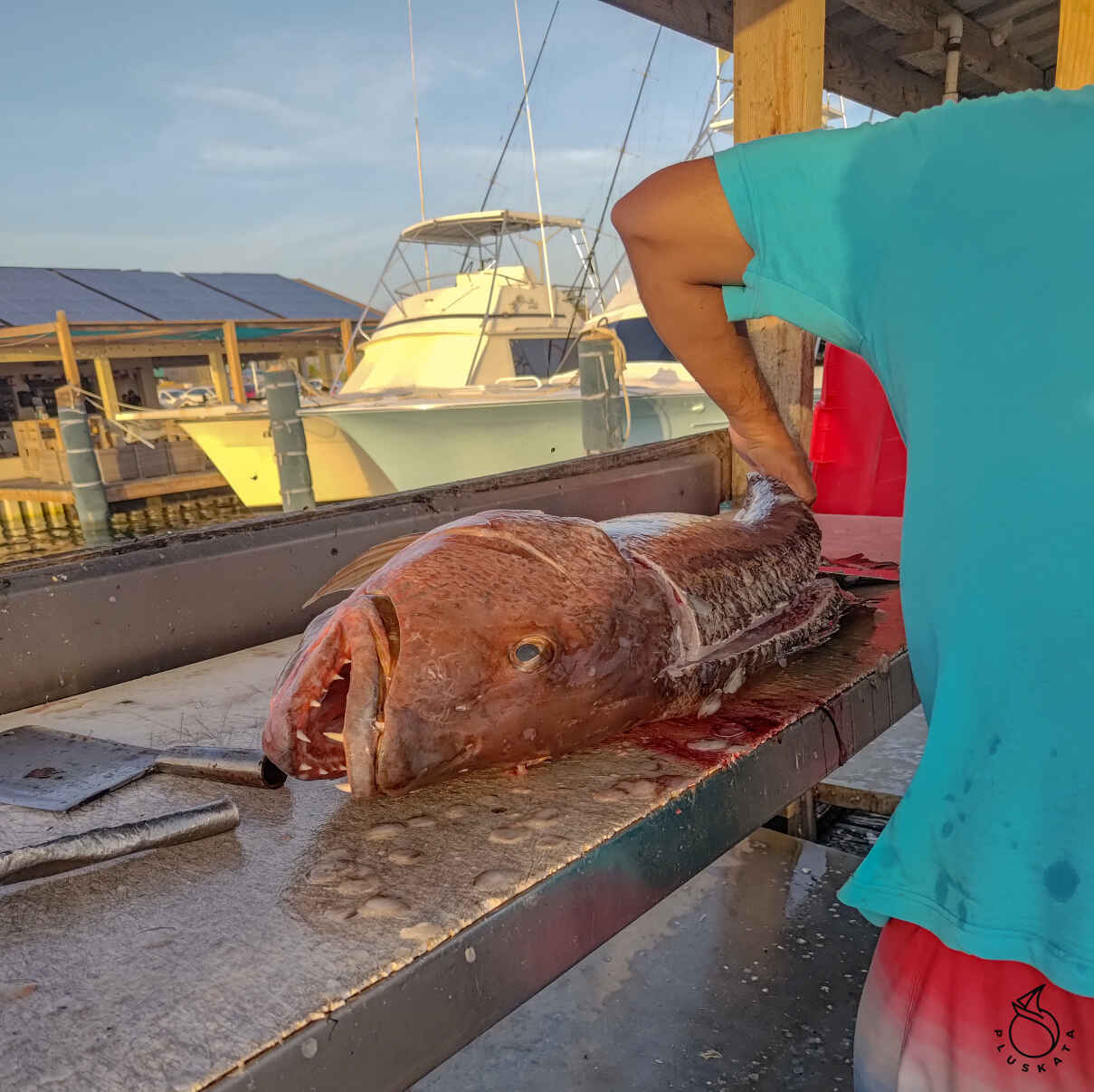
Playa Lagoon
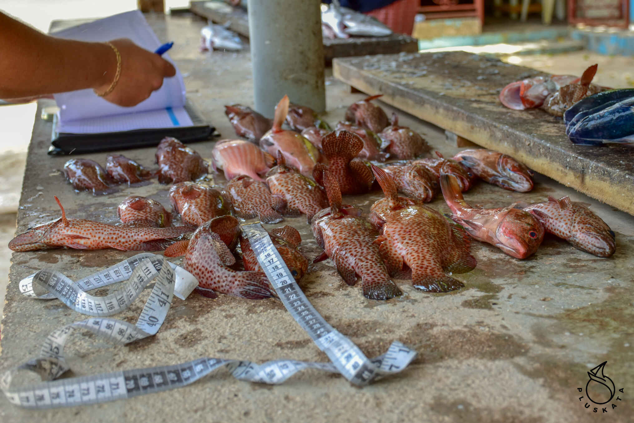
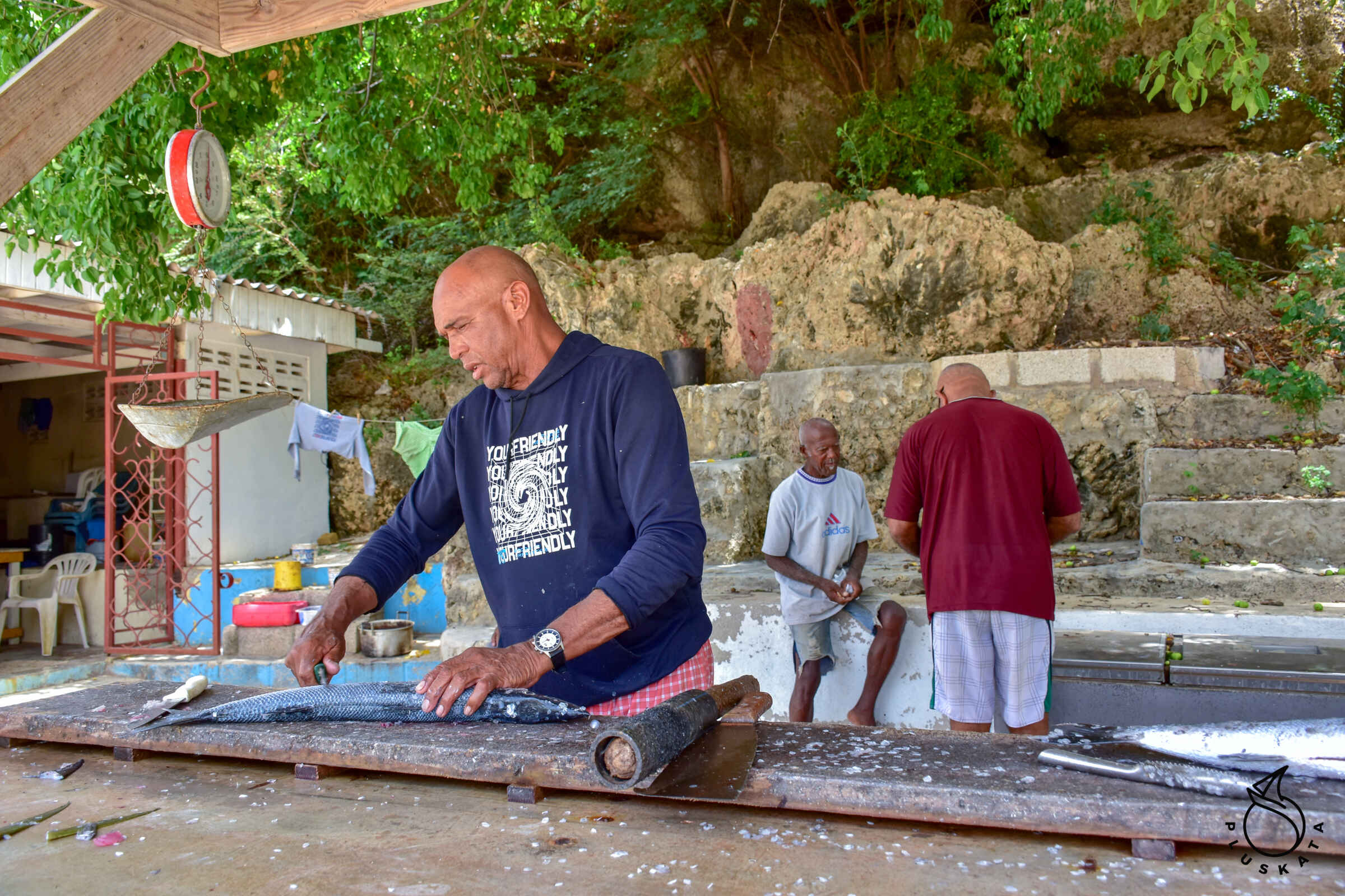
Nice little beach where kids come for PE lessons. On both sides of the beach there are cliffs with coral reefs, and on the side table, one man is processing fish, while the other is counting and measuring the remaining ones – he checks the average of the species. There are also a few iguanas hanging around the parking lot. A crew of bricklayers plasters concrete benches on the beach.
Playa Jeremi
Another beach with cliffs on both sides and blue water. There is a small bar with smoothies and coffee here. You can also eat a hamburger with fries. There are much fewer people on the beach than on Laguna beach.
Playa Forti
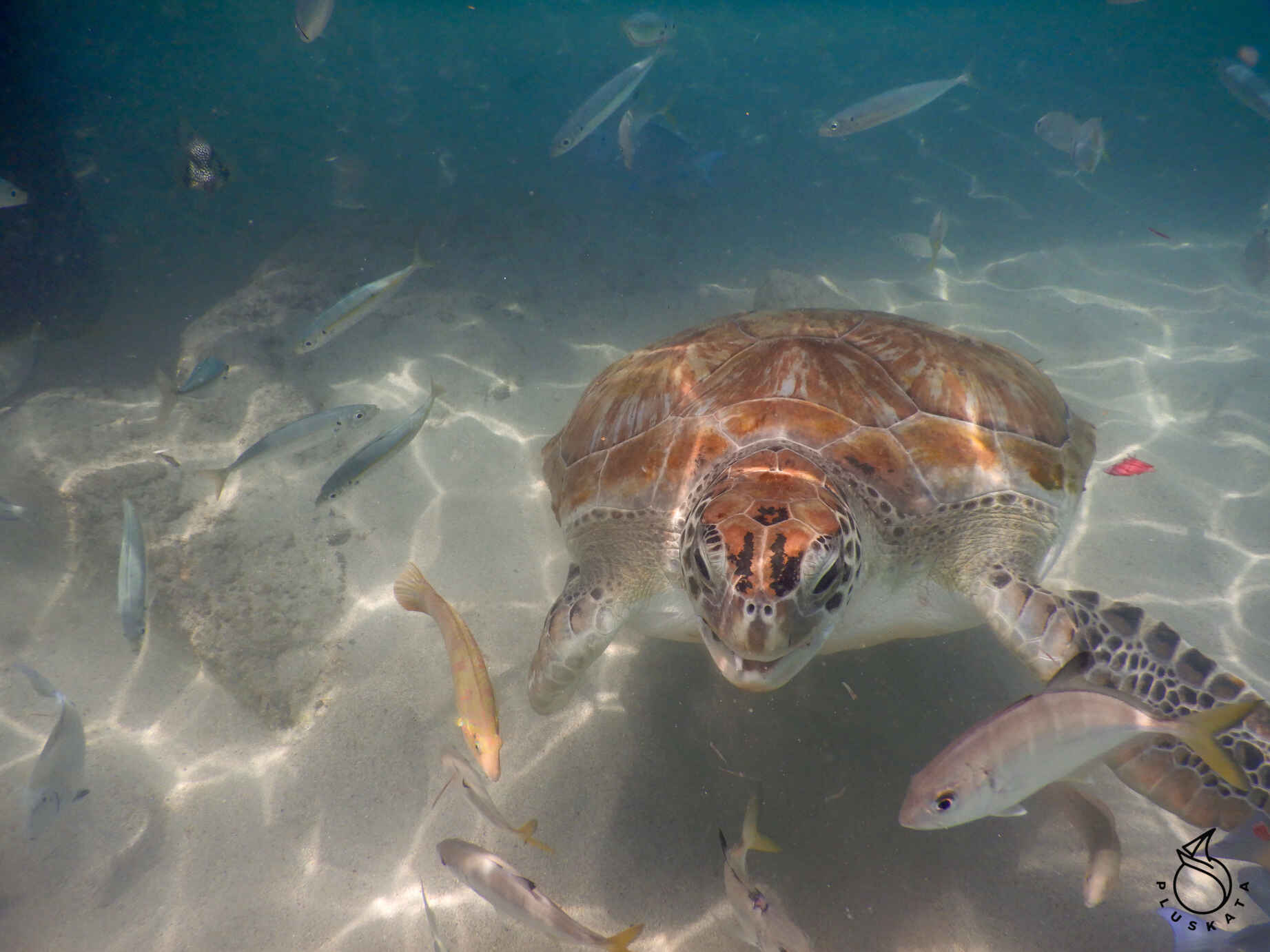
You can jump from the cliffs on this beach straight into the water, although there is information everywhere that you do it at your own risk and it is not a recommended sport. You can also go snorkeling and sometimes meet a turtle.
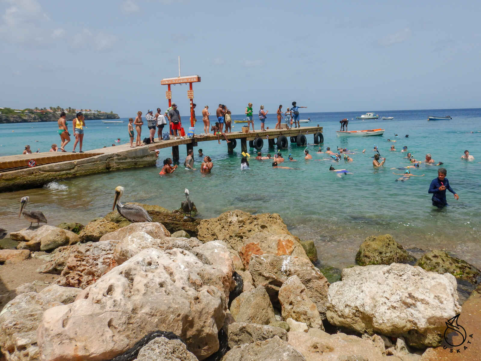
Playa Grande
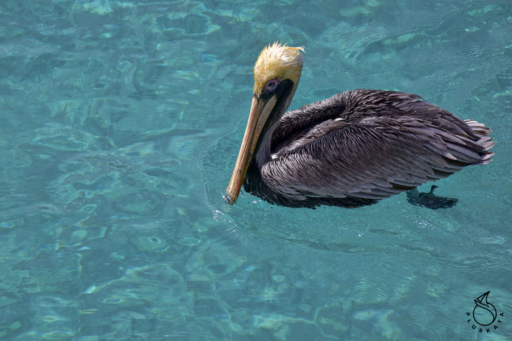
On this beach you can swim with turtles in the morning. You need to arrive in the morning (around 10-11 am). A guy is sitting on the pier and feeding the turtles with fish leftovers. There are a lot of turtles, but also a lot of people. You must take a mask with a snorkel. A waterproof/underwater camera will also be useful. Turtles should not be touched, although sometimes it is difficult to avoid them. The water is cloudy near the shore, but a little further it is clear and the turtles are clearly visible. They are not afraid of people at all. Small and large fish and cormorants swim around the turtles.
Playa Kalki
A small beach with a diving office. Apparently the area is home to the most beautiful diving sites in Curacao. You can buy drinks, juices and coffee at the beach bar. Tables and sofas directly on the beach are subject to an additional charge.
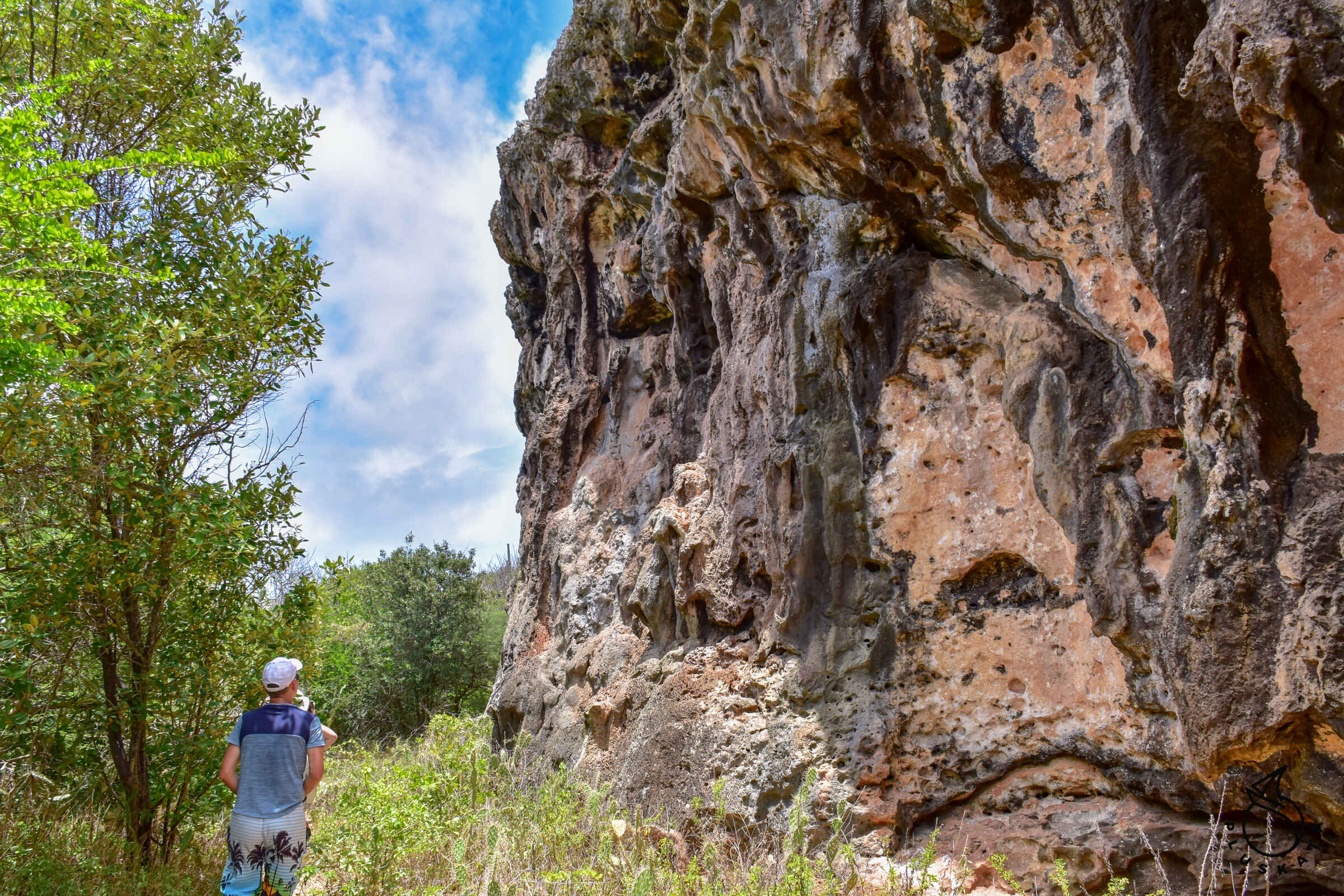
Watamula Hole
A hole in the cliff through which sea waves flow. The hole is about 1 m in diameter, but the water streams are quite large. It is located in the north of the island. A gravel road leads to it.
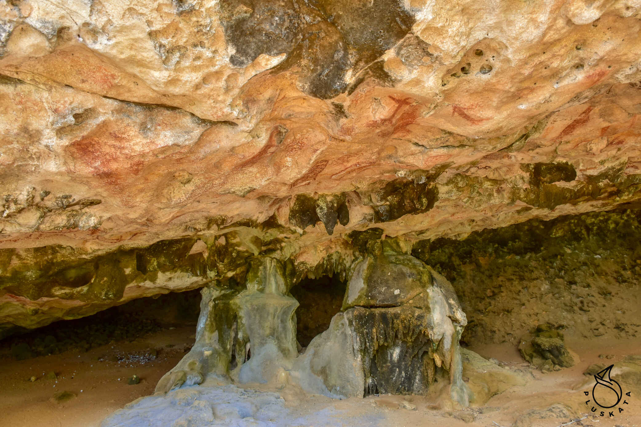
Kueba Bos di San Antonio
A very nice cave with intact dripstones, quite shallow (at least where you could enter) – you need a flashlight. You can get to the cave from the parking lot in Tera Cora along a path towards the windmills.
There is a bench at the entrance to the cave.
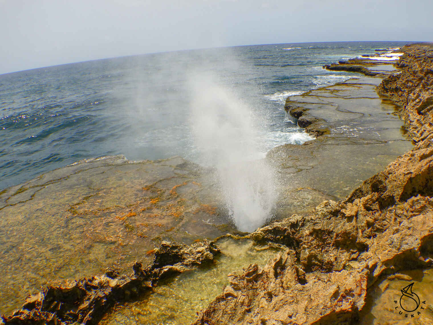
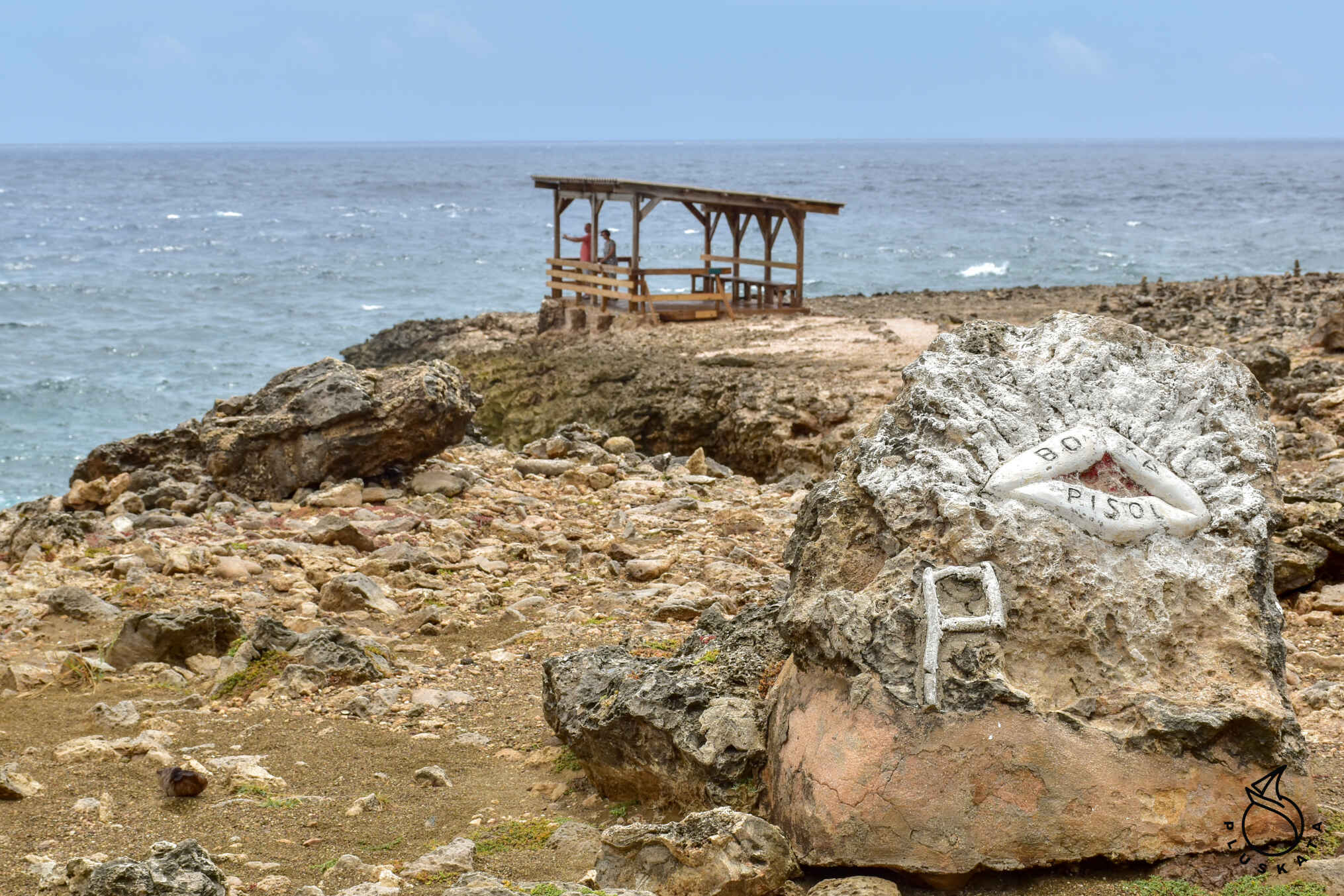
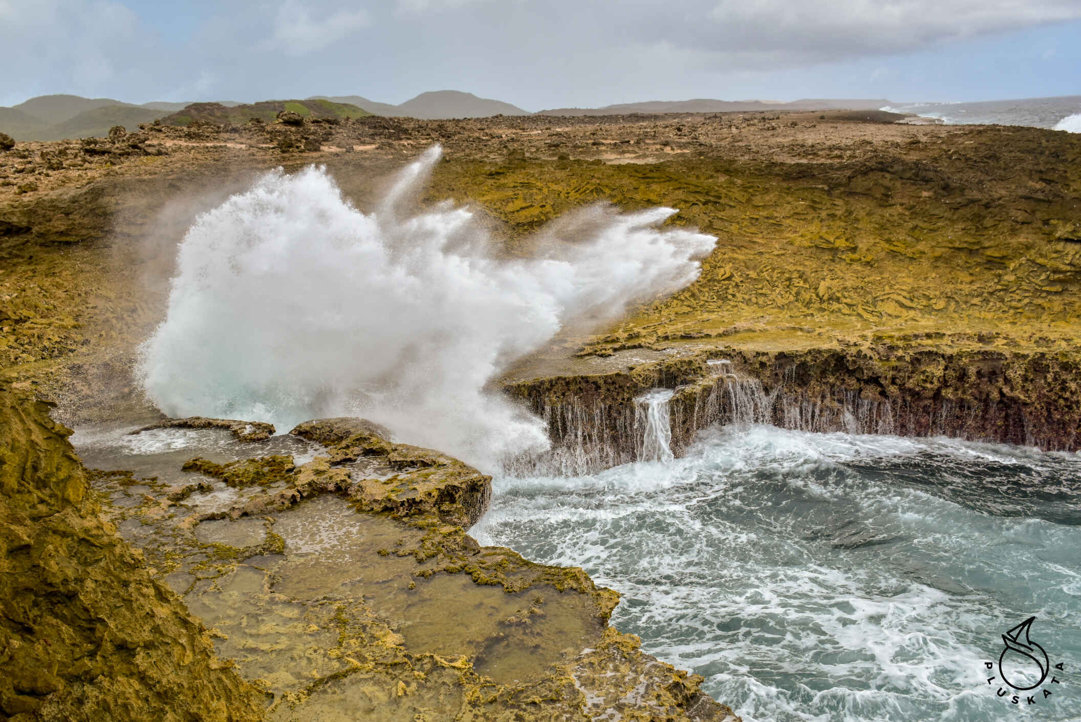
Shete Boka National Park
Shete Boka (“seven bays”) National Park is a nature reserve in Bandabou, Curaçao. The park was established in 1994 and covers an area of approximately 200 hectares. Admission is $15 per person.
The most famous attraction of this area is Boka Tabla, a cave into which waves flow through an opening from the sea, on the other side there is an entrance from the land and you can see the sea under the rocks. Stairs carved into the rocks lead directly to the mouth of the cave; where you can sit on the very shore and watch the waves.
Once inside the cave, you can walk along the limestone bluffs above for spectacular views of the rugged northern coast of Curacaos. Coves within the park are protected turtle nesting areas.
In the northeast, find There are two more bays: Boka Kalki and Boka Pistol. Boka Kalki is a bay partially covered with mangroves, while Boka Pistol is a very narrow bay where the rising sea hits the coast with explosions that resemble gunshots.
The next place is a natural bridge, Boka Wandomi. At the bottom of the bridge over the water there is a special viewing platform.
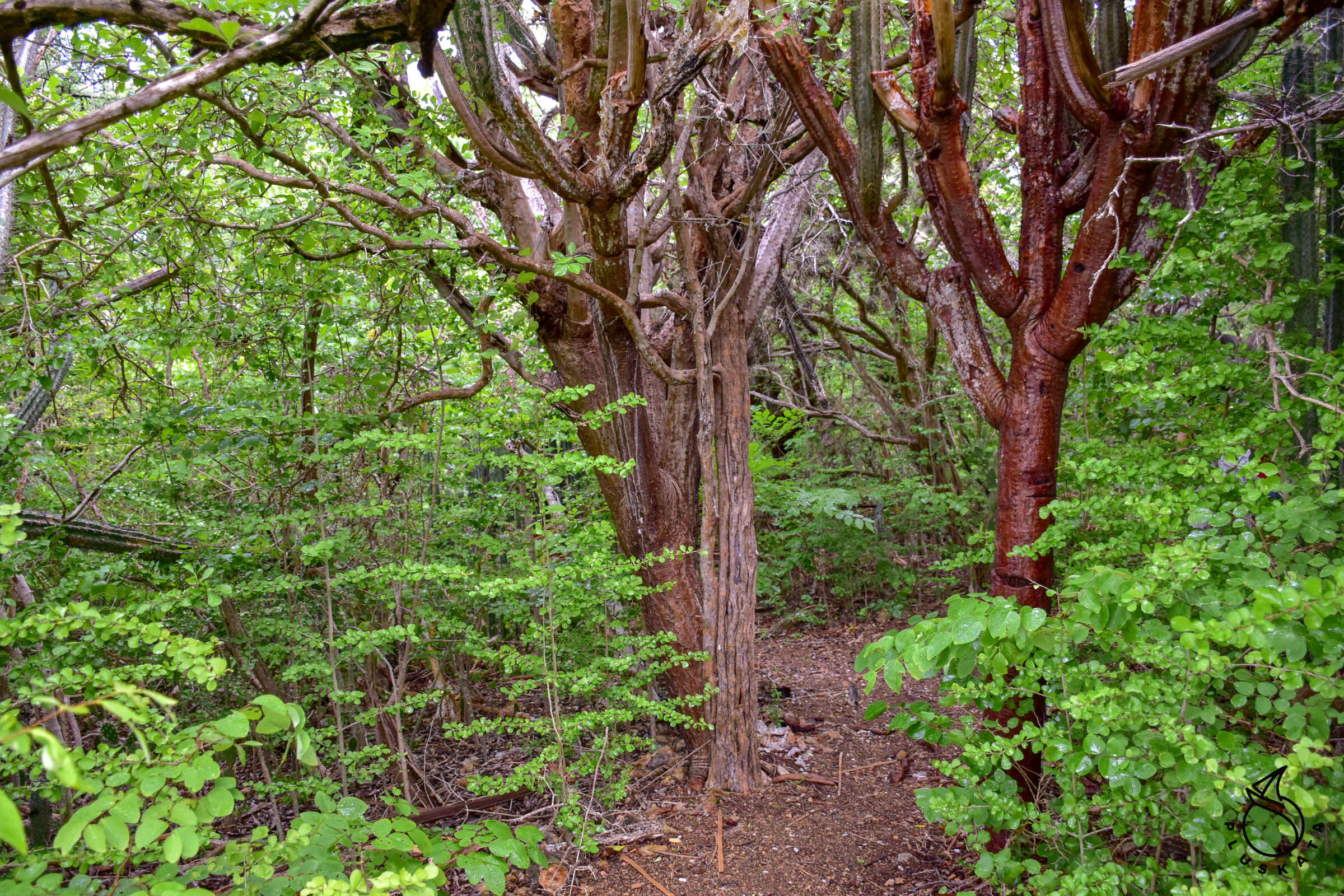
Christoffelpark National Park
Christoffel Park is the largest national park on the island of Curacao. This park is located in the north-eastern part of the country. The total area of the park is 1,860 ha. It was founded in Curacao in 1955. There are many different varieties of local flora and fauna. It is worth going during the rainy season – it is very green there.
Admission to the park costs $15 per person. Drones are not allowed in the park.
You must leave the park before 1:30 p.m.
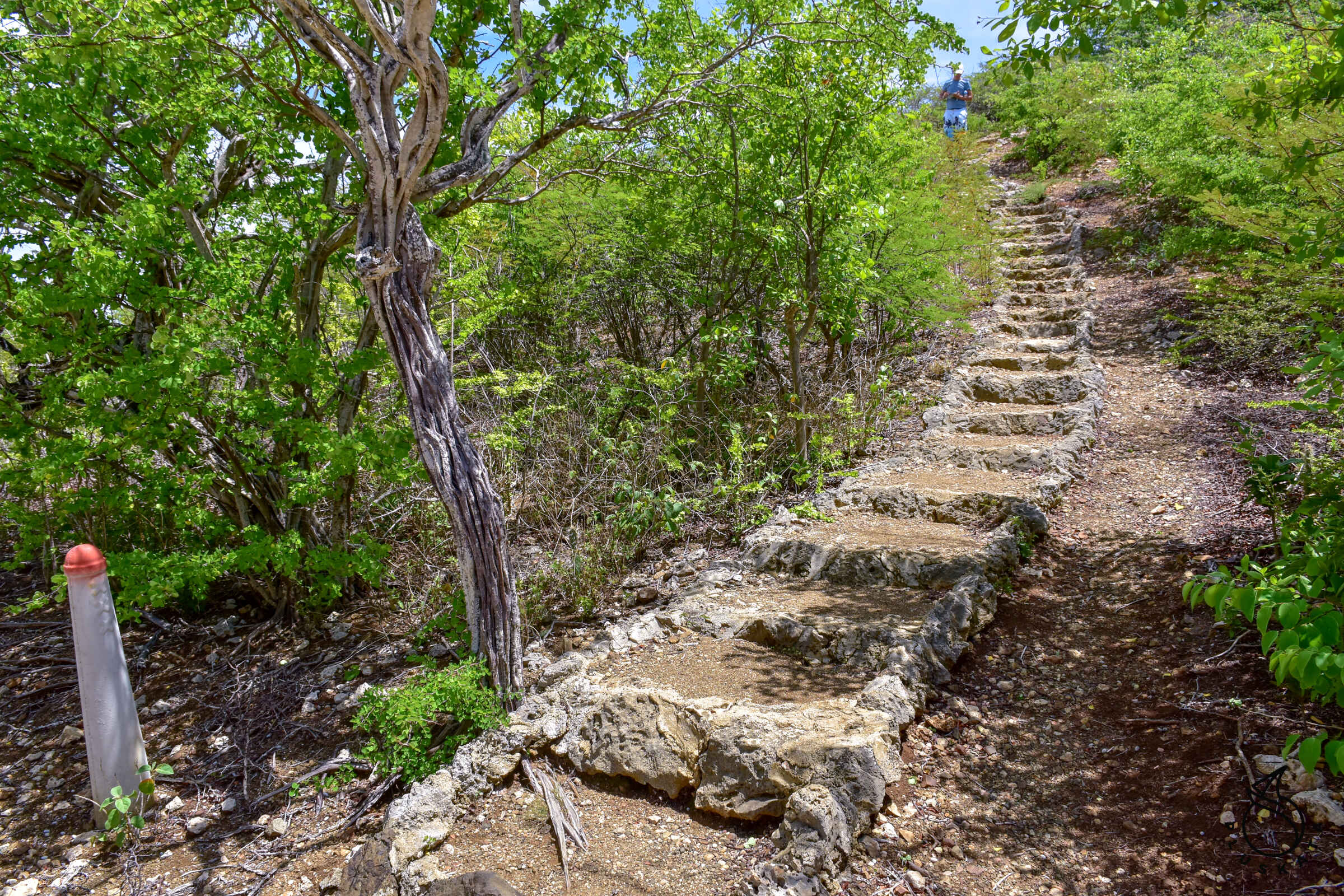
There are two car routes in the park – mountain and northern (from the sea). You can only enter the mountain route until 10 a.m. It is also forbidden to enter mountain trails after 10 a.m. They attribute it to high temperatures. Before setting off on the mountain route, you must sign a form stating that you know the park’s regulations, that you are healthy, in good shape and have enough water to drink (2 liters per person). At the office you can buy a map of the park and routes for $1.
It is worth taking a special token that opens the barrier to enter the route. Otherwise, you need to ask the staff to open it.
Mountain route:
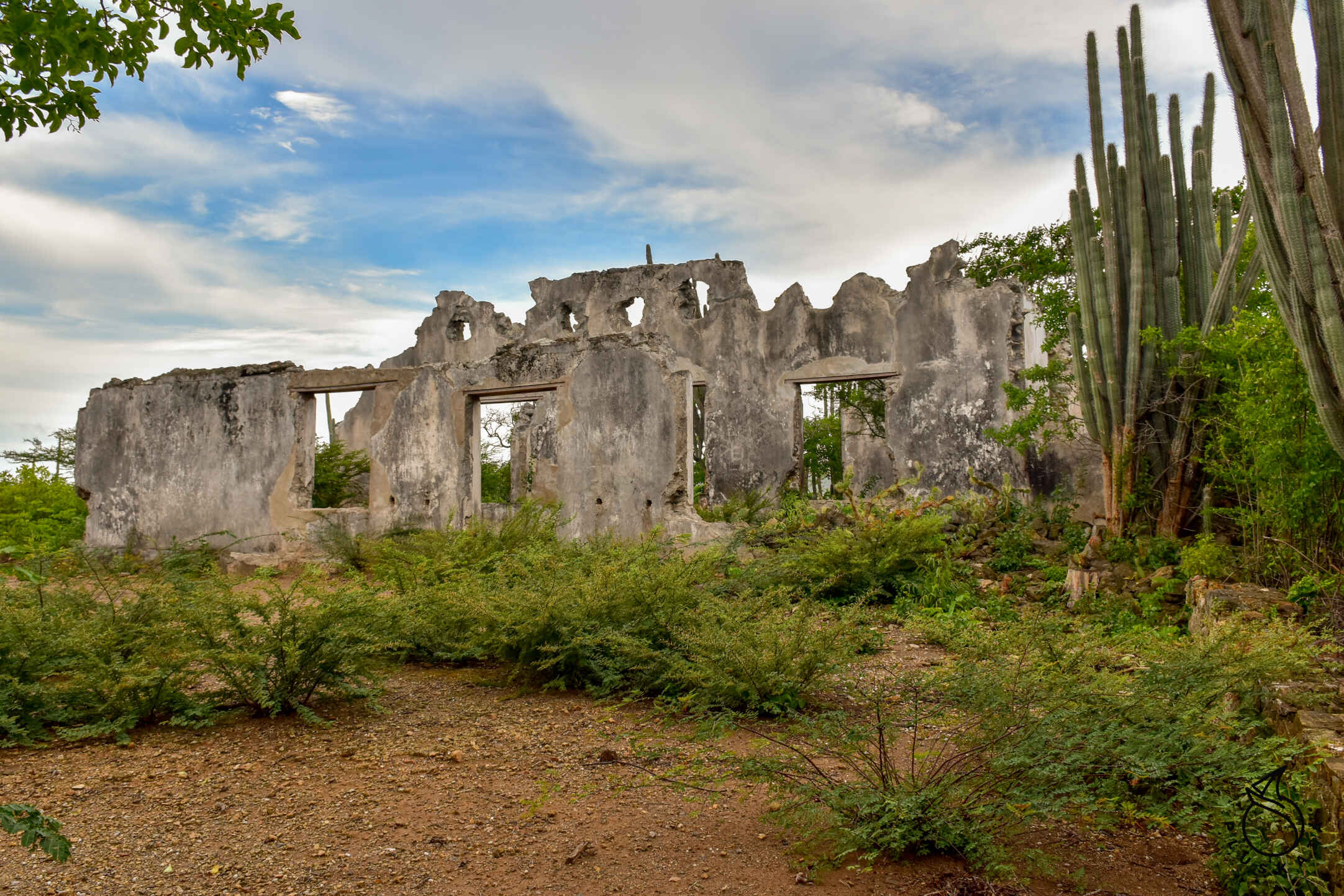
Zorguvlied – a farm that was founded by Jonathan van Beuningen around 1716 and ceased to be used around 1852. You can now see the ruins of the farm (outbuildings and residential buildings). Knip plantation viewpoint – view of the plantation buildings. This plantation was founded in 1693. The house, located southwest at the foot of Knip Hill, was inhabited until 1969.
Along the way we can see mosses and lichens living in symbiosis with trees. These organisms thrive here due to the high levels of moisture in the air. They are excellent indicators of air pollution, living only in places where the air is still clean.
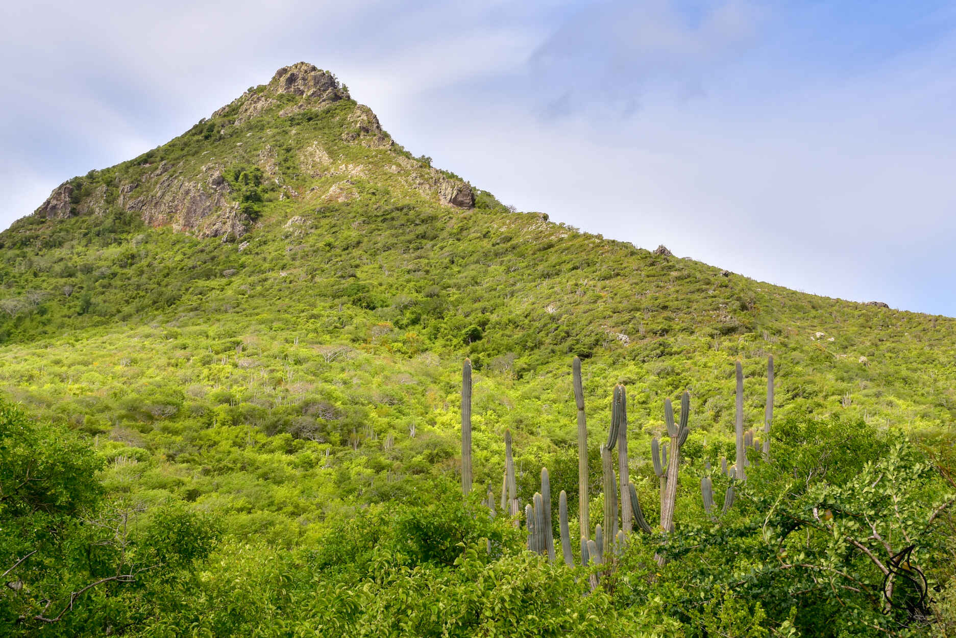
There is a parking lot along the way from which the trail starts to the highest peak of Curacao – Christoffelberg – 372 m above sea level. It is recommended to enter the trail before 10 a.m.
Northern route:
Salina – Seawater was let in and then sealed off to allow wind and sun to evaporate the water, leaving behind salt which was then collected. However, the salt pan you are viewing was never used to collect salt. The natural development of this city began with the inner bay, which was gradually cut off from the sea by limestone gravel and limestone sand coming from the coral reefs located in front of the coast. During heavy rains, the saline floods again, providing a seasonal habitat for water birds such as herons, ducks and even flamingos.
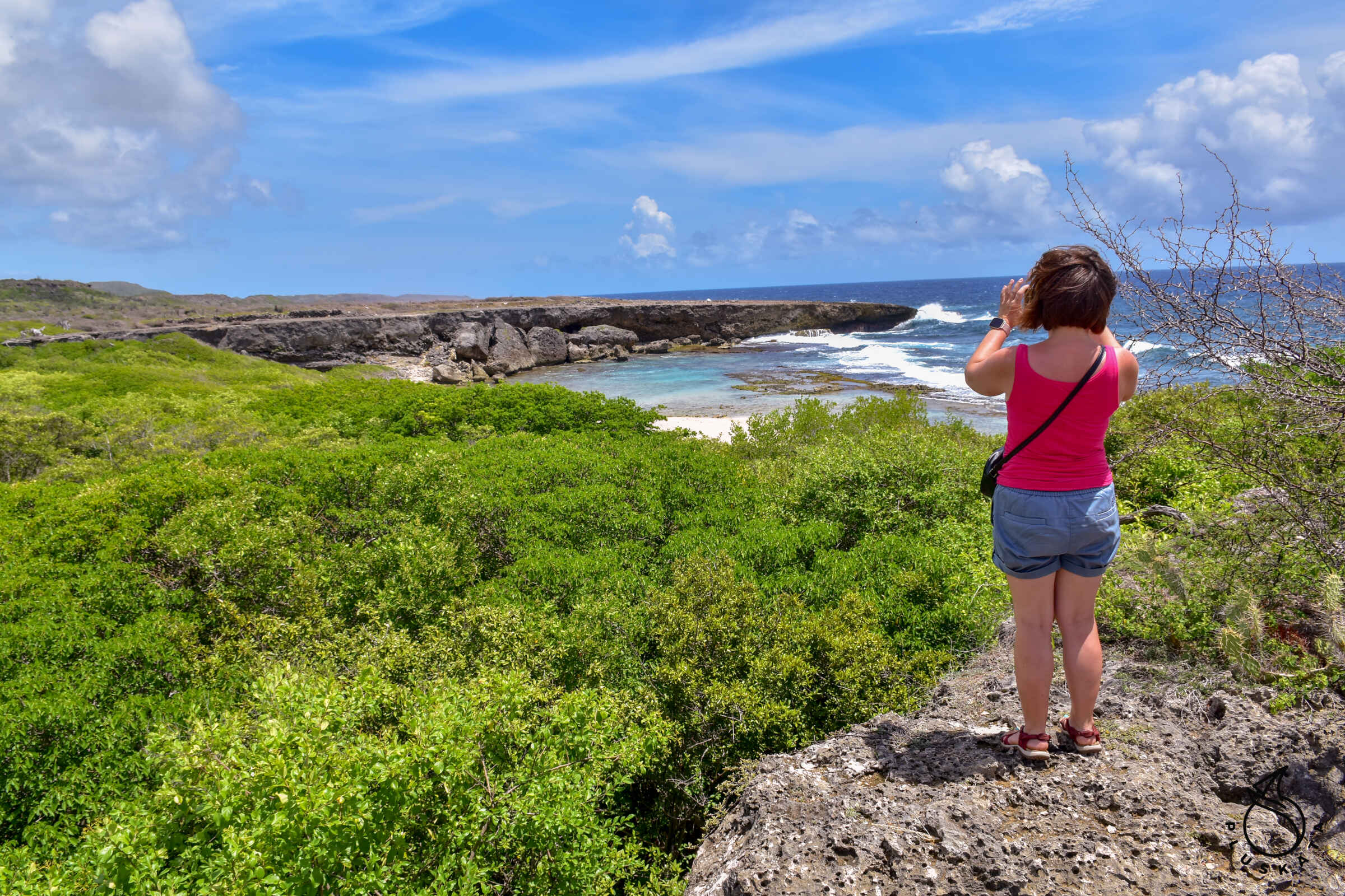
Boca Grandi – The area separating the saline from the sea is characterized by the presence of salt-resistant trees. Parts of the rock lying in the intertidal area (alternately exposed to air and water) have a pink tint due to the calcareous algae that prefer such conditions to grow. From the parking lot you go down the stairs to the beach and then through the bushes and along the rocks. The water on the beach is crystal clear.
Grottoes – There are several caves – one of them has Indian rock paintings (this cave is closed with a grate), another is shallow – wasps and bees have settled in it, and the third one is large and very colorful – you need a flashlight to get to the end cave.