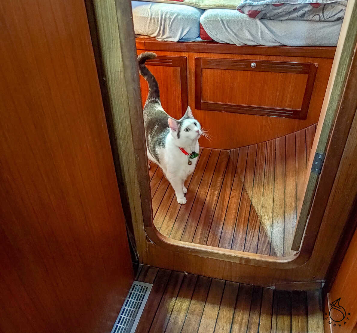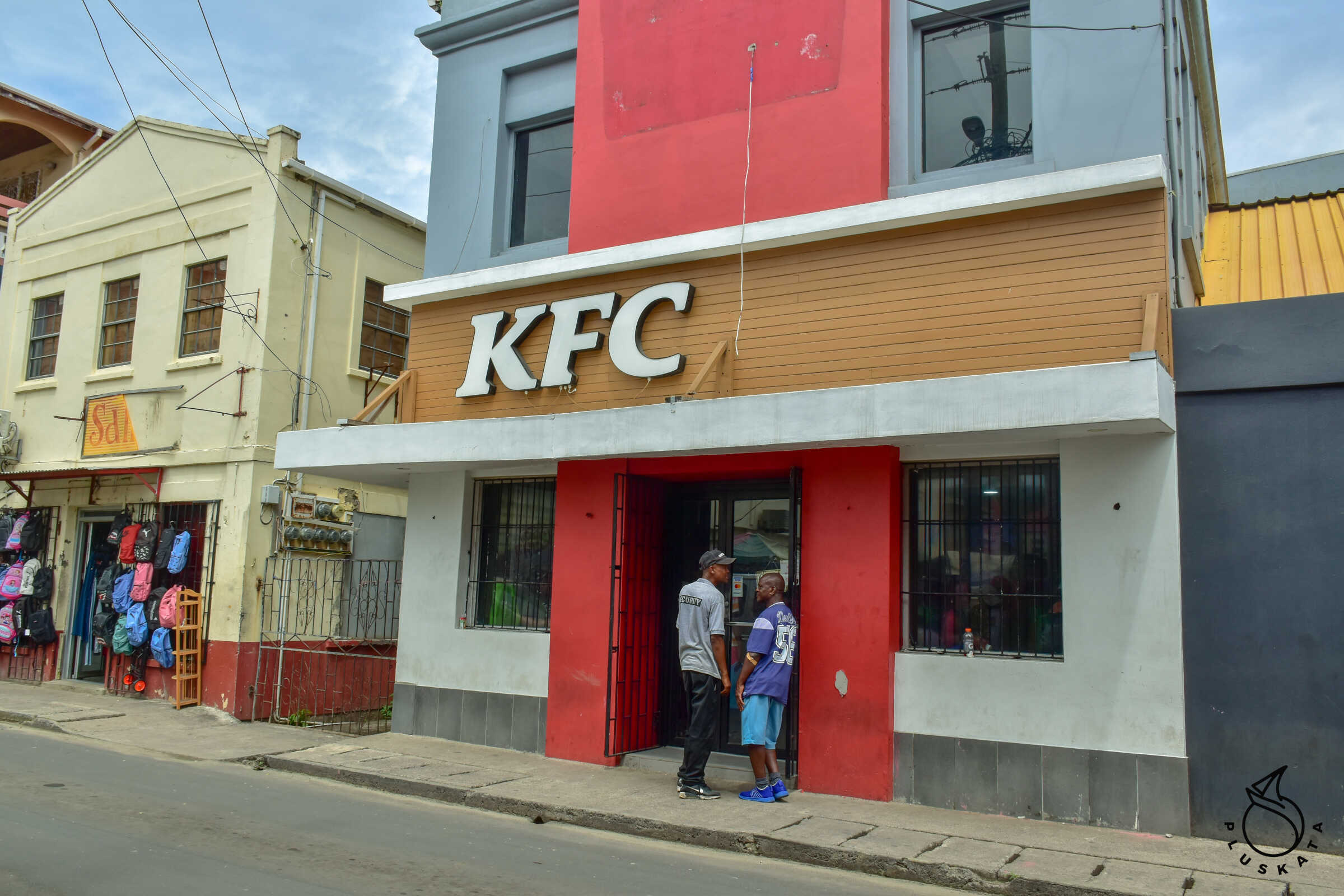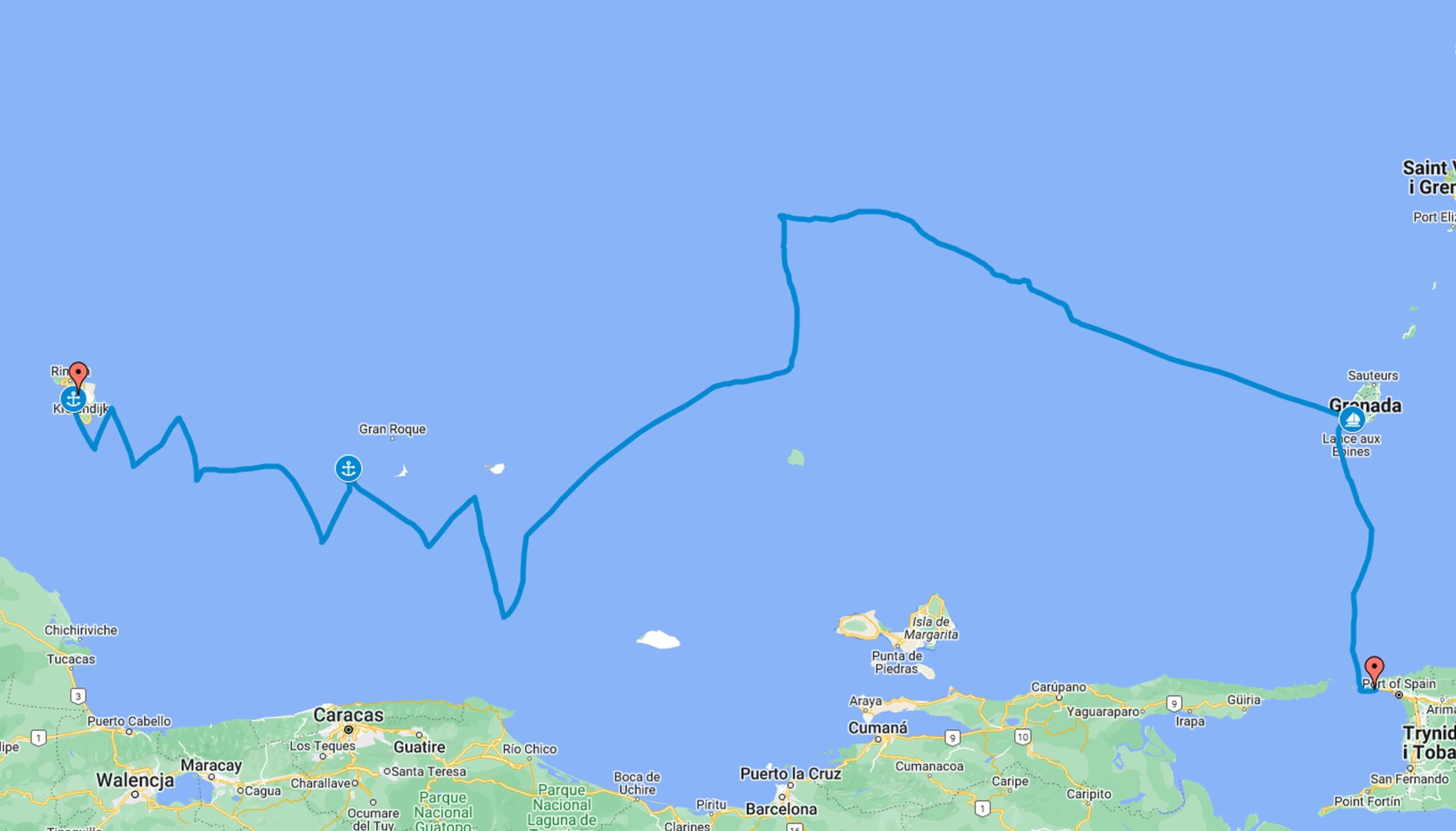
Route: Harbour Village (Bonaire) – Klein Bonaire-Dos Mosquitos (Los Roques-Venezuela)-Port Louis (Grenada)-Chaguaramas (Trinidad)
Date: 24.08-09.09.2024
Miles/hours: 666Mm/198h
Bonaire check out
First I fill out a declaration in the Sailclear system, then we go with the whole crew to the Customs and Immigration office. There I give the customs officer the declaration number from the application, and he prints and stamps the departure declaration. Then the Immigration officials take our passports, stamp and print the departure confirmation and that’s the whole procedure.
Route to Grenada
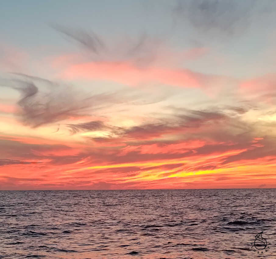
Day one Saturday
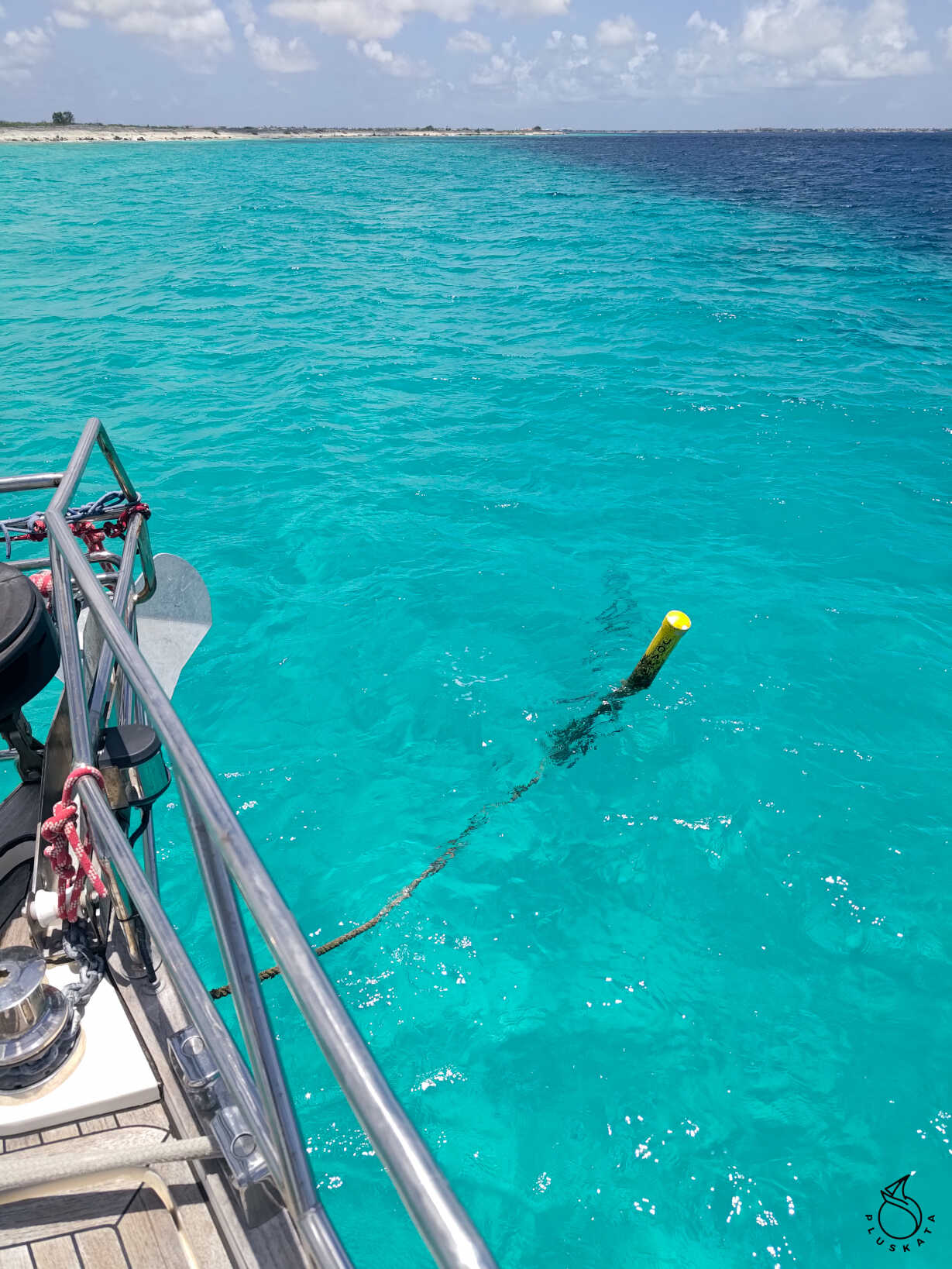
After paying for electricity and water at the marina, we set off to Klein Bonaire to snorkel at the reef. We stop at a yellow buoy (a vertical post with a rope and an eye with a thimble at the end). The thimble is so large that our hook doesn’t fit on it, but the mooring line goes through freely and the thimble doesn’t hurt it. We snorkel at the edge of the reef. There are lots of colourful fish and the reef has a lot of plants, unfortunately the slope slopes down very quickly, so you can’t see the colours, but they are definitely beautiful. After about an hour, we move on.
Day two, Sunday
When we sail past Aves de Sotavento, the border guard (Estación de Guardacostas Aves de Sotavento) calls us and asks for the details of the yacht and crew. We talk a little in English and a little in Spanish. They are clearly bored. Even when the officer couldn’t say something in English, he used Google Translate and played it back to the receiver (in a woman’s voice).
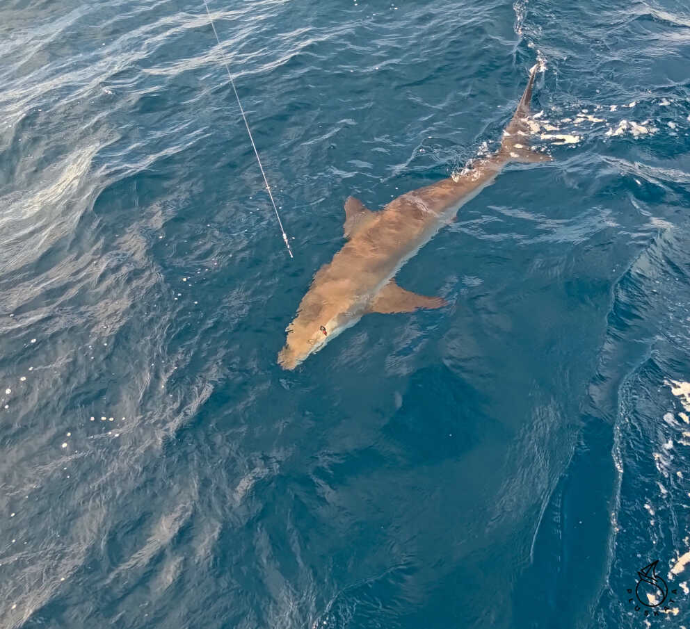
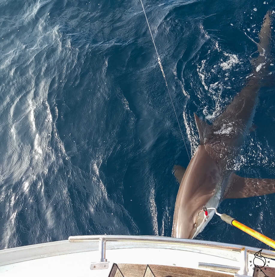
In the afternoon, we decide to use the fishing rod. Tomek puts on our best bait and we release the line. We sail the whole time. Not half an hour has passed before the fuse on the reel starts rattling. We have caught something really big. We help ourselves a little with the engine, and Tomek pulls the line as best he can. He barely manages, but after an hour of fighting, a two-meter shark emerges. We decide to release it, but we want to get our bait back. We try with a boat hook and a hook, unfortunately without success. Finally, the snap releases and the shark swims away with our bait in its mouth.
Day three Monday
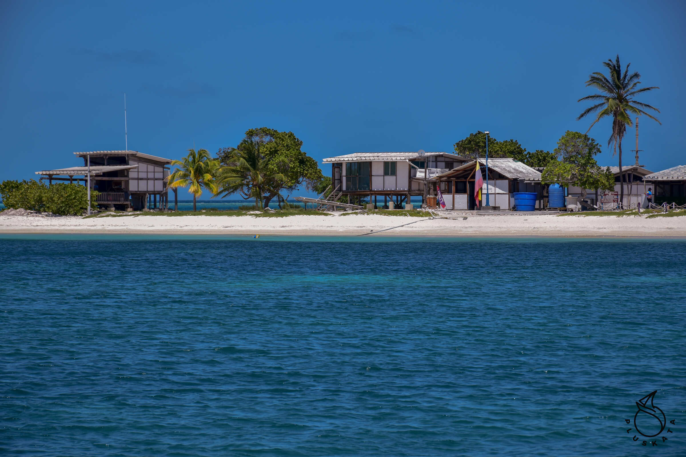
In the morning, after sailing 168 Mm, we reach the Los Roques Archipelago and drop anchor at the southern island of Dos Mosquitos. On the island there is an airport, a few fishermen’s huts, cottages for rent and a beautiful sandy beach with blue water. After anchoring, we drink coffee and admire the turtles swimming around the yacht.
Day four Tuesday
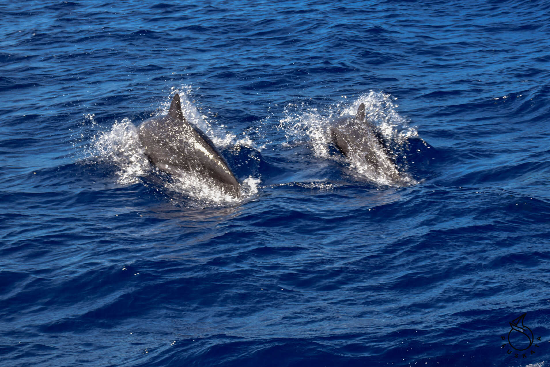
In the morning, we are visited by dolphins. They sail with us for almost half an hour. At noon another guest swims past us – this time alone and not jumping out of the water, and his dorsal fin has a strange triangular shape. We already know this silhouette. It’s a shark. We were hoping it would give us our bait, but it was its friend. It swims a bit next to us and eventually swims away.
In the afternoon the dolphins appear again – this time a large school and they sail with us for almost an hour, racing with the boat.
Day five, Wednesday
In the morning we decide to let the rod out again. Tomek puts on a new bait and we pull it obediently behind the boat. The wind is not too strong, so we don’t sail fast. In the afternoon Tomek decides that some trash must have caught on the rod, so we pull out the line – and there’s a mai-mai at the end. And what a surprise. It’s small enough that we pull it out with a landing net. Tomek dresses it – it’ll be dinner for tomorrow – there are 3 of us, so that’s enough. I correct the winding of the line on the drum, so first I have to let the line out. When pulling it in, it turns out that we caught the blue line that got wound around the screw. We drop the sails, and Tomek dives, and after half an hour we are free.
In the evening, a tired bird arrives, sits on the bow basket and starts to toilet.
Day six, Thursday
At night, it turns out that we have sailed into a current that Windy believes we should have already passed. This model for the current does not work (Mercator). We have to turn, so we wake the bird (he was still sitting on the bow basket), who flies away. In the morning, we pass quite a lot of rain – at least the deck will be rinsed. After the rain, there is a lull, so we turn the engines and look for a better wind.
Day seven, Friday
In the morning, clouds appear on the horizon, so we maneuver between the rains. The wind is variable in both strength and direction. We sail a bit and a bit on the engine. Sargasso appears, so we give up fishing.
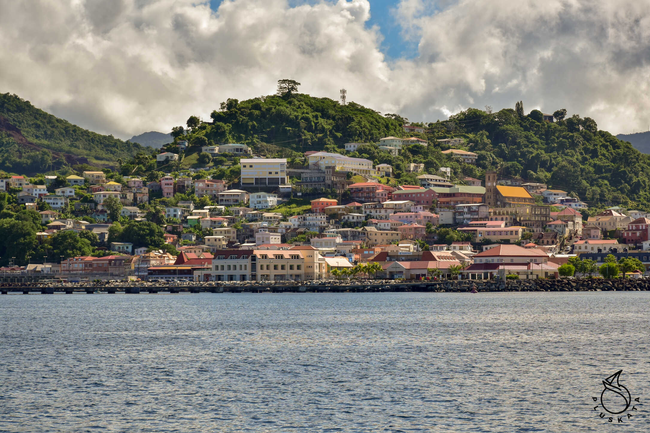
Day eight Saturday
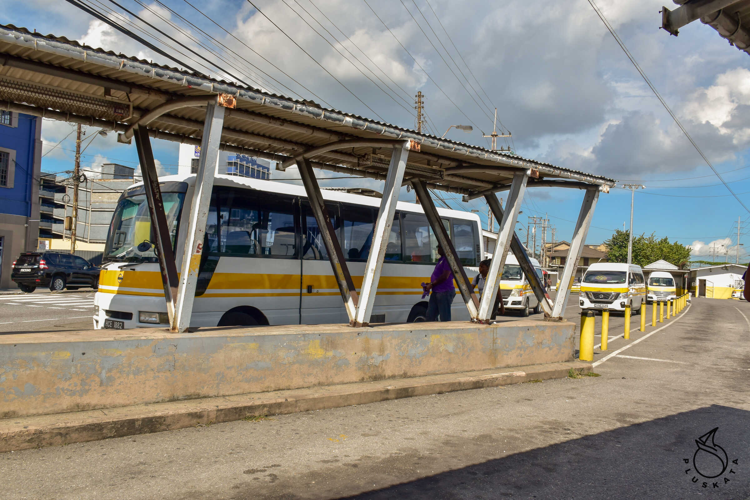
In the morning we see Grenada on the horizon. We enter the bay and call the marina on VHF channel 14
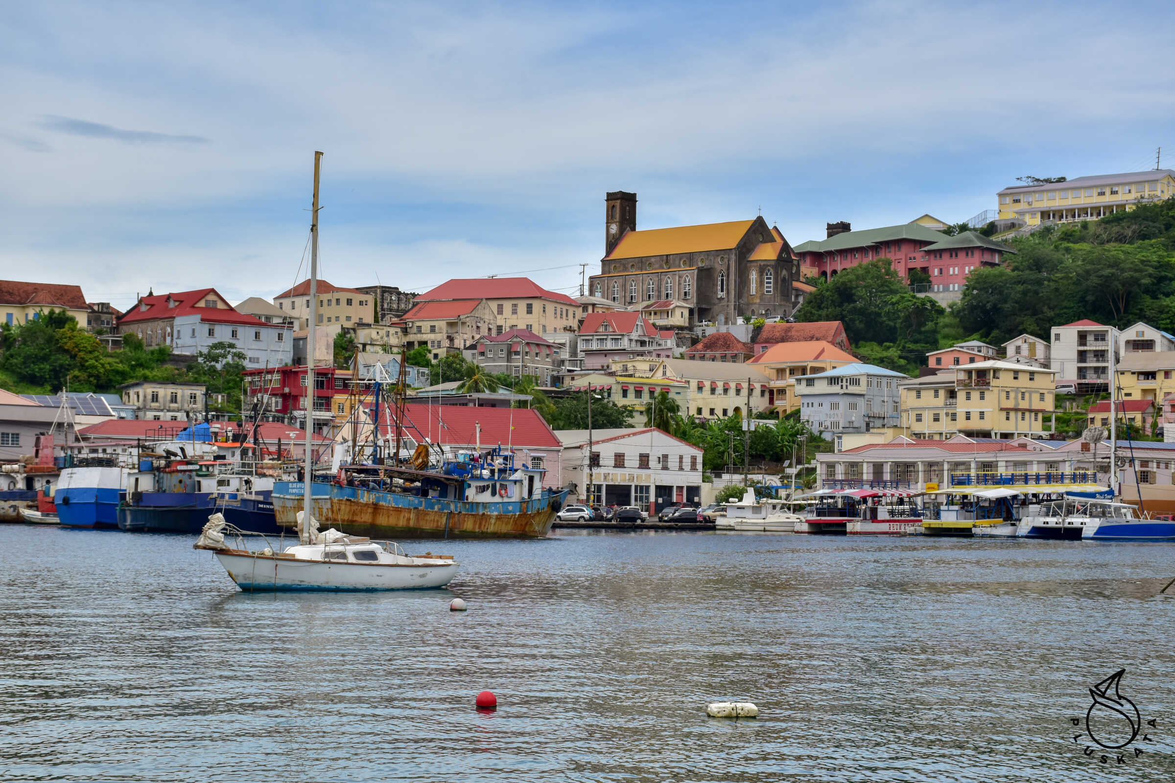
Grenada
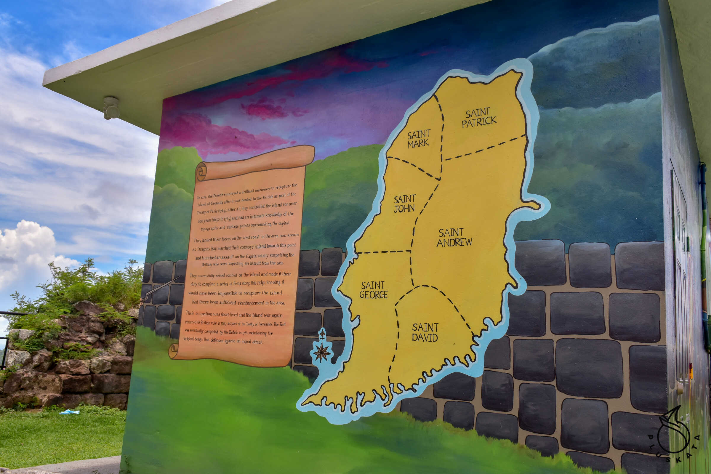
Grenada is a sovereign state in Central America, in the Lesser Antilles archipelago, located on nine islands. In addition to Grenada, the country also includes eight smaller islands from the southern group of the Grenadines. These are Carriacou Island and Little Martinique, as well as the uninhabited Saline, Frigate, Caille, Large, Diamond and Ronde. The currency is the East Caribbean dollar (as in most of the Eastern Antilles). Traffic is on the left and the roads are narrow, so renting a car is only for the brave.
Grenada Check in
Customs and Immigration are in the same room (two separate desks) at the back of the marina office. Sailclear works, it is worth filling it out in advance. On site, you have to pay 75EC$ for a cruising permit (valid for a month or until you leave Grenada – whichever comes first). You can pay this by card. Additionally, there is a fee of 20EC$ per person and 17EC$ port fee – this must be paid in cash – you can pay in USD or EC$ – you can also mix, which I do. The lady at the next desk stamps passports, I pay and that’s it.
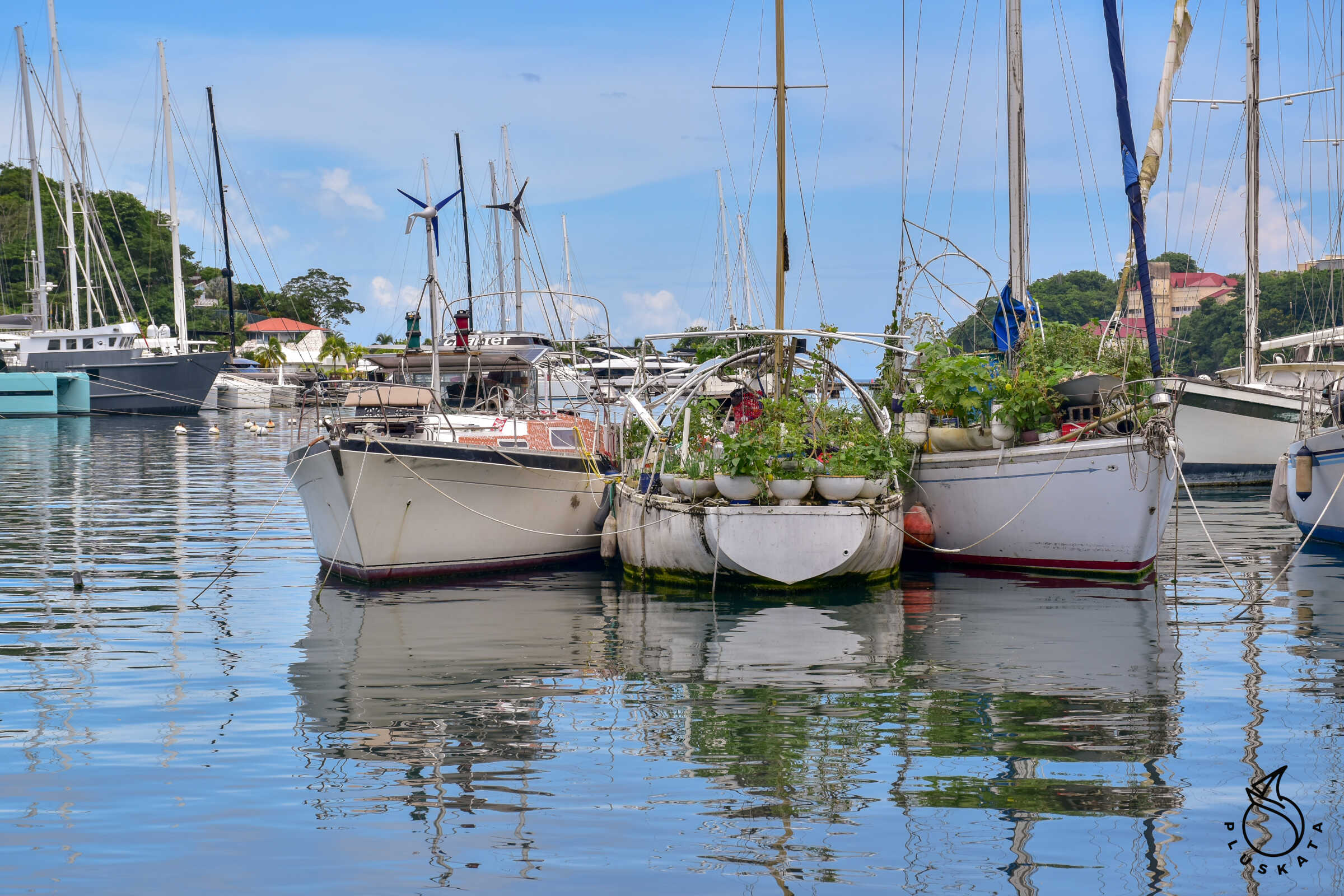
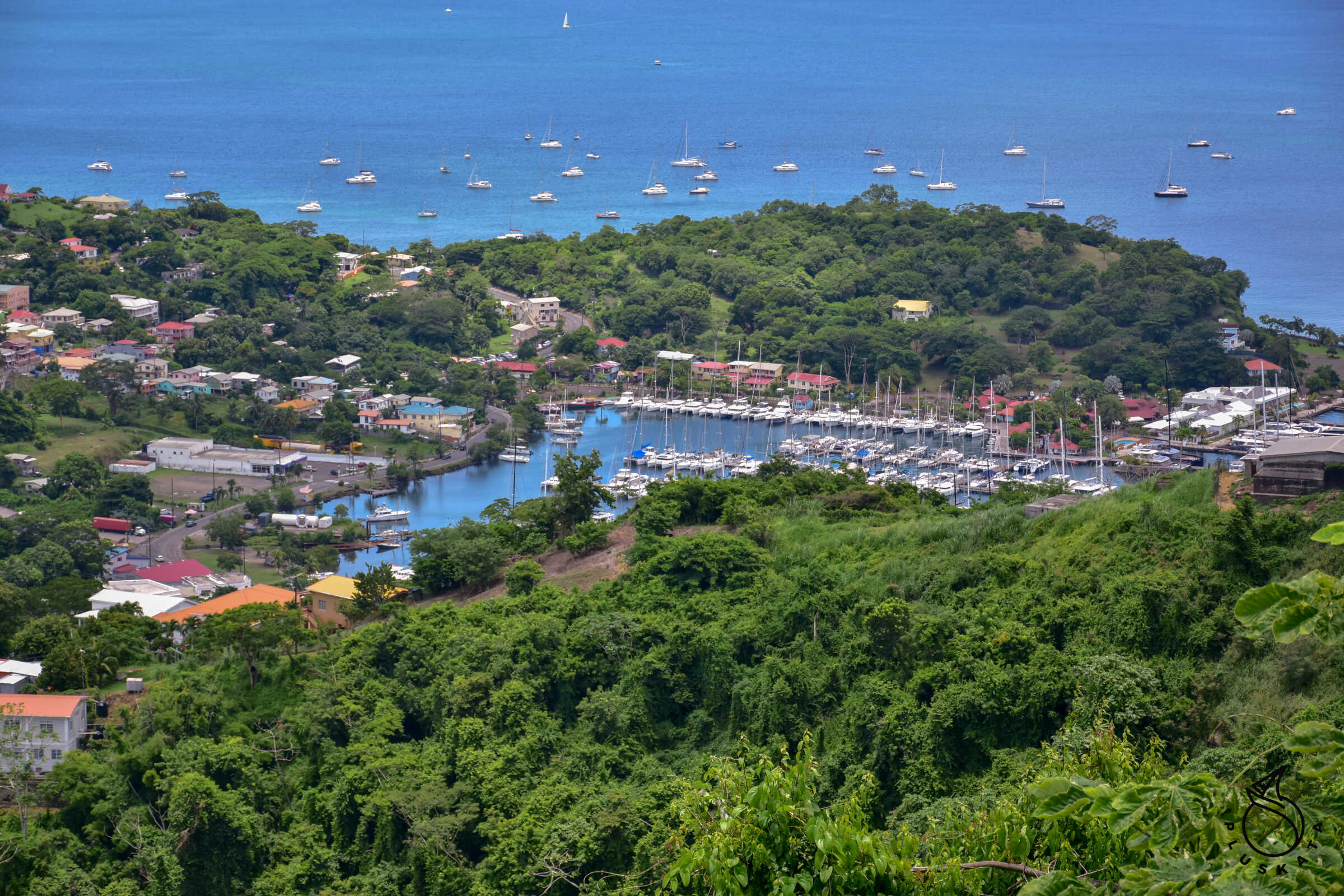
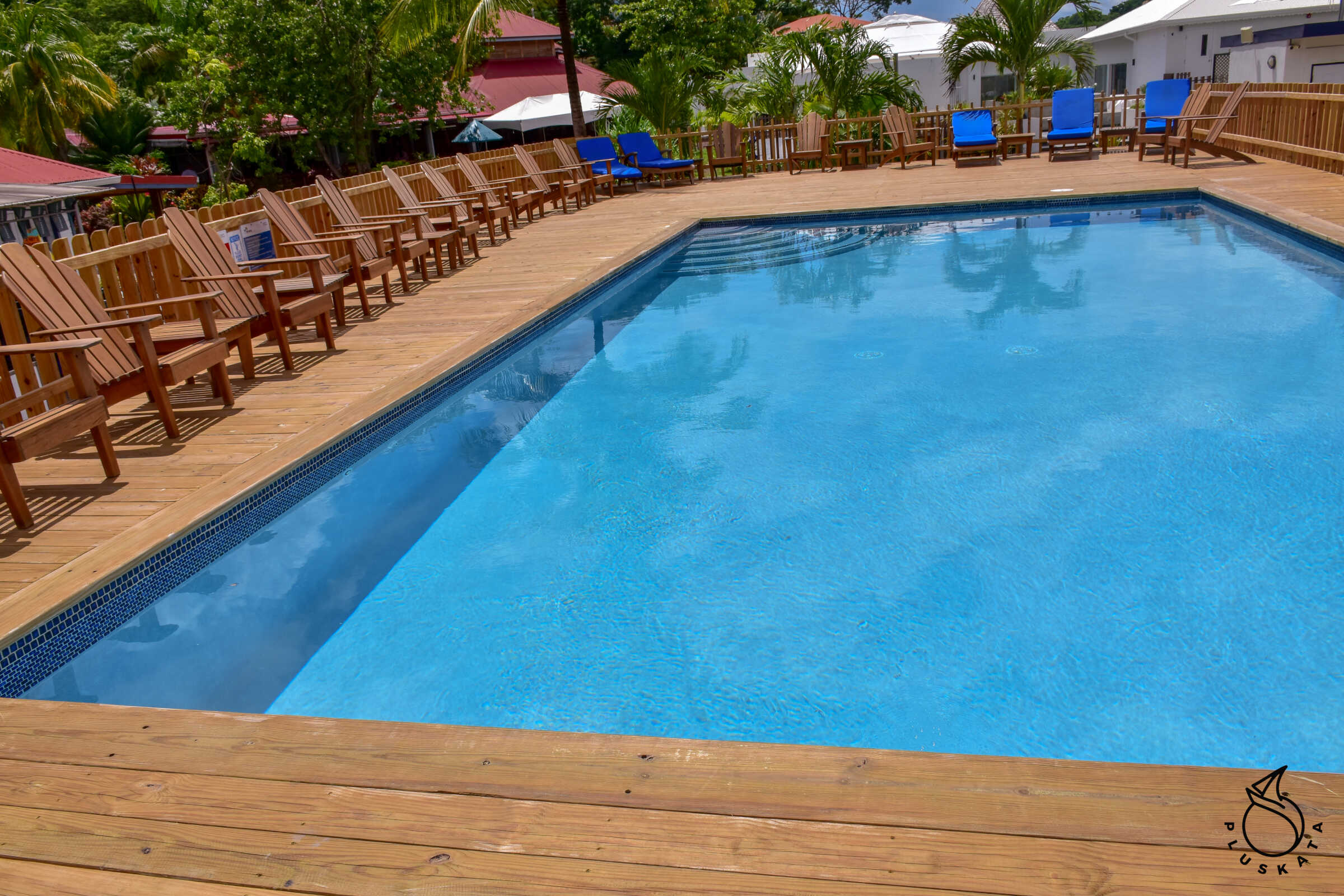
Marina Port Louis
A very nice, large marina with decent toilets (with air conditioning), internet, which is temporarily out of order (the address pool has probably filled up), a swimming pool (small but nice). Garbage is sorted into white and coloured glass, aluminium, plastic and others. Unfortunately, it is not cheap – 1.4USD per foot of the yacht’s length. In addition, there is a fee for water and electricity according to meters (payable on the last day). There are two sailing shops in the city near the marina – Island Water and Budget Marina. You can call the marina on VHF channel 14. They answer quite quickly. The mariner tells you how and on which side to hang the fenders and takes the mooring lines.
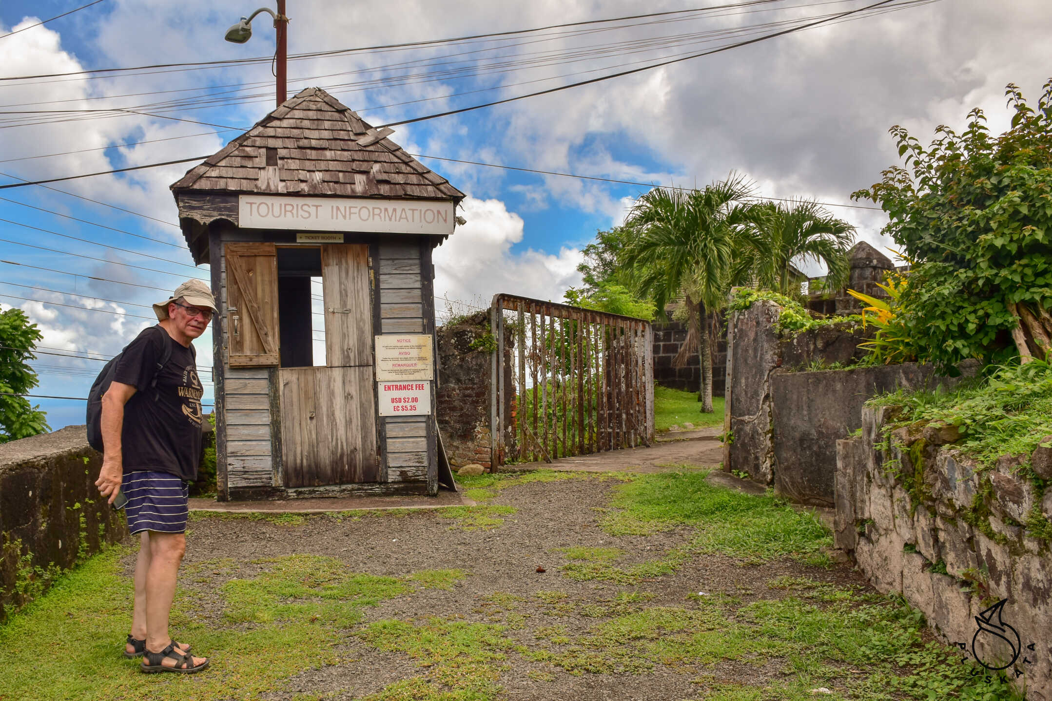
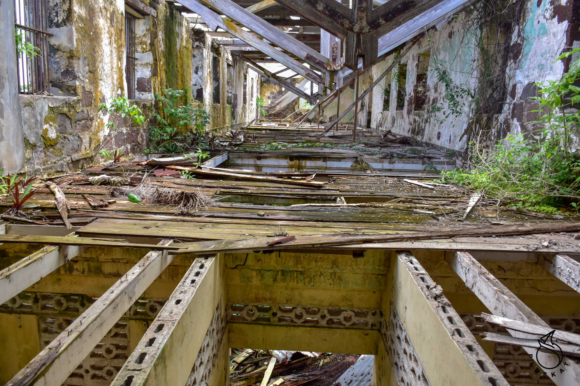
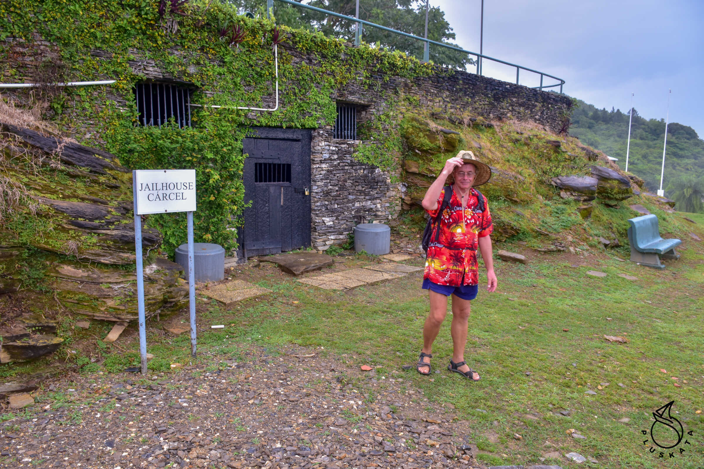
Forts Matthew and Frederick
A trip from the marina takes about 1 hour each way on foot. Two forts next to each other. Fort Matthew is larger, but it is practically a ruin, although you can enter the tunnels under the fort, there are many quarters – tiny rooms and even prison cells. Fort Frederick has been restored and is still maintained with information boards and a nice view of the city. Entry to both forts costs 2 USD per person, but in Fort Matthew the lady waives the fee. We return by a different route, making a circle.
Bus transport
There are buses running around the entire island (theoretically they take about 15 people, but if necessary more). The island is divided into 9 zones and the buses have zone numbers. In each zone there are several or a dozen routes (e.g. in zone 9). Buses have a number and route written on the front. Theoretically, they stop at the stops, but if you ask nicely, they will stop in between, or even deviate from the route (then you usually have to pay extra). Fares range from 2 to 6 EC$ per person.
It is best to come to the bus station and get on the first bus that suits you, if everyone fits. The driver “packs” the passengers and sets off. If we want to get off somewhere along the way, we immediately tell the driver where, and when our destination is approaching, it is a good idea to tap on the bodywork (this is usually done by the driver’s assistant). Drivers change every now and then (e.g. when one drives past his house, he gets off, and another driver gets in his place. If we want to get on the bus not at the station, we simply wave (often the driver simply asks if we want to go, and we say where we want to go and get on)
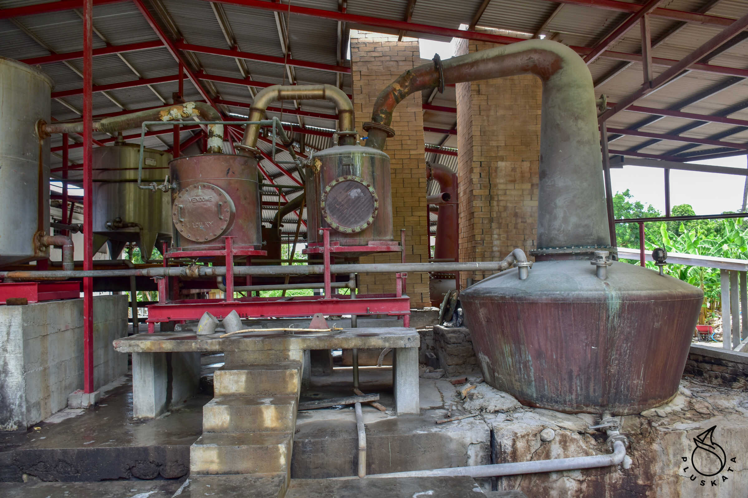
River Antonie Rum Distillery
The only operating rum distillery in the Caribbean that uses 18th-century machinery and technology.
A cane press is a mill wheel placed on a river. The cane is squeezed twice, with a conveyor belt feeding the first squeeze and workers feeding the cane manually for the second. The juice flows from the press into a vat, where it is heated and molasses is made. Here, they use squeezed sugar cane as fuel. Molasses of the appropriate “sweetness” is poured into subsequent tanks from where it is pumped into fermentation vats. The vats are systematically emptied and the slightly fermented molasses is pumped to the distillery. As a result of distillation, 2 strengths of rum are obtained – 75% and 69%.
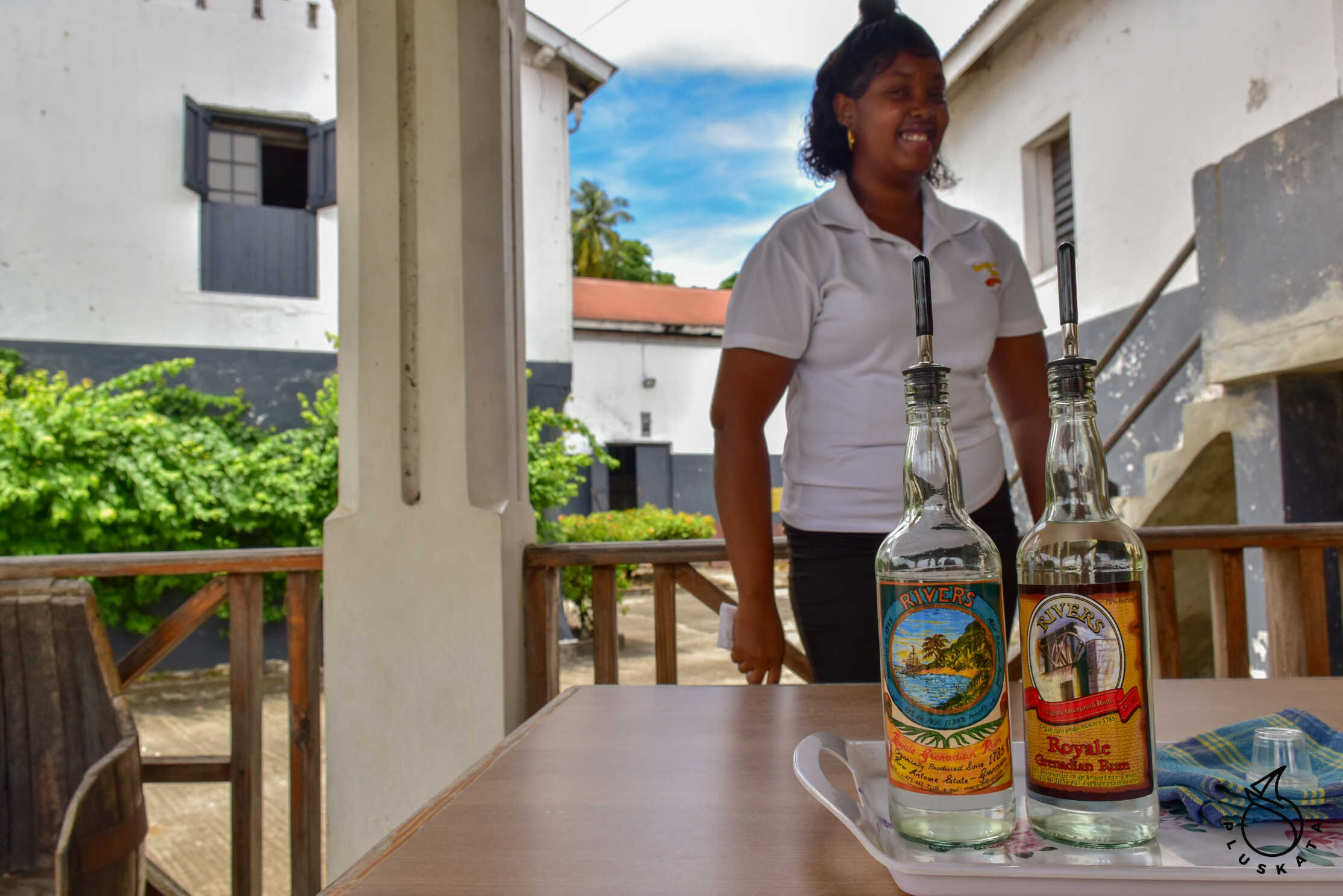
They only produce white rum 75% goes through another distillation process. At the end of the tour there is a tasting and then a shop. We buy a shared bottle of 75% rum and 69% for us. We return to the main road and take a bus to Grenville.
Gernville
A beautiful city in the north-eastern part of Grenada. The third largest city on the island. Many shops, many churches, a bus station for zone 9 and 6 lines. It is worth walking through the streets of the city, but an hour is enough for this.
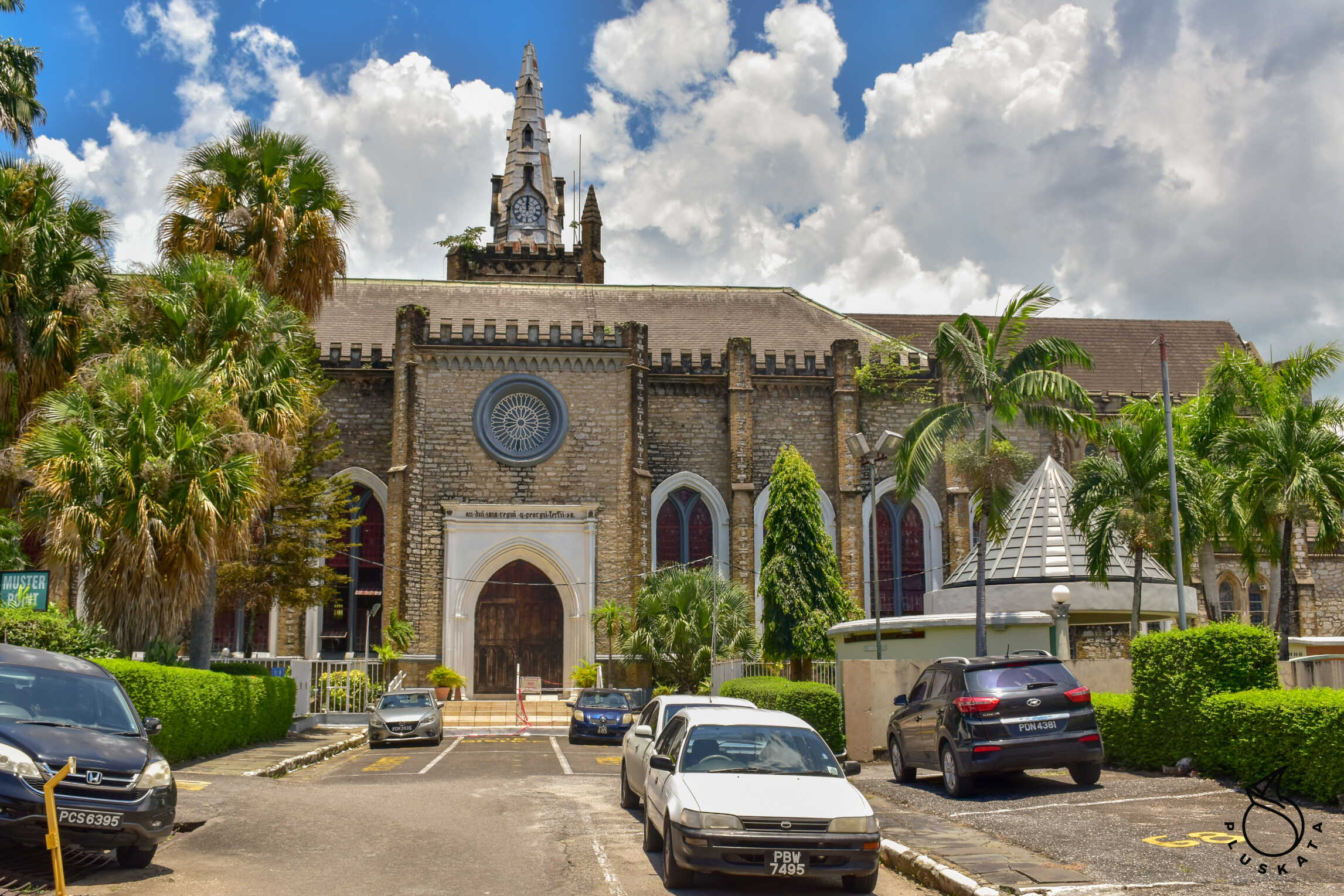
St. George
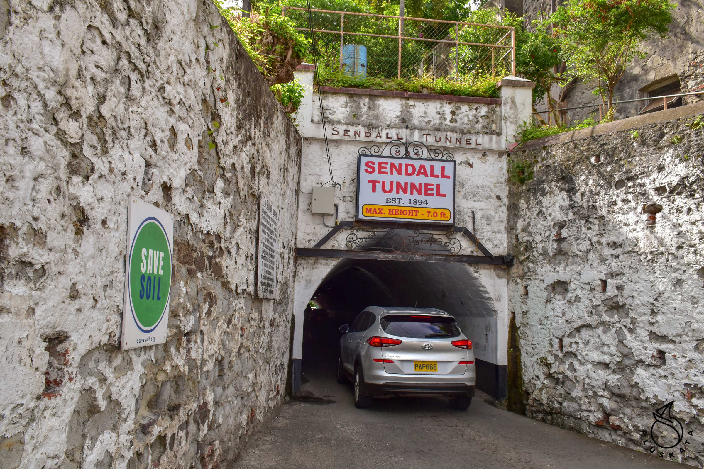
The capital of the island. There are 3 forts in the area – one of them (Fort George) is under renovation, a historic tunnel from 1894 (Sendall Tunnel) about 40m long, numerous churches. It is worth visiting the vegetable market near the bus station – the busiest time is on Saturday, but the stalls are also open on other days.
Grenada Check-out
Check out is similar to check in: I fill in the entry form in the Sailclear application, come to the office with the entry check-in paper and Sailclear number, get another exit check-in paper and more stamps in my passports.
Trinidad
One of the larger Caribbean islands located outside the hurricane path. There is a lot of greenery and a variety of birds and animals on the island.
Coral Cove Marina
Marina at the end of the bay, concrete jetties, swimming pool, showers and toilets. On the marina premises there is a small grocery store, a few bars and a sailing store. The price per foot of the yacht is 0.45 USD and an additional 3.5 USD per day for utilities (water, electricity, utilities, etc.). There is a guard at the entrance to the jetty, and the gate to the jetties is closed at night (guard nik is available 24/7, but sometimes he goes to talk to his buddies and you have to look for him.
The pool is about 6×6 m and about 1.8 m deep. The water in the pool is definitely warm, but that’s standard at these latitudes.
Trinidad check-in
First, you need to get health clearance – you can fill out the forms on the website and send them by email, or use the marina’s help (that’s what I do). With a printed health certificate we all go to the Immigration and Customs office (located in the Crewsinn complex on the other side of the bay (about 1.5 km from the marina). First Immigration – I fill out the crew list in copies (fortunately you can do it on carbon paper), stowaway declaration, health declaration and a few other papers, then the lady photocopies the passports and yacht registration certificate.
Then we go to Customs, where we leave one crew list, declaration of departure from the previous port and a completed declaration of entry (2 copies – there is carbon paper). I receive the declaration of entry. And now we are legally in Trinidad.
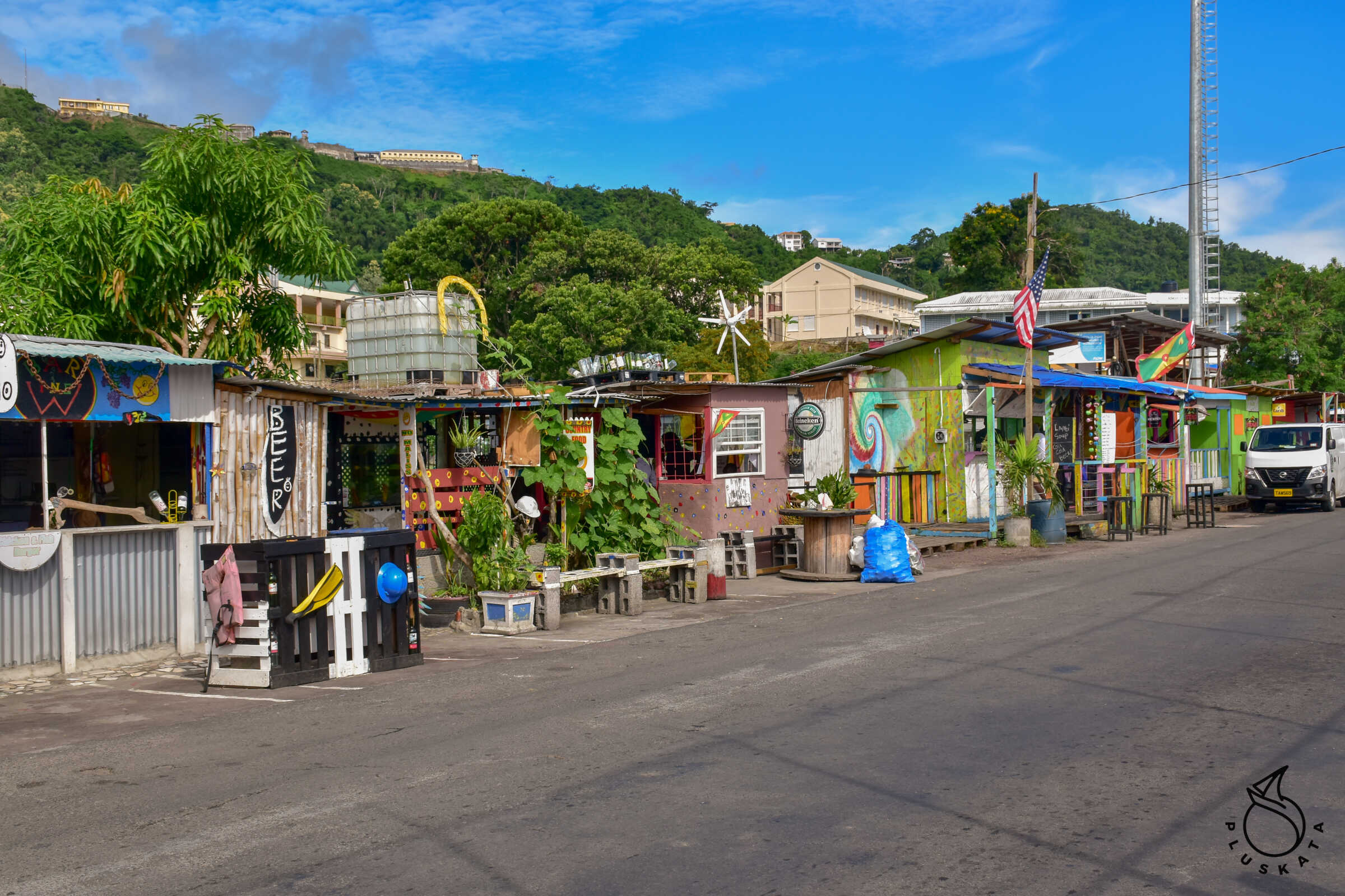
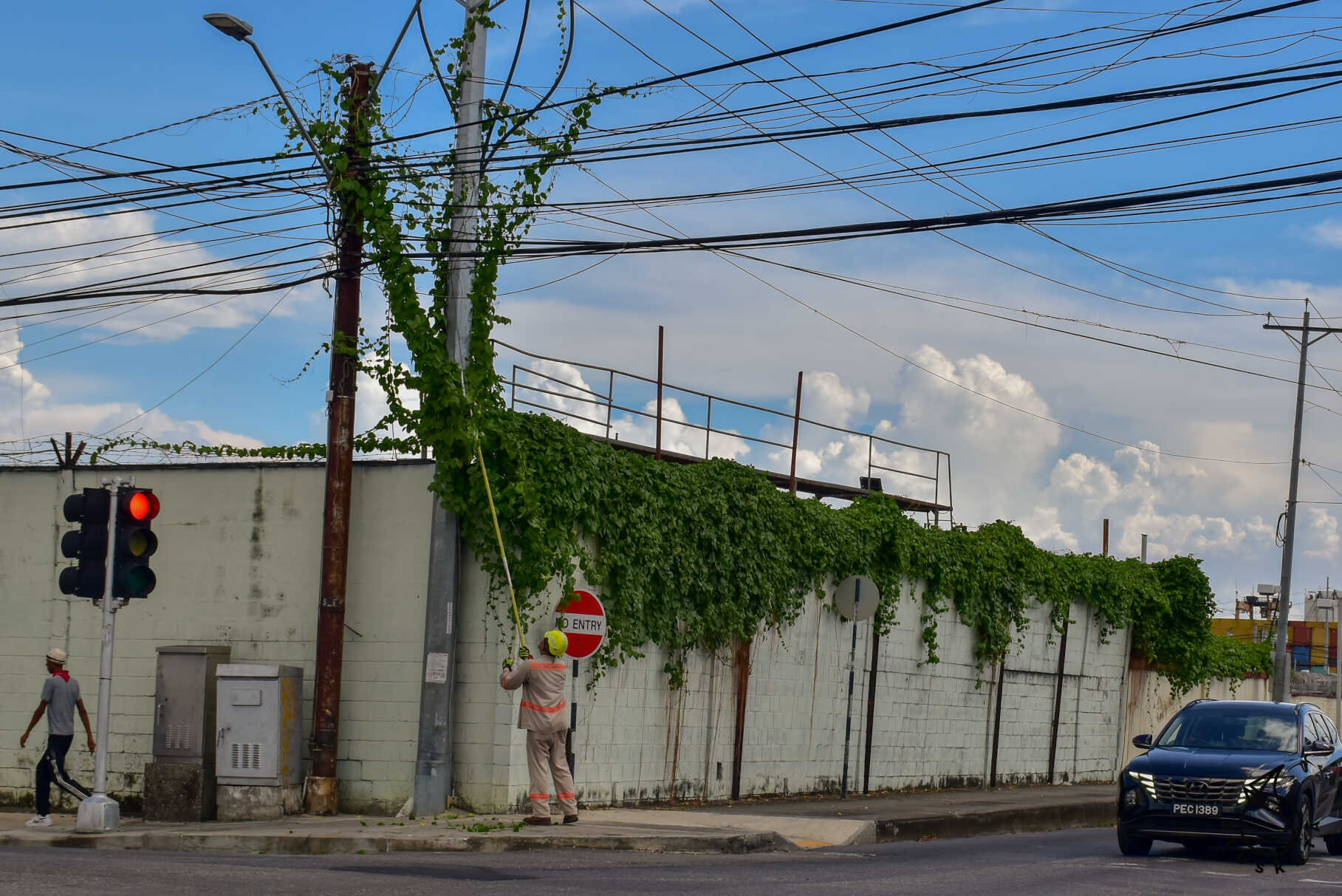
Chaguaramas
A town in the north-eastern part of the island. This is a sailing centre – large marinas are located here – this is where yachts are stored during the hurricane season. Large Power Boat and Peak marinas have huge yards for storing boats, but a symbolic place in the water. There are many sailing shops and service companies. Social gatherings are held in the marinas – in Peak in Fridays around 6:30 p.m.
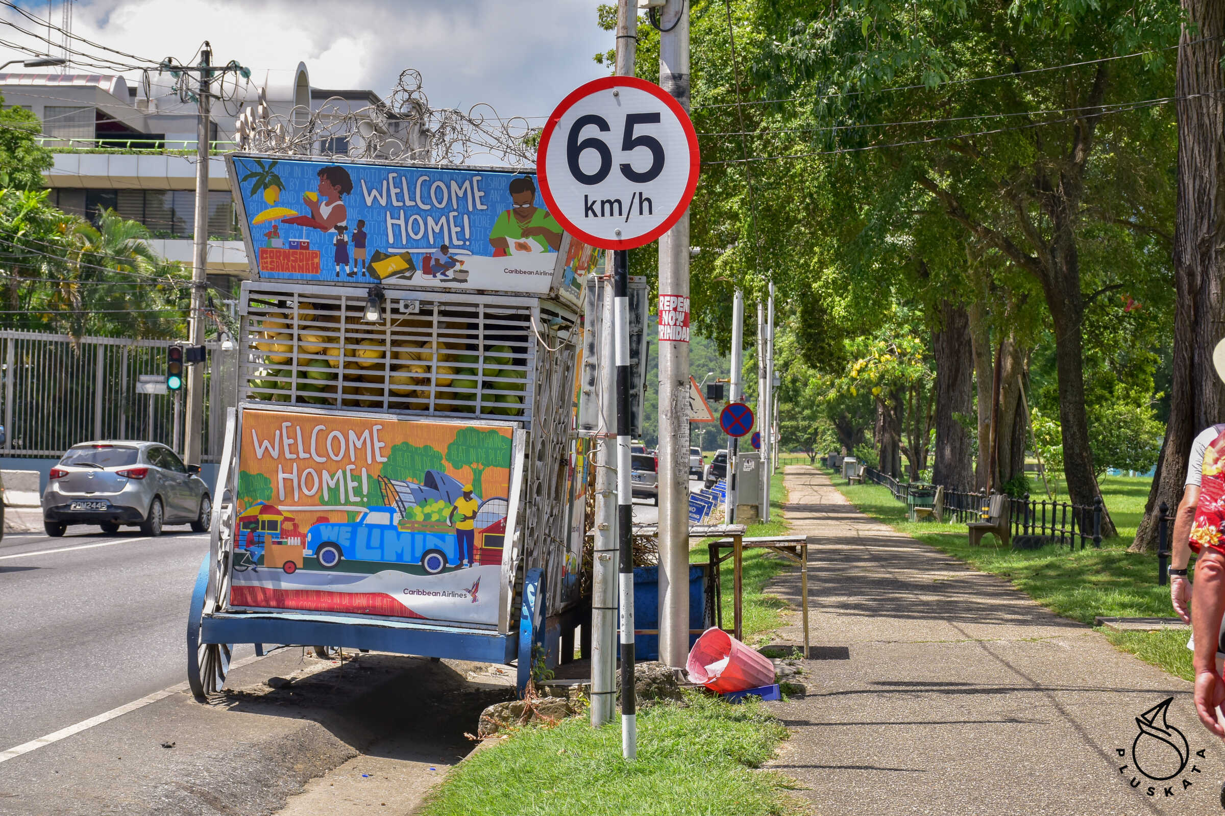
Bus transport
Buses (large red ones) run around the island but they run very rarely. Bus tickets must be purchased in advance – the driver does not accept money. A good solution is Maxi Taxi – buses that run on specific routes and pick people up along the way.
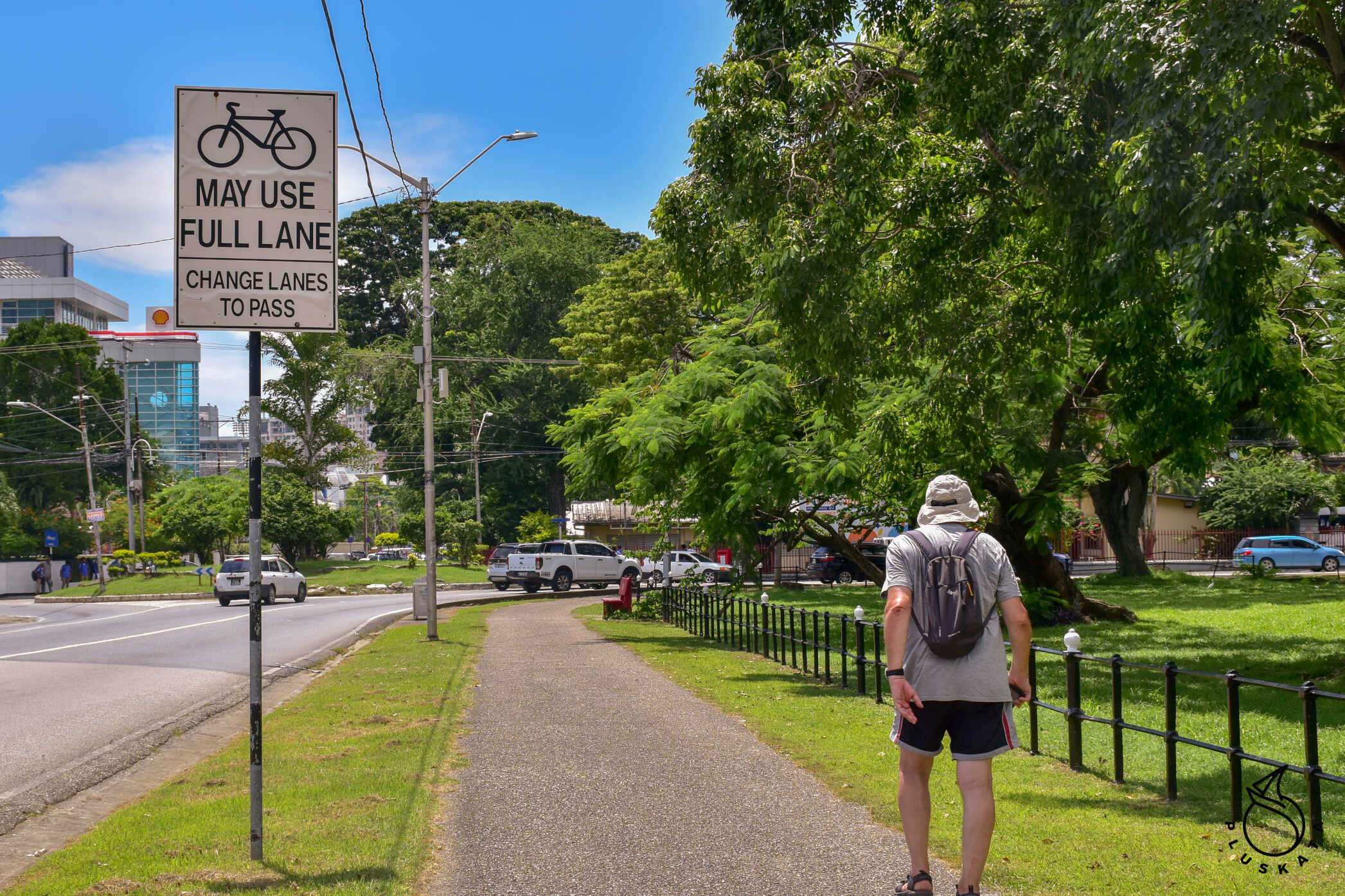
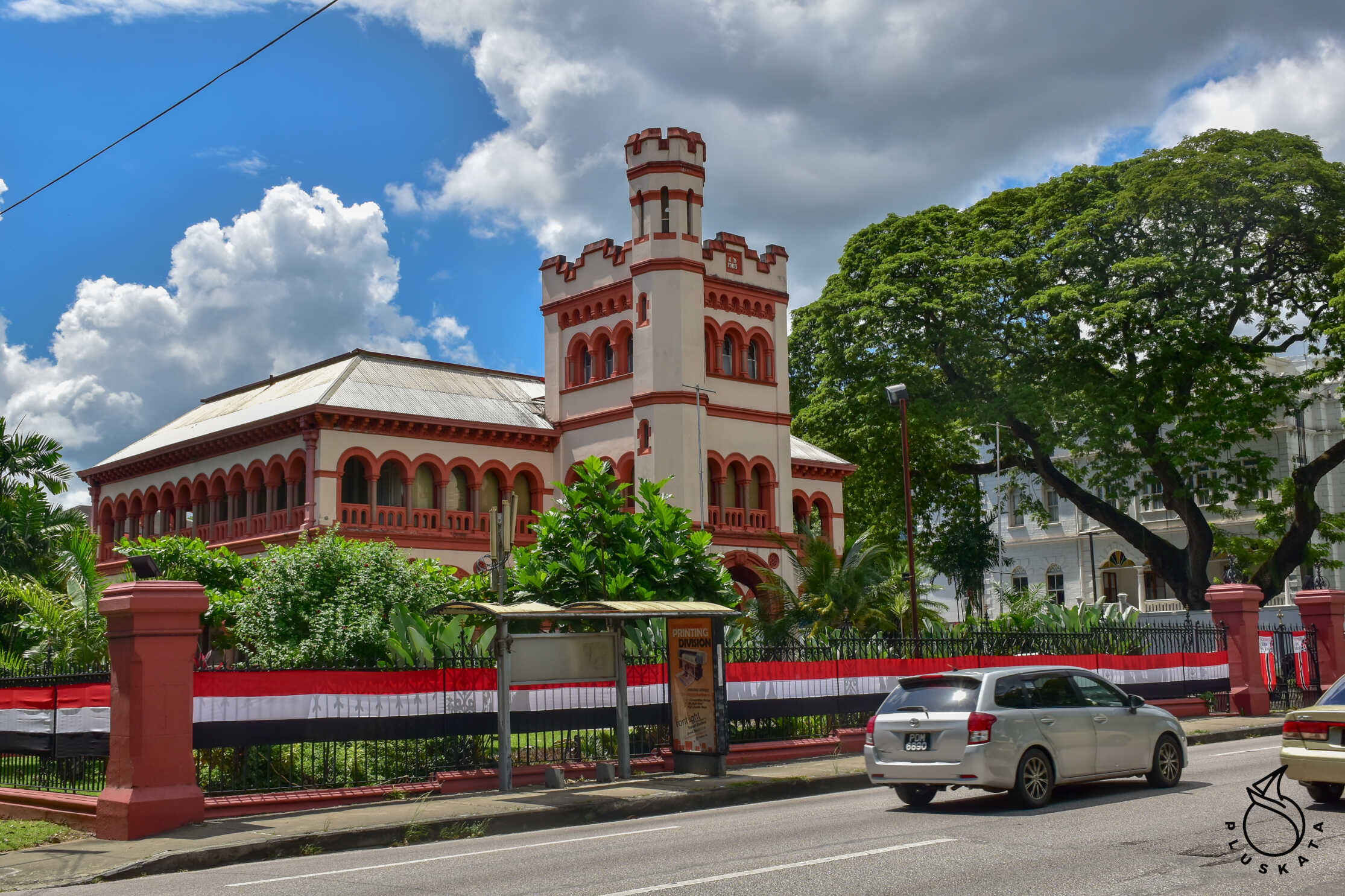
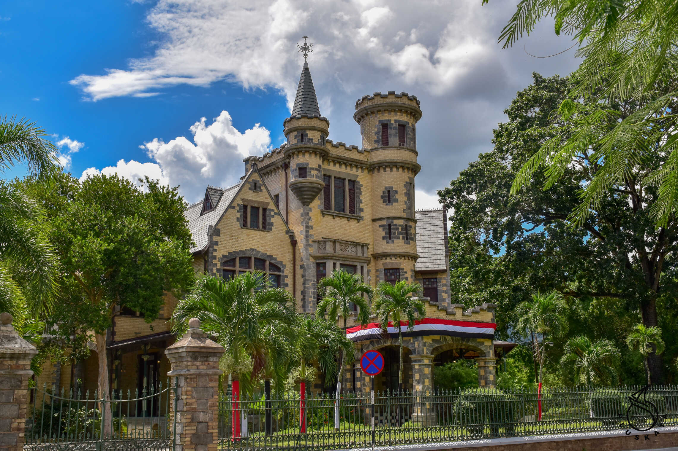
Port of Spain
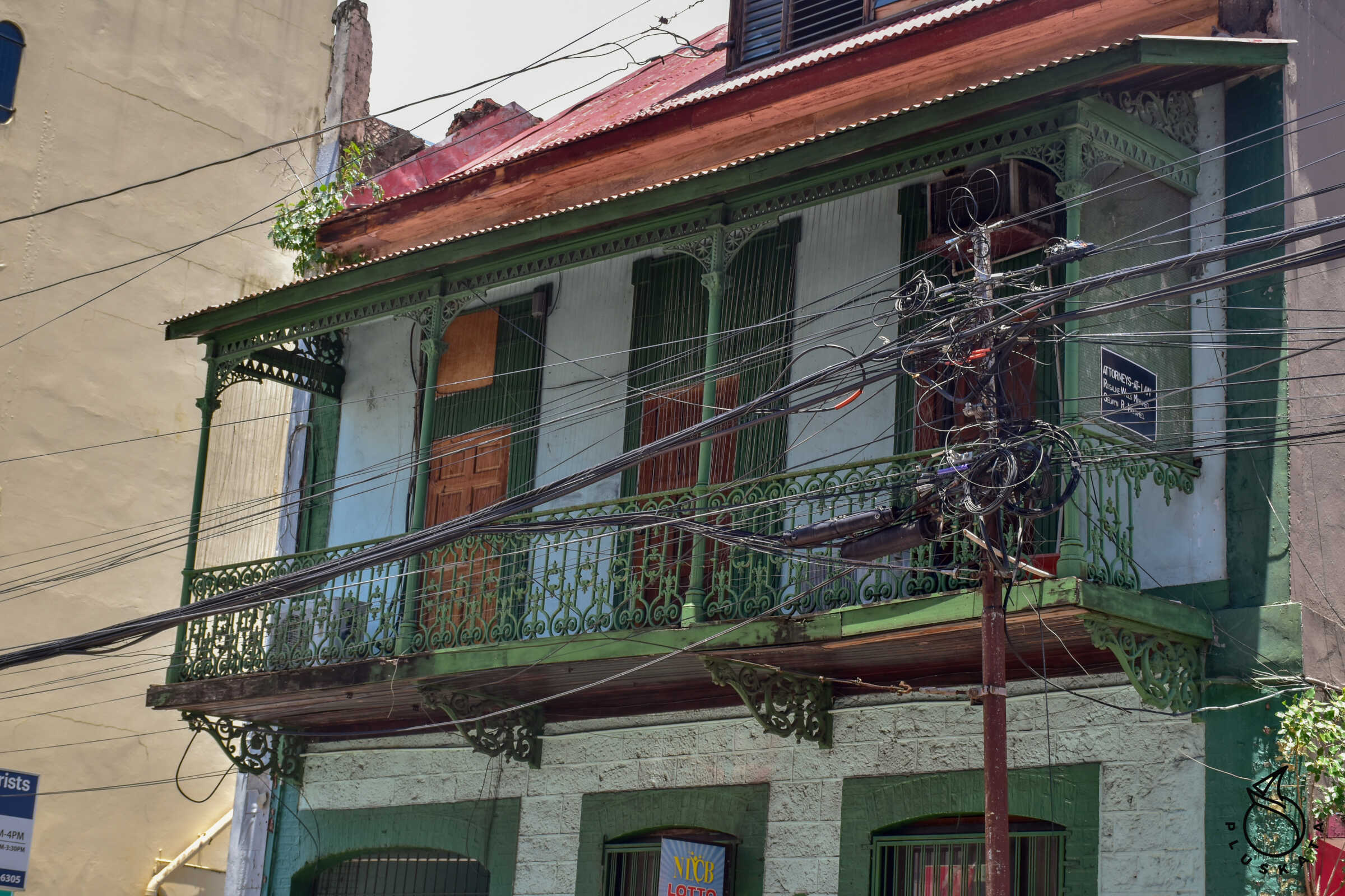
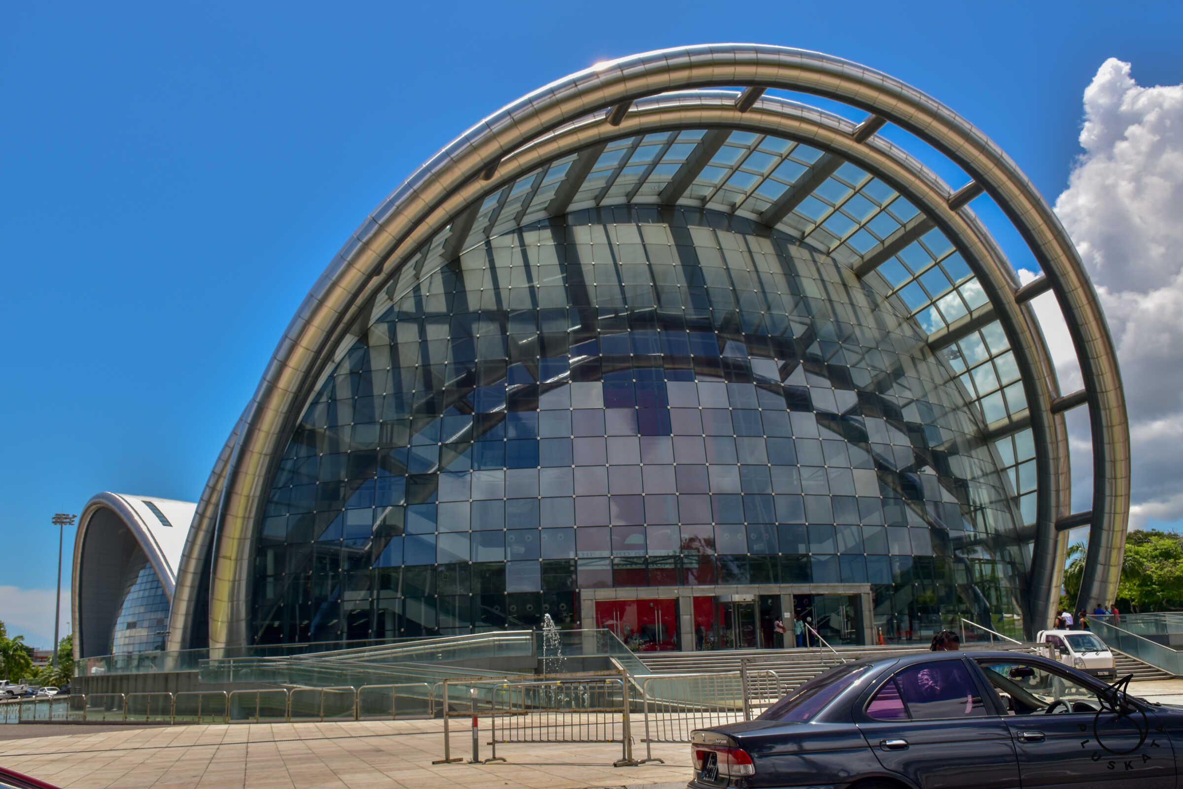
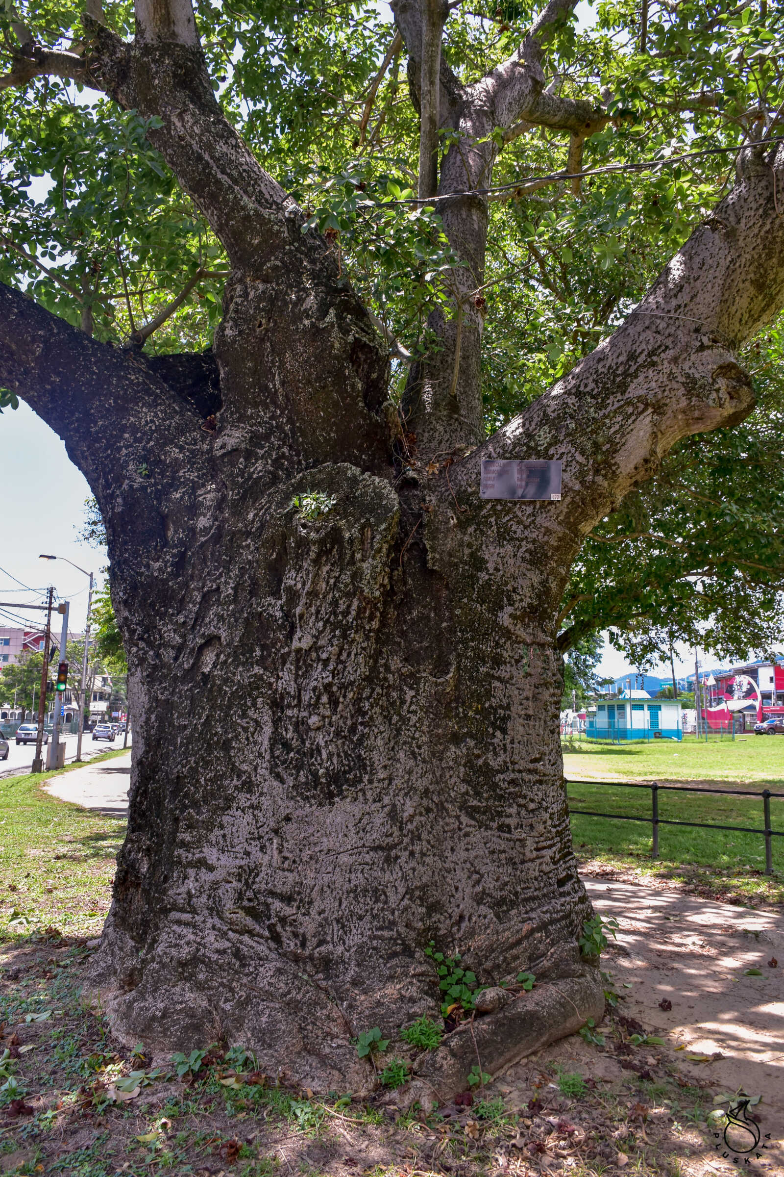
The capital of the country. Lots of green parks and squares. It is worth visiting the zoo and the beautiful botanical garden. This is the cultural centre of the entire island – dance performances, festivals, theatre performances and exhibitions held at the National Academy of Performing Arts and the National Carnival and Entertainment Center, commonly called Little Carib. There is also the largest park on the island, Queen’s Savannah, with an area of 110 ha. On Maraval Road it is worth seeing seven famous buildings of Port Of Spain – from colonial buildings in various states of maintenance to a beautiful palace.
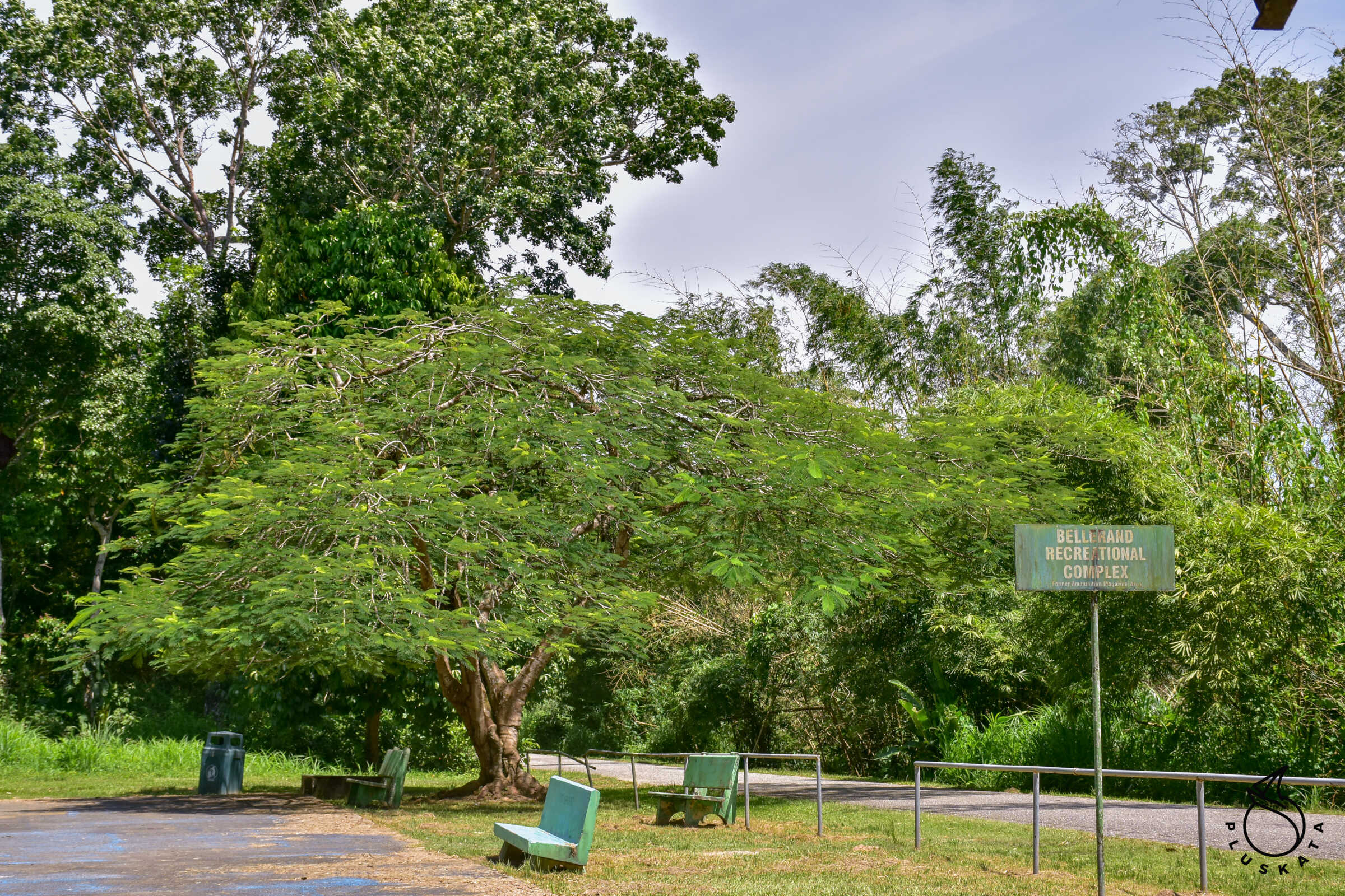
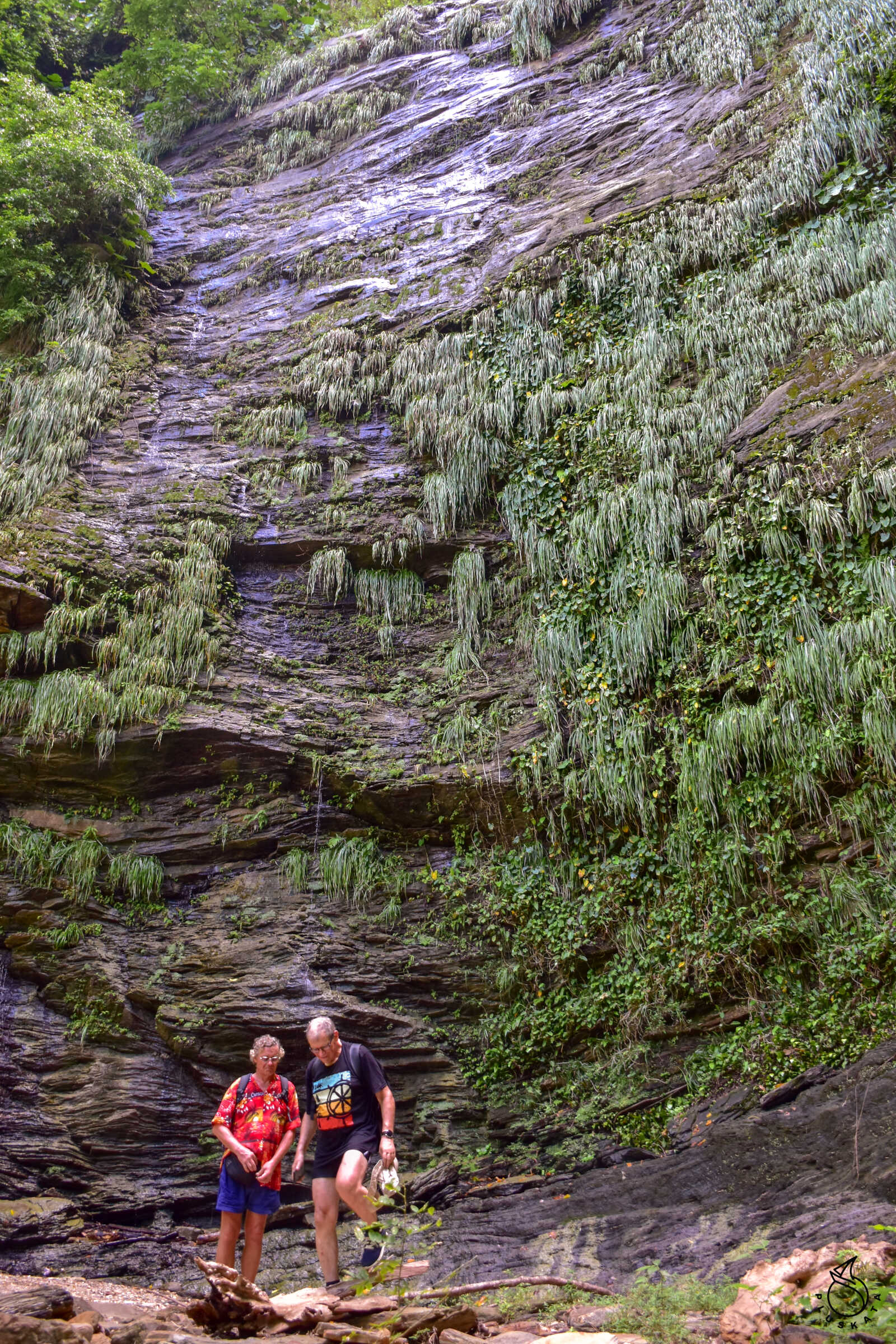
Edith Falls
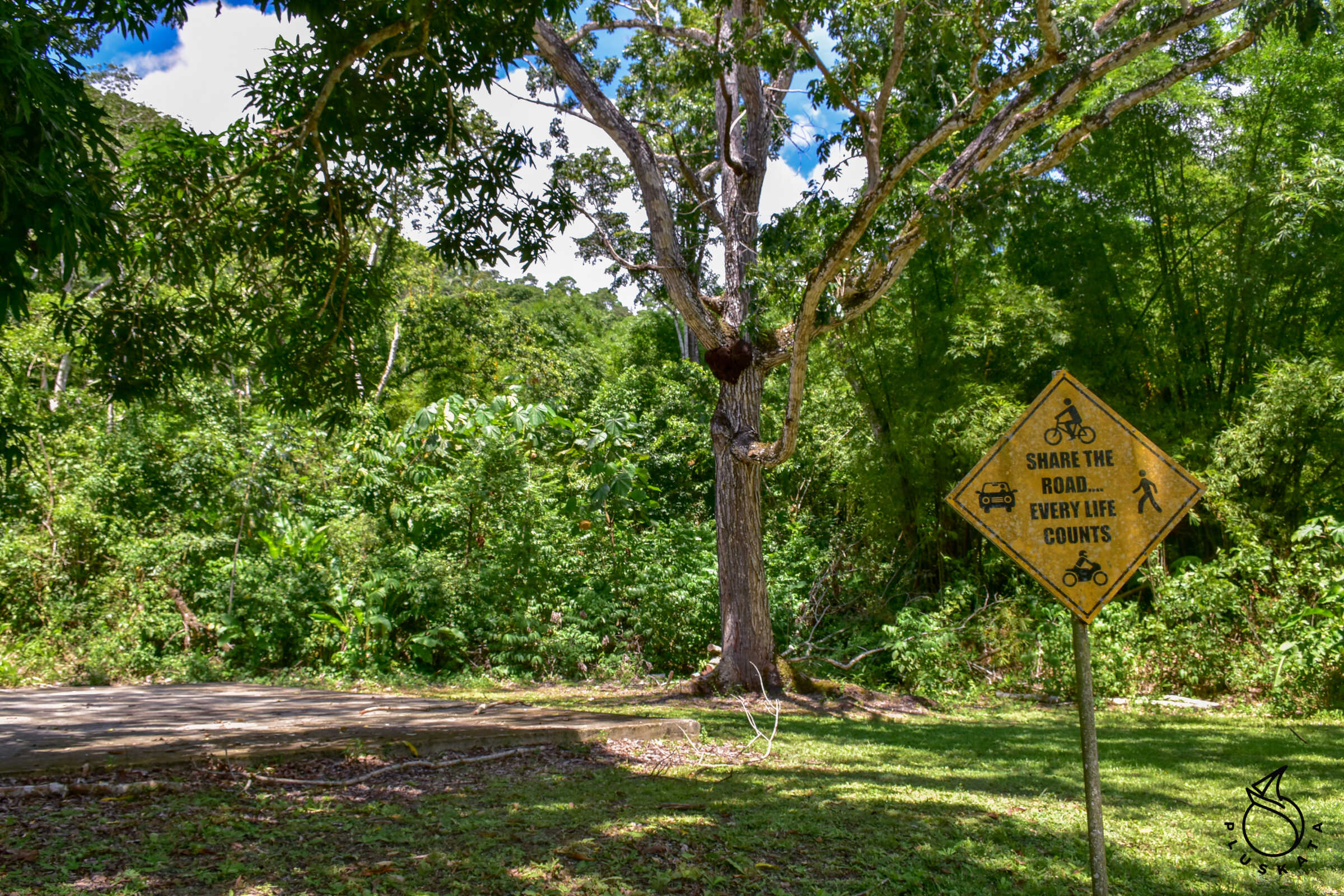
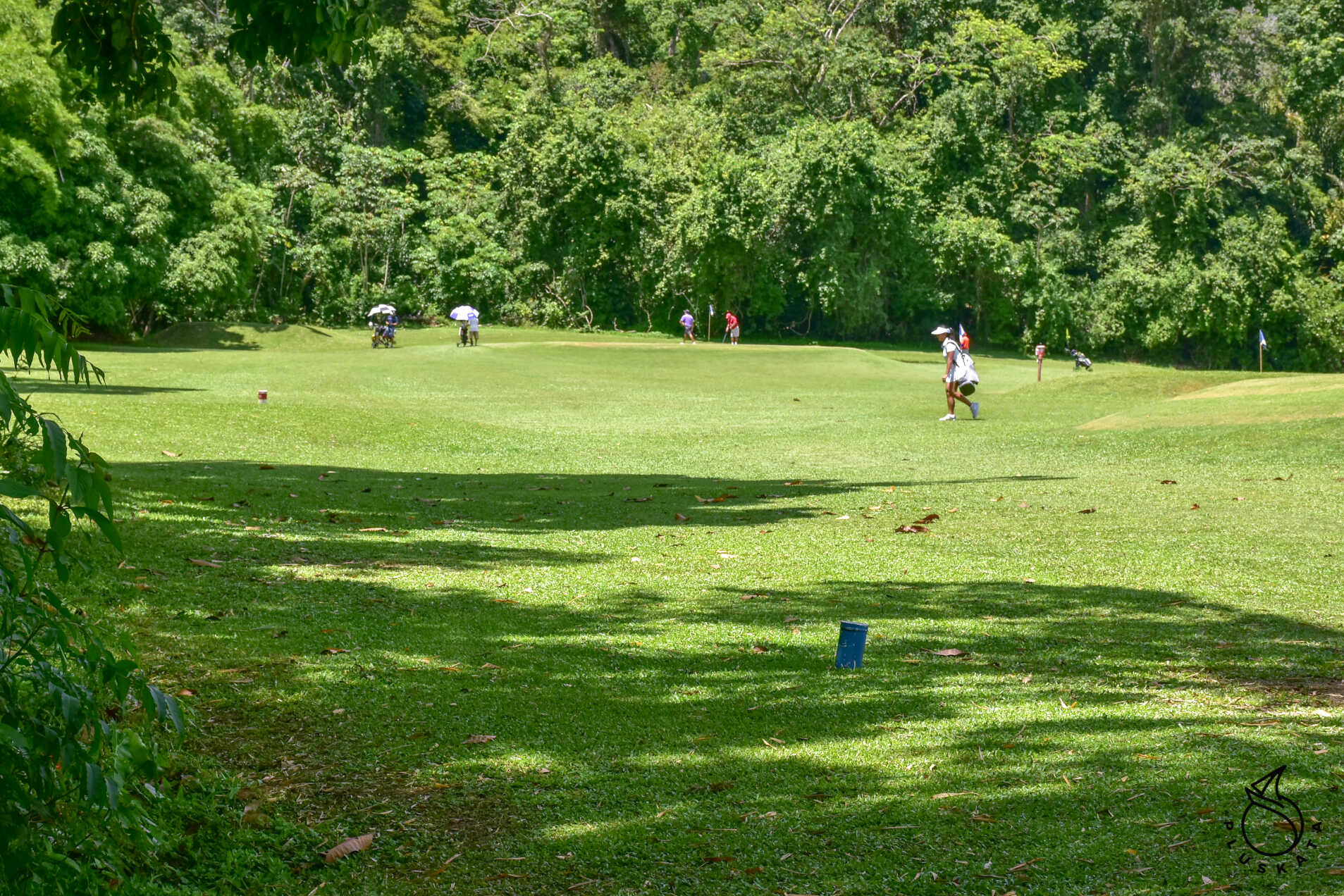
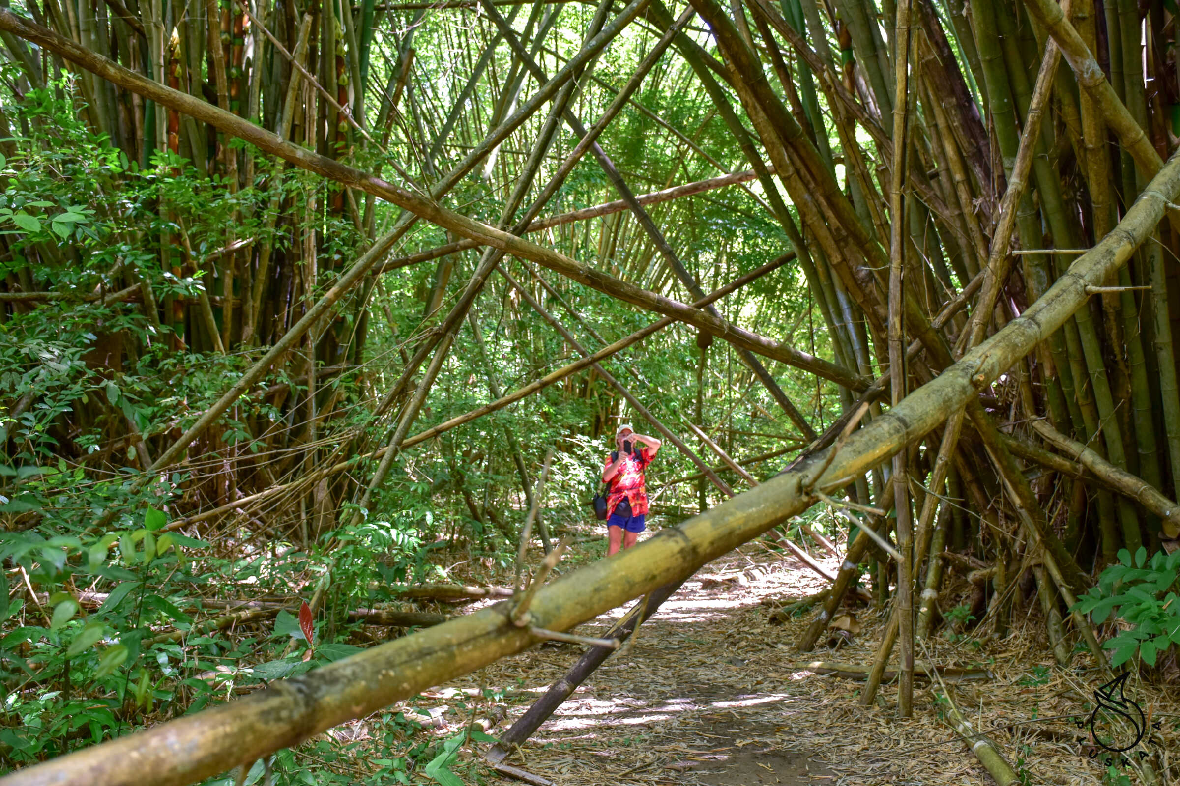
A group of beautiful waterfalls. It takes about 2.5 hours to walk from the marina in each direction. You can take a bus or hitchhike. On the way we pass large golf courses. The last 1.2 km is a path through the forest, sometimes on stones along the stream bed – it is worth taking comfortable shoes (sandals with stiff and non-slip soles are fine).
On the way you can see the remains of cocoa, banana and coffee plantations. The waterfalls themselves are actually wet rock walls (but high – about 75m) with small streams. Apparently there is more water there after heavy rains. At the waterfall we eat a second breakfast, drinking water from the waterfall. Returning in the forest, we accidentally hit a nest of wild bees, which sting us severely, leaving numerous stings. Tomek, who was the last to go, escaped by avoiding the “bee-infested” area. The places after the stings swell and itch for a few days.
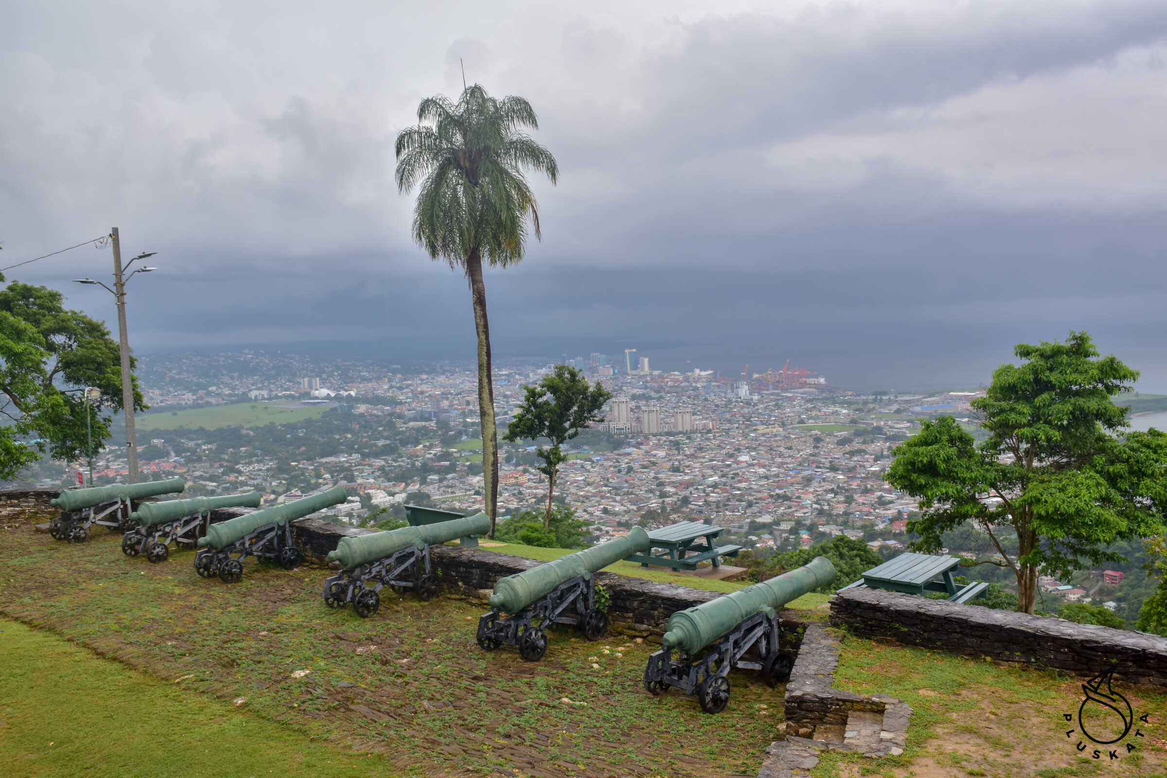
Fort George
Formerly called La Vigie, Fort George is located on the hills north of St. James overlooking the Gulf of Paria. The fort, which was part of a complex of fortifications, is the best place to get one of the most spectacular views of Port of Spain and the sea. In addition to the beautiful view, this well-preserved structure houses original cannons, dungeons, artifacts from the period and a signal station that was founded in 1802 and designed by Prince Kofi Nti, son of King Kofi Calclai of the Ashanti of West Africa. Built in 1804 under the direction of the then British Governor, Brigadier General Sir Thomas Hislop, the fortifications at Fort George consisted of naval defenses and a series of supporting batteries: V. I. of York; Princess Charlotte; Abercombry and Cambridge on the lower slopes and Cumberland to the north above the Fort. Considered almost impregnable at the time, it was Trinidad’s main defensive position but never saw warfare. During the rumours of war, Port-of-Spain merchants stored their documents, cash and valuables here. Fort George ceased to be a military outpost in 1846.
You can get there by yellow maxi taxi to the beginning of the road and then about an hour on foot up the asphalt road.